Phillips County, Montana

Last updated

Phillips County
Phillips County Courthouse Malta.JPG
Phillips County Courthouse in Malta
Map of Montana highlighting Phillips County.svg
Location within the U.S. state of Montana
Montana in United States.svg
Montana's location within the U.S.
Coordinates: 48°16′N107°55′W / 48.26°N 107.92°W / 48.26; -107.92
CountryFlag of the United States.svg United States
StateFlag of Montana.svg  Montana
FoundedFebruary 5, 1915
Seat Malta
Largest cityMalta
Area
  Total5,212 sq mi (13,500 km2)
  Land5,140 sq mi (13,300 km2)
  Water72 sq mi (190 km2)  1.4%
Population
 (2020)
  Total4,217
  Estimate 
(2022)
4,240 Increase2.svg
  Density0.81/sq mi (0.31/km2)
Time zone UTC−7 (Mountain)
  Summer (DST) UTC−6 (MDT)
Congressional district 2nd
  • Montana county number 11

Phillips County is a county in the U.S. state of Montana. As of the 2020 census, the population was 4,217. [1] Its county seat is Malta. [2] Before February 5, 1915, Phillips County was part of Blaine County, and before 1912 both were part of Chouteau County. [3] It was named for rancher and state senator Benjamin D. Phillips.

Contents

Its northern boundary is the Canada–United States border with Saskatchewan. The Missouri River defines its southern boundary.

Geography

According to the United States Census Bureau, the county has a total area of 5,212 square miles (13,500 km2), of which 5,140 square miles (13,300 km2) is land and 72 square miles (190 km2) (1.4%) is water. [4] It is the second-largest county in Montana by land area and third-largest by total area.

Adjacent counties and rural municipalities

National protected areas

Demographics

Historical population
CensusPop.Note
1920 9,311
1930 8,208−11.8%
1940 7,892−3.8%
1950 6,334−19.7%
1960 6,027−4.8%
1970 5,386−10.6%
1980 5,367−0.4%
1990 5,163−3.8%
2000 4,601−10.9%
2010 4,253−7.6%
2020 4,217−0.8%
2022 (est.)4,240 [5] 0.5%
U.S. Decennial Census [6]
1790–1960, [7] 1900–1990, [8]
1990–2000, [9] 2010–2020 [1]

2020 census

As of the 2020 census, there were 4,217 people living in the county.[ citation needed ]

2010 census

As of the 2010 census, there were 4,253 people, 1,819 households, and 1,159 families residing in the county. The population density was 0.8 inhabitants per square mile (0.31/km2). There were 2,335 housing units at an average density of 0.5 per square mile (0.19/km2). The racial makeup of the county was 87.0% white, 8.3% American Indian, 0.2% Asian, 0.4% from other races, and 4.0% from two or more races. Those of Hispanic or Latino origin made up 1.9% of the population. In terms of ancestry, 26.2% were Norwegian, 24.3% were German, 13.4% were Irish, 10.1% were American, and 9.0% were English.

Of the 1,819 households, 27.6% had children under the age of 18 living with them, 52.9% were married couples living together, 7.4% had a female householder with no husband present, 36.3% were non-families, and 32.2% of all households were made up of individuals. The average household size was 2.27 and the average family size was 2.86. The median age was 46.8 years.

The median income for a household in the county was $36,453 and the median income for a family was $55,362. Males had a median income of $41,826 versus $26,417 for females. The per capita income for the county was $24,227. About 11.4% of families and 13.5% of the population were below the poverty line, including 17.1% of those under age 18 and 4.8% of those age 65 or over.

Politics

From its creation until 1964, voters of Phillips County were fairly balanced; they selected Democratic Party candidates in 58% of national elections. After 1964 the Republican presidential candidate has garnered the county's vote in every election.

United States presidential election results for Phillips County, Montana [10]
Year Republican Democratic Third party
No.%No.%No.%
2020 1,93681.28%41617.46%301.26%
2016 1,72379.36%31814.65%1305.99%
2012 1,68875.76%47121.14%693.10%
2008 1,42367.03%63830.05%622.92%
2004 1,67777.28%45621.01%371.71%
2000 1,72777.51%42318.99%783.50%
1996 1,39255.44%70528.08%41416.49%
1992 1,02639.09%63424.15%96536.76%
1988 1,46260.26%90537.30%592.43%
1984 1,93470.35%78728.63%281.02%
1980 1,72364.95%74528.08%1856.97%
1976 1,34754.18%1,11744.93%220.88%
1972 1,65964.88%82832.38%702.74%
1968 1,35351.41%1,10041.79%1796.80%
1964 1,24243.47%1,61256.42%30.11%
1960 1,45749.81%1,45549.74%130.44%
1956 1,60552.94%1,42747.06%00.00%
1952 1,77158.70%1,22440.57%220.73%
1948 96437.52%1,50658.62%993.85%
1944 1,08942.82%1,43556.43%190.75%
1940 1,11032.98%2,22566.10%310.92%
1936 85024.33%2,55573.13%892.55%
1932 1,12733.90%2,05461.79%1434.30%
1928 1,67159.09%1,13540.13%220.78%
1924 1,23646.69%47317.87%93835.44%
1920 1,69367.13%64825.69%1817.18%
1916 99942.42%1,25253.16%1044.42%

Communities

City

Towns

Census-designated places

Other unincorporated communities

See also

The fairgrounds for Phillips County Phillips County Montana Fairgrounds.jpg
The fairgrounds for Phillips County

Related Research Articles

<span class="mw-page-title-main">Hill County, Montana</span> County in Montana, United States

Hill County is a county located in the U.S. state of Montana. As of the 2020 census, the population was 16,309. Its county seat is Havre. It lies along the United States border with Canada, abutting Alberta and Saskatchewan.

<span class="mw-page-title-main">Wibaux County, Montana</span> County in Montana, United States

Wibaux County is a county in the U.S. state of Montana. As of the 2020 census, the population was 937, making it the fourth-least populous county in Montana. Its county seat is Wibaux.

<span class="mw-page-title-main">Valley County, Montana</span> County in Montana, United States

Valley County is a county in the U.S. state of Montana. Valley County was created in 1893 with area partitioned from Dawson County. As of the 2020 census, the population was 7,578. Its county seat is Glasgow. It is located on the Canada–United States border with Saskatchewan.

<span class="mw-page-title-main">Stillwater County, Montana</span> County in Montana, United States

Stillwater County is a county in the U.S. state of Montana. As of the 2020 census, the population was 8,963. Its county seat is Columbus.

<span class="mw-page-title-main">Roosevelt County, Montana</span> County in Montana, United States

Roosevelt County is a county in the U.S. state of Montana. As of the 2020 census, the population was 10,794. Its county seat is Wolf Point. Roosevelt County was created by the Montana Legislature in 1919 from a portion of Sheridan County. The name honors former president Theodore Roosevelt, who had died earlier that year.

<span class="mw-page-title-main">Ravalli County, Montana</span> County in Montana, United States

Ravalli County is a county in the southwestern part of the U.S. state of Montana. As of the 2020 census, the population was 44,174. Its county seat is Hamilton.

<span class="mw-page-title-main">Powder River County, Montana</span> County in Montana, United States

Powder River County is a county in the U.S. state of Montana. As of the 2020 census, the population was 1,694. Its county seat is Broadus.

<span class="mw-page-title-main">Musselshell County, Montana</span> County in Montana, United States

Musselshell County is a county in south-central Montana. As of the 2020 census, the population was 4,730. Its county seat is Roundup.

<span class="mw-page-title-main">Mineral County, Montana</span> County in Montana, United States

Mineral County is a county located in the U.S. state of Montana. As of the 2020 census, the population was 4,535. Its county seat is Superior.

<span class="mw-page-title-main">McCone County, Montana</span> County in Montana, United States

McCone County is a county located in the U.S. state of Montana. As of the 2020 census, the population was 1,729. Its county seat is Circle.

<span class="mw-page-title-main">Madison County, Montana</span> County in Montana, United States

Madison County is a county in the U.S. state of Montana. As of the 2020 census, the population was 8,623. Its county seat is Virginia City. The county was founded in 1865; at the time it was part of the Montana Territory.

<span class="mw-page-title-main">Lake County, Montana</span> County in Montana, United States

Lake County is a county located in the northwest part of the U.S. state of Montana. As of the 2020 census, the population was 31,134. Its county seat is Polson.

<span class="mw-page-title-main">Jefferson County, Montana</span> County in Montana, United States

Jefferson County is a county in Montana, United States. As of the 2020 census, the population was 12,085. Its county seat is Boulder. The county was created in 1865 and named for President Thomas Jefferson.

<span class="mw-page-title-main">Garfield County, Montana</span> County in Montana, United States

Garfield County is a county located in the U.S. state of Montana. As of the 2020 census, the population was 1,173. Its county seat is Jordan.

<span class="mw-page-title-main">Fergus County, Montana</span> County in Montana, United States

Fergus County is a county in the U.S. state of Montana. As of the 2020 census, the population was 11,446. Its county seat is Lewistown. The county was founded in 1885 and named for James Fergus, a Montana politician who was instrumental in creating the county.

<span class="mw-page-title-main">Chouteau County, Montana</span> County in Montana, United States

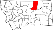
Chouteau County is a county located in the North-Central region of the U.S. state of Montana. As of the 2020 census, the population was 5,895. Its county seat is Fort Benton. The county was established in 1865 as one of the original nine counties of Montana, and named in 1882 after Pierre Chouteau Jr., a fur trader who established a trading post that became Fort Benton, which was once an important port on the Missouri River.

<span class="mw-page-title-main">Cascade County, Montana</span> County in Montana, United States

Cascade County is a county located in the U.S. state of Montana. As of the 2020 census, the population was 84,414, making it the fifth-most populous county in Montana. Its county seat is Great Falls.

<span class="mw-page-title-main">Broadwater County, Montana</span> County in Montana, United States

Broadwater County is a county in the U.S. state of Montana. As of the 2020 census, the population was 6,774. Its county seat is Townsend. The county was named for Charles Arthur Broadwater, a noted Montana railroad, real estate, and banking magnate.

<span class="mw-page-title-main">Blaine County, Montana</span> County in Montana, United States

Blaine County is a county in the U.S. state of Montana. As of the 2020 census, the population was 7,044. Its county seat is Chinook. The county was named for James G. Blaine, former United States Secretary of State. It is on the north line of the state, and thus shares the southern border of Canada opposite Saskatchewan.

<span class="mw-page-title-main">Beaverhead County, Montana</span> County in Montana, United States

Beaverhead County is the largest county by area in the U.S. state of Montana. As of the 2020 census, the population was 9,371. Its county seat is Dillon. The county was founded in 1865.

References

  1. 1 2 "State & County QuickFacts". United States Census Bureau. Retrieved May 8, 2023.
  2. "Find a County". National Association of Counties. Retrieved June 7, 2011.
  3. Koschmann, A.H.; M.H. Bergendahl (1968). "Principal Gold-Producing Districts of the United States, Phillips County Montana Gold Production". United States Geological Survey . Retrieved February 17, 2008.
  4. "2010 Census Gazetteer Files". United States Census Bureau. August 22, 2012. Archived from the original on December 5, 2014. Retrieved November 29, 2014.
  5. "Annual Estimates of the Resident Population for Counties: April 1, 2020 to July 1, 2022". United States Census Bureau. Retrieved May 8, 2023.
  6. "U.S. Decennial Census". United States Census Bureau. Retrieved November 29, 2014.
  7. "Historical Census Browser". University of Virginia Library. Retrieved November 29, 2014.
  8. "Population of Counties by Decennial Census: 1900 to 1990". United States Census Bureau. Retrieved November 29, 2014.
  9. "Census 2000 PHC-T-4. Ranking Tables for Counties: 1990 and 2000" (PDF). United States Census Bureau. Archived (PDF) from the original on March 27, 2010. Retrieved November 29, 2014.
  10. Leip, David. "Atlas of US Presidential Elections". uselectionatlas.org. Retrieved April 3, 2018.
  11. Bowdoin MT Google Maps (accessed January 4, 2019)
  12. Caldwell MT Google Maps (accessed January 4, 2019)
  13. Cole MT Google Maps (accessed January 4, 2019)
  14. Content MT Google Maps (accessed January 4, 2019)
  15. Cree Crossing MT Google Maps (accessed January 4, 2019)
  16. Jordan Crossing MT Google Maps (accessed January 4, 2019)
  17. Tattnall MT Google Maps (accessed January 4, 2019)
  18. Wagner MT Google Maps (accessed January 4, 2019)

Further reading

48°16′N107°55′W / 48.26°N 107.92°W / 48.26; -107.92