Geography
According to the United States Census Bureau, the county has a total area of 2,383 square miles (6,170 km2), of which 2,372 square miles (6,140 km2) is land and 11 square miles (28 km2) (0.5%) is water. [5]
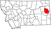
Dawson County is located in the extreme eastern portion of Montana, about fifteen to twenty miles west of the Dakota line. [6]
Dawson County contains part of Montana's badlands. Makoshika State Park is an example of that area's unusual rock formations. Dawson County's principal water sources are the Yellowstone River, which bisects its southeastern section, and the Redwater River in its northwest corner. Numerous creeks are tributary to these streams, furnishing abundant and accessible facilities watering livestock and for small irrigation enterprises and water conservation projects. In the upper bench lands, artesian well irrigation has received considerable attention.
The largest Triceratops skull ever found was discovered in 1992 and excavated in 2003 in Dawson County, Montana, in the famous Hell Creek Formation. It is a 65-million-year-old male Triceratops skull, 9.2 feet long, 5.2 feet high and 4.6 feet wide and weighing over 600 kg. It has been dubbed 'Dragon King' and is understood to be the most expensive skull to ever trade privately. [7] [8]
Parts of Dawson County were taken to form Valley County in 1893, Richland County and part of Wibaux County in 1914, part of Prairie County in 1915, and Garfield County and part of McCone County in 1919. [6]
Major highways
In 1920, Dawson County was traversed by the National Parks Highway or Red Trail, the Black Trail, the Green Trail and the Blue Trail, all of which passed through Glendive. [6]
Demographics
Historical population| Census | Pop. | Note | %± |
|---|
| 1890 | 2,056 | | — |
|---|
| 1900 | 2,443 | | 18.8% |
|---|
| 1910 | 12,725 | | 420.9% |
|---|
| 1920 | 9,239 | | −27.4% |
|---|
| 1930 | 9,881 | | 6.9% |
|---|
| 1940 | 8,618 | | −12.8% |
|---|
| 1950 | 9,092 | | 5.5% |
|---|
| 1960 | 12,314 | | 35.4% |
|---|
| 1970 | 11,269 | | −8.5% |
|---|
| 1980 | 11,805 | | 4.8% |
|---|
| 1990 | 9,505 | | −19.5% |
|---|
| 2000 | 9,059 | | −4.7% |
|---|
| 2010 | 8,966 | | −1.0% |
|---|
| 2020 | 8,940 | | −0.3% |
|---|
| 2022 (est.) | 8,830 | [9] | −1.2% |
|---|
|
2010 census
As of the 2010 census, there were 8,966 people, 3,749 households, and 2,429 families living in the county. The population density was 3.8 inhabitants per square mile (1.5/km2). There were 4,233 housing units at an average density of 1.8 per square mile (0.69/km2). The racial makeup of the county was 95.7% white, 1.7% American Indian, 0.3% black or African American, 0.3% Asian, 0.3% from other races, and 1.6% from two or more races. Those of Hispanic or Latino origin made up 2.0% of the population. In terms of ancestry, 46.6% were German, 16.3% were Norwegian, 15.5% were Irish, 8.2% were English, and 6.5% were American.
Of the 3,749 households, 26.8% had children under the age of 18 living with them, 54.1% were married couples living together, 6.7% had a female householder with no husband present, 35.2% were non-families, and 31.2% of all households were made up of individuals. The average household size was 2.26 and the average family size was 2.82. The median age was 43.5 years.
The median income for a household in the county was $50,752 and the median income for a family was $63,982. Males had a median income of $45,222 versus $30,993 for females. The per capita income for the county was $24,602. About 7.4% of families and 9.3% of the population were below the poverty line, including 15.5% of those under age 18 and 9.6% of those age 65 or over.
Economy
Dawson County is known for its dryland grain, coal mines and gas and oil wells. [15] There are 522 current farms and ranches, and 296 commercial businesses. [16]
Lying in the heart of the western third of the Fort Union region, Dawson County is plentifully supplied with lignite coal. Local natural gas has supplied Glendive since at least 1920. Excellent clays for pottery and brick-making are also found in the county. [6]
From early days, Dawson County was known as a splendid stock county, because of the native cover of a heavy and nutritious grass. Unlike some other parts of the state, the livestock industry did not die out. In the early 20th century, the county was known for pure-bred stock raising, dairying, and the production of hogs and poultry.
While there is some broken land around the Sheep Bluffs, in the northwestern part of the county, and east of the Yellowstone, smooth prairies and rolling land predominated in the county, making conditions excellent for farming purposes. The dark sandy loam soil, with a heavy clay subsoil, was a big producer.
The principal crops in the early years of the 20th century were barley, oats and wheat. Sixty per cent of the land was tillable, and the remainder afforded good grazing. As of 1920, the headgates of the Lower Yellowstone Irrigation Project, which irrigated approximately 90,000 acres, were located at Intake, in Dawson County, and further irrigation was planned. Unirrigated land was also producing excellent crops, with up to 400 bushels of potatoes in one acre of unirrigated land. In 1915, Dawson County won first and second prizes on Northwestern Dent corn at the St. Paul Corn Show, and in December of the following year, at the First National Corn Show, held at the same city, took first and second prizes and three third prizes. In 1920, it was estimated that the acreage planted in corn in Dawson County alone was as great as the corn acreage for the entire state in 1910. [6]

Park County is a county in the U.S. state of Wyoming. As of the 2020 United States Census, the population was 29,624. The county seat is Cody.

McKenzie County is a county in the U.S. state of North Dakota. As of the 2020 census, the population was 14,704. Its county seat is Watford City.

Wibaux County is a county in the U.S. state of Montana. As of the 2020 census, the population was 937, making it the fourth-least populous county in Montana. Its county seat is Wibaux.
Valley County is a county in the U.S. state of Montana. Valley County was created in 1893 with area partitioned from Dawson County. As of the 2020 census, the population was 7,578. Its county seat is Glasgow. It is located on the Canada–United States border with Saskatchewan.

Richland County is a county in the U.S. state of Montana. As of the 2020 census, the population was 11,491. Its county seat is Sidney.

Prairie County is a county in the U.S. state of Montana. As of the 2020 census, the population was 1,088, making it the fifth-least populous county in Montana. Its county seat is Terry. Prairie County was created by the Montana Legislature in 1915 out of parts of Custer, Dawson, and Fallon Counties. The name was selected in a contest and reflects the predominant landscape of the region.

Park County is a county in the U.S. state of Montana. At the 2020 census, the population was 17,191. Its county seat is Livingston. A small part of Yellowstone National Park is in the southern part of the county.

Musselshell County is a county in south-central Montana. As of the 2020 census, the population was 4,730. Its county seat is Roundup.

Gallatin County is located in the U.S. state of Montana. With its county seat in Bozeman, it is the second-most populous county in Montana, with a population of 118,960 in the 2020 Census.

Fallon County is a county located in the U.S. state of Montana. As of the 2020 census, the population was 3,049. Its county seat is Baker. The county was created in 1913 from a portion of Custer County. It is named for Benjamin O'Fallon, a nephew of Captain William Clark and an Indian agent for the upper Missouri region from 1823 to 1827.

Carbon County is a county located in the U.S. state of Montana. As of the 2020 census, the population was 10,473. Its county seat is Red Lodge.

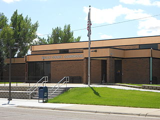
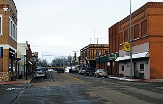
Glendive is a city in and the county seat of Dawson County, Montana, United States, and home to Dawson Community College. Glendive was established by the Northern Pacific Railway when they built the transcontinental railroad across the northern tier of the western United States from Minnesota to the Pacific Coast. The town was the headquarters for the Yellowstone Division that encompassed 875 route miles (1,408 km); 546 (879) in main line and 328 (528) in branches with the main routes from Mandan, North Dakota, to Billings, Montana, and from Billings to Livingston. The town of Glendive is an agricultural and ranching hub of eastern Montana sited between the Yellowstone River and the Badlands. Makoshika State Park is located just east of Glendive.

Richey is a town in Dawson County, Montana, United States. It is located to the north of Glendive, the county seat. The population was 164 at the 2020 census. The town has a strong agriculture economy with wheat, oats and barley as the main crops as well as significant cattle and sheep ranches.
Sidney is a city in and the county seat of Richland County, Montana, United States, less than 10 mi (16 km) west of the North Dakota border. The population was 6,346 at the 2020 census. The city lies along the Yellowstone River and is in proximity to the badlands of the Dakotas. Sidney is approximately midway between Glendive, Montana and Williston, North Dakota.
Wibaux is a town in and the county seat of Wibaux County, Montana, United States. It is the only incorporated town in Wibaux County. The population was 462 at the 2020 census.

Ballantine is a census-designated place (CDP) in Yellowstone County, Montana, United States. It lies approximately nine miles (14 km) northeast of Billings on Interstate 94. The population was 346 at the 2000 census. Ballantine, along with the communities of Pompey's Pillar, Worden, and Huntley, is part of the Huntley Project, an irrigation district created by the United States Bureau of Reclamation. The majority of Ballantine's population lives on scattered farms and ranches surrounding the actual townsite.

Huntley is a census-designated place (CDP) in Yellowstone County, Montana, United States. The population was 411 at the 2000 census. Huntley lent its name to the Huntley Project, a federal irrigation project that began delivering water to the arid district in 1907. Today, Huntley is an eastern suburb of Billings and is located east of Shepherd and west of Worden.

Shepherd is a census-designated place (CDP) in Yellowstone County, Montana, United States. The population was 193 at the 2000 census. Shepherd is a Billings suburb located to the northeast. The unincorporated town was named after R.E. Shepherd, a prominent early settler and owner of the Billings Land and Irrigation Company and the Merchants National Bank. The post office opened in 1915.

Worden is a census-designated place (CDP) in Yellowstone County, Montana, United States. The population was 582 at the 506 at the 2020 census. Worden, along with Ballantine, Huntley, and Pompey's Pillar, is part of the Huntley Project, an irrigation district established by the United States Bureau of Reclamation in 1907.

West Glendive is a census-designated place (CDP) in Dawson County, Montana, United States. The population was 1,998 at the 2020 census.