Sidney, Missouri

Last updated

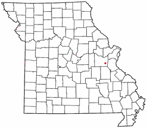
Sidney is an unincorporated community in Putnam County, in the U.S. state of Missouri. [1]

Putnam County, Missouri county in Missouri, US

Putnam County is a county located in North Central Missouri. As of the 2010 census, the population was 4,979. Its county seat is Unionville. The county was organized February 28, 1845 and named for Israel Putnam, a hero in the French and Indian War and a general in the American Revolutionary War.

U.S. state constituent political entity sharing sovereignty as the United States of America

In the United States, a state is a constituent political entity, of which there are currently 50. Bound together in a political union, each state holds governmental jurisdiction over a separate and defined geographic territory and shares its sovereignty with the federal government. Due to this shared sovereignty, Americans are citizens both of the federal republic and of the state in which they reside. State citizenship and residency are flexible, and no government approval is required to move between states, except for persons restricted by certain types of court orders. Four states use the term commonwealth rather than state in their full official names.

Missouri State of the United States of America

Missouri is a state in the Midwestern United States. With over six million residents, it is the 18th-most populous state of the Union. The largest urban areas are St. Louis, Kansas City, Springfield, and Columbia; the capital is Jefferson City. The state is the 21st-most extensive in area. In the South are the Ozarks, a forested highland, providing timber, minerals, and recreation. The Missouri River, after which the state is named, flows through the center of the state into the Mississippi River, which makes up Missouri's eastern border.

History

A post office called Sidney was established in 1889, and remained in operation until 1908. [2] The community most likely has the name of a local citizen. [3]

Related Research Articles

Luebbering, Missouri unincorporated community in Missouri

Luebbering is an unincorporated community in eastern Franklin County, Missouri, United States. It is located on Missouri Route FF, approximately ten miles southeast of St. Clair and about 2.5 miles south of Lonedell.

Oakton is an unincorporated community in Barton County, in the U.S. state of Missouri.

Stringtown is an unincorporated community in Cole County, in the U.S. state of Missouri.

Chapel is an unincorporated community in Putnam County, in the U.S. state of Missouri.

Chariton is an unincorporated community in Putnam County, in the U.S. state of Missouri.

Elko is an unincorporated community in Putnam County, in the U.S. state of Missouri.

Esper is an unincorporated community in Putnam County, in the U.S. state of Missouri.

Galesburg is an unincorporated community in Putnam County, in the U.S. state of Missouri.

Glendale is an unincorporated community in Putnam County, in the U.S. state of Missouri.

Graysville is an unincorporated community in Putnam County, in the U.S. state of Missouri.

Hartford is an unincorporated community in Putnam County, in the U.S. state of Missouri.

Howland is an extinct town in Putnam County, in the U.S. state of Missouri. The GNIS classifies it as a populated place.

Lickskillet is an extinct town in Putnam County, in the U.S. state of Missouri. The GNIS classifies it as a populated place.

Martinstown is an unincorporated community in Putnam County, in the U.S. state of Missouri.

Omaha is an unincorporated community in Putnam County, in the U.S. state of Missouri.

Quinn is an unincorporated community in Putnam County, in the U.S. state of Missouri.

Rosewood is an unincorporated community in Putnam County, in the U.S. state of Missouri.

St. John is an unincorporated community in Putnam County, in the U.S. state of Missouri.

Terre Haute is an extinct town in Putnam County, in the U.S. state of Missouri. The GNIS classifies it as a populated place.

Edinburg is an unincorporated community in Scotland County, in the U.S. state of Missouri.

References

  1. U.S. Geological Survey Geographic Names Information System: Sidney, Missouri
  2. "Post Offices". Jim Forte Postal History. Retrieved 11 December 2016.
  3. "Putnam County Place Names, 1928–1945". The State Historical Society of Missouri. Archived from the original on June 24, 2016. Retrieved December 11, 2016.

Coordinates: 40°21′15″N92°49′09″W / 40.35417°N 92.81917°W / 40.35417; -92.81917

Geographic coordinate system Coordinate system

A geographic coordinate system is a coordinate system that enables every location on Earth to be specified by a set of numbers, letters or symbols. The coordinates are often chosen such that one of the numbers represents a vertical position and two or three of the numbers represent a horizontal position; alternatively, a geographic position may be expressed in a combined three-dimensional Cartesian vector. A common choice of coordinates is latitude, longitude and elevation. To specify a location on a plane requires a map projection.