Wyreka, Missouri

Last updated

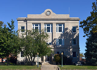
Wyreka is an unincorporated community in Putnam County, in the U.S. state of Missouri. [1]

Putnam County, Missouri U.S. county in Missouri, United States

Putnam County is a county located in North Central Missouri. As of the 2010 census, the population was 4,979. Its county seat is Unionville. The county was organized February 28, 1845 and named for Israel Putnam, a hero in the French and Indian War and a general in the American Revolutionary War.

U.S. state constituent political entity of the United States

In the United States, a state is a constituent political entity, of which there are currently 50. Bound together in a political union, each state holds governmental jurisdiction over a separate and defined geographic territory and shares its sovereignty with the federal government. Due to this shared sovereignty, Americans are citizens both of the federal republic and of the state in which they reside. State citizenship and residency are flexible, and no government approval is required to move between states, except for persons restricted by certain types of court orders.

Missouri U.S. state in the United States

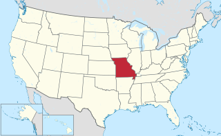
Missouri is a state in the Midwestern United States. With over six million residents, it is the 18th-most populous state of the Union. The largest urban areas are St. Louis, Kansas City, Springfield and Columbia; the capital is Jefferson City. The state is the 21st-most extensive in area. Missouri is bordered by eight states : Iowa to the north, Illinois, Kentucky and Tennessee to the east, Arkansas to the south and Oklahoma, Kansas and Nebraska to the west. In the South are the Ozarks, a forested highland, providing timber, minerals and recreation. The Missouri River, after which the state is named, flows through the center of the state into the Mississippi River, which makes up Missouri's eastern border.

Wyreka was platted in 1858. [2] The name most likely is a phonetic transfer from Yreka, California. [2]

Plat map showing a piece of land, drawn to scale, with details such as nearby properties, boundaries, land size, flood zones, the surrounding neighborhood, easements, and monuments

In the United States, a plat is a map, drawn to scale, showing the divisions of a piece of land. United States General Land Office surveyors drafted township plats of Public Lands Surveys to show the distance and bearing between section corners, sometimes including topographic or vegetation information. City, town or village plats show subdivisions into blocks with streets and alleys. Further refinement often splits blocks into individual lots, usually for the purpose of selling the described lots; this has become known as subdivision.

Yreka, California City in California

Yreka is the county seat of Siskiyou County, California, United States, located near the Shasta River; the city covers an area of approximately 10 square miles (26 km2), most of which is land. As of the 2010 United States Census, the population was 7,765, reflecting an increase of 475 from the 7,290 counted in the 2000 Census. Yreka is home to the College of the Siskiyous, Klamath National Forest Interpretive Museum and the Siskiyou County Museum.

Related Research Articles

Mercer County, Missouri U.S. county in Missouri

Mercer County is a county located in the northwestern portion of the U.S. state of Missouri. As of the 2010 census, the population was 3,785, making it the second-least populous county in Missouri. Its county seat is Princeton. The county was organized February 14, 1845 and named for General John F. Mercer of the Revolutionary War.

Moody, Missouri unincorporated community in Missouri

Moody is an unincorporated community in southwestern Howell County, Missouri, United States. It is located sixteen miles south of West Plains, just north of Route 142 on Route E. Bennetts River flows past the west side of the community. The Missouri-Arkansas state line is approximately 1.5 miles to the south.

Lemons is a census-designated place in Putnam County, Missouri, United States. It is located approximately four miles south of Unionville on Route 5.

Medicine Creek is a stream in Grundy, Livingston, Putnam, and Sullivan counties of the U.S. state of Missouri. It is a tributary to the Grand River.

Cooper Creek is a stream in Henry and St. Clair counties of Missouri. It is a tributary of Deepwater Creek within the Truman Reservoir.

Tuckahoe is an unincorporated community in Jasper County, in the U.S. state of Missouri.

Walnut Creek is a stream in Polk County the Ozarks of southwest Missouri. It is a tributary of the Little Sac River.

Chapel is an unincorporated community in Putnam County, in the U.S. state of Missouri.

Chariton is an unincorporated community in Putnam County, in the U.S. state of Missouri.

Elko is an unincorporated community in Putnam County, in the U.S. state of Missouri.

Esper is an unincorporated community in Putnam County, in the U.S. state of Missouri.

Galesburg is an unincorporated community in Putnam County, in the U.S. state of Missouri.

Glendale is an unincorporated community in Putnam County, in the U.S. state of Missouri.

Hartford is an unincorporated community in Putnam County, in the U.S. state of Missouri.

Lickskillet is an extinct town in Putnam County, in the U.S. state of Missouri. The GNIS classifies it as a populated place.

Quinn is an unincorporated community in Putnam County, in the U.S. state of Missouri.

St. John is an unincorporated community in Putnam County, in the U.S. state of Missouri.

Terre Haute is an extinct town in Putnam County, in the U.S. state of Missouri. The GNIS classifies it as a populated place.

West Liberty is an extinct town in Putnam County, in the U.S. state of Missouri.

References

  1. U.S. Geological Survey Geographic Names Information System: Wyreka, Missouri
  2. 1 2 "Putnam County Place Names, 1928–1945". The State Historical Society of Missouri. Archived from the original on June 24, 2016. Retrieved December 11, 2016.

Coordinates: 40°31′46″N93°15′54″W / 40.52944°N 93.26500°W / 40.52944; -93.26500

Geographic coordinate system Coordinate system

A geographic coordinate system is a coordinate system that enables every location on Earth to be specified by a set of numbers, letters or symbols. The coordinates are often chosen such that one of the numbers represents a vertical position and two or three of the numbers represent a horizontal position; alternatively, a geographic position may be expressed in a combined three-dimensional Cartesian vector. A common choice of coordinates is latitude, longitude and elevation. To specify a location on a plane requires a map projection.