Worthington, Missouri

Last updated
Worthington, Missouri
Putnam County Missouri Incorporated and Unincorporated areas Worthington Highlighted.svg
Location of Worthington, Missouri
Coordinates: 40°24′31″N92°41′21″W / 40.40861°N 92.68917°W / 40.40861; -92.68917 Coordinates: 40°24′31″N92°41′21″W / 40.40861°N 92.68917°W / 40.40861; -92.68917
Country United States
State Missouri
County Putnam
Area
[1]
  Total0.13 sq mi (0.33 km2)
  Land0.13 sq mi (0.33 km2)
  Water0.00 sq mi (0.00 km2)
Elevation
[2]
807 ft (246 m)
Population
 (2020)
  Total47
  Density373.02/sq mi (143.53/km2)
Time zone UTC-6 (Central (CST))
  Summer (DST) UTC-5 (CDT)
ZIP code
63567
Area code 660
FIPS code 29-81106 [3]
GNIS feature ID2399744 [2]

Worthington is a village in southeast Putnam County, Missouri, United States. The population was 47 at the 2020 census. [4]

Contents

History

A post office called Worthington has been in operation since 1902. [5] The community has the name of an early citizen. [6]

Geography

Worthington is located on Missouri Route W approximately one-half mile west of the Putnam-Schuyler county line which is on the Chariton River. Queen City (in Schuyler County) is approximately 6.5 miles to the east and the community of Martinstown on Missouri Route 149 is four miles west. [7]

According to the United States Census Bureau, the village has a total area of 0.11 square miles (0.28 km2), all land. [8]

Demographics

Historical population
CensusPop.Note
1920 327
1930 239−26.9%
1940 220−7.9%
1950 186−15.5%
1980 105
1990 86−18.1%
2000 893.5%
2010 81−9.0%
2020 47−42.0%
U.S. Decennial Census [9]

2010 census

As of the census [10] of 2010, there were 81 people, 33 households, and 19 families residing in the village. The population density was 736.4 inhabitants per square mile (284.3/km2). There were 52 housing units at an average density of 472.7 per square mile (182.5/km2). The racial makeup of the village was 100.0% White.

There were 33 households, of which 36.4% had children under the age of 18 living with them, 45.5% were married couples living together, 3.0% had a female householder with no husband present, 9.1% had a male householder with no wife present, and 42.4% were non-families. 39.4% of all households were made up of individuals, and 3% had someone living alone who was 65 years of age or older. The average household size was 2.45 and the average family size was 3.26.

The median age in the village was 32.5 years. 32.1% of residents were under the age of 18; 9.8% were between the ages of 18 and 24; 22.3% were from 25 to 44; 30.8% were from 45 to 64; and 4.9% were 65 years of age or older. The gender makeup of the village was 58.0% male and 42.0% female.

2000 census

As of the census [3] of 2000, there were 89 people, 42 households, and 27 families residing in the village. The population density was 726.8 inhabitants per square mile (280.6/km2). There were 58 housing units at an average density of 473.6 per square mile (182.9/km2). The racial makeup of the villagewas 100.00% White.

There were 42 households, out of which 31.0% had children under the age of 18 living with them, 45.2% were married couples living together, 11.9% had a female householder with no husband present, and 35.7% were non-families. 28.6% of all households were made up of individuals, and 7.1% had someone living alone who was 65 years of age or older. The average household size was 2.12 and the average family size was 2.56.

In the village, the population was spread out, with 20.2% under the age of 18, 9.0% from 18 to 24, 31.5% from 25 to 44, 29.2% from 45 to 64, and 10.1% who were 65 years of age or older. The median age was 38 years. For every 100 females, there were 134.2 males. For every 100 females age 18 and over, there were 136.7 males.

The median income for a household in the village was $11,964, and the median income for a family was $10,625. Males had a median income of $20,417 versus $18,750 for females. The per capita income for the village was $7,396. There were 52.0% of families and 42.1% of the population living below the poverty line, including 60.0% of under eighteens and 14.3% of those over 64.

Related Research Articles

<span class="mw-page-title-main">Putnam County, Missouri</span> County in Missouri, United States

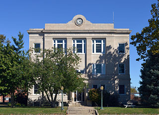
Putnam County is in north central Missouri. At the 2020 census, the population was 4,681. Its county seat is Unionville. The county was organized February 28, 1845, and named for Israel Putnam, a hero in the French and Indian War and a general in the American Revolutionary War.

<span class="mw-page-title-main">Leslie, Missouri</span> Village in Missouri, United States

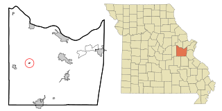
Leslie is a village in west central Franklin County, Missouri, United States. The population was 171 at the 2010 census.

<span class="mw-page-title-main">Parkway, Missouri</span> Village in Missouri, United States

Parkway is a village in Franklin County, Missouri, United States. The population was 439 at the 2010 census.

<span class="mw-page-title-main">Evergreen, Missouri</span> Village in Missouri, United States

Evergreen is a village in Laclede County, Missouri, United States. The population was 28 at the 2010 census. It was named Twin Bridges at the 2000 census.

<span class="mw-page-title-main">St. Elizabeth, Missouri</span> Village in Missouri, United States

St. Elizabeth or Saint Elizabeth is a village in Miller County, Missouri, United States. The population was 336 at the 2010 census.

<span class="mw-page-title-main">Pascola, Missouri</span> Village in Missouri, United States

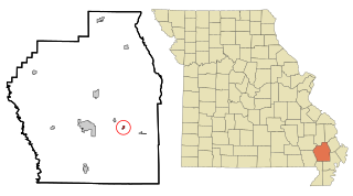
Pascola is a village in Pemiscot County, Missouri, United States. The population was 108 at the 2010 census.

<span class="mw-page-title-main">Livonia, Missouri</span> Village in Missouri, United States

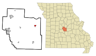
Livonia is a village in eastern Putnam County, Missouri, United States. The population was 52 at the 2020 census.

<span class="mw-page-title-main">Lucerne, Missouri</span> Village in Missouri, United States

Lucerne is a village in western Putnam County, Missouri, United States. The population was 57 at the 2020 census.

<span class="mw-page-title-main">Powersville, Missouri</span> Village in Missouri, United States

Powersville is a village in northwest Putnam County, Missouri, United States. The population was 42 at the 2020 census.

<span class="mw-page-title-main">Pasadena Park, Missouri</span> Village in Missouri, United States

Pasadena Park is a village in St. Louis County, Missouri, United States. The population was 470 at the 2010 census. It is part of the Normandy School District, and is distinct from the city of Pasadena Hills.

<span class="mw-page-title-main">Velda Village Hills, Missouri</span> Village in Missouri, United States

Velda Village Hills is a village in northeastern St. Louis County, Missouri, United States. The population was 1,055 at the 2010 census.

<span class="mw-page-title-main">Wilbur Park, Missouri</span> Village in Missouri, United States

Wilbur Park is a village in St. Louis County, Missouri, United States. The population was 471 at the 2010 census.

<span class="mw-page-title-main">Penermon, Missouri</span> Village in Missouri, United States

Penermon is a village in Stoddard County, Missouri, United States. The population was 64 at the 2010 census.

<span class="mw-page-title-main">Bull Creek, Missouri</span> Village in Missouri, United States

Bull Creek is a village in northwest Taney County, Missouri, United States. The population was 426 at the 2020 census. It is part of the Branson, Missouri Micropolitan Statistical Area.

<span class="mw-page-title-main">Deerfield, Missouri</span> Village in Missouri, United States

Deerfield is a village in Vernon County, Missouri, United States. The population was 40 at the 2020 census.

<span class="mw-page-title-main">Moundville, Missouri</span> Village in Missouri, United States

Moundville is a village in southwest Vernon County, Missouri, United States. The population was 124 at the 2010 census.

<span class="mw-page-title-main">Richards, Missouri</span> Village in Missouri, United States

Richards is a village in northwest Vernon County, Missouri, United States. The population was 96 at the 2010 census.

<span class="mw-page-title-main">Riverlea, Ohio</span> Village in Ohio, United States

Riverlea is a village in Franklin County, Ohio, United States, surrounded by Worthington on its north, south, and east sides, and bordered on the west by the Olentangy River, across which is Columbus. Riverlea was incorporated in 1939, a small community that formed on former farmland. The population was 599 at the 2020 census.

<span class="mw-page-title-main">Belmore, Ohio</span> Village in Ohio, United States

Belmore is a village in Putnam County, Ohio, United States. The population was 65 at the 2020 census.

<span class="mw-page-title-main">Continental, Ohio</span> Village in Ohio, United States

Continental is a village in Putnam County, Ohio, United States. The population was 1,153 at the 2010 census.

References

  1. "ArcGIS REST Services Directory". United States Census Bureau. Retrieved August 28, 2022.
  2. 1 2 U.S. Geological Survey Geographic Names Information System: Worthington, Missouri
  3. 1 2 "U.S. Census website". United States Census Bureau . Retrieved 2008-01-31.
  4. "Explore Census Data". data.census.gov. Retrieved 2021-12-16.
  5. "Post Offices". Jim Forte Postal History. Retrieved 11 December 2016.
  6. "Putnam County Place Names, 1928–1945". The State Historical Society of Missouri. Archived from the original on June 24, 2016. Retrieved December 11, 2016.
  7. Missouri Atlas & Gazetteer, DeLorme, 1st ed. 1998, p. 17 ISBN   0899332242
  8. "US Gazetteer files 2010". United States Census Bureau . Retrieved 2012-07-08.
  9. "Census of Population and Housing". Census.gov. Retrieved June 4, 2015.
  10. "U.S. Census website". United States Census Bureau . Retrieved 2012-07-08.