Skerton

Last updated

Skerton
St Luke's Church, Skerton.jpg
Location map United Kingdom Lancaster 2018.svg
Red pog.svg
Skerton
Location of suburb in Lancaster unparished area
Location map United Kingdom City of Lancaster.svg
Red pog.svg
Skerton
Location in the City of Lancaster district
Lancashire UK location map.svg
Red pog.svg
Skerton
Location within Lancashire
District
Shire county
Region
Country England
Sovereign state United Kingdom
List of places
UK
England
Lancashire
54°03′34″N2°48′02″W / 54.0595°N 2.8005°W / 54.0595; -2.8005

Skerton is an area in the north of Lancaster, Lancashire, England, on the other side of the River Lune to the castle. It was formerly a township, but in the late 1800s it was incorporated into Lancaster and the neighbouring townships. Skerton Bridge takes the A6 southwards towards the city centre.

Contents

Origin of the name

The origin of the name is based on Old Norse sker, Skerton meaning the tun by the reefs (i.e. sand banks in the River Lune which ran through the original Township). [1] The history of the Township to 1914 is shown in the Victoria County History. [2]

Neighbouring Lancaster annexed parts of Skerton in the late nineteenth and early twentieth centuries, when the Township was divided between Lancaster and adjacent parishes. [3] The records, show variants the name over time, 'Skerton' (1200), 'Skereton' (1292), 'Storton' (1201), and 'Sherton' (1292). Of those evolutions of the original Norse name Skerton is the modern version. [4]

History

After the Conquest of 1066, which saw control of the 'realm of England' transferred from the Saxon kings to William the Conqueror, the town of Lancaster was seized as the personal fiefdom of the Norman King. The historic hill that now plays host to the castle had previously been the site of a Roman fort and, following the Norman Conquest, was designated as the site upon which to build what is now Lancaster Castle.

The land being carved up by the Norman aristocracy, the land playing host to 'Schertune' was granted to the Halton fee, of which Earl Tostig, (See Tostig Godwinson), was a member. Tostig, having been loyal to the Norman King was rewarded in this instance with personal possession of Skerton, (Amongst other rewards of land). During his possession, the Skerton was assessed as being 'six-plough lands'.

After Tostig's possession, Skerton was retained in demesne by the Lords of Lancaster; in 1094, demesne tithes from Skerton were granted to St Martin's at Sees by Count Roger of Poitou. The land surrounding Skerton remained more or less 'Virgo intacta', an exception being made when half a Plough-land was granted to William De Skerton, (Reeve from 1201 to 1202), to be held by this Serjeanty.

In 1297, it has been recorded that there were three free tenants, these being Alan de Paries, the Abbot of Furness and Lawrence, the son of Thomas De Lancaster. [5]

During the course of the 18th century, three charities arose in connection with the settlement of Skerton...and that two of them should be geared towards the endowment of education. A school is known to have existed in Skerton since 1734, (making Skerton the second-oldest provider of education in Lancaster, after the establishment of the Lancaster Royal Grammar School in 1235, some five hundred years earlier), when the trust deed of one Jane Jepson, (dated 25 March 1734), confirmed that £100 was delivered into the hands of John Housman for the fulfilment of a number of purposes; particularly, that £60 should be earmarked for either the purchase of construction of a schoolhouse, and that any remainder or surplus should be lent out at interest...and the return from this latter investment used to employ a schoolmaster for the teaching of poor children. [6]

A later endowment came in the form of Henry Williamson's trust deed, (dated 10 February 1767), when he bequeathed £100 to be used for investments that would yield a sufficient rate of return: "...towards teaching young children belonging to the township to read the Bible, write, knit or sew, and if any overplus should be, that the same should be laid out in clothing such children as would be indigent". [7]

Intervening between these two noble patronages, we are also aware of an apparently-anonymous endowment, referred to only as 'Money's Charity'...which, (we learn from Cross Fleury's 1891 history of Lancaster), had emerged under an indenture dated 13 December 1760, (in recitation of an earlier indenture of mortgage, dating from 2 November 1750), whereby 'two messuages and a garden situate in Skerton', had been mortgaged to James Rigmaiden and Peter Cook, (referred to in contemporary documentation as 'Sidesmen' of the parish), as trustees on behalf of the residents of Skerton in the interests of securing support for those poor inhabitants of the same, requiring relief...as per agreement between the aforesaid trustees and John Money, who undertook to demise same premises in pursuance thereof, for a period of one thousand years. [8]

Whilst the archaic language of 18th century land-conveyances and trust deeds would appear to ensure that much of this complex arrangement remains incomprehensible to the modern reader, it is with the careful paraphrasing of Cross Fleury that we are able to determine that the 'Money's Charity' thus primarily entailed the effective transfer of four dwellinghouses and a cattleshed to the care of the parish of Skerton; with a view to the sub-leasing of the same and the use of the rents therefrom, in relief of the poor. [9]

In the intervening years leading up to Incorporation of the Township of Skerton in 1888, we read of the two 'National Schools' attached to the parish church of St Luke, brought under government inspection following the Education Act 1870, and enlarged in 1877 at the cost of around £900; with a subsequent annuity of £27 paid from the endowment of the historic Williamson and Jepson Charities. At that time administered by the Vicar and Church Wardens of St Luke's Church, as named trustees. [10]

The 1888 Incorporation of Skerton as a township brought with it a flurry of new buildings inclined towards the civic advancement of the people. A new county police station was completed in 1889 and still stands today on Owen Road. Referred to by Cross Fleury in 1891 as having cost £5,000. [11]

Tramways are also known to have run through Skerton; served by the Lancaster Corporation Tramways, which were in operation from 14 January 1903, until 4 April 1930 when services ceased. [12] As around 3 miles of tramline are known to have been laid down and mention is made in contemporary sources dating from 1914 of a route having passed through Skerton on its way to Morecambe. [13]

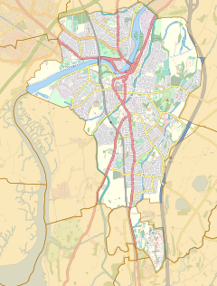
Skerton was formerly a township and chapelry in the parish of Lancaster, [14] in 1866 Skerton became a separate civil parish, [15] on 9 November 1900 the parish was abolished and merged with Lancaster and Heaton with Oxcliffe. [16] In 1891 the parish had a population of 311. [17] It is now in the unparished area of Lancaster.

Related Research Articles

<span class="mw-page-title-main">Blackburn Hundred</span> Former sub-division of Lancashire, UK

Blackburn Hundred is a historic sub-division of the county of Lancashire, in northern England. Its chief town was Blackburn, in the southwest of the hundred. It covered an area similar to modern East Lancashire, including the current districts of Ribble Valley, Pendle, Burnley, Rossendale, Hyndburn, Blackburn with Darwen, and South Ribble.

<span class="mw-page-title-main">River Irk</span> River in Greater Manchester, England

The River Irk is a river in the historic county of Lancashire in the North West England that flows through the northern most Lancastrian towns of the ceremonial county of Greater Manchester.

<span class="mw-page-title-main">History of Lancashire</span>

Lancashire is a county of England, in the northwest of the country. The county did not exist in 1086, for the Domesday Book, and was apparently first created in 1182, making it one of the youngest of the traditional counties.

<span class="mw-page-title-main">Halton-with-Aughton</span> Human settlement in England

Halton-with-Aughton is a civil parish and electoral ward located 3 miles (5 km) east of Lancaster, England, on the north bank of the River Lune. The main settlement is the village of Halton, or Halton-on-Lune, in the west, and the parish stretches to the hamlet of Aughton in the east. It lies in the City of Lancaster district of Lancashire, and has a population of 2,227, down from 2,360 in 2001.

<span class="mw-page-title-main">Bispham, Blackpool</span> Human settlement in England

Bispham is a village on the Fylde coast in the Borough of Blackpool in Lancashire, England.

Rossall is a settlement in Lancashire, England and a suburb of the market town of Fleetwood. It is situated on a coastal plain called The Fylde. Blackpool Tramway runs through Rossall, with two stations: Rossall School on Broadway and Rossall Square on South strand.

<span class="mw-page-title-main">Staining, Lancashire</span> Human settlement in England

Staining is a village and civil parish in Lancashire, England, on the Fylde coast close to the seaside resorts of Blackpool and Lytham St Annes, and the market town of Poulton-le-Fylde. At the 2011 Census, it had a population of 2,290. Historically, the village was part of the township of Hardhorn-with-Newton. Now the hamlet of Newton is part of the civil parish of Staining; Hardhorn belongs to Poulton-le-Fylde.

<span class="mw-page-title-main">Hambleton, Lancashire</span> Human settlement in England

Hambleton is a village and civil parish in the English county of Lancashire. It is situated on a coastal plain called the Fylde and in an area east of the River Wyre known locally as Over Wyre. Hambleton lies approximately 3 miles (4.8 km) north-east of its post town, Poulton-le-Fylde, and about 7 miles (11 km) north-east of the seaside resort of Blackpool. In the 2001 United Kingdom census, the parish had a population of 2,678, increasing to 2,744 at the 2011 census.

<span class="mw-page-title-main">Stalmine</span> Village in Wyre Borough, Lancashire, England

Stalmine is a village in the civil parish of Stalmine-with-Staynall, in the Wyre borough of Lancashire, England, in a part of the Fylde known as Over Wyre. The village is located on a small hill on the A588, the main road between Hambleton and Lancaster, with the highest level 75 ft above sea level. The village name has been spelled Stalmin and Stalemynne. The village had a population of 1,087 at the 2011 Census.

<span class="mw-page-title-main">Elswick, Lancashire</span> Human settlement in England

Elswick is a rural village and civil parish on the Fylde coast of Lancashire, England. At the 2011 Census, it had a population of 1,079.

Heaton is mostly a residential district of Bolton, Greater Manchester, England. It lies about 2 miles (3 km) north west of Bolton town centre. It is bounded by Deane to the south, Markland Hill to the west, and Smithills and Halliwell to the north.

<span class="mw-page-title-main">Caton-with-Littledale</span> Human settlement in England

The civil parish of Caton-with-Littledale is situated in Lancashire, England, near the River Lune. The parish lies within the Forest of Bowland Area of Outstanding Natural Beauty and contains the villages of Caton, Brookhouse, Caton Green, Littledale and Townend.

<span class="mw-page-title-main">Stalmine-with-Staynall</span> Parish in Wyre Borough, Lancashire, England

Stalmine-with-Staynall is a civil parish within the Wyre borough of Lancashire, England, in a part of the Fylde known as Over Wyre. The parish contains the village of Stalmine and the hamlets of Staynall and Wardley. The civil parish had a population of 1,486 at the 2011 Census, of which 1,087 lived in Stalmine village.

<span class="mw-page-title-main">Great Eccleston</span> Human settlement in England

Great Eccleston is a village and civil parish in Lancashire, England situated on a coastal plain called the Fylde. The village lies to the south of the River Wyre and the A586 road, approximately 10 miles (16 km) upstream from Fleetwood. At the 2001 census, the parish had a population of 1,473, rising slightly to 1,486 at the 2011 census.

<span class="mw-page-title-main">Aldcliffe</span> Human settlement in England

Aldcliffe is a hamlet, and former township and civil parish, now in the parish of Aldcliffe-with-Stodday, south-west of Lancaster, in the Lancaster district, in the county of Lancashire, England. The hamlet is located on the east bank of the River Lune, and is one and a half miles south west of the Lancaster city centre.

<span class="mw-page-title-main">Inskip-with-Sowerby</span> Parish in Wyre Borough, Lancashire, England

Inskip-with-Sowerby is a civil parish in the Borough of Wyre, in Lancashire, England. A part of the Fylde, the parish includes the village of Inskip and the hamlets Crossmoor to the west and Sowerby to the east. Also Inskip Moss Side lies about a mile north-west of the village at grid reference SD452391. In 2011 it had a population of 840.

<span class="mw-page-title-main">Honour of Clitheroe</span>

The Honour of Clitheroe is an ancient grouping of manors and royal forests centred on Clitheroe Castle in Lancashire, England; an honour traditionally being the grant of a large landholding complex, not all of whose parts are contiguous. In the case of Clitheroe, this complex was loosely clustered around the ancient wapentake of Blackburnshire.

<span class="mw-page-title-main">Carleton, Lancashire</span> Village in Lancashire, England

Carleton is a village on the coastal plain of the Fylde in the Borough of Wyre in Lancashire, England. It consists of Great Carleton, Little Carleton, Norcross and Whiteholme and is situated close to Poulton-le-Fylde. Other nearby settlements include Thornton, Bispham and Blackpool. Historically, Carleton was in the parish of Poulton-le-Fylde. It borders the Borough of Blackpool immediately to the west.

<span class="mw-page-title-main">St Anne's Church, Woodplumpton</span> Church in Lancashire, England

St Anne's is a church in the village of Woodplumpton in Lancashire, England. It is an active Anglican parish church in the Diocese of Blackburn, and the archdeaconry of Lancaster, and the deanery of Garstang. The church is recorded in the National Heritage List for England as a designated Grade II* listed building. The churchyard at St Anne's is the supposed burial place of a 17th-century alleged witch named Meg Shelton.

<span class="mw-page-title-main">St Wilfrid's Church, Halton-on-Lune</span> Church in Lancashire, England

St Wilfrid's Church is an Anglican church in Halton-on-Lune, a village in the English county of Lancashire. It is an active parish church in the Diocese of Blackburn and the archdeaconry of Lancaster. Halton may have been the site of an ancient Anglo-Saxon minster. Of the current structure, the tower dates from the 16th century and the remainder was built 1876–77 by Paley and Austin. The church is recorded in the National Heritage List for England as a designated Grade II listed building.

References

  1. Ekwall E,The Concise Oxford Dictionary of English Place Names 4th Edition 1960. reprinted 1970, pp. 424, 425.
  2. For a fully referenced history see the on-line Victoria County History, A History of the County of Lancaster, Vol 8, Eds. William Farrer & J. Brownbill, (1914) pp.98-61
  3. See W Farrer & J Brownbill op. Cit.
  4. See Ekwall op. cit.
  5. Fleury 1891 , p. 550
  6. Fleury 1891 , p. 561
  7. Fleury 1891 , p. 561
  8. Fleury 1891 , p. 561
  9. Fleury 1891 , p. 562
  10. Fleury 1891 , p. 560
  11. Fleury 1891 , p. 563
  12. The Golden Age of Tramways. Published by Taylor and Francis.
  13. For a fully referenced history see the on-line Victoria County History, A History of the County of Lancaster, Vol 8, Eds. William Farrer & J. Brownbill, (1914) pp.98-61
  14. "History of Skerton, in Lancaster and Lancashire". A Vision of Britain through Time . Retrieved 25 March 2024.
  15. "Relationships and changes Skerton CP/Tn through time". A Vision of Britain through Time. Retrieved 25 March 2024.
  16. "Lancaster Registration District". UKBMD. Retrieved 25 March 2024.
  17. "Population statistics Skerton CP/Tn through time". A Vision of Britain through Time. Retrieved 25 March 2024.