Skokomish, Washington

Last updated

Skokomish, Washington
CDP
Skokomish Casino Lucky Dog.JPG
The Lucky Dog Casino of the Skokomish Tribe
Mason County Washington Incorporated and Unincorporated areas Skokomish Highlighted.svg
Location of Skokomish, Washington
Coordinates: 47°20′00″N123°09′27″W / 47.33333°N 123.15750°W / 47.33333; -123.15750
Country United States
State Washington
County Mason
Area
  Total6.9 sq mi (17.8 km2)
  Land6.7 sq mi (17.2 km2)
  Water0.2 sq mi (0.6 km2)
Elevation
30 ft (9 m)
Population
 (2010)
  Total617
  Density89/sq mi (35/km2)
Time zone UTC-8 (Pacific (PST))
  Summer (DST) UTC-7 (PDT)
ZIP code
98584
Area code 360
FIPS code 53-64775 [1]
GNIS feature ID1867633 [2]

Skokomish is a census-designated place (CDP) in Mason County, Washington, United States. The population was 617 at the 2010 census. The town is the headquarters of the Skokomish Indian Tribe.

Contents

Geography

According to the United States Census Bureau, the CDP has a total area of 6.9 square miles (17.8 km2), of which, 6.7 square miles (17.2 km2) of it is land and 0.2 square miles (0.6 km2) of it (3.20%) is water.

Demographics

As of the census [1] of 2000, there were 616 people, 186 households, and 153 families residing in the CDP. The population density was 92.5 people per square mile (35.7/km2). There were 195 housing units at an average density of 29.3/sq mi (11.3/km2). The racial makeup of the CDP was 19.16% White, 78.90% Native American, 0.16% Asian, 0.32% from other races, and 1.46% from two or more races. Hispanic or Latino of any race were 2.27% of the population.

There were 186 households, out of which 49.5% had children under the age of 18 living with them, 43.0% were married couples living together, 21.5% had a female householder with no husband present, and 17.7% were non-families. 12.4% of all households were made up of individuals, and 3.2% had someone living alone who was 65 years of age or older. The average household size was 3.31 and the average family size was 3.42.

In the CDP, the population was spread out, with 38.1% under the age of 18, 8.1% from 18 to 24, 28.6% from 25 to 44, 18.3% from 45 to 64, and 6.8% who were 65 years of age or older. The median age was 28 years. For every 100 females, there were 103.3 males. For every 100 females age 18 and over, there were 109.3 males.

The median income for a household in the CDP was $24,038, and the median income for a family was $26,563. Males had a median income of $23,750 versus $25,125 for females. The per capita income for the CDP was $9,548. About 26.6% of families and 29.3% of the population were below the poverty line, including 27.3% of those under age 18 and 10.6% of those age 65 or over.

Related Research Articles

<span class="mw-page-title-main">Mignon, Alabama</span> CDP in Alabama, United States

Mignon is a census-designated place (CDP) in Talladega County, Alabama, United States. At the 2020 census, the population was 1,186.

<span class="mw-page-title-main">Lakeview, California</span> Census-designated place in California, United States

Lakeview is a census-designated place (CDP) in Riverside County, California, United States. The population was 2,104 at the 2010 census, up from 1,619 at the 2000 census. The community is named for nearby Mystic Lake.

<span class="mw-page-title-main">Goodland, Florida</span> Census-designated place in Florida

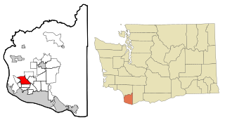
Goodland is a census-designated place (CDP) in Collier County, Florida, United States. The population was 267 at the 2010 census. It is part of the Naples–Marco Island Metropolitan Statistical Area. Located on the southeast portion of Marco Island, it is the closest community to Cape Romano, the southern tip of a nearby island that was the official site of the Florida landfall of Hurricane Wilma.

<span class="mw-page-title-main">Watertown, Florida</span> CDP in Florida, United States

Watertown is a census-designated place (CDP) in Columbia County, Florida, United States. As of the 2010 census, it had a population of 2,829.

<span class="mw-page-title-main">North Weeki Wachee, Florida</span> Census-designated place in Florida, United States

North Weeki Wachee is a census-designated place (CDP) in Hernando County, Florida, United States. The population was 8,524 at the 2010 census, up from 4,253 at the 2000 census.

<span class="mw-page-title-main">Puhi, Hawaii</span> Census-designated place in Hawaii, United States

Puhi is a census-designated place (CDP) in Kauaʻi County, Hawaiʻi, United States. The population was 3,380 at the 2020 census, up from 1,186 at the 2000 census.

<span class="mw-page-title-main">Oak Park, Indiana</span> CDP in Indiana, United States

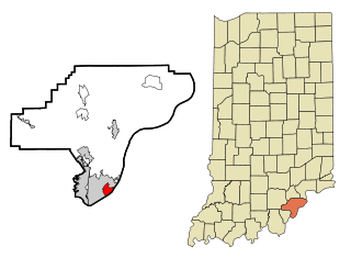
Oak Park is a census-designated place (CDP) in Clark County, Indiana, United States. The population was 5,379 at the 2000 census.

<span class="mw-page-title-main">Meridian Station, Mississippi</span> Census-designated place in Mississippi, United States

Meridian Station is a census-designated place (CDP) in Lauderdale County, Mississippi, United States, corresponding to the residential portions of Naval Air Station Meridian. The population was 1,090 at the 2010 census.

<span class="mw-page-title-main">Imperial, Missouri</span> Census-designated place in Missouri, United States

Imperial is a census-designated place (CDP) in Jefferson County, Missouri, United States, and is a suburb of St. Louis. The population was 4,947 at the 2020 census. Imperial was originally known as West Kimmswick, the historic Catholic church of St. John’s in Imperial, became an independent parish in 1869.

<span class="mw-page-title-main">Lemay, Missouri</span> CDP in Missouri, United States

Lemay is a census-designated place (CDP) in south St. Louis County, Missouri, United States. The population was 16,645 at the 2010 census.

<span class="mw-page-title-main">Springdale, New Jersey</span> Populated place in Camden County, New Jersey, US

Springdale is an unincorporated community and census-designated place (CDP) located within Cherry Hill Township, in Camden County, in the U.S. state of New Jersey. As of the 2010 United States Census, the section population was 14,518.

<span class="mw-page-title-main">Brownville, New Jersey</span> Populated place in Middlesex County, New Jersey, US

Brownville is an unincorporated community and census-designated place (CDP) located within Old Bridge Township, in Middlesex County, in the U.S. state of New Jersey. As of the 2010 United States Census, the CDP's population was 2,383.

<span class="mw-page-title-main">Yorketown, New Jersey</span> Populated place in Monmouth County, New Jersey, US

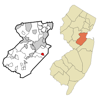
Yorketown is an unincorporated community and census-designated place (CDP) within Manalapan Township, in Monmouth County, in the U.S. state of New Jersey. At the 2020 census, the CDP's population was 6,739.

<span class="mw-page-title-main">Dry Creek, Oklahoma</span> Census-designated place in Oklahoma, United States

Dry Creek is an unincorporated community and census-designated place (CDP) in Cherokee County, Oklahoma, United States. The population was 227 at the 2010 census.

<span class="mw-page-title-main">Gopher Flats, Oregon</span> CDP in Oregon, United States

Gopher Flats is a census-designated place (CDP) in Umatilla County, Oregon, United States. The population was 401 at the 2000 census. It is part of the Pendleton–Hermiston Micropolitan Statistical Area.

Jacksonville is a census-designated place (CDP) in Indiana County, Pennsylvania, United States. The population was 637 at the 2010 census. It was formerly an independent borough, until January 1, 1993 when it was returned to Black Lick Township, Pennsylvania.

<span class="mw-page-title-main">Scissors, Texas</span> Census-designated place in Texas

Scissors is a census-designated place (CDP) in Hidalgo County, Texas. The population was 3,186 at the 2010 United States Census. It is part of the McAllen–Edinburg–Mission Metropolitan Statistical Area.

<span class="mw-page-title-main">West Mountain, Utah</span> CDP in Utah, United States

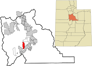
West Mountain is a census-designated place (CDP) in Utah County, Utah, United States. It is part of the Provo–Orem Metropolitan Statistical Area. As of the 2010 census, the CDP population was 1,186. The town is at the base of West Mountain and bears its name.

<span class="mw-page-title-main">Salmon Creek, Washington</span> Census-designated place in Washington, United States

Salmon Creek is a census-designated place (CDP) in Clark County, Washington, United States. The population was 19,686 at the 2010 census, up from 16,767 at the 2000 census.

<span class="mw-page-title-main">Guilford (CDP), Maine</span> CDP in Maine, United States

Guilford is a census-designated place (CDP) in the town of Guilford in Piscataquis County, Maine, United States. The population was 945 at the 2000 census.

References

  1. 1 2 "U.S. Census website". United States Census Bureau . Retrieved January 31, 2008.
  2. "Skokomish". Geographic Names Information System . United States Geological Survey, United States Department of the Interior.