Solon, Iowa

Last updated

Solon, Iowa
Solon iowa downtown.jpg
Downtown Solon, Iowa
Solon IA logo.jpg
Motto: 
A Place to Put Down Roots
Johnson County Iowa Incorporated and Unincorporated areas Solon Highlighted.svg
Location of Solon in the state of Iowa
Coordinates: 41°48′24″N91°29′45″W / 41.80667°N 91.49583°W / 41.80667; -91.49583
Country Flag of the United States.svg  United States
State Flag of Iowa.svg  Iowa
County Johnson
RegionIowa City Metropolitan Statistical Area
Government
  Type Mayor-council government
   Mayor Daniel O’niel
Area
[1]
  Total1.32 sq mi (3.43 km2)
  Land1.32 sq mi (3.43 km2)
  Water0.00 sq mi (0.00 km2)
Elevation
801 ft (244 m)
Population
 (2020)
  Total3,018
  Density2,277.74/sq mi (879.46/km2)
Time zone UTC-6 (Central)
  Summer (DST) UTC-5 (Central)
ZIP code
52333
Area code 319
FIPS code 19-73875
GNIS feature ID0461748
Website www.solon-iowa.com

Solon is a city located in Johnson County, Iowa, United States. Part of the Iowa City, Iowa Metropolitan Statistical Area, it is located a few miles from Lake MacBride State Park and the larger cities of Coralville and Iowa City. The population was 3,018 at the time of the 2020 census. [2]

Contents

History

Solon was platted in 1840. [3] It is named for the classical Athenian statesman, lawmaker, and lyric poet Solon. Ironically, the local high school's mascot is the Spartans; Sparta was famously an enemy of Athens, Solon's home. The National Register of Historic Places-listed Stone Academy is just north of town. [4]

Geography

According to the United States Census Bureau, the city has a total area of 1.39 square miles (3.60 km2), all land. [5]

Demographics

Historical populations
YearPop.±%
1880 383    
1890 353−7.8%
1900 397+12.5%
1910 450+13.4%
1920 471+4.7%
1930 493+4.7%
1940 515+4.5%
1950 527+2.3%
1960 604+14.6%
1970 837+38.6%
1980 969+15.8%
1990 1,050+8.4%
2000 1,177+12.1%
2010 2,037+73.1%
2020 3,018+48.2%
Source: "U.S. Census website". United States Census Bureau . Retrieved March 29, 2020. and Iowa Data Center
Source:
U.S. Decennial Census [6] [2]

2010 census

As of the census [7] of 2010, there were 2,037 people, 759 households, and 528 families living in the city. The population density was 1,465.5 inhabitants per square mile (565.8/km2). There were 832 housing units at an average density of 598.6 per square mile (231.1/km2). The racial makeup of the city was 97.8% White, 0.3% African American, 0.3% Asian, 0.6% from other races, and 0.8% from two or more races. Hispanic or Latino of any race were 1.5% of the population.

There were 759 households, of which 46.2% had children under the age of 18 living with them, 55.5% were married couples living together, 9.7% had a female householder with no husband present, 4.3% had a male householder with no wife present, and 30.4% were non-families. 26.4% of all households were made up of individuals, and 10.3% had someone living alone who was 65 years of age or older. The average household size was 2.60 and the average family size was 3.17.

The median age in the city was 35.4 years. 32.2% of residents were under the age of 18; 4.4% were between the ages of 18 and 24; 29% were from 25 to 44; 20.9% were from 45 to 64; and 13.5% were 65 years of age or older. The gender makeup of the city was 48.3% male and 51.7% female.

2000 census

As of the census [8] of 2000, there were 1,177 people, 457 households, and 304 families living in the city. The population density was 887.1 inhabitants per square mile (342.5/km2). There were 496 housing units at an average density of 373.8 per square mile (144.3/km2). The racial makeup of the city was 98.73% White, 0.25% African American, 0.08% Native American, 0.25% Pacific Islander, 0.17% from other races, and 0.51% from two or more races. Hispanic or Latino of any race were 0.17% of the population.

There were 457 households, out of which 37.6% had children under the age of 18 living with them, 54.3% were married couples living together, 9.0% had a female householder with no husband present, and 33.3% were non-families. 28.9% of all households were made up of individuals, and 12.5% had someone living alone who was 65 years of age or older. The average household size was 2.43 and the average family size was 3.04.

26.2% are under the age of 18, 7.4% from 18 to 24, 30.1% from 25 to 44, 18.5% from 45 to 64, and 17.8% who were 65 years of age or older. The median age was 38 years. For every 100 females, there were 97.8 males. For every 100 females age 18 and over, there were 86.1 males.

The median income for a household in the city was $46,953, and the median income for a family was $58,289. Males had a median income of $38,352 versus $26,111 for females. The per capita income for the city was $18,029. About 0.3% of families and 2.3% of the population were below the poverty line, including 0.6% of those under age 18 and 1.5% of those age 65 or over.

Architecture

Education

The Solon area is served by the Solon Community School District.

Notable people

Related Research Articles

<span class="mw-page-title-main">Moulton, Iowa</span> City in Iowa, United States

Moulton is a city in Appanoose County, Iowa, United States. The population was 607 at the time of the 2020 census.

<span class="mw-page-title-main">Hudson, Iowa</span> City in Iowa, United States

Hudson is a city in Black Hawk County, Iowa, United States. The population was 2,546 at the time of the 2020 census. The rural community of Hudson has grown in recent years and is included as a part of the Waterloo-Cedar Falls Metropolitan Statistical Area.

<span class="mw-page-title-main">Fairbank, Iowa</span> City in Iowa, United States

Fairbank is a city in Buchanan and Fayette counties in the U.S. state of Iowa. The population was 1,111 at the time of the 2020 census.

<span class="mw-page-title-main">Mondamin, Iowa</span> City in Iowa, United States

Mondamin is a city in Harrison County, Iowa, United States. The population was 339 at the time of the 2020 census.

<span class="mw-page-title-main">Woodbine, Iowa</span> City in Iowa, United States

Woodbine is a city in Harrison County, Iowa, United States, along the Boyer River. The population was 1,625 at the time of the 2020 census.

<span class="mw-page-title-main">Hills, Iowa</span> City in Iowa, United States

Hills is a city in Johnson County, Iowa, United States. It is part of the Iowa City, Iowa Metropolitan Statistical Area. The population was 863 at the time of the 2020 census. It is part of the Iowa City Community School District.

<span class="mw-page-title-main">Whittemore, Iowa</span> City in Iowa, United States

Whittemore is a city in Kossuth County, Iowa, United States. The population was 497 at the time of the 2020 census.

<span class="mw-page-title-main">Walker, Iowa</span> City in Iowa, United States

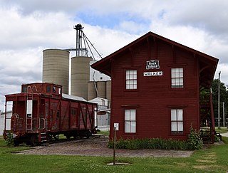
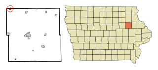
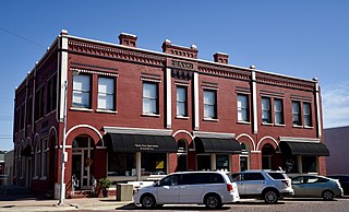
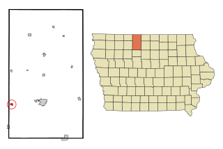
Walker is a city in Linn County, Iowa. The population was 688 at the 2020 census. It is part of the Cedar Rapids, Iowa metropolitan area.

<span class="mw-page-title-main">Wapello, Iowa</span> City in Iowa, United States

Wapello is a city in and the county seat of Louisa County, Iowa, United States. The population was 2,084 at the time of the 2020 census.

<span class="mw-page-title-main">Leighton, Iowa</span> City in Iowa, United States

Leighton is a city in Mahaska County, Iowa, United States. The population was 158 in the 2020 census, an increase from 153 in the 2000 census.

<span class="mw-page-title-main">Runnells, Iowa</span> City in Iowa, United States

Runnells is a city in the southeastern corner of Polk County, Iowa, United States. The population was 457 at the time of the 2020 census. It is part of the Des Moines–West Des Moines Metropolitan Statistical Area. Runnells has its own Post Office, located at 112 Brown Street.

<span class="mw-page-title-main">Carson, Iowa</span> City in Iowa, United States

Carson is a city in Pottawattamie County, Iowa, United States. The population was 766 at the 2020 census. Carson has a number of interesting and historic places.

<span class="mw-page-title-main">Macedonia, Iowa</span> City in Iowa, United States

Macedonia is a city in Pottawattamie County, Iowa, United States. The population was 267 at the time of the 2020 census.

<span class="mw-page-title-main">McClelland, Iowa</span> City in Iowa, United States

McClelland is a city in Pottawattamie County, Iowa, United States. The city was founded in 1903 after the Great Western Railroad was extended to include Council Bluffs, Iowa The population was 146 at the time of the 2020 census.

<span class="mw-page-title-main">Minden, Iowa</span> City in Iowa, United States

Minden is a city in Pottawattamie County, Iowa, United States. The population was 600 at the time of the 2020 census. It has possessed a post office since 1875.

<span class="mw-page-title-main">Kellerton, Iowa</span> City in Iowa, United States

Kellerton is a city in eastern Ringgold County, Iowa, United States. The population was 243 at the time of the 2020 census.

<span class="mw-page-title-main">Dixon, Iowa</span> City in Iowa, United States

Dixon is a city in Scott County, Iowa, United States. The population was 202 at the time of the 2020 census.

<span class="mw-page-title-main">Glenwillow, Ohio</span> Village in Ohio, United States

Glenwillow is a village in Cuyahoga County, Ohio, United States. The population was 994 at the 2020 census. A suburb of Cleveland, it is a part of the Cleveland metropolitan area.

<span class="mw-page-title-main">South Solon, Ohio</span> Village in Ohio, United States

South Solon is a village in Madison County, Ohio, United States. The population was 329 at the 2020 census. Despite their similar names, South Solon is not adjacent to the city of Solon, Ohio, a suburb of Cleveland in Cuyahoga County. The two towns are approximately 170 miles (270 km) apart.

Solon Springs is a town in Douglas County, Wisconsin, United States. As of the 2010 census, the town had a total population of 910. The Village of Solon Springs is located within the town. The unincorporated community of Sauntry is also located in the town.

References

  1. "2020 U.S. Gazetteer Files". United States Census Bureau. Retrieved March 16, 2022.
  2. 1 2 "2020 Census State Redistricting Data". census.gov. United states Census Bureau. Retrieved August 12, 2021.
  3. Aurner, Clarence Ray (1912). Leading Events in Johnson County, Iowa, History, Volume 1. Western Historical Press. p. 165.
  4. "National Register Database and Research - National Register of Historic Places (U.S. National Park Service)". www.nps.gov. Retrieved June 16, 2019.
  5. "US Gazetteer files 2010". United States Census Bureau. Archived from the original on July 2, 2012. Retrieved May 11, 2012.
  6. "Census of Population and Housing". Census.gov. Retrieved June 4, 2015.
  7. "U.S. Census website". United States Census Bureau . Retrieved May 11, 2012.
  8. "U.S. Census website". United States Census Bureau . Retrieved January 31, 2008.