South Bend, Washington

Last updated

South Bend
South Bend, Washington
Pacific County Courthouse (Washington state).jpg
Pacific County Courthouse, South Bend
Nickname: 
Oyster Capital of the World
Pacific County Washington Incorporated and Unincorporated areas South Bend Highlighted.svg
Location of South Bend, Washington
Coordinates: 46°39′49″N123°48′4″W / 46.66361°N 123.80111°W / 46.66361; -123.80111
Country United States
State Washington
County Pacific
Area
[1]
  Total1.99 sq mi (5.16 km2)
  Land1.64 sq mi (4.25 km2)
  Water0.35 sq mi (0.91 km2)
Elevation
56 ft (17 m)
Population
 (2020)
  Total1,746
  Density880/sq mi (340/km2)
Time zone UTC-8 (Pacific (PST))
  Summer (DST) UTC-7 (PDT)
ZIP code
98586
Area code 360
FIPS code 53-65625 [2]
GNIS feature ID1509692 [3]
Website City of South Bend

South Bend is a city in and the county seat of Pacific County, Washington, United States. [4] The population was 1,746 as of the 2020 census. The town is widely-known for its oyster production and scenery.

Contents

History

South Bend was officially incorporated on September 27, 1890. The name of the city comes from its location on the Willapa River. [5] The county seat was relocated from Oysterville to South Bend in 1893. The Pacific County Courthouse is on the National Register of Historic Places. The old South Bend Courthouse was the site of the first and only execution carried out in Pacific County, when convicted murderer Lum You was hanged in 1902.

Geography

South Bend is located at 46°39′49″N123°48′4″W / 46.66361°N 123.80111°W / 46.66361; -123.80111 (46.663477, -123.801176) [6] on the Willapa river.

According to the United States Census Bureau, the city has a total area of 2.01 square miles (5.21 km2), of which, 1.63 square miles (4.22 km2) is land and 0.38 square miles (0.98 km2) is water. [7]

Climate

Climate data for South Bend, WA
MonthJanFebMarAprMayJunJulAugSepOctNovDecYear
Mean daily maximum °F (°C)46
(8)
50
(10)
54
(12)
57
(14)
62
(17)
66
(19)
70
(21)
72
(22)
69
(21)
60
(16)
51
(11)
46
(8)
59
(15)
Mean daily minimum °F (°C)32
(0)
33
(1)
35
(2)
37
(3)
42
(6)
47
(8)
50
(10)
50
(10)
45
(7)
39
(4)
36
(2)
33
(1)
40
(5)
Average precipitation inches (mm)12.05
(306)
10.75
(273)
9.25
(235)
6.31
(160)
4.03
(102)
2.84
(72)
1.45
(37)
1.47
(37)
3.24
(82)
6.82
(173)
12.67
(322)
12.76
(324)
83.64
(2,123)
Source: The Weather Channel [8]

Demographics

Historical population
CensusPop.Note
1900 711
1910 3,023325.2%
1920 1,948−35.6%
1930 1,798−7.7%
1940 1,771−1.5%
1950 1,8574.9%
1960 1,671−10.0%
1970 1,7957.4%
1980 1,686−6.1%
1990 1,551−8.0%
2000 1,80716.5%
2010 1,637−9.4%
2020 1,7466.7%
U.S. Decennial Census [9]
2020 Census [10]

2010 census

As of the 2010 census, [11] there were 1,637 people, 684 households, and 414 families living in the city. The population density was 1,004.3 inhabitants per square mile (387.8/km2). There were 780 housing units at an average density of 478.5 per square mile (184.7/km2). The racial makeup of the city was 72.2% White, 0.2% African American, 3.4% Native American, 5.5% Asian, 13.3% from other races, and 5.4% from two or more races. Hispanic or Latino of any race were 19.4% of the population.

There were 684 households, of which 27.5% had children under the age of 18 living with them, 43.3% were married couples living together, 11.1% had a female householder with no husband present, 6.1% had a male householder with no wife present, and 39.5% were non-families. 33.8% of all households were made up of individuals, and 16.5% had someone living alone who was 65 years of age or older. The average household size was 2.31 and the average family size was 2.93.

The median age in the city was 43.9 years. 22.8% of residents were under the age of 18; 8.1% were between the ages of 18 and 24; 20.7% were from 25 to 44; 26.8% were from 45 to 64; and 21.7% were 65 years of age or older. The gender makeup of the city was 50.3% male and 49.7% female.

2000 census

As of the 2000 census, [2] there were 1,807 people, 702 households, and 471 families living in the city.

The population density was 999.4 people per square mile (385.5/km2). There were 815 housing units at an average density of 450.7 per square mile (173.9/km2).

The racial makeup of the city was 83.45% White, 9.24% Hispanic or Latino, 4.93% Asian, 3.71% Native American, 0.17% African American, and 0.17% Pacific Islander. 3.76% identified themselves as some other race and 3.82% as two or more races. 17.7% were of German, 11.6% American, 9.1% Irish and 7.7% English ancestry according to Census 2000.

Of the 702 households, 52.3% consisted of married couples living together, 32.9% were non-family households, 29.5% contained children under the age of 18, 26.9% were made up of individuals only, 13.0% had someone living alone who was 65 years of age or older, and 10.0% had a female householder with no husband present. The average household size was 2.48 and the average family size was 3.02.

In the city, the population was spread out, with 26.4% under the age of 18, 7.7% from 18 to 24, 23.6% from 25 to 44, 24.1% from 45 to 64, and 18.2% who were 65 years of age or older. The median age was 39 years. For every 100 females, there were 94.9 males. For every 100 females age 18 and over, there were 94.7 males.

The median income for a household in the city was $29,211, and the median income for a family was $35,221. Males had a median income of $35,069 versus $23,906 for females. The per capita income for the city was $14,776. About 12.8% of families and 18.3% of the population were below the poverty line, including 25.5% of those under age 18 and 6.5% of those age 65 or over.

Notable natives

See also

Related Research Articles

<span class="mw-page-title-main">Pacific County, Washington</span> County in Washington, United States

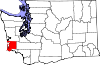
Pacific County is a county in the U.S. state of Washington. As of the 2020 census, the population was 23,365. Its county seat is South Bend, and its largest city is Raymond. The county was formed by the government of Oregon Territory in February 1851 and is named for the Pacific Ocean.

<span class="mw-page-title-main">Lincoln County, Washington</span> County in Washington, United States

Lincoln County is a county located in the U.S. state of Washington. As of the 2020 census, the population was 10,876, making it the fifth-least populous county in the state. The county seat and largest city is Davenport.

<span class="mw-page-title-main">Thomson, Minnesota</span> Former City in Minnesota, United States

Thomson was a city in Carlton County, Minnesota, United States, located along the Saint Louis River. The population was 159 at the 2010 census.

<span class="mw-page-title-main">Plantersville, Mississippi</span> Town in Mississippi, United States

Plantersville is a town in Lee County, Mississippi. The population was 868 at the 2020 census.

<span class="mw-page-title-main">River Bend, Missouri</span> Village in Missouri, United States

River Bend is a village in Jackson County, Missouri, United States. The population was 3 at the 2020 census. It is the only part of Jackson County that lies north of the Missouri River. In 1951, the Missouri River was relocated to a new channel, creating River Bend,. The county line still follows the original riverbed. It is part of the Kansas City metropolitan area. The mayor is Alex Dockler.

<span class="mw-page-title-main">South Bend, Nebraska</span> Village in Nebraska, United States

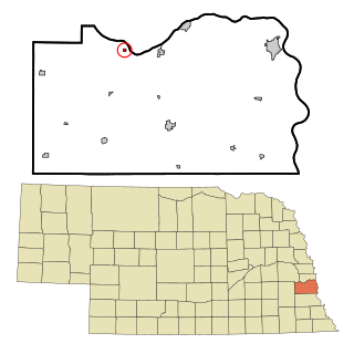
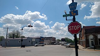
South Bend is a village in Cass County, Nebraska, United States. The population was 92 at the 2020 census. The main landmark is a pedestrian bridge across the Platte River which leads to Schramm Park State Recreation Area. It was built in 2004 on the pillars of the abandoned Rock Island Railroad bridge. Thirty-five trains a day—most of them coal trains—still pass through the area on the BNSF Railway main.

<span class="mw-page-title-main">North Bend, Ohio</span> Village in Ohio, United States

North Bend is a village in Miami Township, Hamilton County, Ohio, United States, along the Ohio River. It is a part of the Greater Cincinnati area. The population was 835 at the 2020 census.

<span class="mw-page-title-main">South Bend Township, Pennsylvania</span> Township in Pennsylvania, United States

South Bend Township is a township in Armstrong County, Pennsylvania, United States. The population was 1,010 at the 2020 census, a decrease from the figure of 1,167 tabulated in 2010.

<span class="mw-page-title-main">Brady Township, Clarion County, Pennsylvania</span> Township in Pennsylvania, United States

Brady Township is a township in Clarion County, Pennsylvania, United States. The population was 75 at the 2020 census, an increase from the figure of 55 tabulated in 2010.

<span class="mw-page-title-main">Pymatuning North, Pennsylvania</span> Census-designated place in Pennsylvania, United States

Pymatuning North is a census-designated place (CDP) in Crawford County, Pennsylvania, United States. The population was 311 at the 2010 census.

<span class="mw-page-title-main">Pleak, Texas</span> Village in Texas, United States

Pleak is a village in Fort Bend County, Texas, United States, within the Houston–Sugar Land–Baytown metropolitan area. It is on Texas State Highway 36, south of Rosenberg. Its population was 971 at the 2020 census.

<span class="mw-page-title-main">Castle Rock, Washington</span> City in Washington, United States

Castle Rock is a city in Cowlitz County, Washington, United States. Located between the Willapa Hills and the western base of Mount St. Helens, Castle Rock is at the heart of Washington timber country in the Pacific temperate rain forest. Castle Rock is part of the Longview, Washington Metropolitan Statistical Area; the population was 2,446 as of the 2020 census.

<span class="mw-page-title-main">Westport, Washington</span> City in Washington, United States

Westport is a city in Grays Harbor County, Washington, United States. It had a population of 2,213 at the 2020 census. Westport is located on a peninsula on the south side of the entrance to Grays Harbor from the Pacific Ocean.

<span class="mw-page-title-main">Raymond, Washington</span> City in Washington, United States

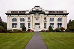
Raymond is a city in Pacific County, Washington, United States. The population was 2,882 at the 2010 census. The 2020 census showed the population of 3,081, an increase of 6.4%. The town's economy has traditionally been based on logging and fishing, together with a limited amount of tourism.

Arbor Vitae is a town in Vilas County, Wisconsin, United States. The population was 3,153 at the 2000 census. The unincorporated community of Arbor Vitae is located in the town.

<span class="mw-page-title-main">Van Tassell, Wyoming</span> Town in Wyoming, United States

Van Tassell is a town in Niobrara County, Wyoming, United States. The population was 15 at the 2010 census.

<span class="mw-page-title-main">West Bend, Iowa</span> Village in Iowa, United States

West Bend is a village in Kossuth and Palo Alto (originally) counties in the U.S. state of Iowa. The population was 791 at the time of the 2020 census.

<span class="mw-page-title-main">Gaines Township, Kent County, Michigan</span> Charter township in Michigan, United States

Gaines Charter Township is a charter township of Kent County in the U.S. state of Michigan. The population was 28,812 at the 2020 census. The township is part of the Grand Rapids metropolitan area and is located about 3.0 miles (4.8 km) south of the city of Grand Rapids.

Willapa is a census-designated place (CDP) in Pacific County, Washington, east of the city of Raymond. The population was 210 as of the 2010 census. The name comes from that of the Willapa people, an Athapaskan-speaking people, now extinct, who occupied the Willapa River valley, which was similarly named after the Willapa people, along which the census-designated place Willapa is located.

Anson is a census-designated place (CDP) in the town of Anson in Somerset County, Maine, United States. The population was 818 at the 2000 census.

References

  1. "2019 U.S. Gazetteer Files". United States Census Bureau. Retrieved August 7, 2020.
  2. 1 2 "U.S. Census website". United States Census Bureau . Retrieved January 31, 2008.
  3. "South Bend". Geographic Names Information System . United States Geological Survey, United States Department of the Interior.
  4. "Find a County". National Association of Counties. Retrieved June 7, 2011.
  5. Washington Place Names Index Archived 2009-03-09 at the Wayback Machine . Retrieved on 2007-05-30.
  6. "US Gazetteer files: 2010, 2000, and 1990". United States Census Bureau. February 12, 2011. Retrieved April 23, 2011.
  7. "US Gazetteer files 2010". United States Census Bureau. Archived from the original on July 2, 2012. Retrieved December 19, 2012.
  8. "Monthly Averages for South Bend, WA". The Weather Channel. Retrieved January 22, 2011.
  9. United States Census Bureau. "Census of Population and Housing" . Retrieved August 31, 2014.
  10. "Census Bureau profile: South Bend, Washington". United States Census Bureau. May 2023. Retrieved May 12, 2024.
  11. "U.S. Census website". United States Census Bureau . Retrieved December 19, 2012.