Elkhorn is an unincorporated community and census-designated place (CDP) in Monterey County, California, United States.
Elkhorn City is a home rule-class city in Pike County, Kentucky, in the United States. The population was 982 at the 2010 census. The city is located in proximity to the Breaks Interstate Park.

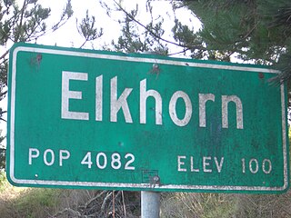
Elkhorn is a neighborhood on the western edge of the city of Omaha, Nebraska, United States. The population was 6,062 at the 2000 census and was estimated by the Census Bureau at 8,192 in 2005. It was named after the Elkhorn River. Elkhorn was once an independent city in Douglas County until it was annexed by Omaha.

Elkhorn is a city in Walworth County, Wisconsin, United States. It is southwest of Milwaukee and northwest of Chicago. The population was 10,084 at the 2010 census. It is the county seat.

Elkhorn is a census-designated place (CDP) in Jefferson County, Montana, United States, in the Elkhorn Mountains of the southwestern part of the state. As of the 2010 census it had a population of 10. The community is considered a ghost town, and two of its buildings are preserved as Elkhorn State Park.

Theodore Roosevelt National Park is an American national park comprising three geographically separated areas of badlands in western North Dakota. The park was named for U.S. President Theodore Roosevelt. The park covers 70,446 acres of land in three sections: the North Unit, the South Unit, and the Elkhorn Ranch Unit.

The Elkhorn Mountains are a mountain range, part of the Blue Mountains, in the northeastern part of Oregon in the United States. The highest point in the range is Rock Creek Butte, which is 9,106 feet (2,776 m) above sea level. The Elkhorn Mountains are partly within the Wallowa–Whitman National Forest and the North Fork John Day Wilderness.

Elkhorn Creek is an 18.3-mile-long (29.5 km) stream running through several counties in central Kentucky in the United States. The stream drains an area of 499.5 square miles (1,294 km2). It derives its name from the shape, as seen on a map, of its main stem with its two primary forks.
The Fremont, Elkhorn and Missouri Valley Railroad (FE&MV), sometimes called "the Elkhorn," was a railroad established in 1869 in the state of Nebraska in the Midwestern United States.
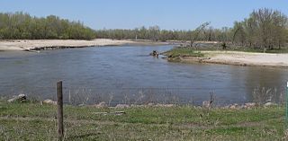
The Elkhorn River originates in the eastern Sandhills of Nebraska and is one of the largest tributaries of the Platte River, flowing 290 miles (470 km) and joining the Platte just southwest of Omaha, approximately 1 mile (2 km) south and 3 miles (5 km) west of Gretna.

Elkhorn is an unincorporated community in McDowell County, West Virginia, United States. Elkhorn lies on U.S. Route 52 and takes its name from the creek that flows through the community.

The Elkhorn Slough National Estuarine Research Reserve is one of 28 National Estuarine Research Reserves established nationwide as field laboratories for scientific research and estuarine education. Elkhorn Slough is located approximately 100 miles (160 km) south of San Francisco, California on the central shore of Monterey Bay. The Reserve is administered by the National Oceanic and Atmospheric Administration. It is managed as Elkhorn Slough Ecological Reserve by the California Department of Fish and Game.

Elkhorn Grove Township is one of twelve townships in Carroll County, Illinois, USA. As of the 2010 census, its population was 229 and it contained 98 housing units.

Abington Township is one of fifteen townships in Wayne County, Indiana, United States. As of the 2010 census, its population was 853 and it contained 366 housing units.

The Elkhorn Wildlife Area is a wildlife management area located near North Powder, Oregon, United States. The large site covers parts of Union and Baker counties, including parts of the Wallowa-Whitman National Forest.

Elkhorn Grove is an unincorporated community in Carroll County, Illinois, United States. Elkhorn Grove is located on Elkhorn Creek north-northeast of Milledgeville.
Elkhorn Park is a neighborhood in northern Lexington, Kentucky, United States. Its boundaries are Dover Road to the north, North Broadway to the east, New Circle Road to the south, and Russell Cave Road to the west.

Elkhorn Creek is a 7.6-mile (12 km) long stream in Marion County, Oregon, United States. Its source is on the northern edge of the Willamette National Forest, about 3.5 miles (5.6 km) north of Big Cliff Reservoir. The creek flows mostly west, receiving Big Twelve Creek, Buckhorn Creek, and Buck Creek all from the south, and it enters the Little North Santiam River just south of Elkhorn Woods Park, about 5 miles (8.0 km) north of the city of Gates. The stream's valley is surrounded by the western Cascade foothills, covered with coniferous trees characteristic of the Pacific Northwest, and lined with red alders at the water's edge. The creek supports runs of rainbow and coastal cutthroat trout, as well as Pacific giant salamanders. On September 30, 1996, a 6.4-mile (10.3 km) portion of the stream, from the mouth nearly to the source, was protected as part of the National Wild and Scenic Rivers System.


