South Riding, Virginia

Last updated

South Riding, Virginia
2016-07-31 14 55 05 View east across South Riding, Loudoun County, Virginia from a plane departing Washington Dulles International Airport.jpg
View of South Riding, with Freedom High School visible in the lower center
USA Virginia Northern location map.svg
Red pog.svg
South Riding
USA Virginia location map.svg
Red pog.svg
South Riding
Usa edcp location map.svg
Red pog.svg
South Riding
Coordinates: 38°55′3″N77°31′5″W / 38.91750°N 77.51806°W / 38.91750; -77.51806
CountryFlag of the United States.svg  United States
State Flag of Virginia.svg  Virginia
County Flag of Loudoun County, Virginia.svg Loudoun
FoundedJanuary 1995
Named for South Yorkshire
Government
  TypeBoard of Directors
  President of the Board of DirectorsSteve Pasquale (Nonpartisan)
Area
[1]
  Total6.92 sq mi (17.92 km2)
  Land6.85 sq mi (17.73 km2)
  Water0.07 sq mi (0.19 km2)
Elevation
295 ft (90 m)
Population
 (2010) [2]
  Total33,877
  Estimate 
(2020)
33,877
  Density4,896.2/sq mi (1,890.45/km2)
Time zone UTC−5 (Eastern (EST))
  Summer (DST) UTC−4 (EDT)
ZIP code
20152 (Chantilly)
Area code 703
FIPS code 51-74100
GNIS feature ID2584921

South Riding is a census-designated place and planned community in Loudoun County, Virginia, United States. The South Riding homeowner association was founded in January 1995 to provide services to the community. [3] Neighboring U.S. Route 50 and State Route 28 provide access to the Dulles/Reston/Tysons Corner technology corridor and other major employment centers in Northern Virginia and Washington, D.C.

Contents

In 2020, the population was 33,877. [2] In 2019, the United States Census Bureau estimated it to be 31,515. [4]

History

Establishment and development

In January 1995, the Declarant of developers who owned the land established South Riding Proprietary as a not for profit corporation, as a way of providing services to residents of what became South Riding. In 2009, South Riding Proprietary was granted 501(c)(4) status by the Internal Revenue Service. The Proprietary continues to own and govern South Riding. [3]

Recreational and cultural activities

Parks, recreation, and community activities are managed by the Dulles South Recreation & Community Center, located along Riding Center Drive. The center is home to, among other activities, a climbing wall, a competitive pool, a leisure pool, a senior center, and facilities which can be rented. [5]

Parks and recreation

South Riding features numerous green spaces, with around 6 miles of trails.

South Riding is home to South Riding Golf Club, designed by golf course architect Dan Maples, and opened in 1997. It was voted one of the "Top 100 Courses in the Mid-Atlantic" by the Washington Golf Monthly Magazine, and was voted "Best New Course" by Golf Digest in 1998. [6]

South Riding has several pools, including South Riding Center Pool, Meadows Pool, Town Hall Pool, and the Hyland Hills Swimming Pool and Splash Park, as well as the indoor pools at the Dulles South Recreation & Community Center. [7]

Transportation

South Riding is less than a mile south of U.S. Route 50, which connects the town to Chantilly and Virginia State Route 28 in the east. South Riding is crossed by four other major roads: Virginia State Route 2200 (Tall Cedars Parkway) in the center, Virginia State Route 742 (Poland Road) in the center, Virginia State Route 606 (Loudoun County Parkway) slightly to the west, Virginia State Route 659 (Gum Spring Road), which forms the town's western border, Virginia State Route 609, Virginia State Route 620, which forms the town's southern border, and Virginia State Route 28. The Fairfax County line forms the town's eastern border.

South Riding is served by the East Gate bus station in the Town Center, which serves and is the eastern terminus of the 88 route.[ citation needed ] The 88 route connects the town to settlements further west along U.S. Route 50, including Stone Ridge.

Residents in South Riding, can even catch international flights at Dulles Airport only 10 miles from town.

Geography

South Riding is located in southeastern Loudoun County. Neighboring communities are Arcola and Dulles to the north, Stone Ridge to the west, Conklin to the south, Schneider Crossroads to the southeast, and Chantilly in Fairfax County to the east.

According to the United States Census Bureau, the South Riding CDP has a total area of 6.9 square miles (17.9 km2), of which 0.1 square miles (0.2 km2), or 1.05%, are water. [1] The community is drained by Elklick Run, a south-flowing tributary of Cub Run and part of the Bull Run watershed flowing south to the Occoquan River and eventually the tidal Potomac River.

Housing

According to Redfin in July 2023, South Riding home prices were down 13.3% compared to last year, selling for a median price of $650K. On average, homes in South Riding sell after 9 days on the market compared to 18 days last year. There were 33 homes sold in July this year, down from 45 last year. [8] The majority of houses consist of three or more bedrooms, and most are owner-occupied. Big families may benefit from the market's options for well-sized homes as they browse South Riding real estate. You'll find brand new homes and luxurious residences built in South Riding's earlier years by award-winning developers. Beautiful, Colonial homes are the most prominent style. [9] Between june and august 2023 the inflow of new residents from New York City to South Riding was 3,549 people, San Francisco, California 182 people, from Blacksburg 168 people and more cities meanwhile the outflows for the same period of time 3,393 South Riding residents moved to Salisbruy, Maryland, 2,117 to Virginia Beach, 1,730 to Miami, Florida and other cities majority to Florida State.

Climate

The climate in this area is characterized by hot, humid summers and generally mild to cool winters. According to the Köppen Climate Classification system, South Riding has a humid subtropical climate, abbreviated "Cfa" on climate maps. [10]

Climate data for South Riding, Virginia, 1990–present normals, extremes 1970–present
MonthJanFebMarAprMayJunJulAugSepOctNovDecYear
Record high °F (°C)75 (23)79 (26)89 (31)93 (33)97 (36)102 (38)105 (40)104 (40)99 (37)94 (34)84 (28)79 (26)105 (40)
Average high °F (°C)42.5 (5.8)46.4 (8)55.5 (13)66.7 (19.2)75.1 (23.9)83.8 (28.7)87.9 (31)86.6 (30.3)79.4 (26.3)68.2 (20.1)57.5 (14.1)46 (7.7)66.3 (19)
Average low °F (°C)23.9 (-4.5)26 (-3.3)32.9 (0.5)42.1 (5.6)51.2 (10.6)61 (16.1)65.5 (18.6)64.2 (17.8)56.3 (13.5)43.8 (6.5)35.3 (1.8)27.1 (-2.7)44.1 (6.7)
Record low °F (°C)-18 (-27)-14 (-25)-1 (-18)17 (-8)28 (-2)36 (2)41 (5)38 (3)30 (-1)15 (-9)9 (-12)-4 (-20)-18 (-27)
Average precipitation inches (mm)2.7 (68)2.7 (68)3.4 (86)3.5 (88)4.6 (115)4 (101)3.7 (93)3.5 (88)3.9 (99)3.3 (83)3.4 (86)3 (76)41.5 (1054)
Average snowfall inches (cm)7.3 (18.5)7.6 (19.3)2.8 (7.1)0.3 (0.7)0 (0)0 (0)0 (0)0 (0)0 (0)0 (0)0.5 (1.2)3.5 (8.8)22 (55.8)
Average precipitation days1091111121111998910119
Average snowy days43200000000210

Government

South Riding is a census-designated place in Loudoun County; therefore, schools, roads, and law enforcement are provided by the county.

South Riding Proprietary staff

South Riding is owned and governed by the not for profit South Riding Proprietary. All persons who purchase residential property in South Riding are automatically members of the Proprietary, and are subject to dues, which cannot be severed unless the property is sold. By the governing documents, members are subject to responsibilities, and are granted rights and privileges. The Proprietary is headquartered at Town Hall on Center Street, and is led by General Manager Kristi Felouzis. [11]

Board of directors

The Board of Directors is the executive branch of the community government, led by the President, currently Steve Pasquale, and the Vice President, currently Michael Hardin. There are seven members elected by residents. As stated by the governing documents, the Board's responsibilities include, "developing the annual budget and setting assessments, promulgating and enforcing rules and regulations, administering the architectural scheme of the community and regulating exterior appearance of the homes and providing for the necessary personnel and contractual services to maintain all commonly owned property and facilities". The Board of Directors also establishes committees which handle specific issues. The board meets monthly at the South Riding Center.[ citation needed ]

Representation

South Riding lies entirely within Virginia's 10th congressional district, currently represented in Congress by Representative Jennifer Wexton (D-Leesburg). It is represented by Karrie Delaney (D-Centreville) in the state House of Delegates, and by John J. Bell in the state Senate.[ citation needed ]

Local media

South Riding lies within the distribution zone for two national newspapers, the Washington Post, and the Washington Times, as well as for the local Loudoun Times-Mirror. South Riding is also covered by AOL's Patch service's Chantilly division.

Education

Primary and secondary schools

As a part of Loudoun County, South Riding is served by Loudoun County Public Schools and private schools. South Riding has one high school, Freedom High School, serving the entire town. Middle schoolers in South Riding attend either J. Michael Lunsford Middle School or Mercer Middle School.

Public elementary schools

  • Hutchison Farm Elementary School
  • Cardinal Ridge Elementary
  • Little River Elementary School
  • Pinebrook Elementary
  • Liberty Elementary School

Day care/after school programs

  • Montessori School of South Riding
  • Everbrook Academy of South Riding
  • Minnieland Academy at South Riding
  • Kiddie Academy of South Riding
  • The Madame Curie School of Science & Technology
  • ALOHA Mind Math of South Riding
  • East Gate Montessori School
  • The Goddard School of Chantilly
  • Winwood Children's Center
  • C2 Education of South Riding
  • South Riding KinderCare
  • Primrose School of South Riding
  • Huntington Learning Center of South Riding
  • South Riding Learning Center

Private high schools

  • St. Paul VI Catholic High School

Public libraries

South Riding is served by Gum Spring Library, a branch of Loudoun County Public Library in Stone Ridge.

Demographics

As of 2021, South Riding has a median household income of $170,456. [12]

South Riding, Virginia – Racial and Ethnic Composition
(NH = Non-Hispanic)
Note: the US Census treats Hispanic/Latino as an ethnic category. This table excludes Latinos from the racial categories and assigns them to a separate category. Hispanics/Latinos may be of any race.
Race / EthnicityPop 2010 [13] Pop 2020 [14] % 2010% 2020
White alone (NH)13,01913,555
Black or African American alone (NH)1,5062,409
Native American or Alaska Native alone (NH)3947
Asian alone (NH)6,99513,161
Pacific Islander alone (NH)1027
Some Other Race alone (NH)44149
Mixed Race/Multi-Racial (NH)8371,866
Hispanic or Latino (any race)1,8062,663
Total24,25633,877
Historical population
CensusPop.Note
2010 22,982
2018 (est.)31,07135.2%

As of the 2022 census: White 41.4%, Black 9.9%, Asian 35.3%, Hispanic 9.0%. Between 2010 and 2022, the White population decreased by more than 30%, Asians increased by more than 20% and Latinos decreased by 0.9%. [15] The age breakdown of the town is 6.0% under 5 years old, 30.3% under 18 years old, and 65 years or older around 5.3% and from the total population 49.0% are females. [12]

The population per square mile in 2010 was 3,516.1 but 10 years later, in 2020, this increased to 4,949.2. [12]

Related Research Articles

<span class="mw-page-title-main">Annandale, Virginia</span> Census-designated place in Virginia, US

Annandale is a census-designated place (CDP) in Fairfax County, Virginia. The population of the CDP was 43,363 as of the 2020 United States Census. It is home to the oldest and largest branch of the Northern Virginia Community College system, and to one of the D.C. area's Koreatowns.

<span class="mw-page-title-main">Centreville, Virginia</span> Census-designated Place in Virginia, United States

Centreville is a census-designated place (CDP) in Fairfax County, Virginia, United States and a suburb of Washington, D.C. The population was 73,518 as of the 2020 census. Centreville is approximately 20 miles (32 km) west of Washington, D.C.

<span class="mw-page-title-main">Chantilly, Virginia</span> CDP in Virginia, United States

Chantilly is a census-designated place (CDP) in western Fairfax County, Virginia. The population was 24,301 as of the 2020 census. Chantilly is named after an early-19th-century mansion and farm, which in turn took the name of an 18th-century plantation that was located in Westmoreland County, Virginia. The name "Chantilly" originated in France with the Château de Chantilly, about 28 miles north of Paris.

<span class="mw-page-title-main">Herndon, Virginia</span> Town in Virginia, United States

Herndon is a town in Fairfax County, Virginia, United States, part of the Washington, D.C., metropolitan area. In 2020, the population at the census was 24,655, which makes it the largest of three incorporated towns in the county.

<span class="mw-page-title-main">Reston, Virginia</span> Census-designated place in Virginia, United States

Reston is a census-designated place in Fairfax County, Virginia, United States, and a principal city of the Washington metropolitan area. As of the 2020 U.S. Census, Reston's population was 63,226.

<span class="mw-page-title-main">Sterling, Virginia</span> Census-designated place in Virginia

Sterling, Virginia, refers most specifically to a census-designated place (CDP) in Loudoun County, Virginia, United States. The population of the CDP as of the 2020 United States Census was 30,337 The CDP boundaries are confined to a relatively small area between Virginia State Route 28 on the west and Virginia State Route 7 on the northeast, excluding areas near SR 606 and the Dulles Town Center.

<span class="mw-page-title-main">Ashburn, Virginia</span> Census-designated place in Virginia, United States

Ashburn is a rapidly growing census-designated place (CDP) in Loudoun County, Virginia, United States. At the 2010 United States census, its population was 43,511, up from 3,393 in 1990. It is 30 miles (48 km) northwest of Washington, D.C., and part of the Washington metropolitan area.

<span class="mw-page-title-main">Brambleton, Virginia</span> Census-designated place in Virginia

Brambleton is a census-designated place (CDP) in Loudoun County, Virginia, United States, south of the Dulles Greenway. The population as of the 2010 United States Census was 9,845. In 2017, Brambleton had an estimated population of 19,900, with a median age of 34.3 and a median household income of $173,690. Between 2016 and 2017 the population of Brambleton, VA grew from 17,063 to 19,876, a 16.5% increase and its median household income grew from $164,321 to $173,690, a 5.7% increase. Construction started on the Brambleton community in 2001.

Stone Ridge is a census-designated place in Loudoun County, Virginia, United States. Residences use Aldie mailing addresses, and it is near Washington Dulles International Airport. The population as of the 2020 census was 15,039. Stone Ridge is a Van Metre Homes planned, mixed-use community.

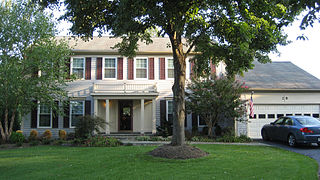
Lansdowne is a census-designated place and planned community located near Leesburg, Virginia in Loudoun County, Virginia. The population as of the 2010 United States Census was 11,253. It is north of State Route 7 and south of the Potomac River. Before the Revolutionary War, the Lee family established Coton Manor here. A section of the Potomac Heritage Trail runs through Lansdowne. It is the home of Inova Loudoun Hospital, the Jack Kent Cooke Foundation, Lansdowne Resort, Prison Fellowship, and Lansdowne Woods of Virginia, a gated, age-restricted community.

<span class="mw-page-title-main">Broadlands, Virginia</span> Census-designated place in Virginia

Broadlands is a census-designated place (CDP) in Loudoun County, Virginia, United States. It is a 1,500-acre (610 ha) master-planned community started and developed by Van Metre Homes in the 1990s. It is built on wetlands and is certified as a Community Wildlife Habitat by the National Wildlife Federation.

<span class="mw-page-title-main">Dranesville, Virginia</span> Census-designated place in Virginia, United States

Dranesville is a census-designated place (CDP) in Fairfax County, Virginia, United States. Dranesville is located on the Leesburg Pike at its intersection with Georgetown Pike. The U.S. Census Bureau defines Dranesville as a census-designated place (CDP) with a population of 11,921 as of 2010. At the 2020 Census the population was 11,785.

<span class="mw-page-title-main">Countryside, Virginia</span> Census-designated place in Virginia

Countryside is a census-designated place in Loudoun County, Virginia, United States. The population as of the 2010 census was 10,072. It is located about 27 miles (43 km) northwest of Washington and is bounded by the Potomac River to the north, and by Route 7 to the south. Located in eastern Loudoun County, it is about 9 miles (14 km) north of Washington Dulles International Airport. It is bordered by the community of Cascades to the east and by Dulles Town Center to the south, across Route 7.

<span class="mw-page-title-main">Dulles Town Center, Virginia</span> Census-designated place in Virginia

Dulles Town Center is a census-designated place (CDP) in Loudoun County, Virginia, United States. It is located about 7 miles (11 km) north of Washington Dulles International Airport. The CDP is the location of the Dulles Town Center shopping mall, for which it is named. The United States Postal Service considers Dulles Town Center to be a subsection of Dulles, which is itself a subsection of Sterling; none of these locations is an incorporated municipality.

<span class="mw-page-title-main">Cascades, Virginia</span> Census-designated place in Virginia

Cascades is a census-designated place (CDP) in Loudoun County, Virginia, United States. The population as of the 2010 United States Census was 11,912. Along with nearby Countryside and Lowes Island, it is considered one of the three main components of the Potomac Falls community within Sterling, Virginia.

<span class="mw-page-title-main">Loudoun Valley Estates, Virginia</span> Census-designated place in Virginia

Loudoun Valley Estates is a census-designated place (CDP) in Loudoun County, Virginia, United States. The population as of the 2010 United States Census was 3,656. It is a Toll Brothers community located near the planned Ashburn Metro station complex and Moorefield Station town center in the southern part of Ashburn, Virginia. Loudoun Valley Estates is governed by a homeowners' association.

Sugarland Run is a planned community and census-designated place in Loudoun County, Virginia, United States. The population at the 2010 census was 11,799. In 2020, it was estimated to be 12,956. Sugarland Run is part of the Washington metropolitan area and is 26 miles (42 km) by road northwest of Washington, D.C.

<span class="mw-page-title-main">Greenbriar, Virginia</span> Census-designated place in Virginia, United States

Greenbriar is a census-designated place in Fairfax County, Virginia, United States. The population at the 2020 census was 8,421. The community between Fairfax City and Chantilly dates from the late 1960s, when it was developed by Levitt & Sons. The community is famous for having only one road within its territory that does not start with an "M" or "P", which is Acorn Hill. A popular belief is that the roads were named after the architect's two children. One drawback for residents of the community is that with nearly identical sounding named roads in such close proximity to each other and house numbers being the same, the US Postal Service along with UPS and FedEx sometimes deliver items to the wrong house.

<span class="mw-page-title-main">McNair, Virginia</span> Census-designated place in Virginia, United States

McNair is a census-designated place located in the Oak Hill section of Fairfax County, Virginia, United States. It is directly to the east of Washington Dulles International Airport. The population as of the 2020 census was 21,598. Much of the population resides in the McNair Farms planned community. The community has a school called McNair Elementary.

Kincora is a census-designated place in Loudoun County, Virginia, United States. The CDP was first drawn prior to the 2020 census.

References

  1. 1 2 "2020 U.S. Gazetteer Files –Virginia". United States Census Bureau. Retrieved March 2, 2021.
  2. 1 2 "Total Population: 2020 Census DEC Summary File 1 (P1), South Riding CDP, Virginia". data.census.gov. U.S. Census Bureau. Retrieved March 2, 2021.
  3. 1 2 admin. "About South Riding". www.southriding.net. Retrieved October 20, 2020.
  4. United States Census Bureau. "South Riding CDP, Virginia". data.census.gov. Retrieved October 20, 2020.
  5. "Dulles South Recreation & Community Center | Loudoun County, VA - Official Website". www.loudoun.gov. Retrieved October 21, 2020.
  6. "Golf South Riding, VA - South Riding Golf Club - Voted Top 100 Courses to play in the Mid-Atlantic - The Washington Golf Monthly". southridinggc.com. Retrieved October 21, 2020.
  7. admin. "Dulles South Recreation and Community Center Pools". Loudoun County, VA - Official Website. Retrieved October 21, 2020.
  8. Redfin.com. Accessed August 3, 2011.
  9. Longandfoster.com. Accessed August 3, 2011.
  10. "Dulles, Virginia Travel Weather Averages (Weatherbase)". Weatherbase. Retrieved October 22, 2020.
  11. admin. "Staff". southriding.net. Retrieved October 20, 2020.
  12. 1 2 3 "U.S. Census Bureau QuickFacts: South Riding CDP, Virginia". www.census.gov.
  13. "P2 HISPANIC OR LATINO, AND NOT HISPANIC OR LATINO BY RACE - 2010: DEC Redistricting Data (PL 94-171) - South Riding CDP, Virginia". United States Census Bureau .
  14. "P2 HISPANIC OR LATINO, AND NOT HISPANIC OR LATINO BY RACE - 2020: DEC Redistricting Data (PL 94-171) - South Riding CDP, Virginia". United States Census Bureau .
  15. "South Riding, Virginia". census.gov. Retrieved August 10, 2016.