Sublimity, Oregon

Last updated

Sublimity, Oregon
Sublimity post office.jpg
Post office in Sublimity
Marion County Oregon Incorporated and Unincorporated areas Sublimity Highlighted.svg
Location in Oregon
Coordinates: 44°49′46″N122°47′32″W / 44.82944°N 122.79222°W / 44.82944; -122.79222
Country United States
State Oregon
County Marion
Incorporated 1903
Government
   Mayor James F. Kingsbury[ citation needed ]
Area
[1]
  Total0.94 sq mi (2.43 km2)
  Land0.94 sq mi (2.43 km2)
  Water0.00 sq mi (0.00 km2)
Elevation
[2]
554 ft (169 m)
Population
 (2020) [3]
  Total2,967
  Density3,163.11/sq mi (1,221.46/km2)
Time zone UTC-8 (Pacific)
  Summer (DST) UTC-7 (Pacific)
ZIP code
97385
Area code 503
FIPS code 41-70700 [4]
GNIS feature ID2411991 [2]
Website http://www.cityofsublimity.org

Sublimity is a city in Marion County, Oregon, United States. The population was 2,967 at the 2020 census. It is part of the Salem Metropolitan Statistical Area.

Contents

Geography

According to the United States Census Bureau, the city has a total area of 0.93 square miles (2.41 km2), all of it land. [5]

Demographics

Historical population
CensusPop.Note
1910 138
1920 17224.6%
1930 21424.4%
1940 28030.8%
1950 36731.1%
1960 49033.5%
1970 63429.4%
1980 1,07769.9%
1990 1,49138.4%
2000 2,14844.1%
2010 2,68124.8%
2020 2,96710.7%
U.S. Decennial Census [6] [3]

2010 census

As of the census of 2010, there were 2,681 people, 1,063 households, and 678 families living in the city. The population density was 2,882.8 inhabitants per square mile (1,113.1/km2). There were 1,142 housing units at an average density of 1,228.0 per square mile (474.1/km2). The racial makeup of the city was 95.8% White, 0.2% African American, 0.5% Native American, 0.4% Asian, 1.0% from other races, and 2.0% from two or more races. Hispanic or Latino of any race were 3.1% of the population. [4]

There were 1,063 households, of which 27.5% had children under the age of 18 living with them, 53.9% were married couples living together, 7.2% had a female householder with no husband present, 2.6% had a male householder with no wife present, and 36.2% were non-families. 33.2% of all households were made up of individuals, and 24.4% had someone living alone who was 65 years of age or older. The average household size was 2.33 and the average family size was 2.97. [4]

The median age in the city was 47.6 years. 21.6% of residents were under the age of 18; 5.6% were between the ages of 18 and 24; 18.8% were from 25 to 44; 24.9% were from 45 to 64; and 29% were 65 years of age or older. The gender makeup of the city was 47.1% male and 52.9% female. [4]

2000 census

As of the United States 2000 Census, there were 2,148 people, 686 households, and 509 families living in the city. The population density was 2,259.7 inhabitants per square mile (872.5/km2). There were 711 housing units at an average density of 748.0 per square mile (288.8/km2). The racial makeup of the city was 97.44% White, 0.09% African American, 0.47% Native American, 0.28% Asian, 0.23% Pacific Islander, 0.23% from other races, and 1.26% from two or more races. Hispanic or Latino of any race were 1.63% of the population. [4]

There were 686 households, out of which 36.2% had children under the age of 18 living with them, 65.6% were married couples living together, 6.6% had a female householder with no husband present, and 25.7% were non-families. 22.0% of all households were made up of individuals, and 13.7% had someone living alone who was 65 years of age or older. The average household size was 2.67 and the average family size was 3.14. [4]

In the city, the population was spread out, with 24.3% under the age of 18, 5.4% from 18 to 24, 22.2% from 25 to 44, 18.7% from 45 to 64, and 29.3% who were 65 years of age or older. The median age was 43 years. For every 100 females, there were 81.7 males. For every 100 females age 18 and over, there were 75.5 males. [4]

The median income for a household in the city was $49,034, and the median income for a family was $55,921. Males had a median income of $42,734 versus $25,924 for females. The per capita income for the city was $18,646. About 4.9% of families and 7.5% of the population were below the poverty line, including 7.8% of those under age 18 and 8.9% of those age 65 or over. [4]

Historic buildings

Historic buildings in Sublimity include:

Related Research Articles

<span class="mw-page-title-main">Dellwood, Minnesota</span> City in Minnesota, United States

Dellwood is a city in Washington County, Minnesota, United States and a suburb of St. Paul. The population was 1,063 at the 2010 census.

<span class="mw-page-title-main">Quaker City, Ohio</span> Village in Ohio, United States

Quaker City is a village in Guernsey County, Ohio, United States. The population was 379 at the 2020 census.

<span class="mw-page-title-main">Evendale, Ohio</span> Village in Ohio, United States

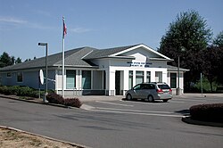
Evendale is a village in Hamilton County, Ohio, United States, within the Cincinnati metropolitan area. The population was 2,669 at the 2020 census.

<span class="mw-page-title-main">Haines, Oregon</span> City in Oregon, United States

Haines is a city in Baker County, Oregon, United States. The population was 416 at the 2010 census.

<span class="mw-page-title-main">Richland, Oregon</span> City in Oregon, United States

Richland is a city in Baker County, Oregon, United States. The population was 156 at the 2010 census.

<span class="mw-page-title-main">Butte Falls, Oregon</span> City in Oregon, United States

Butte Falls is a city in Jackson County, Oregon, United States. The population was 423 at the 2010 census. As of July 1, 2018, the city's population was estimated to be 450.

<span class="mw-page-title-main">Dunes City, Oregon</span> City in Oregon, United States

Dunes City is a city in Lane County, Oregon, United States. The population was 1,303 at the 2010 census.

<span class="mw-page-title-main">Siletz, Oregon</span> City in Oregon, United States

Siletz is a city in Lincoln County, Oregon, United States. The population was 1,212 at the 2010 census. The city is located next to the Siletz Reservation and is the site of the annual Nesika Illahee Pow Wow in August.

<span class="mw-page-title-main">Harrisburg, Oregon</span> City in Oregon, United States

Harrisburg is a city in Linn County, Oregon, United States. The population was 3,567 at the 2010 census.

<span class="mw-page-title-main">Lyons, Oregon</span> City in Oregon, United States

Lyons is a city in Linn County, Oregon, United States. The population was 1,161 at the 2010 census. The center of population of Oregon is located in Lyons.

<span class="mw-page-title-main">Sodaville, Oregon</span> City in Oregon, United States

Sodaville is a city in Linn County, Oregon, United States. The population was 308 at the 2010 census.

<span class="mw-page-title-main">Donald, Oregon</span> City in Oregon, United States

Donald is a city in Marion County, Oregon, United States. The population was 1,009 at the 2020 census. It is part of the Salem Metropolitan Statistical Area.

<span class="mw-page-title-main">Turner, Oregon</span> City in Oregon, United States

Turner is a city in Marion County, Oregon, United States. The population was 2,944 at the 2020 census. It is part of the Salem Metropolitan Statistical Area. The community was incorporated by the Oregon Legislative Assembly on February 10, 1905.

<span class="mw-page-title-main">Grass Valley, Oregon</span> City in Oregon, United States

Grass Valley is a city in Sherman County, Oregon, United States. The population was 164 at the 2010 census.

<span class="mw-page-title-main">Adams, Oregon</span> City in Oregon, United States

Adams is a city in Umatilla County, Oregon, United States, located about 13 miles (21 km) northeast of Pendleton on Oregon Route 11. The population was 350 at the 2010 census. It is part of the Pendleton–Hermiston Micropolitan Statistical Area.

<span class="mw-page-title-main">Stanfield, Oregon</span> City in Oregon, United States

Stanfield is a city in Umatilla County, Oregon, United States. The population was 2,043 at the 2010 census. It is part of the Pendleton–Hermiston Micropolitan Statistical Area.

<span class="mw-page-title-main">Mosier, Oregon</span> City in Oregon, United States

Mosier is a city along the Columbia River in Wasco County, Oregon, United States. The population was 433 at the 2010 census.

<span class="mw-page-title-main">Banks, Oregon</span> City in Oregon, United States

Banks is a city in Washington County, Oregon, United States which is located in the Tualatin Valley. It is the southern anchor to the Banks–Vernonia State Trail, which is a 21-mile (34 km) long linear trail popular with bicyclists, hikers, and equestrians. The population was 1,777 at the 2010 census. The community was named for John and Nancy Banks, who owned a nearby dairy farm. Incorporated in 1921, it is located in the western part of the county where Oregon Route 6 intersects Oregon Route 47.

<span class="mw-page-title-main">Pine Lake, Wisconsin</span> Town in Wisconsin, United States

Pine Lake is a town in Oneida County, Wisconsin. The population was 2,720 at the time of the 2000 census. The unincorporated community of Roosevelt is located in the town.

<span class="mw-page-title-main">Oregon (town), Wisconsin</span>

Oregon is a town in Dane County, Wisconsin, United States. The population was 3,148 at the 2000 census. The village of Oregon is located mostly within the town.

References

  1. "ArcGIS REST Services Directory". United States Census Bureau. Retrieved October 12, 2022.
  2. 1 2 U.S. Geological Survey Geographic Names Information System: Sublimity, Oregon
  3. 1 2 "Census Population API". United States Census Bureau. Retrieved October 12, 2022.
  4. 1 2 3 4 5 6 7 8 "U.S. Census website". United States Census Bureau . Retrieved December 21, 2012.
  5. "US Gazetteer files 2010". United States Census Bureau. Archived from the original on January 25, 2012. Retrieved December 21, 2012.
  6. "Census of Population and Housing". Census.gov. Retrieved June 4, 2015.