| Taconic Crest Trail | |
|---|---|
Taconic Crest Trail marker | |
| Length | 35 mi (56 km) |
| Location | Berkshire County, Massachusetts, Rensselaer County, New York, and Bennington County, Vermont |
| Use | Hiking, backpacking, snowshoeing |
| Elevation | |
| Highest point | Berlin Mountain, New York, 2,818 ft (859 m) |
| Lowest point | NY Route 346, North Petersburgh, New York, 500 ft (150 m) |
| Hiking details | |
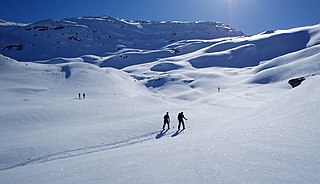
| Trail difficulty | Moderately difficult |
| Season | easiest mid-May through early October |
| Hazards | deer ticks, poison ivy, weather |

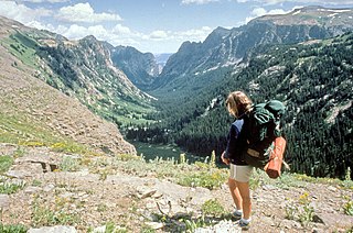
The Taconic Crest Trail is a 35 mi (56 km) hiking trail in the Taconic Mountains in the northeastern United States. The trail extends from U.S. Route 20 in Hancock, Massachusetts, less than 1 mi (1.6 km) east of the New York border, north along the ridgecrest of the Taconic Range, first within Massachusetts, then weaving along the border of New York and Massachusetts and New York and Vermont, and ending in Petersburgh, New York, on NY Route 346, near the Vermont border. Much of the route has been conserved as state forest, conservation easement, or forest preserve.

Hiking is the preferred term, in Canada and the United States, for a long, vigorous walk, usually on trails (footpaths), in the countryside, while the word walking is used for shorter, particularly urban walks. On the other hand, in the United Kingdom, and the Republic of Ireland, the word "walking" is acceptable to describe all forms of walking, whether it is a walk in the park or backpacking in the Alps. The word hiking is also often used in the UK, along with rambling, hillwalking, and fell walking. The term bushwalking is endemic to Australia, having been adopted by the Sydney Bush Walkers club in 1927. In New Zealand a long, vigorous walk or hike is called tramping. It is a popular activity with numerous hiking organizations worldwide, and studies suggest that all forms of walking have health benefits.

The Taconic Mountains or Taconic Range are a physiographic section of the larger New England province and part of the Appalachian Mountains, running along the eastern border of New York State and adjacent New England from northwest Connecticut to western Massachusetts, north to central western Vermont. The range includes notable summits such as Mount Equinox and Mount Greylock, the highest point in Massachusetts. Currently local residents, consistent with the prominent 19th century geologist, T. Nelson Dale, consider the Mount Greylock Massif as a subsidiary of the main Taconic Range to the west.

U.S. Highway 20 (US 20) is an east–west United States highway that stretches from the Pacific Northwest all the way to New England. The "0" in its route number indicates that US 20 is a coast-to-coast route. Spanning 3,365 miles (5,415 km), it is the longest road in the United States, and particularly from Newport, Oregon to Boston, Massachusetts, the route is roughly parallel to that of the newer Interstate 90 (I-90), which is in turn the longest Interstate Highway in the U.S. There is a discontinuity in the official designation of US 20 through Yellowstone National Park, with unnumbered roads used to traverse the park.
Contents
Forest types on the Taconic Crest Trail are mixed oak-hickory forest and northern hardwood forest with microclimate summit balds, alkaline-loving plant communities, and red spruce/ balsam fir stands on the higher summits. The geology is thrust faulted metamorphic rock over younger sedimentary rock.

The northern hardwood forest is a general type of North American forest ecosystem found over much of southeastern and south central Canada, Ontario and Quebec, extending south into the United States in northern New England, New York, and Pennsylvania, and west along the Great Lakes to Minnesota and western Ontario. Some ecologists consider it a transitional forest because it contains species common to both the oak-hickory forest community to the south and the Boreal forest community to the north. The trees and shrub species of the Northern Hardwood Forest are known for their brilliant fall colors, making the regions that contain this forest type popular fall foliage tourist destinations.
A microclimate is a local set of atmospheric conditions that differ from those in the surrounding areas, often with a slight difference but sometimes with a substantial one. The term may refer to areas as small as a few square meters or square feet or as large as many square kilometers or square miles. Because climate is statistical, which implies spatial and temporal variation of the mean values of the describing parameters, within a region there can occur and persist over time sets of statistically distinct conditions, that is, microclimates. Microclimates can be found in most places.

In the Appalachian Mountains of the eastern United States, balds are mountain summits or crests covered primarily by thick vegetation of native grasses or shrubs occurring in areas where heavy forest growth would be expected.
The Taconic Crest Trail passes through the New York towns of Stephentown, Berlin and Petersburgh; the Massachusetts towns of Hancock and Williamstown; and Pownal, Vermont. It is crossed by New York Route 2, Massachusetts Route 43, the seasonal Pittsfield State Forest Berry Pond Campground access road, and by Lebanon Springs Road in Hancock. The trail is supported by the New York State Department of Environmental Conservation (NYSDEC), the Taconic Hiking Club, the Trust for Public Land, the National Park Service, Williams College, Rensselaer Land Trust, the Massachusetts Department of Conservation and Recreation, and the Williamstown Rural Lands Foundation.

Stephentown is a town in Rensselaer County, New York, United States. The population was 2,903 at the 2010 census. The town, which was originally Jericho Hallow in the Massachusetts Bay Colony, was renamed for Stephen Van Rensselaer. The town is in the southeast corner of the county, and has a sign proclaiming it to be the only Stephentown on Earth.

Berlin is a town in Rensselaer County, New York, United States. The population was 1,880 at the 2010 census. The town is named after Berlin in Germany, although natives pronounce the name differently, with the accent on the first syllable.

Williamstown is a town in Berkshire County, in the northwest corner of Massachusetts, United States. It shares a border with Vermont to the north and New York to the west. It is part of the Pittsfield, Massachusetts Metropolitan Statistical Area. The population was 7,754 at the 2010 census. A college town, it is home to Williams College, the Clark Art Institute and the Tony-awarded Williamstown Theatre Festival, which runs every July and August.


