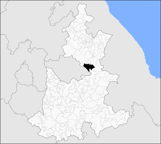
Ojinaga Municipality is one of the 67 municipalities of Chihuahua, in northern Mexico. The municipal seat lies at Ojinaga, a rural bordertown on the U.S.-Mexico border. The municipality has an area of 9,500.50 km².

Municipalities are the second-level administrative divisions of Mexico, where the first-level administrative division is the state. They should not be confused with cities or towns that may share the same name as they are distinct entities and do not share geographical boundaries. As of January 2021, there are 2,454 municipalities in Mexico, excluding the 16 boroughs of Mexico City.

Colotenango is a town and municipality in the Guatemalan department of Huehuetenango. The municipality is situated at 1,590 m (5,220 ft) above sea level and has a population of 34,834. It covers an area of 62 km2 (24 sq mi). The annual festival is August 12–15.

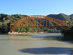
Tenosique is a town located in Tenosique Municipality in the southeastern corner of the state of Tabasco, in Mexico. Its official name is Tenosique de Pino Suárez. The town had a 2005 census population of 31,392 inhabitants, while the municipality had a population of 55,601.

Chimalhuacán is a city and municipality located in the eastern part of State of Mexico, Mexico. It lies just outside the northeast border of Mexico City and is part of the Greater Mexico City urban area.

Las Margaritas is a city, and the surrounding municipality of the same name, in the Mexican state of Chiapas. The municipal seat is located some 25 km to the northeast of Comitán de Domínguez, while the municipality extends to the east as far as the border with Guatemala. Part of the Lagunas de Montebello National Park is in the municipality's territory.

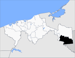
Villa Corzo is a city and one of the 119 municipalities of Chiapas, in southern Mexico. The city of Villa Corzo (the municipal seat is located at

Olinalá is one of the 81 municipalities of Guerrero, in south-western Mexico. The municipal seat lies at Olinalá. The municipality covers an area of 1,028.1 km2.
Nanchital is a municipality in Veracruz, Mexico. It is about 438 km from the state capital, Xalapa. It has an area of 63.99 km2. It is at 18°04′N94°25′W.

San Miguel Suchixtepec is a town and municipality in Oaxaca in south-western Mexico. The municipality covers an area of 107.17 km². It is part of the Miahuatlán District in the south of the Sierra Sur Region.
San Miguel Tlacamama is a town and municipality in Oaxaca in south-western Mexico. The municipality covers an area of 108.44 km². It is located in the Jamiltepec District in the west of the Costa Region.
Santiago Lalopa is a town and municipality in Oaxaca in south-western Mexico. The municipality covers an area of km². It is part of the Villa Alta District in the center of the Sierra Norte Region.
Silacayoapam is a town and municipality in Oaxaca in south-western Mexico. It is part of the Silacayoapam District in the Mixteca Region.

Chiautzingo Municipality is a municipality in Puebla in south-eastern Mexico.
Libres is a town and municipality in Puebla in south-eastern Mexico.

Cañada Morelos Municipality is a municipality in Puebla in south-eastern Mexico.
Nealtican (municipality) is a town and municipality in Puebla in south-eastern Mexico.
Santa Inés Ahuatempan (municipality) is a town and municipality in Puebla in south-eastern Mexico.

Tlachichuca (municipality) is a town and municipality in Puebla in south-eastern Mexico.It is the starting point for many climbers wishing to ascend Pico de Orizaba. The municipality covers an area of 459.25 km². The municipality has a total population of 7,181.
Zapotitlán Municipality is a municipality in Puebla in south-eastern Mexico.