Texas State Highway 242

Last updated

Texas 242.svg

State Highway 242

Texas State Highway 242
SH 242, highlighted in red
Route information
Maintained by TxDOT
Length21.633 mi [1]  (34.815 km)
Existed1985–present
Major junctions
West endTexas FM 1488.svg FM 1488 in The Woodlands
Major intersectionsI-45.svg I-45 in Conroe
East endI-69.svgUS 59.svg I-69  / US 59 in Patton Village
Location
Country United States
State Texas
Counties Montgomery
Highway system
Texas 241.svg SH 241 Texas 243.svg SH 243

State Highway 242 (SH 242) is a Texas state highway connecting The Woodlands and Patton Village in southeast Texas.

Contents

Route description

SH 242 begins at FM 1488 in The Woodlands. [2] The roadway, also known locally as College Park Drive, curves to the southeast and passes to the south of W. G. Jones State Forest. It then turns to the east and crosses I-45 in the southern outskirts of Conroe. The route continues to the east, crossing FM 1314 and FM 1485, before reaching its eastern terminus at I-69  / US 59 in Patton Village. [3]

History

SH 242 was originally designated on December 22, 1936 as a route from SH 6 at or near Hempstead to SH 38 (now SH 6) at or near Sugar Land. [4] This route was deleted on September 26, 1939, as it became part of SH 6. SH 242 was designated between I-45 and US 59 (now dual-signed as I-69/US 59) on May 22, 1985. The westward extension to FM 1488 was designated on May 29, 1986. [1]

A pair of flyover ramps connecting SH 242 westbound to southbound I-45 and northbound I-45 to westbound SH 242 were constructed in 2015 by the Montgomery County Transportation Program (MCTP). The flyovers were both tolled, utilizing solely electronic toll collection and were opened to the public on May 11, 2015, initially toll-free. Between July 6, 2015, and May 28, 2019, the flyovers were tolled, with the Montgomery County Toll Road Authority (MCTRA) owning and maintaining the ramps while the Harris County Toll Road Authority (HCTRA) collected the toll fees. After a unanimous vote by the Montgomery County Commissioners Court, the tolls on the flyovers were lifted, with ownership and maintenance being transferred to the Texas Department of Transportation (TxDOT). [5] Another flyover ramp from northbound I-45 to eastbound SH 242 is in planning stages and will not be tolled. [6] Long term plans also include a three-level diamond interchange with an overpass for SH 242 through movements over I-45. [7]

Major intersections

The entire route is in Montgomery County.

Locationmi [8] kmDestinationsNotes
The Woodlands 0.00.0Texas FM 1488.svg FM 1488  Magnolia, Conroe Western terminus
Conroe 4.47.1I-45.svg I-45  Houston, Dallas I-45 exit 79 southbound; 79A & 79B northbound.
4.77.6South Trade Center ParkwayInterchange [9]
10.516.9Texas FM 1314.svg FM 1314  Conroe, Porter Interchange [10] [11]
15.224.5Texas FM 1485.svg FM 1485  New Caney
Patton Village 21.634.8I-69.svgUS 59.svg I-69  / US 59  Houston, Cleveland I-69/US 59 exit 161; eastern terminus.
1.000 mi = 1.609 km; 1.000 km = 0.621 mi

Related Research Articles

<span class="mw-page-title-main">Texas State Highway 249</span> Highway in Texas

State Highway 249, also known depending on its location as West Mount Houston Road, the Tomball Parkway, Tomball Tollway, MCTRA 249 Tollway, or the Aggie Expressway, is a 49.443-mile (79.571 km) generally north–south highway in Southeast Texas. The southern terminus is in North Houston at Interstate 45 (I-45). The current northern terminus of the highway is east of Navasota at SH 105.

The Harris County Toll Road Authority maintains and operates a 103-mile (165.8 km) toll road system in the Greater Houston area of Texas, United States. Its headquarters are located in Houston's Fairbanks/Northwest Crossing neighborhood.

<span class="mw-page-title-main">Texas State Highway 70</span> State highway in Texas

State Highway 70 is a state highway in Texas. The route runs approximately 315 miles (507 km) from US 277 near Blackwell to US 83 south of Perryton.

<span class="mw-page-title-main">Texas State Highway 72</span> State highway in Texas, United States

State Highway 72 is a Texas state highway that runs approximately 111 miles (179 km) from near Fowlerton to Cuero in South Texas.

<span class="mw-page-title-main">Farm to Market Road 973</span>

Farm to Market Road 973 is a farm-to-market road in Travis and Williamson counties in the U.S. state of Texas.

<span class="mw-page-title-main">Texas State Highway 174</span> State highway in Texas

State Highway 174 is a state highway in Texas that connects Meridian and Burleson.

<span class="mw-page-title-main">Texas State Highway 127</span> State highway in Texas

State Highway 127 is a state highway in Uvalde County in the U.S. state of Texas that connects Sabinal and Concan in south Texas.

<span class="mw-page-title-main">Farm to Market Road 1954</span> Road in Texas

Farm to Market Road 1954 is a farm to market road in Archer and Clay counties, Texas.

<span class="mw-page-title-main">Texas State Highway 172</span> State highway in Texas

State Highway 172 is a state highway in Texas that connects Ganado to Olivia on the Gulf Coast.

<span class="mw-page-title-main">Texas State Highway 186</span> State highway in Texas

State Highway 186 is a state highway located in the Rio Grande Valley of the U.S. state of Texas. The route connects US 281 to the Gulf of Mexico at Port Mansfield.

<span class="mw-page-title-main">Texas State Highway 240</span> State highway in Texas

State Highway 240 is a Texas state highway that runs from Harrold east to Burkburnett, then south parallel to Interstate 44 to Wichita Falls.

<span class="mw-page-title-main">Texas State Highway 315</span> State highway in Texas

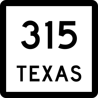
State Highway 315 is a state highway in Texas that runs from Mount Enterprise northeast to Carthage.

<span class="mw-page-title-main">Farm to Market Road 1171</span>

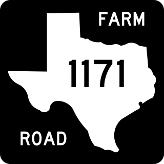
Farm to Market Road 1171 is a farm to market road in Denton County, Texas.

<span class="mw-page-title-main">Farm to Market Road 149</span>

Farm to Market Road 149 is a farm to market road in the U.S. state of Texas. It runs approximately 48.3 miles (77.7 km) in Montgomery and Grimes counties, connecting the cities of Montgomery and Anderson.

<span class="mw-page-title-main">Farm to Market Road 1459</span>

Farm to Market Road 1459 is a farm to market road in Brazoria County, Texas.

<span class="mw-page-title-main">Farm to Market Road 2004</span>

Farm to Market Road 2004 is a farm to market road in Brazoria and Galveston counties, Texas.

<span class="mw-page-title-main">Farm to Market Road 1938</span> State road in Texas

Farm to Market Road 1938 (FM 1938) is a Farm to Market Road in the US state of Texas. The highway runs from State Highway 26 (SH 26) to FM 1709, in Tarrant County. While located in Westlake, FM 1938 is named Precinct Line Road. While located in Southlake, from the northern border of Southlake to its junction with FM 1709, FM 1938 is named Randol Mill Avenue, and from the FM 1709 intersection to its southern terminus, the highway is named Davis Boulevard. FM 1938 was designated in 1952, in Hockley County, but was cancelled and redesignated in 1955, at its modern location in Tarrant County. In 1995, the entire route of FM 1938 was redesignated as Urban Road 1938 by the Texas Department of Transportation (TxDOT). FM 1938 passes through central North Richland Hills and Southlake, providing access to several businesses. As of 2012, FM 1938 is in the process of being extended from an intersection with FM 1709 to the north frontage road of SH 114.

<span class="mw-page-title-main">Farm to Market Road 1450</span>

Farm to Market Road 1450 is a Farm to Market Road in the U.S. state of Texas maintained by the Texas Department of Transportation (TxDOT). The road, located in southeastern Reeves and northern Pecos counties, begins at U.S. Route 285 near Pecos and intersects FM 1776, State Highway 18, and Ranch to Market Road 2593 before terminating at FM 1053. The route number was formerly designated over a road in Freestone County.

<span class="mw-page-title-main">Texas State Highway Spur 57</span> State highway in Texas

Spur 57 is a state highway spur in Ward County, Texas. It is the former route of US 80 between Pyote and Monahans.

<span class="mw-page-title-main">Farm to Market Road 1776</span>

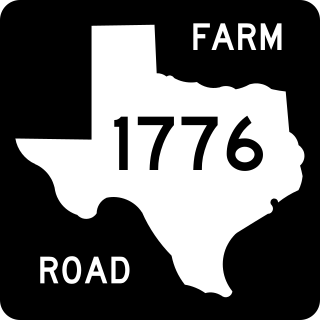
Farm to Market Road 1776 (FM 1776) is a Farm to Market Road in the U.S. state of Texas maintained by the Texas Department of Transportation (TxDOT). The 45-mile (72 km) road begins at a junction with Interstate 10 (I-10) and U.S. Highway 67 (US 67) in Pecos County west of Fort Stockton and extends northward through the town of Coyanosa before ending at State Highway 18 (SH 18) in Ward County south of Monahans. The road has an interchange with US 285 northeast of Fort Stockton.

References

  1. 1 2 Transportation Planning and Programming Division (n.d.). "State Highway No. 242". Highway Designation Files. Texas Department of Transportation . Retrieved 2008-04-04.
  2. Transportation Planning and Programming Division (2012). Texas County Mapbook (PDF) (Map) (2012 ed.). 1:120,000. Texas Department of Transportation. p. 560. OCLC   867856197 . Retrieved 2011-11-25.[ dead link ]
  3. Transportation Planning and Programming Division (2012). Texas County Mapbook (PDF) (Map) (2012 ed.). 1:120,000. Texas Department of Transportation. p. 580. OCLC   867856197 . Retrieved 2011-11-25.[ dead link ]
  4. "Minutes of the December 21, 1936 State Highway Commission meeting" (PDF).
  5. Jules Rogers (May 28, 2019), "Montgomery County Commissioners unanimously remove tolls along Hwy. 242 flyovers", Community Impact Newspaper, retrieved May 30, 2019
  6. Thompson, Ben (April 6, 2021). "Eastbound, Nontolled Flyover Road from I-45 to Eastbound Hwy. 242 Enters Preconstruction Phase". CommunityImpact.com. The Woodlands: Community Impact Newspaper . Retrieved June 5, 2023.
  7. "Montgomery County Precinct 2 Mobility Study - Recommendations". Experience.ArcGIS.com. The Woodlands: Houston-Galveston Area Council. Retrieved June 5, 2023.
  8. Google (2011-11-25). "State Highway 242" (Map). Google Maps . Google. Retrieved 2011-11-25.
  9. Google (2020-08-03) TX-242 Conroe, Texas (Street View) Google Maps Retrieved 2020-08-03.
  10. SH 242 Schematic from East of San Jacinto River to FM 1314 Texas Department of Transportation 2016-12-26 (Retrieved 2020-08-03)
  11. SH 242 at FM 1314 Google Maps. Retrieved 8 January 2021