
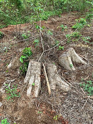
Deforestation or forest clearance is the removal and destruction of a forest or stand of trees from land that is then converted to non-forest use. Deforestation can involve conversion of forest land to farms, ranches, or urban use. About 31% of Earth's land surface is covered by forests at present. This is one-third less than the forest cover before the expansion of agriculture, with half of that loss occurring in the last century. Between 15 million to 18 million hectares of forest, an area the size of Bangladesh, are destroyed every year. On average 2,400 trees are cut down each minute. Estimates vary widely as to the extent of deforestation in the tropics. In 2019, nearly a third of the overall tree cover loss, or 3.8 million hectares, occurred within humid tropical primary forests. These are areas of mature rainforest that are especially important for biodiversity and carbon storage.

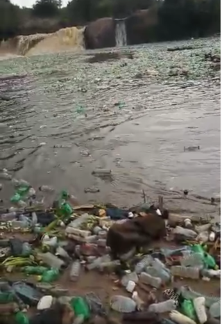
Environmental degradation is the deterioration of the environment through depletion of resources such as quality of air, water and soil; the destruction of ecosystems; habitat destruction; the extinction of wildlife; and pollution. It is defined as any change or disturbance to the environment perceived to be deleterious or undesirable. The environmental degradation process amplifies the impact of environmental issues which leave lasting impacts on the environment.

Land degradation is a process in which the value of the biophysical environment also biochemical environment is affected by a combination of human-induced processes acting upon the land. It is viewed as any change or disturbance to the land perceived to be deleterious or undesirable. Natural hazards are excluded as a cause; however human activities can indirectly affect phenomena such as floods and bush fires.
Land development is the alteration of landscape in any number of ways such as:

Environmentally, Colombia is a mega-diverse country from its natural land terrain to its biological wildlife. Its biodiversity is a result of its geographical location and elevation. It is the fourth largest South American country and only country in South America to have coasts on the Pacific and Caribbean Sea. Colombia's terrain can be divided into six main natural zones: The Caribbean, the Pacific, The Orinoco region, The Amazonia region, the Andean region, and the Insular region. 52.2% of the environment is predominately the Andes, Amazon, and Pacific Basins, followed by the Orinoco basin 13.9%, the Andes and the Caribbean. The Tropical Andes, Choco, and the Caribbean are considered biodiversity hotspots which puts these areas at high risk of concentration of colonizing activities. Colombia host over 1800 bird species and at least one new species are detected every year. Decades of civil war and political unrest have impeded biological and environmental research in Colombia. The political unrest in Colombia catalyzes the alteration of land patterns through the cultivation of coca and opium crops, the redirection of extractive activities, and land abandonment in some areas.

Environmental issues in Haiti include a historical deforestation problem, overpopulation, a lack of sanitation, natural disasters, and food insecurity. The major reasons for these environmental issues are corruption, human exploitation, and the embezzlement of taxpayers' funds for personal gains. In addition, there is not sufficient protection or management of the country's natural resources. Other environmental issues, such as decreases in precipitation and more severe natural disasters, will likely arise in Haiti as a result of climate change. Experts agree that Haiti needs to adopt new policies to address both the issues that already exist and to prepare for the effects of climate change.

African environmental issues are caused by human impacts on the natural environment and affect humans and nearly all forms of life. Issues include deforestation, soil degradation, air pollution, water pollution, garbage pollution, climate change and water scarcity. These issues result in environmental conflict and are connected to broader social struggles for democracy and sovereignty.
Deforestation during the Roman period was a result of the geographical expansion of the Roman Empire, with its increased population, large-scale agriculture, and unprecedented economic development. Roman expansion marks the transition in the Mediterranean from prehistory to the historical period beginning around 500 BC. Earth sustained a few million people 8,000 years ago and was still fundamentally pristine, but Rome drove human development in Western Europe and was a leading contributor of the deforestation around the Mediterranean.

In ecology, resilience is the capacity of an ecosystem to respond to a perturbation or disturbance by resisting damage and subsequently recovering. Such perturbations and disturbances can include stochastic events such as fires, flooding, windstorms, insect population explosions, and human activities such as deforestation, fracking of the ground for oil extraction, pesticide sprayed in soil, and the introduction of exotic plant or animal species. Disturbances of sufficient magnitude or duration can profoundly affect an ecosystem and may force an ecosystem to reach a threshold beyond which a different regime of processes and structures predominates. When such thresholds are associated with a critical or bifurcation point, these regime shifts may also be referred to as critical transitions.
Deforestation in Nigeria refers to the extensive and rapid clearing of forests within the borders of Nigeria. This environmental issue has significant impacts on both local and global scales.

Deforestation is a major threat to biodiversity and ecosystems in Costa Rica. The country has a rich biodiversity with some 12,000 species of plants, 1,239 species of butterflies, 838 species of birds, 440 species of reptiles and amphibians, and 232 species of mammals, which have been under threat from the effects of deforestation. Agricultural development, cattle ranching, and logging have caused major deforestation as more land is cleared for these activities. Despite government efforts to mitigate deforestation, it continues to cause harm to the environment of Costa Rica by impacting flooding, soil erosion, desertification, and loss of biodiversity.

Deforestation is one of the most serious environmental issues in Sri Lanka. Sri Lanka's current forest cover as of 2017 was 29.7%. In the 1920s, the island had a 49 percent forest cover but by 2005 this had fallen by approximately 26 percent. Between 1990 and 2000, Sri Lanka lost an average of 26,800 ha of forests per year. This amounts to an average annual deforestation rate of 1.14%. Between 2000 and 2005 the rate accelerated to 1.43% per annum. However, with a long history of policy and laws towards environmental protection, deforestation rates of primary cover have decreased 35% since the end of the 1990s thanks to a strong history of conservation measures. The problem of deforestation in Sri Lanka is not as significant in the southern mountainous regions as it is in northern and lowland southern Sri Lanka, largely due to the nature of environmental protection.
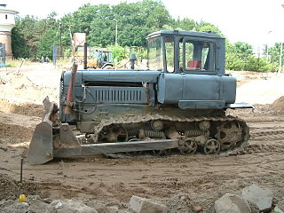
The environmental impact of agriculture is the effect that different farming practices have on the ecosystems around them, and how those effects can be traced back to those practices. The environmental impact of agriculture varies widely based on practices employed by farmers and by the scale of practice. Farming communities that try to reduce environmental impacts through modifying their practices will adopt sustainable agriculture practices. The negative impact of agriculture is an old issue that remains a concern even as experts design innovative means to reduce destruction and enhance eco-efficiency. Though some pastoralism is environmentally positive, modern animal agriculture practices tend to be more environmentally destructive than agricultural practices focused on fruits, vegetables and other biomass. The emissions of ammonia from cattle waste continue to raise concerns over environmental pollution.
Rudrasagar Lake, also known as Twijilikma, is a lake located in Melaghar, Tripura, India.

The European Union (EU) Environmental Policy was initiated in 1973 with the "Environmental Action Programme" at which point the Environmental Unit was formed. The policy has thereafter evolved "to cover a vast landscape of different topics enacted over many decades" (Reuters) and in 2015 the Institute for European Environmental Policy estimated that "the body of EU environmental law" amounted to 500+ directives, regulations and decisions.
"Over the past decades the European Union has put in place a broad range of environmental legislation. As a result, air, water and soil pollution has significantly been reduced. Chemicals legislation has been modernised and the use of many toxic or hazardous substances has been restricted. Today, EU citizens enjoy some of the best water quality in the world"
River Rwizi is a river located in South Western Uganda in district called Mbarara. River Rwizi is a river located in southwestern Uganda. It is the second-longest river in Uganda, after the Nile River. The river originates in the hills of Buhweju District and flows through the districts of Sheema, Bushenyi, Ntungamo, Rwampara, Mbarara, Isingiro, Kiruhura, Lyantonde, Rakai, and Kyotera. It eventually empties into Lake Victoria. Many swamps feed river Rwizi, including Nyakafumura, part of the Mushasha water basin, and Kanyabukanja wetland. These marshes function as water reservoirs or catchments, gently releasing water into the river to support the surrounding population.
Laos is increasingly suffering from environmental problems, with deforestation a particularly significant issue, as expanding commercial exploitation of the forests, plans for additional hydroelectric facilities, foreign demand for wild animals and nonwood forest products for food and traditional medicines, and a growing population all create increasing pressure.

The Niger Delta swamp forests is a tropical moist forest ecoregion in southern Nigeria. It consists of freshwater swamp forests in the Niger Delta of the Niger River. This swamp forest is the second largest in Africa after the Congolian swamp forests. Although there are large cities just outside the ecoregion, the area has been relatively isolated by the difficulty of building roads across the swamps, although this is changing with development of oil and logging industries. Scientific surveys have only begun in recent years, and new species were being identified into the 1990s. Crude oil exploration and pollution has been a threat to forests in the Niger Delta region.

In Nigeria, firewood is a traditional source of energy for domestic and commercial use. Fuel wood is derived from cutting and burning wood materials such as logs and twigs. It has long been prevalent among rural and sometimes urban dwellers.

Fruit production is a major driver of deforestation around the world. In tropical countries, forests are often cleared to plant fruit trees, such as bananas, pineapples, and mangos. This deforestation is having a number of negative environmental impacts, including biodiversity loss, ecosystem disruption, and land degradation.

