The Sandusky River is a tributary to Lake Erie in north-central Ohio in the United States. It is about 133 miles (214 km) long and flows into Lake Erie at the southwest side of Sandusky Bay.
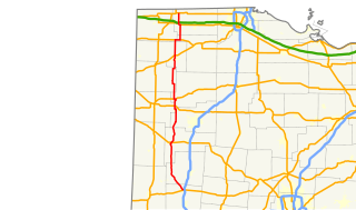
Franklin Township is one of the twelve townships of Fulton County, Ohio, United States. The 2010 census found 743 people in the township.

German Township is one of the twelve townships of Fulton County, Ohio, United States. The 2010 census found 6,443 people in the township, 2,097 of whom lived in the unincorporated portions of the township.

The Wisconsin Department of Natural Resources (WDNR) is an agency of the state of Wisconsin charged with conserving and managing Wisconsin's natural resources. The Wisconsin Natural Resources Board has the authority to set policy for the WDNR. The WDNR is led by the Secretary, who is appointed by the Governor of Wisconsin. The WDNR develops regulations and guidance in accordance with laws passed by the Wisconsin Legislature. It administers wildlife, fish, forests, endangered resources, air, water, waste, and other issues related to natural resources. The central office of the WDNR is located in downtown Madison, near the state capitol.

Ouabache is a state park in Indiana. It is located 30 miles (48 km) south of Fort Wayne, Indiana. It was originally the Wells County State Forest and Game Preserve, formed in the early 1930s. In 1962 it became the Ouabache State Recreation Area, before finally achieving state park status in 1983.

The South Branch Wildlife Management Area is 1,092 acres (4.42 km2) of mixed oak-hickory woodlands and pastures in Hampshire and Hardy Counties, West Virginia, USA. The South Branch WMA consists of four separate tracts along the South Branch Potomac River around and south of the river gorge known as The Trough. It is known throughout the region for its dove, squirrel, deer, and wild turkey hunting. The WMA is owned by the West Virginia Division of Natural Resources.

Des Plaines Fish and Wildlife Area is an Illinois state park on 5,000 acres (2,023 ha) in Will County, Illinois, United States. It is located on floodplain adjacent to the confluence of the Des Plaines River and the Kankakee River to form the Illinois River.

The Snake Hill Wildlife Management Area is a hilly area covering 3,092 acres (1,251 ha) along the Cheat River canyon in Monongalia and Preston Counties, West Virginia. The wildlife management area is largely lies directly south of Coopers Rock State Forest, protecting the southern side of Cheat Canyon.

Little Indian Creek Wildlife Management Area is located on 1,036 acres (419 ha) southwest of Westover in Monongalia County, West Virginia. The wildlife management area is centered on reclaimed former coal mine land along Little Indian Creek, a tributary of the Monongahela River.

Green Bottom Wildlife Management Area is located on former plantation lands of U.S. Congressman and Confederate General Albert G. Jenkins. The 1,096 acres (444 ha) in Cabell County and Mason County are located along the banks of the Ohio River about 16 miles (26 km) north of Huntington, West Virginia. The Green Bottom WMA land is a mixture of farmland, mixed hardwood forest, wetlands, and open water. The Jenkins Plantation Museum is located on Corps of Engineers land adjacent to the WMA. The museum is located in the original 1835 Green Bottom Plantation House, and is operated by the West Virginia Division of Culture and History.

Purse State Park is a former Maryland state park located on the Potomac River in Charles County that has been subsumed into the 1,365-acre (552 ha) Nanjemoy Wildlife Management Area. As the Purse Area, the former park is known for fossil hunting on the beaches of Wades Bay at the southern end of the Nanjemoy WMA. Fossil discoveries have included shark teeth and Cibicides.

Hillcrest Wildlife Management Area is located in Hancock County near New Cumberland, West Virginia. Located on 2,212 acres (895 ha) of former farmland, the flat bottoms and rolling hills provide open fields, old orchards and small forest lots.

McClintic Wildlife Management Area, known locally as the "TNT area", is located in Mason County about 5 miles (8 km) north of Point Pleasant, West Virginia. Located on 3,655 acres (1,479 ha) of former wartime industrial land, the WMA is occupied by farmland, woodlands, and wetlands encompassing 31 ponds. The area still contains stored explosives.

Meadow River Wildlife Management Area, is located near Rupert, West Virginia in Greenbrier County. Occupying 2,385 acres (965 ha) of river bottomland, the WMA is located along the Meadow River and consists mainly of wetlands habitat.

The Islands of the Potomac Wildlife Management Area is a Wildlife Management Area (WMA) consisting of 30 islands in the Potomac River in Maryland along its border with the state of Virginia. It is administered by the Maryland Department of Natural Resources.

Shannondale Springs Wildlife Management Area is located near Charles Town, West Virginia in Jefferson County. Shannondale Springs WMA is located on 1,361 acres (551 ha) of hills covered with oak-hickory woodlands, brushy areas, and open fields.

Woodrum Lake Wildlife Management Area, is located about 3 miles (4.8 km) east of Romance, West Virginia in Jackson County. Woodrum Lake WMA is located on 1,696 acres (686 ha) of hilly oak-hickory hardwood lots mixed with abandoned farmland.

Fox Forest Wildlife Management Area (WMA) is located south of Elkins, West Virginia in Randolph County. It is located along the Tygart Valley River and is adjacent to the West Virginia Division of Natural Resources' Elkins Operations Center.

Goll Woods State Nature Preserve is a 321-acre (130 ha) Nature Preserve in western Fulton County, Ohio near Archbold, Ohio.

The South Dakota Department of Game, Fish, and Parks (GFP) is the U.S. State of South Dakota's State Agency charged with the management of the state's public recreational and outdoor resources. The GFP manages the 13 State Parks and 43 State Recreation Areas within the South Dakota State Parks System, totaling over 96,000 acres of public lands. The agency manages the hunting of game and the state's fisheries, manages several wildlife management areas and game production areas to restore or establish habitat for a variety of species. The agency conducts public outdoor education programs, typically focusing on hunting and boating safety. The department issues hunting and fishing licenses along with issuance of boat registrations. The agency is also charged with enforcement of fish and game laws, including invasive species regulations. The agency is headquartered in Pierre, South Dakota.