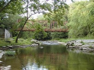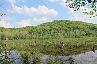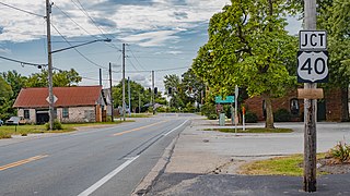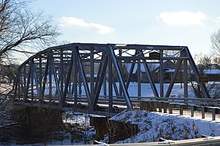
The Stillwater River is a 69.3-mile-long (111.5 km) tributary of the Great Miami River in western Ohio in the United States. Via the Great Miami and Ohio rivers, it is part of the Mississippi River watershed.

Little Beaver Creek is a wild and scenic area in Ohio. The Little Beaver Creek watershed is located primarily in Columbiana County in eastern Ohio, and in portions of Carroll County, Mahoning County, and western Pennsylvania, draining approximately 605 mi² (1,567 km²), of which 503 mi² (1,303 km²) are in Ohio. The watershed in total size covers an area of approximately 510 square miles, with about 80% of this being situated in Ohio. The great majority of land within the watershed is privately owned. Within the watershed are roughly 808 miles of linear streams.

Alum Creek is 58-mile (93 km) long creek that runs north to south in central Ohio. The creek originates in Morrow County and then flows through Delaware County and finally into Franklin County, where it ends at Big Walnut Creek, which drains into the Scioto River. Alum Creek is a source of drinking water for the city of Westerville, Ohio.
Gifford State Forest is the smallest state forest in the U.S. state of Ohio. It includes some hiking trails, forested hills and bluffs, and a small breeding nursery. It is located in Bern Township, Athens County. This forest was donated by William Gifford Selby in 1959 and is named after his mother Virginia Gifford.

Town Creek is a 41.6-mile-long (66.9 km) tributary stream of the Potomac River in the U.S. states of Maryland and Pennsylvania. The creek is formed from the confluence of Sweet Root Creek and Elk Lick Creek, about 0.5 miles (0.8 km) south of Buchanan State Forest in Bedford County, Pennsylvania. Town Creek flows south along the base of Warrior Mountain into Allegany County, Maryland. The Chesapeake and Ohio Canal crosses it at the Town Creek Aqueduct. It empties into the Potomac about 4 miles (6 km) east of Oldtown, Maryland.

Big Walnut Creek starts near Mount Gilead, Ohio in Morrow County. It flows south to eastern Delaware County and parallels Alum Creek. It passes to the east of Sunbury and into Hoover Reservoir, which then crosses into Franklin County. From the dam outflow in Westerville the creek flows through Gahanna and Whitehall. Near Obetz it is joined by its principal tributaries Alum Creek and Blacklick Creek at the Three Creeks Columbus Metro Park. It flows through southern Franklin County and joins the Scioto River near the Franklin-Pickaway Counties line at 39°47′57″N83°00′34″W.

Zaleski State Forest is a state forest in the U.S. state of Ohio, located primarily in Vinton County, with areas in Athens County as well. The 28,000 acre (110 km²) forest surrounds Lake Hope State Park in Vinton County, and borders the Waterloo Wildlife Research Station in Athens County.

Clear Creek is a tributary of the Hocking River. It starts in western Fairfield County and flows southwest into northern Hocking County. In the upper half of the creek's watershed was glaciated and currently has a large amount of agricultural land use. The lower half is part of the unglaciated Allegheny Plateau and is much more forested. The creek's mouth is found at 39°35′49″N82°32′46″W
Beaver Creek State Forest is a state forest in Columbiana County, Ohio, United States.
Blue Rock State Forest is a state forest in Muskingum County, Ohio, United States.
Brush Creek State Forest is a state forest in Adams County, Ohio, United States.
Tar Hollow State Forest is a state forest in Hocking, Ross, and Vinton counties in the U.S. state of Ohio. It is part of an area of protected land that also includes Tar Hollow State Park.
Yellow Creek State Forest is a state forest in Columbiana County, Ohio, United States.

The Trimble Community Forest or Trimble Township Community Forest is a 1,200-acre (4.9 km2) forest preserve owned by the Appalachia Ohio Alliance, a land trust located in southeast Ohio. Formerly called Taylor Ridge, it was purchased in 2006 from the Sunday Creek Coal Company, and was formerly part of the Sunday Creek State Wildlife Area. The land has a long history of coal, oil, natural gas, and timber production. The AOA negotiated with the Trimble Township Trustees on its use before purchase. It is located in Athens County, Ohio, south of Ohio State Route 78, between Glouster, Ohio and Murray City, Ohio.

Culberson Woods State Nature Preserve is located in Clinton County, Ohio, United States. It protects one of the largest remnants of the white swamp forest which once covered the uplands of the Till Plans of Ohio and Indiana. This type of swamp has poorly drained, white clay soil and is wet in the winter but dry in the summer.

Summerford is an unincorporated community in Somerford Township, Madison County, Ohio, United States. It is located at 39°56′00″N83°29′30″W, at the intersection of U.S. Route 40 and State Route 56.

Raccoon Creek is a 114-mile-long (183 km) stream that drains parts of five Ohio counties in the United States. It originates in Hocking County, Ohio. It flows through Vinton County and Gallia County and a corner of Meigs County. Its largest tributary, Little Raccoon Creek, arises in Jackson County. The watershed also includes part of Athens County, drained by another tributary, Hewett Fork. The other major tributaries are Elk Fork, located entirely in Vinton County, and Brushy Fork, which is mostly in Vinton County with a small area in Hocking County.

The Vinton Furnace State Experimental Forest and Raccoon Ecological Management Area (REMA) is a state forest in Vinton County, Ohio, United States. It comprises 15,849 acres, the largest remaining intact block of forest in Ohio still available for permanent protection. Since 2000, data collected at the forest has been cited in nearly 200 academic articles.
Deep Creek State Forest (DCSF) is a 380-acre state forest 11 miles north of St. Augustine, Florida in St. Johns County, Florida. Deep Creek State Forest is located on both sides of Deep Creek, for which it is named. The state forest is west of the Guana River Wildlife Management Area across the Intracoastal Waterway.
Captina is an unincorporated community in Belmont County, in the U.S. state of Ohio.


