National Wild and Scenic Rivers System

Last updated
Logo of the National Wild and Scenic Rivers System US-NationalWildAndScenicRiversSystem-Logo.svg
Logo of the National Wild and Scenic Rivers System
President Lyndon B. Johnson signs the National Wild and Scenic Rivers Act into law, October 2, 1968 National Wild and Scenic River signing.jpg
President Lyndon B. Johnson signs the National Wild and Scenic Rivers Act into law, October 2, 1968

The National Wild and Scenic Rivers System was created by the Wild and Scenic Rivers Actof 1968 (Public Law 90-542 [1] ), enacted by the U.S. Congress to preserve certain rivers with outstanding natural, cultural, and recreational values in a free-flowing condition for the enjoyment of present and future generations.

Contents

The Act is notable for safeguarding the special character of these rivers, while also recognizing the potential for their appropriate use and development. It encourages river management that crosses political boundaries and promotes public participation in developing goals for river protection. The Act, signed into law by President Lyndon B. Johnson in the height of the United States environmental era, states:

"It is hereby declared to be the policy of the United States that certain selected rivers of the Nation which, with their immediate environments, possess outstandingly remarkable scenic, recreational, geologic, fish and wildlife, historic, cultural or other similar values, shall be preserved in free-flowing condition, and that they and their immediate environments shall be protected for the benefit and enjoyment of present and future generations. The Congress declares that the established national policy of dams and other construction at appropriate sections of the rivers of the United States needs to be complemented by a policy that would preserve other selected rivers or sections thereof in their free-flowing condition to protect the water quality of such rivers and to fulfill other vital national conservation purposes." (Wild & Scenic Rivers Act) [2]

The Act established the National Wild and Scenic Rivers System to protect and enhance rivers found to be regionally and nationally significant. Rivers may be designated by Congress or, if certain requirements are met, the Secretary of the Interior. Each designated river is administered by either a federal, state, or tribal agency, or as a partnership between any number of these government entities and local NGOs. Designated segments need not include the entire river and may include headwaters and tributaries. For federally administered rivers, the designated boundaries generally average one-quarter mile on either bank in the lower 48 states and one-half mile on rivers outside national parks in Alaska in order to protect river-related values.

As of August 2018, the National System protects over 12,700 miles (20,400 km) of 209 rivers in 40 states and the Commonwealth of Puerto Rico; this is less than one-quarter of one percent of the nation's rivers, which flow over 3.5 million miles (5,600,000 kilometers) across the United States. [3] By comparison, more than 75,000 large dams across the country have modified at least 600,000 miles (970,000 km), or about 17 percent of American rivers.

History

Taunton River in Massachusetts is a Wild and Scenic River. Wild & Scenic Taunton River.jpg
Taunton River in Massachusetts is a Wild and Scenic River.

The National Wild and Scenic Rivers Act was an outgrowth of the recommendations of a Presidential commission, the Outdoor Recreation Resources Review Commission (ORRRC). Among other things, the commission recommended that the nation protect wild rivers and scenic rivers from development that would substantially change their free-flowing nature and values. At this time, the country was also experiencing rapid degradation of its water resources due to municipal and industrial effluent being released into the nation's rivers. Many waterways and the fish in them were toxic, rendering them unusable by surrounding communities. Populations of aquatic species were declining and people were being relocated from their communities due to rampant dam building. All across the country people were writing letters imploring the President and First lady to protect their beloved rivers. Ultimately, the act was sponsored by Sen. Frank Church (D-Idaho) and signed into law by President Lyndon B. Johnson on October 2, 1968. A river, or river section, may be designated by the U.S. Congress or the Secretary of the Interior. In 1968, as part of the original act, eight rivers were designated as National Wild and Scenic Rivers (Clearwater, Eleven Point, Feather, Rio Grande, Rogue, St. Croix, Salmon, and Wolf). [4] As of November 2018, 209 rivers, totaling 12,754 miles of river in 40 states and Puerto Rico, have Wild and Scenic status. [2] By comparison, more than 75,000 large dams across the country have modified at least 600,000 miles, or about 17%, of American rivers.

Selected rivers in the United States are preserved for possessing Outstandingly Remarkable Values (ORVs) that fall into the 8 categories: Scenic, Recreation, Geologic, Fish, Wildlife, Historic, Culture, or Other similar values. These values can be considered synonymous with ecosystem services, or those goods and services that nature provides freely and that ultimately benefit society. [5] Rivers (or sections of rivers) so designated are set out for protection and enhancement in perpetuity by preserving their free-flowing condition from dams and development that would otherwise diminish the quality of their remarkable values. National Wild and Scenic designation essentially vetoes the licensing of new dams on, or directly affecting the designated section of river. It also provides strong protection against federally funded bank and channel alterations that adversely affect river values, protects riverfront public lands from new oil, gas, and mineral development, and creates a federal reserved water right to protect flow-dependent values such as fish habitat.

In 2018, America continues to celebrate the 50th Anniversary of the Wild and Scenic Rivers Act. [6]

On August 2, 2018, 20 miles (32 km) of East Rosebud Creek in Montana were designated as a Wild and Scenic, the first Wild and Scenic designation in Montana in over 40 years. [7]

Classifications

Designation as a Wild and Scenic River specifically protects the free-flowing nature of rivers in both federal and non-federal areas, something the Wilderness Act and other federal designations cannot do. Despite misplaced fears, WSR designation does not alter private property rights.

Federally administered National Wild and Scenic Rivers are managed by one or more of the four principal land-managing agencies of the federal government. Of the 209 National Wild and Scenic Rivers, the majority are managed by the United States Forest Service, followed by the National Park Service; ten of those managed by the NPS are official units, while most are part of other parks. The remaining WSR are managed under the Bureau of Land Management's National Conservation Lands, originally called the National Landscape Conservation System, and the U.S. Fish and Wildlife Service in Alaska.

State-managed Wild and Scenic Rivers are subject to the same protections as federally administered rivers. These state rivers can be added to the National System by the Secretary of the Interior following an application by the governor of the state the river flows through.

Designated rivers are assigned one or more classifications: Wild, Scenic, or Recreational. These classifications are based on the developmental character of the river's surroundings on the date of designation. Wild rivers are the most remote and undeveloped while Recreational rivers often have many access points, roads, railroads, bridges, and homes located within the designated corridor. Scenic rivers tend to fall somewhere between the Wild and Recreational level of development. It is important to note that a river's classification is not related to the value(s) that made it worthy of designation. For instance, recreation may not be an outstanding value on a river with a recreational classification, nor scenery on a river classified as scenic. Notably, Wild and Scenic Rivers receive the same standard of protection regardless of classification.

List of National Wild and Scenic Rivers

See also

Related Research Articles

<span class="mw-page-title-main">National Wildlife Refuge</span> United States protected area designation

National Wildlife RefugeSystem (NWRS) is a system of protected areas of the United States managed by the United States Fish and Wildlife Service (FWS), an agency within the Department of the Interior. The National Wildlife Refuge System is the system of public lands and waters set aside to conserve America's fish, wildlife, and plants. Since President Theodore Roosevelt designated Florida's Pelican Island National Wildlife Refuge as the first wildlife refuge in 1903, the system has grown to over 568 national wildlife refuges and 38 wetland management districts encompassing about 856,000,000 acres (3,464,109 km2).

<span class="mw-page-title-main">Nowitna River</span> Tributary of the Yukon River in the Alaska, USA

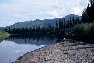
The Nowitna River is a 250-mile (400 km) tributary of the Yukon River in the U.S. state of Alaska. The river flows northeast from the Kuskokwim Mountains through Nowitna National Wildlife Refuge and enters the larger river 38 miles (61 km) northeast of Ruby and southwest of Tanana. Major tributaries include the Titna, Big Mud, Little Mud, Lost, and Sulatna rivers.

<span class="mw-page-title-main">Clackamas River</span> River in Oregon, United States

The Clackamas River is an approximately 83-mile (134 km) tributary of the Willamette River in northwestern Oregon, in the United States. Draining an area of about 940 square miles (2,435 km2), the Clackamas flows through mostly forested and rugged mountainous terrain in its upper reaches, and passes agricultural and urban areas in its lower third. The river rises in eastern Marion County, about 55 miles (89 km) east-southeast of Salem. The headwaters are on the slopes of Olallie Butte in the Mount Hood National Forest, about 10 miles (16 km) north of Mount Jefferson, at an elevation of 4,909 feet (1,496 m) in the Cascade Range. The Clackamas flows briefly north and then flows northwest through the mountains, passing through North Fork Reservoir and Estacada. It then emerges from the mountains southeast of Portland. It joins the Willamette near Oregon City and forms the boundary between Oregon City and Gladstone.

<span class="mw-page-title-main">Protected areas of the United States</span> Legally protected land, eg national parks

The protected areas of the United States are managed by an array of different federal, state, tribal and local level authorities and receive widely varying levels of protection. Some areas are managed as wilderness, while others are operated with acceptable commercial exploitation. As of 2022, the 42,826 protected areas covered 1,235,486 km2 (477,024 sq mi), or 13 percent of the land area of the United States. This is also one-tenth of the protected land area of the world. The U.S. also had a total of 871 National Marine Protected Areas, covering an additional 1,240,000 sq mi (3,200,000 km2), or 26 percent of the total marine area of the United States.

Olympic National Forest is a U.S. National Forest located in Washington, USA. With an area of 628,115 acres (254,189 ha), it nearly surrounds Olympic National Park and the Olympic Mountain range. Olympic National Forest contains parts of Clallam, Grays Harbor, Jefferson, and Mason counties. The landscape of the national forest varies, from the temperate Olympic rain forest to the salt water fjord of Hood Canal to the peaks of Mt. Washington.

<span class="mw-page-title-main">Mokelumne River</span> River in northern California

The Mokelumne River is a 95-mile (153 km)-long river in northern California in the United States. The river flows west from a rugged portion of the central Sierra Nevada into the Central Valley and ultimately the Sacramento–San Joaquin River Delta, where it empties into the San Joaquin River-Stockton Deepwater Shipping Channel. Together with its main tributary, the Cosumnes River, the Mokelumne drains 2,143 square miles (5,550 km2) in parts of five California counties. Measured to its farthest source at the head of the North Fork, the river stretches for 157 miles (253 km).

<span class="mw-page-title-main">Hells Canyon Wilderness (Oregon and Idaho)</span>

The Hells Canyon Wilderness is a wilderness area in the western United States, in Idaho and Oregon. Created 49 years ago in 1975, the Wilderness is managed by both the U.S. Bureau of Land Management and the U.S. Forest Service and contains some of the most spectacular sections of the Snake River as it winds its way through Hells Canyon, North America's deepest river gorge and one of the deepest gorges on Earth. The Oregon Wilderness Act of 1984 added additional acreage and currently the area protects a total area of 217,927 acres (88,192 ha). It lies entirely within the Hells Canyon National Recreation Area except for a small 946-acre (383 ha) plot in southeastern Wallowa County, Oregon which is administered by the Bureau of Land Management. The area that is administered by the Forest Service consists of portions of the Wallowa, Nez Perce, Payette, and Whitman National Forests.

<span class="mw-page-title-main">National Wilderness Preservation System</span> Protection of wilderness areas in the U.S.

The National Wilderness Preservation System (NWPS) of the United States protects federally managed wilderness areas designated for preservation in their natural condition. Activity on formally designated wilderness areas is coordinated by the National Wilderness Preservation System. Wilderness areas are managed by four federal land management agencies: the National Park Service, the U.S. Forest Service, the U.S. Fish and Wildlife Service, and the Bureau of Land Management.

<span class="mw-page-title-main">National Conservation Lands</span> Group of federally-managed protected areas in the United States

National Conservation Lands, formally known as the National Landscape Conservation System, is a 35-million-acre (140,000 km2) collection of lands in 873 federally recognized areas considered to be the crown jewels of the American West. These lands represent 10% of the 258 million acres (1,040,000 km2) managed by the Bureau of Land Management (BLM). The BLM is the largest federal public land manager and is responsible for over 40% of all the federal public land in the nation. The other major federal public land managers include the US Forest Service (USFS), National Park Service (NPS), and the US Fish and Wildlife Service (USFWS).

The Missouri National Recreational River is a National Recreational River located on the border between Nebraska and South Dakota. The designation was first applied in 1978 to a 59-mile section of the Missouri River between Gavins Point Dam and Ponca State Park. In 1991, an additional 39-mile section between Fort Randall Dam and Niobrara, Nebraska, was added to the designation. These two stretches of the Missouri River are the only parts of the river between Montana and the mouth of the Missouri that remain undammed or unchannelized. The last 20 miles of the Niobrara River and 6 miles of Verdigre Creek were also added in 1991.

<span class="mw-page-title-main">Bluestone National Scenic River</span> 4,310 acres in West Virginia (US) managed by the National Park Service

The Bluestone National Scenic River protects a 10.5-mile (16.9 km) section of the Bluestone River in Summers and Mercer counties of southern West Virginia. It was created 26 October 1988 under the Wild and Scenic Rivers Act and is protected by the National Park Service.

<span class="mw-page-title-main">History of the National Wildlife Refuge System</span>

The National Wildlife Refuge System in the United States has a long and distinguished history.

<span class="mw-page-title-main">Wild river</span> A classification of rivers or river systems

A wild river or heritage river (Canada) is a river or a river system designated by a government to be protected and kept "relatively untouched by development and are therefore in near natural condition, with all, or almost all, of their natural values intact."

<span class="mw-page-title-main">Protected areas of California</span> Protected environmental areas of California, US

According to the California Protected Areas Database (CPAD), in the state of California, United States, there are over 14,000 inventoried protected areas administered by public agencies and non-profits. In addition, there are private conservation areas and other easements. They include almost one-third of California's scenic coastline, including coastal wetlands, estuaries, beaches, and dune systems. The California State Parks system alone has 270 units and covers 1.3 million acres (5,300 km2), with over 280 miles (450 km) of coastline, 625 miles (1,006 km) of lake and river frontage, nearly 18,000 campsites, and 3,000 miles (5,000 km) of hiking, biking, and equestrian trails.

The Youghiogheny Scenic & Wild River is a river given special protected status by the state of Maryland. This wild and scenic portion of the Youghiogheny River is located in Western Garrett County, in Western Maryland. The Yough drains an area comprising approximately 397 square miles (1,030 km2) in Maryland, flowing through forests and farms. It rises from the west side of Backbone Mountain in Preston County, West Virginia, near the state's border with Garrett County.

<span class="mw-page-title-main">Little Blitzen River</span> River in Oregon, United States

Little Blitzen River is a 12.5-mile (20.1 km) tributary of the Donner und Blitzen River in the U.S. state of Oregon. Little Blitzen River rises on the west flank of Steens Mountain about 20 miles (32 km) southeast of Frenchglen and about 70 miles (110 km) south of Burns in Harney County. Flowing west in a steep-walled canyon, it joins the South Fork Donner und Blitzen River at 42.6737752°N 118.7935277°W to form the Donner und Blitzen main stem, which continues north about another 40 miles (64 km) to its mouth at 43.291542°N 118.8199273°W in Malheur Lake. The Donner und Blitzen River was named by soldiers of German origin and translates as "thunder and lightning". Little Blitzen River brings to mind one of Santa Claus's reindeer.

Inspired by the National Wild and Scenic Rivers Act the California Wild and Scenic Rivers Act was passed in 1972. The California Wild and Scenic Rivers Act serves a similar purpose to the National Wild and Scenic Rivers Act. Its goal is to protect and preserve certain sections of river in the state of California.

<span class="mw-page-title-main">Lower Delaware National Wild and Scenic River</span> Section of river in Pennsylvania and New Jersey

The Lower Delaware National Wild and Scenic River is a federally designated area of the Delaware River protected under the National Wild and Scenic Rivers System in Pennsylvania and New Jersey. The designation also includes sections of Paunnacussing Creek, Tohickon Creek, Tinicum Creek, Rapp Creek, and Beaver Creek. In total, the protection covers 67.3 miles (108.3 km) miles of waterways.

References

  1. Wild and Scenic Rivers Act. P. L. 90-542; U.S.C. 1271 et seq. 2 October 1968. https://www.rivers.gov/documents/act/complete-act.pdf. Web. 8 August 2018.
  2. 1 2 "About the WSR Act". National Wild and Scenic Rivers System. Retrieved 21 October 2014.
  3. NOAA. "River Habitat". fisheries.noaa.gov/national/habitat-conservation/river-habitat.
  4. "Wild & Scenic River Act Amendments". National Wild and Scenic Rivers System. National Wild and Scenic Rivers. Retrieved January 9, 2016.
  5. Perry, Denielle (December 2017). "[Re]framing the Wild and Scenic Rivers Act for Ecosystem Based Resilience and Adaptation" (PDF). International Journal of Wilderness. 18 (2): 41–48.
  6. "Celebrating 50 Years - Wild & Scenic Rivers System". rivers.gov. Retrieved 30 August 2018.
  7. Fiebig, Mike (2 August 2018). "Montana Stream Becomes First Wild and Scenic River Protected in 50th Anniversary Year". American Rivers. Retrieved 30 August 2018.