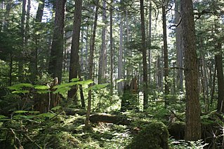
The United States Forest Service (USFS) is an agency of the U.S. Department of Agriculture that administers the nation's 154 national forests and 20 national grasslands. The Forest Service manages 193 million acres (780,000 km2) of land. Major divisions of the agency include the Chief's Office, National Forest System, State and Private Forestry, Business Operations, and Research and Development. The agency manages about 25% of federal lands and is the only major national land management agency not part of the U.S. Department of the Interior, which manages the National Park Service, the U.S. Fish and Wildlife Service, and the Bureau of Land Management.

Man and the Biosphere Programme (MAB) is an intergovernmental scientific program, launched in 1971 by UNESCO, that aims to establish a scientific basis for the improvement of relationships between people and their environments.

The National Wild and Scenic Rivers System was created by the Wild and Scenic Rivers Actof 1968, enacted by the U.S. Congress to preserve certain rivers with outstanding natural, cultural, and recreational values in a free-flowing condition for the enjoyment of present and future generations.

The National Estuarine Research Reserve System is a network of 29 protected areas established by partnerships between the National Oceanic and Atmospheric Administration (NOAA) and coastal states. The reserves represent different biogeographic regions of the United States. The National Estuarine Research Reserve System protects more than 1.3 million acres of coastal and estuarine habitats for long-term research, water-quality monitoring, education, and coastal stewardship.

The Coastal Zone Management Act of 1972 is an Act of Congress passed in 1972 to encourage coastal states to develop and implement coastal zone management plans (CZMPs). This act was established as a United States National policy to preserve, protect, develop, and where possible, restore or enhance, the resources of the Nation's coastal zone for this and succeeding generations.

The National Natural Landmarks (NNL) Program recognizes and encourages the conservation of outstanding examples of the natural history of the United States. It is the only national natural areas program that identifies and recognizes the best examples of biological and geological features in both public and private ownership. The program was established on May 18, 1962, by United States Secretary of the Interior Stewart Udall.

The National Wilderness Preservation System (NWPS) of the United States protects federally managed wilderness areas designated for preservation in their natural condition. Activity on formally designated wilderness areas is coordinated by the National Wilderness Preservation System. Wilderness areas are managed by four federal land management agencies: the National Park Service, the U.S. Forest Service, the U.S. Fish and Wildlife Service, and the Bureau of Land Management.

The Minnesota Department of Natural Resources, or Minnesota DNR, is the agency of the U.S. state of Minnesota charged with conserving and managing the state's natural resources. The agency maintains areas such as state parks, state forests, recreational trails, and recreation areas as well as managing minerals, wildlife, and forestry throughout the state. The agency is divided into six divisions - Ecological & Water Resources, Enforcement, Fish & Wildlife, Forestry, Lands & Minerals, and Parks & Trails.

The Wisconsin Department of Natural Resources (WDNR) is a government agency of the U.S. state of Wisconsin charged with conserving and managing Wisconsin's natural resources. The Wisconsin Natural Resources Board has the authority to set policy for the WDNR. The WDNR is led by the Secretary, who is appointed by the Governor of Wisconsin. The WDNR develops regulations and guidance in accordance with laws passed by the Wisconsin Legislature. It administers wildlife, fish, forests, endangered resources, air, water, waste, and other issues related to natural resources. The central office of the WDNR is located in downtown Madison, near the state capitol.

Natural resource management (NRM) is the management of natural resources such as land, water, soil, plants and animals, with a particular focus on how management affects the quality of life for both present and future generations (stewardship).
The Iowa Department of Natural Resources is a department/agency of the U.S. state of Iowa formed in 1986, charged with maintaining state parks and forests, protecting the environment of Iowa, and managing energy, fish, wildlife, land resources, and water resources of Iowa.

The Conservation Effects Assessment Project (CEAP) was established in 2002 to quantify the environmental impact of the United States Department of Agriculture's (USDA) conservation program. The project focuses on how watersheds are affected. CEAP monitored 14 benchmark watershed sites. The CEAP's vision is to enhance "natural resources and healthier ecosystems through improved conservation effectiveness and better management of agricultural landscapes. The goal is "to improve efficacy of conservations practices and programs by quantifying conservation effects and providing the science and education base needed to enrich conservation planning, implementation, management decisions, and policy."
Mitigation banking is the preservation, enhancement, restoration or creation (PERC) of a wetland, stream, or habitat conservation area which offsets, or compensates for, expected adverse impacts to similar nearby ecosystems. The goal is to replace the exact function and value of specific habitats that would be adversely affected by a proposed activity or project. The public interest is served when enforcement agencies require more habitat as mitigation, often referred to as a mitigation ratio, than is adversely impacted by management or development of nearby acreage.

New York State Forests are administered by the Division of Lands and Forests of the New York State Department of Environmental Conservation (NYSDEC). New York State Forests include reforestation, multiple use, and unique areas; and state nature and historic preserves, with approximately 600,000 acres (2,400 km2) classified as reforestation areas and approximately 9,000 acres (36 km2) classified as multiple use lands. Land within the Adirondack Park or the Catskill Park is not included as part of the State Forest system.
Traditional ecological knowledge (TEK) describes indigenous and other traditional knowledge of local resources. As a field of study in Northern American anthropology, TEK refers to "a cumulative body of knowledge, belief, and practice, evolving by accumulation of TEK and handed down through generations through traditional songs, stories and beliefs. It is concerned with the relationship of living beings with their traditional groups and with their environment." It is important to note that indigenous knowledge is not a universal concept among various societies, but is referred to a system of knowledge traditions or practices that are heavily dependent on "place". Such knowledge is used in natural resource management as a substitute for baseline environmental data in cases where there is little recorded scientific data, or may complement Western scientific methods of ecological management.

Ecosystem management is an approach to natural resource management that aims to ensure the long-term sustainability and persistence of an ecosystems function and services while meeting socioeconomic, political, and cultural needs. Although indigenous communities have employed sustainable ecosystem management approaches for millennia, ecosystem management emerged formally as a concept in the 1990s from a growing appreciation of the complexity of ecosystems, as well as humans' reliance and influence on natural systems.

The California Desert Protection Act of 1994 is a federal law, signed by President Bill Clinton, and passed by the United States Congress on October 8, 1994, that established the Death Valley and Joshua Tree National Parks and the Mojave National Preserve in the California desert.
Florida Ecological Greenways Network work to provide a "system of native landscapes and ecosystems that supports native plant and animal species, sustains clean air, water, fisheries, and other natural resources, and maintains the scenic natural beauty that draws people to visit and settle in Florida," as stated Florida Greenways Commission. It also functions to devise a plan for a statewide greenways system, based on GIS technology and suggestions from the public. The GIS data used includes soil, water, and geological information, wildlife movements and habitat data, as well as existing trails and parks, transportation and infrastructure fixtures, educational and historical sites, and political boundaries. This system would be created in accordance with the December 1994 report from the Florida Greenways Commission to the Governor of the state of Florida, a report which outlined the protocol for creating it. Such a system would connect all aspects of the state's "green infrastructure", making it more comprehensive for use by the state's citizens and more effective in achieving greater sustainability throughout the state of Florida for generations to come.

Ann M. Bartuska is an ecologist and biologist. She is a senior advisor at Resources for the Future and a former Deputy Under Secretary for Research, Education, and Economics (REE) at the United States Department of Agriculture and former USDA Chief Scientist.


