Tobasco, Ohio

Last updated

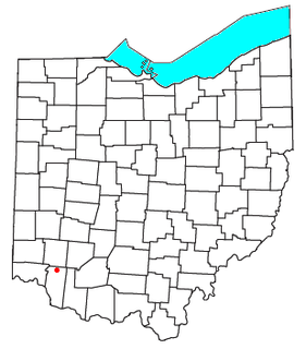
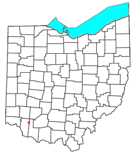
Tobasco is an unincorporated community in Clermont County, in the U.S. state of Ohio. [1]

Clermont County, Ohio County in the United States

Clermont County, popularly called Clermont, is a county in the U.S. state of Ohio. As of the 2010 census, the population was 197,363. Ordinanced in 1800 as part of the Virginia Military District, Clermont is Ohio's eighth oldest county, the furthest county west in Appalachian Ohio, the eleventh oldest county of the former Northwest Territory, and is in the Cincinnati metropolitan area. The county is named for the Clermont Province of France, the home of Vercingetorix, from the French "clear hills or mountain."

U.S. state constituent political entity of the United States

In the United States, a state is a constituent political entity, of which there are currently 50. Bound together in a political union, each state holds governmental jurisdiction over a separate and defined geographic territory and shares its sovereignty with the federal government. Due to this shared sovereignty, Americans are citizens both of the federal republic and of the state in which they reside. State citizenship and residency are flexible, and no government approval is required to move between states, except for persons restricted by certain types of court orders. Four states use the term commonwealth rather than state in their full official names.

Ohio State of the United States of America

Ohio is a Midwestern state in the Great Lakes region of the United States. Of the fifty states, it is the 34th largest by area, the seventh most populous, and the tenth most densely populated. The state's capital and largest city is Columbus.

History

A post office called Tobasco was established in 1878, and remained in operation until 1933. [2] The community derives its name from Tabasco, in Mexico. [3] It was misspelled at the beginning and the spelling remains today. Another historian claims that President Rutherford B. Hayes made an appearance in the area making an outdoor speech in 90º heat. As he wiped his brow he said "It IS hotter than Tabasco sauce out here!" +

Tabasco State of Mexico

Tabasco, officially the Free and Sovereign State of Tabasco, is one of the 32 Federal Entities of Mexico. It is divided into 17 municipalities and its capital city is Villahermosa. It is located in the southeast of the country bordering the states of Campeche to the northeast, Veracruz to the west and Chiapas to the south, and the Petén department of Guatemala to the southeast. It has a coastline to the north with the Gulf of Mexico. Most of the state is covered in rainforest as, unlike most other areas of Mexico, it has plentiful rainfall year round. For this reason, it is also covered in small lakes, wetlands and rivers. The state is subject to major flooding events, with the last occurring in 2007, which affected eighty percent of the state. The state is also home to La Venta, the major site of the Olmec civilization, considered to be the origin of later Mesoamerican cultures. Even though it produces significant quantities of petroleum and natural gas, poverty is still a concern.

Related Research Articles

Goshen, Ohio census-designated place in Ohio, United States

Goshen is a census-designated place in central Goshen Township, Clermont County, Ohio, United States. It is centered on State Route 28, approximately midway between Milford and Blanchester.

Miamiville, Ohio census designated place

Miamiville is an unincorporated community and census-designated place (CDP) in western Miami Township, Clermont County, Ohio, United States, along the Little Miami River and the Loveland Bike Trail. As of the 2010 census it had a population of 242. Although it is unincorporated, it has a post office, with the ZIP code of 45147.

Marathon, Ohio human settlement in United States of America

Marathon is an unincorporated community in eastern Jackson Township, Clermont County, Ohio, United States. Although it is unincorporated, it had a post office, with the ZIP code of 45145. The current ZIP code is 45118. It lies along U.S. Route 50.

Concord is an unincorporated community in Clermont County, in the U.S. state of Ohio.

Monterey is an unincorporated community in Clermont County, in the U.S. state of Ohio.

Olive Branch is an unincorporated community in Clermont County, in the U.S. state of Ohio.

New Palestine is an unincorporated community in Clermont County, in the U.S. state of Ohio.

Perintown is an unincorporated community in Clermont County, in the U.S. state of Ohio.

Afton is an unincorporated community in Clermont County, in the U.S. state of Ohio.

Belfast is an unincorporated community in Clermont County, in the U.S. state of Ohio.

Blowville is an unincorporated community in Clermont County, in the U.S. state of Ohio.

Braziers is an unincorporated community in Clermont County, in the U.S. state of Ohio.

Hennings Mill is an unincorporated community in Clermont County, in the U.S. state of Ohio.

Hills is an unincorporated community in Clermont County, in the U.S. state of Ohio.

Woodville is an unincorporated community in Clermont County, in the U.S. state of Ohio.

Locust Corner is an unincorporated community in Clermont County, in the U.S. state of Ohio.

Ninemile is an unincorporated community in Clermont County, in the U.S. state of Ohio.

Stonelick is an unincorporated community in Clermont County, in the U.S. state of Ohio.

Moores Fork is an unincorporated community in Clermont County, in the U.S. state of Ohio.

Mount Holly is an unincorporated community in Clermont County, in the U.S. state of Ohio.

References

  1. U.S. Geological Survey Geographic Names Information System: Tobasco, Ohio
  2. "Clermont County". Jim Forte Postal History. Retrieved 16 January 2016.
  3. Bright, William (2004). Native American Placenames of the United States. University of Oklahoma Press. p. 499. ISBN   978-0-8061-3598-4.

Coordinates: 39°4′16″N84°17′37″W / 39.07111°N 84.29361°W / 39.07111; -84.29361

Geographic coordinate system Coordinate system

A geographic coordinate system is a coordinate system that enables every location on Earth to be specified by a set of numbers, letters or symbols. The coordinates are often chosen such that one of the numbers represents a vertical position and two or three of the numbers represent a horizontal position; alternatively, a geographic position may be expressed in a combined three-dimensional Cartesian vector. A common choice of coordinates is latitude, longitude and elevation. To specify a location on a plane requires a map projection.