Tolkien's maps

Last updated

Detail from Tolkien's revised map of Wilderland for the first edition of The Hobbit, 1937 Wilderland red-black map (detail).jpg
Detail from Tolkien's revised map of Wilderland for the first edition of The Hobbit , 1937
Detail from J. R. R. Tolkien's preliminary map of Wilderland. The publishers asked for the map to be redrawn to suit line-block printing better, and with improved lettering. J. R. R. Tolkien's preliminary map of Wilderland (detail).jpg
Detail from J. R. R. Tolkien's preliminary map of Wilderland. The publishers asked for the map to be redrawn to suit line-block printing better, and with improved lettering.

J. R. R. Tolkien's maps, depicting his fictional Middle-earth and other places in his legendarium, helped him with plot development, guided the reader through his often complex stories, and contributed to the impression of depth and worldbuilding in his writings.

Contents

Tolkien stated that he began with maps and developed his plots from them, but that he also wanted his maps to be picturesque. Later fantasy writers also often include maps in their novels.

The publisher Allen & Unwin commissioned Pauline Baynes to paint a map of Middle-earth, based on Tolkien's draft maps and his annotations; it became iconic. A later redrafting of the maps by the publisher HarperCollins however made the maps look blandly professional, losing the hand-drawn feeling of Tolkien's maps.

Maps

The Hobbit

The Hobbit contains two simple maps and only around 50 placenames. In the view of the Tolkien critic Tom Shippey, the maps are largely decorative in the "Here be tygers" tradition, adding nothing to the story. [2] The first is Thror's map, in the fiction handed down to Thorin, showing little but the Lonely Mountain drawn in outline with ridgelines and entrances, and parts of two rivers, decorated with a spider and its web, English labels and arrows, and two texts written in runes. [T 1] The other is a drawing of "Wilderland", from Rivendell in the west to the Lonely Mountain and Smaug the dragon in the east. The Misty Mountains are drawn in three dimensions. Mirkwood is shown as a mixture of closely packed tree symbols, spiders and their webs, hills, lakes, and villages. The map is overprinted with placenames in red. [T 2] Both maps have a heavy vertical line not far from the left-hand side, the one on the map of Wilderland marked "Edge of the Wild". This line represented the printed delineation of the margin of the school paper, which came with the printed instruction "Do not write in this margin". [3]

Tolkien's maps were hand-drawn and hand-lettered. The publishers asked for them to be redrawn, to suit line-block printing better, to have sharper lettering, and to use fewer colours. [4]

The Lord of the Rings

J. R. R. Tolkien's design for his son Christopher's contour map on graph paper with handwritten annotations, of parts of Gondor and Mordor and the route taken by the Hobbits with the One Ring, and dates along that route, for an enlarged map in The Return of the King Gondor Mordor Contour Map Detail Graphpaper.jpg
J. R. R. Tolkien's design for his son Christopher's contour map on graph paper with handwritten annotations, of parts of Gondor and Mordor and the route taken by the Hobbits with the One Ring, and dates along that route, for an enlarged map in The Return of the King
Detail of finished contour map by Christopher Tolkien, drawn from his father's graph paper design. The Hobbits' route has been omitted. The city of Minas Tirith (lower left) with its large encircling wall (the Rammas Echor) and the ruined city of Osgiliath astride the River Anduin nearby are shown. Gondor Contour Map Detail.jpg
Detail of finished contour map by Christopher Tolkien, drawn from his father's graph paper design. The Hobbits' route has been omitted. The city of Minas Tirith (lower left) with its large encircling wall (the Rammas Echor) and the ruined city of Osgiliath astride the River Anduin nearby are shown.

The Lord of the Rings contains three maps and over 600 placenames. The maps are a large drawing of the north-west part of Middle-earth, showing mountains as if seen in three dimensions, and coasts with multiple waterlines; [T 3] a more detailed drawing of "A Part of the Shire"; [T 4] and a contour map by Christopher Tolkien of parts of Rohan, Gondor, and Mordor, very different in style. [3] [T 5] Tolkien worked for many years on the book, using a hand-drawn map of the whole of the north-west of Middle-earth on squared (not graph) paper, each 2cm square representing 100 miles. The map had many annotations in pencil and a range of different inks added over the years, the older ones faded until almost illegible. The paper became soft, torn and yellowed through intensive use, and a fold down the centre had to be mended using parcel tape. [7] He made a detailed pencil, ink and coloured pencil design on graph paper, enlarged five times in length from the main map of Middle-earth. His son Christopher drew the contour map from the design. The finished map faithfully reproduced the contours, features and labels of his father's design, but omitted the route (with dates) taken by the Hobbits Frodo and Sam on their way to destroy the One Ring in Mount Doom. Father and son worked desperately to finish the map in time for publication: [6]

I had to devote many days, the last three virtually without food or bed, to drawing re-scaling and adjusting a large map, at which [Christopher] then worked for 24 hours (6am to 6am without bed) in re-drawing just in time. [8]

Shippey notes that many of the places mapped are never used in the text. [2] The map of the Shire is the only one to include political boundaries, in the shape of the divisions between the administrative districts or Farthings. [3]

The Silmarillion

The first edition of The Silmarillion contains two maps. There is a large fold-out drawing of Beleriand. [T 6] The Ered Luin mountain range on its right-hand edge approximately matches the mountain range of that name on the left-hand edge of the main map in The Lord of the Rings. The other is a smaller-scale drawing of the central region of the same area, with coasts, mountains, and rivers but without forests, overprinted in red with the names of the leaders of the Elves in each part of Beleriand. [T 7]

The other continents and regions described in The Silmarillion are not mapped in the book, but Tolkien drew sketches of Arda in its early stages including of Valinor (Aman), and a map of the star-shaped island of Numenor, with little detail other than coasts (with waterlining) and mountains, which was eventually printed in Unfinished Tales . [T 8] Some other absences may be significant; Christopher Tolkien wrote that the frequently mentioned Dwarf-road over the mountains bordering Beleriand is not shown, because the Noldorin Elves who lived there never crossed the mountains. [3]

Functions

Aesthetic experience

The style of Tolkien's maps mixes illustrative principles and purpose with cartographical practice. Alice Campbell, in The J. R. R. Tolkien Encyclopedia , writes that while they have what Tolkien called an "archaic air", they are not authentically medieval in style. [9] In particular, he allows for blank spaces between features, an 18th-century innovation that meant that the features that were drawn were reliable. [9] Campbell states that Tolkien's mapping style echoes William Morris's Arts and Crafts: "they are functional, but with an eye to grace and beauty", and in her view lie somewhere between illustration and cartography. [9]

Tolkien indeed wrote that "there should be picturesque maps, providing more than a mere index to what is said in the text". [T 9] His maps thus have at least three functions: to help the author construct a consistent plot; to guide the reader; and through the "picturesque", the aesthetic experience, to lead the reader into the imagined secondary world. [10]

From map to plot

A linguistic map: Tolkien invented parts of Middle-earth to resolve the linguistic puzzle he had accidentally created by using different European languages for peoples in his legendarium. Linguistic Map of Middle-Earth.svg
A linguistic map: Tolkien invented parts of Middle-earth to resolve the linguistic puzzle he had accidentally created by using different European languages for peoples in his legendarium.

In 1954, Tolkien wrote in a letter to the novelist Naomi Mitchison that [T 10]

I wisely started with a map, and made the story fit (generally with meticulous care for distances). The other way about lands one in confusions and impossibilities, and in any case it is weary work to compose a map from a story — as I fear you have found. [T 10]

Tolkien developed not only maps but names and languages before he arrived at a plot. [12] He had already used Old Norse for the Dwarves of Dale (to the east) in The Hobbit, and he was using modern English for the Hobbits of the Shire (in the west); his choice of Old English for the riders of Rohan implied a linguistic map of Middle-earth, with different peoples, languages and regions. [13]

Karen Wynn Fonstad, author of The Atlas of Middle-earth , [14] commented that in such a world, writing has to be based on detailed knowledge of each of many types of details; she found herself, as Tolkien had, unable to proceed with the atlas until she had mastered all of them. Distances travelled, the chronology of the quest, geology, and terrain all needed to be understood to create the work. [15]

Impression of depth

Campbell stated that the "lovingly detailed" maps helped to shape the stories and create a "believable whole". [9] In Shippey's view, "the names and the maps give Middle-earth that air of solidity and extent both in space and time which its successors [in 20th century fantasy] so conspicuously lack". [16] One way that this works, he argues, is that readers, far from analysing the etymology of place-names as Tolkien habitually did, take them as labels, "as things .. in a very close one-to-one relationship with whatever they label". [17] That in turn makes maps "extraordinarily useful to fantasy, weighing it down as they do with repeated implicit assurances of the existence of the things they label, and of course of their nature and history too." [17]

Geomorphological issues

Issues with the geomorphology of Middle-earth, identified by Alex Acks Geomorphology of Middle-earth.svg
Issues with the geomorphology of Middle-earth, identified by Alex Acks

The geologist Alex Acks, writing on Tor.com, outlines the mismatch between Tolkien's maps and the geomorphological processes of plate tectonics which shape the Earth's continents and mountain ranges. Mountains form mainly next to subduction zones where oceanic crust slides under continental crust, or where continents collide and crumple. Stretching of continental crust, by upwelling of magma, creates broken horst and graben landforms. Acks comments that none of these create right-angle junctions in mountain ranges, such as are seen around Mordor and at both ends of the Misty Mountains on Tolkien's maps. Isolated volcanoes far inland, like Mount Doom, are possible but unlikely: most such volcanoes are islands and occur in roughly straight-line groups as the crust moves across a hotspot in Earth's mantle. [18]

Acks identifies a further issue, with Tolkien's rivers. The Earth's major rivers each drain a raised area of land, forming a drainage basin; the river in the basin takes water and sediment down to the sea, or looked at the other way, branches regularly into smaller and smaller streams that lead up into the hills. A river like the Anduin, on the other hand, has very few branches: it runs more or less as a single large stream for hundreds of miles, and parallel to the Misty Mountain range, rather than directly downhill and away from it. Worse, one of its few tributaries, the Entwash, branches out into a river delta, a basically flat place where a river ends, usually by the sea; but the Anduin goes on flowing past this spot, downhill. Acks excuses another oddity, namely that the Anduin cuts through a gap (between the White Mountains of Gondor and the Ephel Duath of Mordor); this is unusual but can happen, as when the Colorado River cuts across the mountainous Basin and Range Province: the river was there before the mountains, and cut its way down through the rock faster than the mountains grew upwards. Acks comments that the inland Sea of Rhûn seems to be in the bottom of a drainage basin. Again, this can happen; but there must be a watershed, high ground separating it from neighbouring drainage basins, in particular that of the Anduin. But the rivers of Mirkwood run eastwards towards the Sea of Rhûn, propelled by an invisible slope from invisible Mirkwood hills. [19]

Fantasy maps before and after Tolkien

Antecedents

The frontispiece to William Morris's 1897 The Sundering Flood was a map showing the city on a great river, "The Wood Masterless", a "Desert Waste", and towns with English names like "Westcheaping" and "Eastcheaping". [20] The map appears to have been the first fantasy map in the modern sense, defining a wholly invented world. [21] Tolkien stated that he wished to imitate the style and content of Morris's romances, [22] and that he made use of elements from them. [23] [24] Other published examples Tolkien may have had in mind while creating his maps include those of Jonathan Swift, who included maps in his 1726 Gulliver's Travels , and those of Robert Louis Stevenson in his 1883 adventure story Treasure Island . [10]

Influence

Tolkien's maps set a completely new standard for fantasy novels, so that their use has become expected in the genre, which he largely created. [10] Peter Jackson chose to use Tolkien's Middle-earth map in his Lord of the Rings film trilogy. [25] [10] Among later bestselling fantasy authors, George R. R. Martin has used maps in all his A Song of Ice and Fire books, starting with A Game of Thrones . [10]

Derived maps

The "iconic" poster map by Pauline Baynes went far beyond Tolkien's cartography, adding header and footer paintings and inset vignettes. Baynes-Map of Middle-earth.jpg
The "iconic" poster map by Pauline Baynes went far beyond Tolkien's cartography, adding header and footer paintings and inset vignettes.

Iconic poster map

In 1969, Tolkien's publisher Allen & Unwin commissioned the illustrator Pauline Baynes to paint a map of Middle-earth. Tolkien supplied her with copies of his draft maps for The Lord of the Rings, and annotated her copy of his son Christopher's 1954 map for The Fellowship of the Ring. Allen & Unwin published Baynes's map as a poster in 1970. It was decorated with a header and footer showing some of Tolkien's characters, and vignettes of some of his stories' locations. The poster map became "iconic" of Middle-earth. She was the only illustrator of whom Tolkien approved. [26] [27] [28] [29]

Redraftings

Campbell writes that the redrafting of the maps by the publishers HarperCollins for a later edition of The Lord of the Rings made the cartography "bland, modern, professional illustration". [1] In her view, this is "an unintentional reversion to decorative but technically inaccurate medieval-style maps", [1] something that she finds misguided, as in his maps "Tolkien desired accuracy more than decoration". [1] In addition, the redrafting loses what she calls "the illusion of Bilbo's own fair copies of older maps and which suggested a culture without printing presses or engraving", through Tolkien's own "charming hand lettering". [1]

Fan cartography

The Tolkien universe has been subject to significant cartographic efforts by fans, some of whom have published their works in print. These include Karen Wynn Fonstad's The Atlas of Middle-earth . [30]

Related Research Articles

Beorn is a character created by J. R. R. Tolkien, and part of his Middle-earth legendarium. He appears in The Hobbit as a "skin-changer", a man who could assume the form of a great black bear. His descendants or kinsmen, a group of Men known as the Beornings, dwell in the upper Vales of Anduin, between Mirkwood and the Misty Mountains, and are counted among the Free Peoples of Middle-earth who oppose Sauron's forces during the War of the Ring. Like the powerful medieval heroes Beowulf and Bödvar Bjarki, whose names both mean "bear", he exemplifies the Northern courage that Tolkien made a central virtue in The Lord of the Rings.

Hobbits are a fictional race of people in the novels of J. R. R. Tolkien. About half average human height, Tolkien presented hobbits as a variety of humanity, or close relatives thereof. Occasionally known as halflings in Tolkien's writings, they live barefooted, and traditionally dwell in homely underground houses which have windows, built into the sides of hills, though others live in houses. Their feet have naturally tough leathery soles and are covered on top with curly hair.

<span class="mw-page-title-main">Gondor</span> Fictional kingdom in Tolkiens Middle-earth

Gondor is a fictional kingdom in J. R. R. Tolkien's writings, described as the greatest realm of Men in the west of Middle-earth at the end of the Third Age. The third volume of The Lord of the Rings, The Return of the King, is largely concerned with the events in Gondor during the War of the Ring and with the restoration of the realm afterward. The history of the kingdom is outlined in the appendices of the book.

<span class="mw-page-title-main">Rivendell</span> Fictional valley of Elves in J. R. R. Tolkiens Middle-earth

Rivendell is a valley in J. R. R. Tolkien's fictional world of Middle-earth, representing both a homely place of sanctuary and a magical Elvish otherworld. It is an important location in The Hobbit and The Lord of the Rings, being the place where the quest to destroy the One Ring began.

Treebeard, or Fangorn in Sindarin, is a tree-giant character in J. R. R. Tolkien's The Lord of the Rings. He is an Ent and is said by Gandalf to be "the oldest living thing that still walks beneath the Sun upon this Middle-earth." He lives in the ancient Forest of Fangorn, to which he has given his name. It lies at the southern end of the Misty Mountains. He is described as being about 14 feet in height, and in appearance similar to a beech or an oak.

In J. R. R. Tolkien's Middle-earth fiction, Man and Men denote humans, whether male or female, in contrast to Elves, Dwarves, Orcs, and other humanoid races. Men are described as the second or younger people, created after the Elves, and differing from them in being mortal. Along with Ents and Dwarves, these are the "free peoples" of Middle-earth, differing from the enslaved peoples such as Orcs.

<span class="mw-page-title-main">Rohan, Middle-earth</span> Fictional location in J. R. R. Tolkiens Middle-earth legendarium

Rohan is a fictional kingdom of Men in J. R. R. Tolkien's fantasy setting of Middle-earth. Known for its horsemen, the Rohirrim, Rohan provides its ally Gondor with cavalry. Its territory is mainly grassland. The Rohirrim call their land the Mark or the Riddermark, names recalling that of the historical kingdom of Mercia, the region of Western England where Tolkien lived.

In J. R. R. Tolkien's fictional legendarium, Beleriand was a region in northwestern Middle-earth during the First Age. Events in Beleriand are described chiefly in his work The Silmarillion, which tells the story of the early ages of Middle-earth in a style similar to the epic hero tales of Nordic literature, with a pervasive sense of doom over the character's actions. Beleriand also appears in the works The Book of Lost Tales, The Children of Húrin, and in the epic poems of The Lays of Beleriand.

Gil-galad is a fictional character in J. R. R. Tolkien's Middle-earth legendarium, the last high king of the Noldor, one of the main divisions of Elves. He is mentioned in The Lord of the Rings, where the hobbit Sam Gamgee recites a fragment of a poem about him, and The Silmarillion. In the Last Alliance of Elves and Men, Gil-galad and Elendil laid siege to the Dark Lord Sauron's fortress of Barad-dûr, and fought him hand-to-hand for the One Ring. Both Gil-galad and Elendil were killed, and Elendil's son Isildur took the Ring for himself. Gil-galad briefly appears at the opening of Peter Jackson's The Lord of the Rings film trilogy, and features in several video games based on Tolkien's Middle-earth.

In J. R. R. Tolkien's legendarium, the Elves or Quendi are a sundered (divided) people. They awoke at Cuiviénen on the continent of Middle-earth, where they were divided into three tribes: Minyar, Tatyar and Nelyar. After some time, they were summoned by Oromë to live with the Valar in Valinor, on Aman. That summoning and the Great Journey that followed split the Elves into two main groups, which were never fully reunited.

In J. R. R. Tolkien's Middle-earth, the Eagles or Great Eagles, are immense birds that are sapient and can speak. The Great Eagles resemble actual eagles, but are much larger. Thorondor is said to have been the greatest of all birds, with a wingspan of 30 fathoms. Elsewhere, the Eagles have varied in nature and size both within Tolkien's writings and in later adaptations.

<i>The Atlas of Middle-earth</i> 1981 book by Karen Wynn Fonstad

The Atlas of Middle-earth by Karen Wynn Fonstad is an atlas of J. R. R. Tolkien's fictional realm of Middle-earth. It was published in 1981, following Tolkien's major works The Hobbit, The Lord of the Rings, and The Silmarillion. It provides many maps at different levels of detail, from whole lands to cities and individual buildings, and of major events like the Battle of the Pelennor Fields. The maps are grouped by period, namely the First, Second, and Third Ages of Middle-earth, with chapters on The Hobbit and The Lord of the Rings. A final chapter looks at geographic themes such as climate, vegetation, population, and languages around Middle-earth.

Mirkwood is a name used for a great dark fictional forest in novels by Sir Walter Scott and William Morris in the 19th century, and by J. R. R. Tolkien in the 20th century. The critic Tom Shippey explains that the name evoked the excitement of the wildness of Europe's ancient North.

<span class="mw-page-title-main">Middle-earth</span> Continent in Tolkiens legendarium

Middle-earth is the setting of much of the English writer J. R. R. Tolkien's fantasy. The term is equivalent to the Miðgarðr of Norse mythology and Middangeard in Old English works, including Beowulf. Middle-earth is the human-inhabited world, that is, the central continent of the Earth, in Tolkien's imagined mythological past. Tolkien's most widely read works, The Hobbit and The Lord of the Rings, are set entirely in Middle-earth. "Middle-earth" has also become a short-hand term for Tolkien's legendarium, his large body of fantasy writings, and for the entirety of his fictional world.

In J. R. R. Tolkien's writings, Elves are the first fictional race to appear in Middle-earth. Unlike Men and Dwarves, Elves are immortal, though they can be killed in battle. If so, their souls go to the Halls of Mandos in Aman. After a long life in Middle-earth, Elves yearn for the Earthly Paradise of Valinor, and can sail there from the Grey Havens. They feature in The Hobbit and The Lord of the Rings. Their history is described in detail in The Silmarillion.

The geography of Middle-earth encompasses the physical, political, and moral geography of J. R. R. Tolkien's fictional world of Middle-earth, strictly a continent on the planet of Arda but widely taken to mean the physical world, and , all of creation, as well as all of his writings about it. Arda was created as a flat world, incorporating a Western continent, Aman, which became the home of the godlike Valar, as well as Middle-earth. At the end of the First Age, the Western part of Middle-earth, Beleriand, was drowned in the War of Wrath. In the Second Age, a large island, Númenor, was created in the Great Sea, Belegaer, between Aman and Middle-earth; it was destroyed in a cataclysm near the end of the Second Age, in which Arda was remade as a spherical world, and Aman was removed so that Men could not reach it.

<span class="mw-page-title-main">Forests in Middle-earth</span> Forests in Tolkiens Middle-earth fiction

Forests appear repeatedly in J. R. R. Tolkien's fantasy world of Middle-earth. In The Hobbit, Bilbo Baggins and party have adventures in the Trollshaws and in Mirkwood. In The Lord of the Rings, Frodo Baggins and his companions travel through woods in The Shire, and are pursued by Black Riders; to evade them, the party enters the feared Old Forest, where they encounter other hazards. Later the Fellowship comes to the Elvish forest realm of Lothlórien; and after the Fellowship has split up, Frodo and Sam Gamgee travel through Ithilien with its Mediterranean vegetation, while Merry Brandybuck and Pippin Took enter the ancient forest of Fangorn. The Riders of Rohan, on their way to war, are allowed to travel on a secret road through another ancient forest, that of the Drúedain or woses. The Silmarillion, too, features several forests, both in Beleriand which is home to places like the Elvish forest realm of Doriath, protected by the magic of Melian the Maia, and in the south of Valinor, where the Valar liked to hunt in the woods of Oromë.

Tolkien's Middle-earth family trees contribute to the impression of depth and realism in the stories set in his fantasy world by showing that each character is rooted in history with a rich network of relationships. J. R. R. Tolkien included multiple family trees in both The Lord of the Rings and The Silmarillion; they are variously for Elves, Dwarves, Hobbits, and Men.

<span class="mw-page-title-main">J. R. R. Tolkien's artwork</span> Artwork by J. R. R. Tolkien

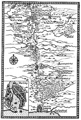
Tolkien's artwork was a key element of his creativity from the time when he began to write fiction. The philologist and author J. R. R. Tolkien prepared a wide variety of materials to support his fiction, including illustrations for his Middle-earth fantasy books, facsimile artefacts, more or less "picturesque" maps, calligraphy, and sketches and paintings from life. Some of his artworks combined several of these elements.

The architecture in Middle-earth, J. R. R. Tolkien's fictional world, is as varied as the Hobbit-holes of the Shire, the tree-houses of Lothlórien, the wooden halls of Rohan, and the stone dwellings and fortifications of Minas Tirith, capital of Gondor. Tolkien uses the architecture in each place, including its interior design, to provide clues to each people's character. The Hobbit Bilbo Baggins's cosy home, Bag End, described in his 1937 children's book The Hobbit, establishes the character of Hobbits as averse to travelling outside the Shire. In his fantasy novel The Lord of the Rings, Lothlórien demonstrates the close integration of the Elves with their natural environment. The King of Rohan's hall, Meduseld, indicates the Rohirrim's affinity with Anglo-Saxon culture, while Gondor's tall and beautiful stone architecture was described by Tolkien as "Byzantine". In contrast, the Dark Lord Sauron and the fallen Wizard Saruman's realms are damaged lands around tall dark towers.

References

Primary

  1. Tolkien 1937 , at start
  2. Tolkien 1937 , at end
  3. Tolkien 1954 , foldout map in first edition
  4. Tolkien 1954 , map before first chapter
  5. Tolkien 1955 , foldout map in first edition
  6. Tolkien 1977 , fold-out map inside back cover
  7. Tolkien 1977 , map in chapter 14, "Of Beleriand and its Realms"
  8. Tolkien 1980 , start of part 2 "The Second Age"
  9. Carpenter 2023 , letter #141 to Allen & Unwin , 9 October 1953
  10. 1 2 3 Carpenter 2023 , letter #144 to Naomi Mitchison , 25 April 1954

Secondary

  1. 1 2 3 4 5 Campbell 2013, p. 408.
  2. 1 2 Shippey 2005, p. 114.
  3. 1 2 3 4 Campbell 2013, p. 407.
  4. Hammond & Scull 1995, pp. 90–95.
  5. McIlwaine 2018, pp. 394–395.
  6. 1 2 McIlwaine 2018, pp. 394–397.
  7. McIlwaine 2018, pp. 400–401.
  8. McIlwaine 2018, p. 394.
  9. 1 2 3 4 Campbell 2013, p. 405.
  10. 1 2 3 4 5 Sundmark 2017, pp. 221–238.
  11. Shippey 2005, pp. 131–133.
  12. Shippey 2005, p. 133.
  13. Shippey 2005, pp. 126–133.
  14. Fonstad 1991, p. 1.
  15. Fonstad 2006, pp. 133–136.
  16. Shippey 2005, p. 118.
  17. 1 2 Shippey 2005, p. 115.
  18. 1 2 Acks 2017a.
  19. 1 2 Acks 2017b.
  20. Morris 1897, frontispiece.
  21. 1 2 Smee 2007, pp. 75–82.
  22. Carpenter 2023 , #1
  23. Carpenter 2023 , #226
  24. Tolkien 1937 , p. 183, note 10
  25. Walker 1981, article 9.
  26. 1 2 McIlwaine 2018, p. 384.
  27. 1 2 Kennedy 2016.
  28. 1 2 Bodleian 2016.
  29. Scull & Hammond 2017, pp. 112–113.
  30. Danielson, Stentor (21 July 2018). "Re-reading the Map of Middle-earth: Fan Cartography's Engagement with Tolkien's Legendarium". Journal of Tolkien Research . 6 (1). Article 4. ISSN   2471-934X.

Sources