Town 'n' Country, Florida

Last updated

Town 'n' Country
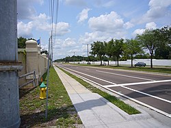
Sheldonutbt.jpg
Town 'n' Country
TownncountryFL.gif
Hillsborough County Florida Incorporated and Unincorporated areas Town 'n' Country Highlighted.svg
Location in Hillsborough County and the state of Florida
Coordinates: 28°0′36″N82°34′22″W / 28.01000°N 82.57278°W / 28.01000; -82.57278
Country United States
State Florida
County Hillsborough
Area
[1]
  Total24.14 sq mi (62.52 km2)
  Land22.09 sq mi (57.22 km2)
  Water2.05 sq mi (5.30 km2)
Elevation
6 ft (2 m)
Population
 (2020)
  Total85,951
  Density3,890.42/sq mi (1,502.11/km2)
Time zone UTC-5 (Eastern (EST))
  Summer (DST) UTC-4 (EDT)
ZIP code
33615
Area code 813
FIPS code 12-72145 [2]
GNIS feature ID1867220 [3]

Town 'n' Country is a census-designated place (CDP) in Hillsborough County, Florida, United States. The population was 85,951 at the 2020 census.

Contents

Within Town 'n' Country are located Bay Crest Park, Countryway, Rocky Creek, Sweetwater Creek.

History

Prior to the 1950s, Town 'n' Country was primarily natural areas and cattle farms. In 1958, the LaMonte-Shimberg Corporation purchased a 525-acre dairy farm from the Webb family near the Hillsborough Avenue-Memorial intersection to construct the Town 'n' Country Park subdivision, making the area one of Tampa’s first suburban communities. By the time the original developers and builders of Town 'n' Country had built their last house, the area covered more than 2,000 acres and stretched over three miles from Memorial Highway on the south to north of Waters Avenue. In this area, nearly 8,000 single-family homes and townhouses were built from 1958 to 1978 by LaMonte-Shimberg. [4]

ZIP code

The ZIP code for Town 'n' Country is 33615; other nearby ZIP codes include 33634 and 33635.

Geography

Town 'n' Country is located in western Hillsborough County at 28°0′36″N82°34′22″W / 28.01000°N 82.57278°W / 28.01000; -82.57278 (28.010046, -82.572815). [5] It is bordered to the south by the city of Tampa and is about 12 miles (19 km) northwest of downtown. The CDP is bordered to the north by Westchase, Citrus Park, and Carrollwood, and to the east by Egypt Lake-Leto. To the west is the city of Oldsmar in Pinellas County. The northwest portion of Tampa International Airport is located within Town 'n' Country CDP.

According to the United States Census Bureau, the CDP has a total area of 24.1 square miles (62.5 km2), of which 22.1 square miles (57.3 km2) are land and 2.0 square miles (5.2 km2), or 8.39%, are water. [6]

Demographics

Historical population
CensusPop.Note
1970 19,453
1980 37,83494.5%
1990 60,94661.1%
2000 72,52319.0%
2010 78,4228.1%
2020 85,9519.6%
source: [7] [8] [9]
Town 'n' Country racial composition
(Hispanics excluded from racial categories)
(NH = Non-Hispanic)
RacePop 2010 [10] Pop 2020 [11] % 2010% 2020
White (NH)32,99227,34442.07%31.81%
Black or African American (NH)6,1695,7837.87%6.73%
Native American or Alaska Native (NH)1721170.22%0.14%
Asian (NH)3,1394,5274.00%5.27%
Pacific Islander or Native Hawaiian (NH)39530.05%0.06%
Some other race (NH)2667740.34%0.90%
Two or more races/Multiracial (NH)1,2852,9111.64%3.39%
Hispanic or Latino (any race)34,38044,44243.84%51.71%
Total78,42285,951

As of the 2020 United States census, there were 85,951 people, 32,107 households, and 21,018 families residing in the CDP. [12]

For the period 2011–15, the estimated median annual income for a household in the CDP was $49,559, and the median income for a family was $54,644. Male full-time workers had a median income of $39,453 versus $36,374 for females. The per capita income for the CDP was $25,195. About 13.0% of families and 15.7% of the population were below the poverty line, including 25.4% of those under age 18 and 11.9% of those age 65 or over. [13]

As of the 2010 United States census, there were 78,422 people, 30,763 households, and 19,054 families residing in the CDP. [14]

In 2010, there were 30,763 households in the CDP, out of which 33.5% had children under the age of 18 living with them, 42.7% were headed by married couples living together, 13.9% had a female householder with no husband present, and 35.3% were non-families. 26.2% of all households were made up of individuals, and 6.6% were someone living alone who was 65 years of age or older. The average household size was 2.57, and the average family size was 3.10. [15]

In 2010, in the CDP, 22.2% of the population were under the age of 18, 9.6% were from 18 to 24, 30.3% were from 25 to 44, 26.2% were from 45 to 64, and 11.6% were 65 years of age or older. The median age was 37.2 years. For every 100 females, there were 95.1 males. For every 100 females age 18 and over, there were 92.3 males. [15]

Related Research Articles

Franklin Park is a census-designated place (CDP) in Broward County, Florida, United States. The population was 1,025 at the 2020 census.

Hillsboro Pines is a census-designated place (CDP) in Broward County, Florida, United States. The population was 496 at the 2020 census.

Roosevelt Gardens is a census-designated place (CDP) in Broward County, Florida, United States. The population was 2,749 at the 2020 census.

<span class="mw-page-title-main">Citrus Park, Florida</span> Census-designated place in Florida, United States

Citrus Park is an unincorporated census-designated place in Hillsborough County, Florida, United States. The population was 28,178 at the 2020 census, up from 24,252 at the 2010 census.

<span class="mw-page-title-main">East Lake-Orient Park, Florida</span> Census-designated place in Florida, United States

East Lake-Orient Park is an unincorporated census-designated place in Hillsborough County, Florida, United States. The population was 22,753 at the 2010 census, up from 5,703 at the 2000 census following an expansion of its borders. The area is the home of the Florida State Fairgrounds, which hosts the Florida State Fair in mid-February of each year. It was previously home to East Lake Square Mall. The ZIP code for East Lake-Orient Park is 33610 and 33619.

<span class="mw-page-title-main">Progress Village, Florida</span> Census-designated place in Florida, United States

Progress Village is a census-designated place (CDP) in Hillsborough County, Florida, United States. Per the 2020 census, the population was 11,188.

<span class="mw-page-title-main">Riverview, Florida</span> Census-designated place in Florida, United States

Riverview is an unincorporated census-designated place in Hillsborough County, Florida, United States. It is located south of Brandon. The population was 107,396 in the 2020 census, up from 71,050 in the 2010 census.

<span class="mw-page-title-main">Coral Terrace, Florida</span> Census-designated place in Florida

Coral Terrace is a suburban unincorporated community and census-designated place (CDP) in Miami-Dade County, Florida, United States. It is part of the Miami metropolitan area of South Florida. The population was 23,142 at the 2020 census, down from 24,376 in 2010.

<span class="mw-page-title-main">Country Club, Florida</span> Census-designated place in Florida

Country Club is a census-designated place and a suburban unincorporated community located in northwest Miami-Dade County, Florida, United States. It is located in the Miami metropolitan area of South Florida. The CDP is named after the Country Club of Miami, which was established in 1961 in what was then an unpopulated and undeveloped section of the county. The population was 49,967 at the 2020 census, up from 3,408 in 1990.

<span class="mw-page-title-main">Country Walk, Florida</span> Census-designated place in Florida

Country Walk is a census-designated place (CDP) in Miami-Dade County, Florida, United States. It is part of the Miami metropolitan area of South Florida. The population was 16,951 at the 2020 census, up from 15,997 at the 2010 census.

<span class="mw-page-title-main">Homestead Base, Florida</span> Census-designated place in Florida

Homestead Base is a census-designated place (CDP) in Miami-Dade County, Florida, United States. The CDP comprises the extent of Homestead Air Reserve Base plus some surrounding land. It is part of the Miami metropolitan area of South Florida. The population was 999 at the 2020 census.
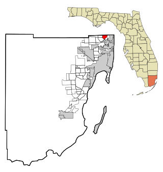
<span class="mw-page-title-main">Ives Estates, Florida</span> Census-designated place in Florida

Ives Estates is a census-designated place (CDP) in Miami-Dade County, Florida. It is part of the Miami metropolitan area of South Florida. The population was 25,005 at the 2020 census, up from 19,525 in 2010.

<span class="mw-page-title-main">Palm Springs North, Florida</span> Census-designated place in Florida

Palm Springs North is an unincorporated community and census-designated place (CDP) in Miami-Dade County, Florida, United States. It is part of the Miami metropolitan area of South Florida. The population was 5,030 at the 2020 census.

<span class="mw-page-title-main">Princeton, Florida</span> Census-designated place in Florida

Princeton is a census-designated place (CDP) and unincorporated community in Miami-Dade County, Florida, United States. It is part of the Miami metropolitan area of South Florida. The population was 39,208 at the 2020 census, up from 22,038 at the 2010 census.

<span class="mw-page-title-main">Richmond West, Florida</span> Census-designated place in Florida

Richmond West is a census-designated place (CDP) in Miami-Dade County, Florida, United States. It is part of the Miami metropolitan area of South Florida. The population was 35,884 at the 2020 census, up from 31,973 at the 2010 census.
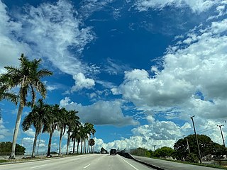
<span class="mw-page-title-main">The Crossings, Florida</span> CDP in Florida

The Crossings is a census-designated place (CDP) and suburb of Miami in Miami-Dade County, Florida, United States. It is part of the Miami metropolitan area of South Florida. The CDP includes the neighborhoods of The Crossings, Devon Aire, and Calusa. The population was 23,276 at the 2020 census.
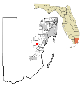
<span class="mw-page-title-main">Three Lakes, Florida</span> Census-designated place in Florida

Three Lakes is a census-designated place (CDP) and planned community in Miami-Dade County, Florida, United States. It is part of the Miami metropolitan area of South Florida. The population was 16,540 at the 2020 census, up from 15,047 in 2010.

<span class="mw-page-title-main">Westwood Lakes, Florida</span> Census-designated place in Florida

Westwood Lakes is a census-designated place and unincorporated community of Miami-Dade County, Florida, United States. It is part of the Miami metropolitan area of South Florida. The population was 11,373 at the 2020 census.
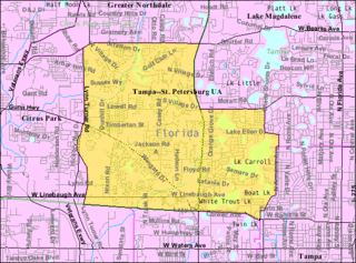
<span class="mw-page-title-main">Carrollwood (CDP), Florida</span> Census-designated place in Florida, United States

Carrollwood is a census-designated place (CDP) in northwestern Hillsborough County, Florida, United States. The population was 33,365 at the 2010 census. The census area includes the unincorporated communities of Carrollwood and Carrollwood Village. For the 2000 census the area was enumerated under the name "Greater Carrollwood" and had a population of 33,519. A similar area was listed as "Lake Carroll" in 1970 and 1980; for the 1990 census it was split into the smaller Carrollwood and Carrollwood Village CDPs.

East Millinocket is a census-designated place (CDP) consisting of the main settlement in the town of East Millinocket in Penobscot County, Maine, United States. The population was 1,567 at the 2010 census.
References

  1. "2020 U.S. Gazetteer Files". United States Census Bureau. Retrieved December 2, 2021.
  2. "U.S. Census website". United States Census Bureau . Retrieved January 31, 2008.
  3. "US Board on Geographic Names". United States Geological Survey. October 25, 2007. Retrieved January 31, 2008.
  4. Plan Hillsborough.
  5. "US Gazetteer files: 2010, 2000, and 1990". United States Census Bureau. February 12, 2011. Retrieved April 23, 2011.
  6. "Geographic Identifiers: 2010 Demographic Profile Data (G001): Town 'n' Country CDP, Florida". American Factfinder. U.S. Census Bureau. Retrieved May 5, 2017.[ dead link ]
  7. "CENSUS OF POPULATION AND HOUSING (1790–2000)". U.S. Census Bureau . Retrieved May 22, 2013.
  8. "Town 'n' Country CDP QuickFacts from the US Census Bureau". Archived from the original on August 8, 2012. Retrieved May 23, 2013.
  9. 1970 census population for Sweetwater Creek.
  10. "P2 HISPANIC OR LATINO, AND NOT HISPANIC OR LATINO BY RACE - 2010: DEC Redistricting Data (PL 94-171) - Town 'n' Country CDP, Florida". United States Census Bureau .
  11. "P2 HISPANIC OR LATINO, AND NOT HISPANIC OR LATINO BY RACE - 2020: DEC Redistricting Data (PL 94-171) - Town 'n' Country CDP, Florida". United States Census Bureau .
  12. "S1101 HOUSEHOLDS AND FAMILIES - 2020: Town 'n' Country CDP, Florida". United States Census Bureau .
  13. "Selected Economic Characteristics: 2011-2015 American Community Survey 5-Year Estimates (DP03): Town 'n' Country CDP, Florida". American Factfinder. U.S. Census Bureau. Archived from the original on February 13, 2020. Retrieved May 5, 2017.
  14. "S1101 HOUSEHOLDS AND FAMILIES - 2010: Town 'n' Country CDP, Florida". United States Census Bureau .
  15. 1 2 "Profile of General Population and Housing Characteristics: 2010 Census Summary File 1 (DP-1): Town 'n' Country CDP, Florida". American Factfinder. U.S. Census Bureau. Archived from the original on February 13, 2020. Retrieved May 5, 2017.