U.S. Route 93 (US 93) is a major north–south numbered highway running from US 60 in Wickenburg, Arizona to the Canadian border north of Eureka, Montana, where the roadway continues into Roosville, British Columbia as Highway 93. It passes through Kingman, Arizona; Las Vegas, Nevada; Twin Falls, Idaho; and Missoula, Montana.

U.S. Route 91 or U.S. Highway 91 (US-91) is a 172.663-mile-long (277.874 km) north–south United States highway running from Brigham City, Utah, to Idaho Falls, Idaho, in the U.S. states of Idaho and Utah. Despite the "1" as the last digit in the number, US-91 is no longer a cross-country artery, as it has mostly been replaced by Interstate 15. The highway currently serves to connect the communities of the Cache Valley to I-15 and beyond. Prior to the mid-1970s, US 91 was an international commerce route from Long Beach, California, to the Canada–US border north of Sweetgrass, Montana. US 91 was routed on the main streets of most of the communities it served, including Las Vegas Boulevard in Las Vegas and State Street in Salt Lake City. From Los Angeles to Salt Lake, the route was built along the corridor of the Arrowhead Trail. A portion of the highway's former route in California is currently State Route 91.

Interstate 515 (I-515) is a 14.444-mile-long (23.245 km) spur route of I-15 in the US state of Nevada that runs from the junction of I-11, I-215, and State Route 564 (SR 564) at the Spaghetti Bowl Interchange in Henderson to the junction of I-15, U.S. Route 93 (US 93), and US 95 at the Las Vegas Spaghetti Bowl Interchange in Downtown Las Vegas. The freeway connects traffic headed from Boulder City and Henderson to Downtown Las Vegas via a direct, high-speed route, and it runs concurrently with both US 93 and US 95 along its entire length.

Interstate 80 (I-80) traverses the northern portion of the US state of Nevada. The freeway serves the Reno metropolitan area and passes through the towns of Fernley, Lovelock, Winnemucca, Battle Mountain, Carlin, Elko, Wells, and West Wendover on its way through the state.

U.S. Route 50 (US 50) is a transcontinental highway in the United States, stretching from West Sacramento, California, in the west to Ocean City, Maryland, on the east coast. The Nevada portion crosses the center of the state and was named "The Loneliest Road in America" by Life magazine in July 1986. The name was intended as a pejorative, but Nevada officials seized it as a marketing slogan. The name originates from large desolate areas traversed by the route, with few or no signs of civilization. The highway crosses several large desert valleys separated by numerous mountain ranges towering over the valley floors, in what is known as the Basin and Range province of the Great Basin.

In the U.S. state of Nevada, U.S. Route 95 Alternate is an alternate route of U.S. Route 95 located in the western part of the state. It connects Schurz to Interstate 80 via the cities of Yerington and Fernley.
U.S. Route 50 (US-50) in Utah crosses the center of the state. The highway serves no major population centers in Utah, with the largest city along its path being Delta. Most of the route passes through desolate, remote areas. Through the eastern half of the state the route is concurrent with Interstate 70 (I-70). US-50 both enters and exits Utah concurrent with US-6, however the two routes are separate through the center of the state.
In the U.S. state of Nevada, U.S. Route 50 Alternate is an east–west alternate route of U.S. Route 50. The highway splits from US 50 in Silver Springs, heading north to Fernley and then southeast to rejoin US 50 west of Fallon. Over the years, the route has held several numerical highway designations.

Interstate 80 Business is an unofficial business loop of Interstate 80 (I-80) that is 2.26 miles (3.64 km) long and serves as the main street for the US cities of West Wendover, Nevada, and Wendover, Utah, along a roadway named Wendover Boulevard. Wendover Boulevard was originally part of US Route 40 (US 40), which connected California to New Jersey via Nevada and Utah. A portion of the Nevada segment is concurrent with US 93 Alternate, and the entire portion in Utah is coterminous with Utah State Route 58 (SR-58). The Nevada Department of Transportation (NDOT) applied for the business loop designation in the early 1980s, but the designation has never been approved; nevertheless, signs are posted in both states. Between July 1976 and 1993, I-80 Bus was concurrent with Nevada State Route 224 (SR 224) in Nevada.

Interstate 80 (I-80) is a part of the Interstate Highway System that runs from San Francisco, California, to Teaneck, New Jersey. The portion of the highway in the US state of Utah is 197.51 miles (317.86 km) long through the northern part of the state. From west to east, I-80 crosses the state line from Nevada in Tooele County and traverses the Bonneville Salt Flats—which are a part of the larger Great Salt Lake Desert. It continues alongside the Wendover Cut-off—the corridor of the former Victory Highway—US Route 40 (US-40) and the Western Pacific Railroad Feather River Route. After passing the Oquirrh Mountains, I-80 enters the Salt Lake Valley and Salt Lake County. A short portion of the freeway is concurrent with I-15 through Downtown Salt Lake City. At the Spaghetti Bowl, I-80 turns east again into the mouth of Parleys Canyon and Summit County, travels through the mountain range, and intersects the eastern end of I-84 near Echo Reservoir before turning northeast toward the Wyoming border near Evanston. I-80 was built along the corridor of the Lincoln Highway and the Mormon Trail through the Wasatch Range. The easternmost section also follows the historical routes of the first transcontinental railroad and US-30S.

The Wendover Cut-off, also called the Wendover Road or Wendover Route, is a two-lane highway in the western part of Tooele County in the U.S. state of Utah. Stretching 40.3 miles (64.9 km) from Wendover to Knolls across the Bonneville Salt Flats, a part of the Great Salt Lake Desert, the cut-off was once part of the primary link between the Nevada state line and Salt Lake City. In 2012, between 240 and 250 vehicles used the cut-off near its western terminus in Wendover on an average day.
U.S. Route 95 is a major U.S. highway traversing the U.S. state of Nevada from north to south directly through Las Vegas and providing connections to both Carson City and Reno. US 95 is cosigned with Interstate 80 for 95 miles (153 km) between a junction in Trinity and Winnemucca before heading north into Oregon at McDermitt. At 646.71 miles (1,040.78 km), it is the longest highway in Nevada.
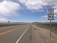
In the U.S. state of Nevada, U.S. Route 93 is a major United States Numbered Highway traversing the eastern edge of the state. The highway connects the Las Vegas area to the Great Basin National Park, and provides further connections to Ely and Wells. US 93 also provides the majority of the most direct connection from the major metropolitan areas of Las Vegas and Phoenix to the Boise, Idaho metropolitan area.

State Route 427 is a 4.7-mile-long (7.6 km) state highway in the U.S. state of Nevada. It connects the community of Wadsworth in eastern Washoe County to the city of Fernley in western Lyon County. SR 427 comprises the former routing of U.S. Route 40 through the towns it serves. SR 427 also provides an eastern link to Pyramid Lake via a junction with State Route 447 in Wadsworth.
Business routes of Interstate 80 (I-80) exist in four states: California, Nevada, Utah, and Wyoming.
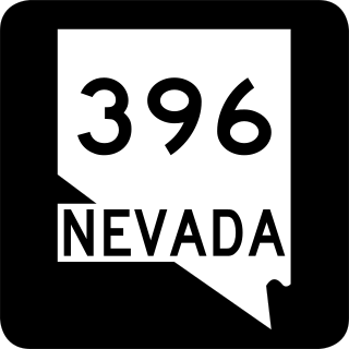
State Route 396 is a state highway in Pershing County, Nevada serving the city of Lovelock. The highway forms a portion of Interstate 80 Business within the city of Lovelock, and previously carried the alignment of former U.S. Route 40 and U.S. Route 95.
Interstate 80 Business (BL-80) is an interstate business route in Pershing County, Nevada. Serving the city of Lovelock along Cornell Avenue, BL-80 is also cosigned along portions of two other state highways through the city, State Route 396 (SR 396) from I-80 exit 105 to SR 856 at Airport Road and SR 856 from SR 396 at Upper Valley Road to I-80 exit 107.
U.S. Route 93 Business is a business route of U.S. Route 93 (US 93) in Clark County, Nevada. The route provides access to Lake Mead and downtown Boulder City from Interstate 11 (I-11). The route was originally part of mainline US 93 before it was realigned around Boulder City along I-11.
Several special routes of U.S. Route 50 exist. In order from west to east they are as follows.