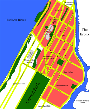
Washington Heights is a neighborhood in the northern part of the borough of Manhattan in New York City. It is named for Fort Washington, a fortification constructed at the highest natural point on Manhattan by Continental Army troops to defend the area from the British forces during the American Revolutionary War. Washington Heights is bordered by Inwood to the north along Dyckman Street, by Harlem to the south along 155th Street, by the Harlem River and Coogan's Bluff to the east, and by the Hudson River to the west.

Fort Tryon Park is a public park located in the Washington Heights and Inwood neighborhoods of the borough of Manhattan in New York City. The 67-acre (27 ha) park is situated on a ridge in Upper Manhattan, close to the Hudson River to the west. It extends mostly from 192nd Street in the south to Riverside Drive in the north, and from Broadway in the east to the Henry Hudson Parkway in the west. The main entrance to the park is at Margaret Corbin Circle, at the intersection of Fort Washington Avenue and Cabrini Boulevard.

The Queen Elizabeth II September 11th Garden is located in Hanover Square in the Financial District of Lower Manhattan, New York City. It commemorates the Commonwealth of Nations member states' victims of the September 11, 2001 attacks on the World Trade Center. It was officially opened by Queen Elizabeth II on July 6, 2010, in a ceremony alongside her husband Prince Philip, Duke of Edinburgh, then-Mayor of New York City Michael Bloomberg, then-Governor of New York David Paterson, and then-Governor of New Jersey Chris Christie.
Manhattantown, now known as Park West Village or West Park Apartments, was a massive urban renewal project in New York City's Manhattan Valley neighborhood. The project, which stretched between West 96th and West 100th streets, bordering Central Park West, was funded by Title I of the Housing Act of 1949, which financed slum clearance under urban redevelopment initiatives. Allegations of corruption were leveled soon after the project's inception in the spring of 1949, culminating in hearings in the Senate's Banking and Currency Committee in 1954.

Seward Park is a public park and playground in the Lower East Side neighborhood of Manhattan, New York City. Located north of East Broadway and east of Essex Street, it is 3.046 acres (12,330 m2) in size and is the first municipally built playground in the United States.

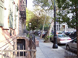
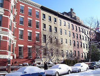
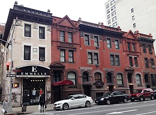
The Audubon Park Historic District is located on five blocks in the Washington Heights neighborhood of Manhattan in New York City. It is roughly bounded by West 155th Street to the south, West 158th Street to the north, Broadway and Edward M. Morgan Place to the east and Riverside Drive West to the west. It consists of 19 large apartment buildings and one duplex house, and abuts the Audubon Terrace Historic District on the southeast. It is named for naturalist John James Audubon, who purchased 20 acres of land there in 1841, at a time when the area was still mostly farms, woodland and the country estates of the rich. After his death, the estate was sold off in parcels for development by Audubon's widow, which is when it became known as "Audubon Park".

East Side of Manhattan refers to the side of Manhattan which abuts the East River and faces Brooklyn and Queens. Fifth Avenue, Central Park from 59th to 110th streets, and Broadway below 8th Street separate it from the West Side.
The West Side of Manhattan refers to the side of Manhattan Island that abuts the Hudson River and faces the U.S. state of New Jersey. The West Side is home to several famed New York City locations, including Fifth Avenue, Central Park, and lower Broadway. The major neighborhoods on the West Side are Inwood, Hudson Heights, Washington Heights, West Harlem, Morningside Heights, Manhattan Valley, the Upper West Side, Hell's Kitchen, Chelsea, the West Village, SoHo, and Tribeca. The 8th Avenue and West Side subway lines connect all parts of the West Side.
Sherman Square is a pocket park bounded by Broadway, Amsterdam Avenue, and West 70th Street on the Upper West Side of Manhattan, in New York City. It was named in 1891 for William Tecumseh Sherman who lived in the area and died that year.
Mulry Square is a triangular parking lot at the southwest corner of Greenwich Avenue and Seventh Avenue South in Greenwich Village, Manhattan, New York City. It was once thought to be the site of a wedge-shaped diner that was the inspiration for Edward Hopper's famous painting Nighthawks. The parking lot's fencing supports Tiles for America, a September 11 memorial consisting of some 6,000 tiles created across the country.
St. Mark's Historic District is a historic district located in the East Village neighborhood of Manhattan, New York City. The district was designated a city landmark by the New York City Landmarks Preservation Commission in 1969, and it was extended in 1984 to include two more buildings on East 10th Street. It was listed on the National Register of Historic Places in 1974 and was expanded in 1985. The boundaries of the NRHP district and its expansion are now coterminous with those of the LPC.
The Lamartine Place Historic District is a small historic district located between Eighth and Ninth Avenues in the Chelsea neighborhood of Manhattan, New York City. It was designated by the New York City Landmarks Preservation Commission on October 13, 2009, and includes twelve mid-19th century rowhouses on the north side of West 29th Street from number 333 on the east end to number 355 on the west end.

The East 17th Street/Irving Place Historic District is a small historic district located primarily on East 17th Street between Union Square East and Irving Place in the Union Square neighborhood of Manhattan, New York City. It was designated by the New York City Landmarks Preservation Commission on June 30, 1988, and encompasses nine mid-19th century rowhouses and apartment buildings on the south side of East 17th Street, from number 104 to number 122, plus one additional building at 47 Irving Place just south of 17th Street.

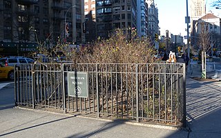
Gorman Park is a 1.89-acre (0.76 ha) park in Washington Heights, Manhattan, New York City. It is bounded by Broadway on the west and Wadsworth Terrace on the east, lying between 188th and 190th Streets.
The Minnesota Strip is an archaic name for an area in Manhattan comprising Eighth Avenue between 42nd Street and 57th Street. It is now part of Hell's Kitchen.

The East 10th Street Historic District is a small historic district located in the Alphabet City area of the East Village neighborhood of Manhattan, New York City. It includes all 26 buildings, numbered 293 to 345, on East 10th Street between Avenue A and Avenue B, across from Tompkins Square Park. The district was designated by the New York City Landmarks Preservation Commission on January 17, 2012.
The Hardenberg/Rhinelander Historic District is a small historic district in the Carnegie Hill neighborhood of the Upper East Side of Manhattan, New York City. It was created by the New York City Landmarks Preservation Commission on May 5, 1998, and consists of six brick, brownstone and terra cotta Northern Renaissance Revival rowhouses along Lexington Avenue between East 89th and 90th Streets, and one apartment building, referred to as "French Flats" at the time, on East 89th Street. All the buildings were constructed in 1888–1889.
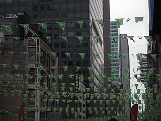
Little Brazil is a small neighborhood in Manhattan, New York City that is centered on the single block of West 46th Street between Fifth and Sixth Avenues. In the 1960s, the street was home to dozens of Brazilian commercial enterprises and Brazilian restaurants, although only a handful remain in the 2000s. It is demarcated by signs between Fifth Avenue and Seventh Avenue, along 46th Street, and several vendors display the green and yellow colors of the Brazilian flag.

Muscota Marsh is a one-acre public park in the Inwood section of the borough of Manhattan in New York City, on the shore of Spuyten Duyvil Creek, a section of the Harlem River. It is adjacent to the much larger Inwood Hill Park and Columbia University's Baker Athletics Complex. The park is notable for its views and for its ecological conservation features.
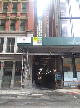
Theatre Alley is a block-long cobblestone alley in the Financial District of Manhattan, New York City, between Ann and Beekman Streets. It is one of Manhattan's few alleys that is not privately owned, and prior to the expansion of 5 Beekman Street adjacent to the alley c. 2010, it was "dank and claustrophobic".