Taliedo is a peripheral district ("quartiere") of the city Milan, Italy, part of the Zone 4 administrative division, located south-east of the city centre. The informal boundaries of the district are three main city streets, respectively Via Mecenate, Via Bonfadini and Via Salomone.

Nosedo is a district ("quartiere") of the city of Milan, Italy. It is part of the Zone 4 administrative division, located south of the city centre. Until 1870, it was an autonomous comune. The name comes from the Latin nocetum, meaning "walnut forest", as walnut trees used to be common in the area.
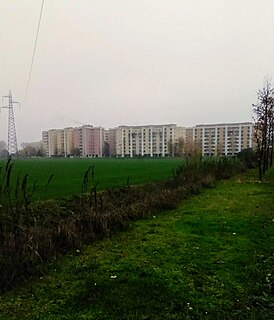
Vigentino is a district ("quartiere") of Milan, Italy, part of the Zone 5 administrative division, located south of the city centre. Before 1923, Vigentino was an autonomous, rural comune. By the mid 20th century, agricultural activities were dismissed, and the area was largely urbanized, with the construction of large apartment blocks.

Chiaravalle is a district (quartiere) of Milan, Italy, part of the Zone 5 administrative division of the city. It is located in the periphery south of the city centre, within the Parco Agricolo Sud Milano nature reserve.

Gratosoglio is a district (quartiere) of the city of Milan, Italy, part of the Zone 5 administrative division. It is located at southernmost end of the city, bordering on the comune of Rozzano, and it is traversed by the Lambro river.
Quintosole is a district ("quartiere") of Milan, Italy, part of the Zone 5 administrative division. It is a rural district, located within the Parco Agricolo Sud Milano nature reserve, south of Milan's urban area. Before 1869, it was an autonomous comune.

Barona is a border district ("quartiere") of the city of Milan, Italy. It is part of the Zone 6 administrative division, and it is located south of the city centre. Its population can be roughly estimated to 85,000. It borders on the comunes of Buccinasco, Assago, and Corsico and the districts of Lorenteggio and Torretta. Its boundaries are marked by the Parco Agricolo Sud Milano nature reserve to the south, by the Naviglio Grande and Naviglio Pavese canals to the east and to the west, and by the Circonvallazione ring road to the north.

Quarto Cagnino is a district (quartiere) of Milan, Italy, part of the Zone 7 administrative division of the city. It borders the districts of Trenno (north), San Siro (east), Baggio (south), and Quinto Romano (west). Before being annexed to Milan, in 1869, it was an autonomous comune and, briefly, a part of Trenno.

Quinto Romano is a district (quartiere) of Milan, Italy, part of the Zone 7 administrative division of the city. Before being annexed to Milan, it was an autonomous comune and a frazione of Trenno.
Figino is a district ("quartiere") of Milan, Italy, part of the Zone 7 administrative division. It is located north-west of the centre, within the Parco Agricolo Sud Milano nature reserve. Before being annexed to Milan, in 1869, it was an autonomous comune, named Figino di Milano.
Assiano is a rural district ("quartiere") of Milan, Italy, part of the Zone 7 administrative division. It is a border district, at the western end of the city area. Before being annexed to Milan, it was an autonomous comune, except for a brief period (1808-1816) when it was included in Cusago.
Muggiano is a district (quartiere) of Milan, Italy, part of the Zone 7 administrative division of the city. It is located in western periphery, bordering on the comunes of Cesano Boscone, Cusago, Settimo Milanese, and Trezzano sul Naviglio. Before being annexed to Baggio, which in turn was annexed to Milan, Muggiano used to an autonomous comune.

Villapizzone is a district ("quartiere") of Milan, Italy. It belongs to the Zone 8, located north of the city centre. It was an autonomous comune until 1869.

Garegnano is a district ("quartiere") of Milan, Italy, part of the Zone 8 administrative division of the city, north-west of the city centre. Before being annexed to Milan, it has been an autonomous comune, originally known as Garegnano Marcido.
Roserio is a district ("quartiere") of Milan, Italy, part of the Zone 8 administrative division of the city. It is the northernmost district, bordering on the comune of Baranzate. Before being annexed to Milan, it has been an autonomous comune, as well as part of Bollate and of Musocco.
Vialba is a district ("quartiere") of Milan, Italy, part of the Zone 8 administrative division of the city. It is located north of the city centre, adjacent to the municipality (comune) of Novate Milanese. Until 1841, Vialba itself was an autonomous comune.
Lampugnano is a district (quartiere) of Milan, Italy, part of the Zone 8 administrative division of the city. Until 1841, it was an autonomous comune. A prominent structure of Lampugnano is PalaSharp, which used to be one of Milan's major indoor arenas, housing sporting events, concerts, live shows and political meetings. The nearby Milan Metro subway is also adjacent to a bus terminal and a major parking, and is thus a reference place for many commuters who travel daily to the city from the western part of the Metropolitan City of Milan.

Affori is a ward of Milan, Italy, part of the Zone 9 administrative division of the city, located north of the city centre. It borders with the wards of Bruzzano, Comasina, Bovisasca, Dergano and Niguarda. Before being annexed to Milan in 1923, it was an autonomous comune.

The Zone 2 of Milan is one of the 9 administrative zones of Milan, Italy. In the "sunburst" geometry of the zones of Milan, Zone 2 is the slice that connects the centre to the periphery in the north-east direction.
Musocco is a district of Milan, located in the north-western outskirts of the city, belonging to Zone 8.