
There are many Roman sites in Great Britain that are open to the public. There are also many sites that do not require special access, including Roman roads, and sites that have not been uncovered.

Watling Street is a historic route in England that crosses the River Thames at London and which was used in Classical Antiquity, Late Antiquity, and throughout the Middle Ages. It was used by the ancient Britons and paved as one of the main Roman roads in Britannia. The route linked Dover and London in the southeast, and continued northwest via St Albans to Wroxeter. The line of the road was later the southwestern border of the Danelaw with Wessex and Mercia, and Watling Street was numbered as one of the major highways of medieval England.

The Fosse Way was a Roman road built in Britain during the first and second centuries AD that linked Isca Dumnoniorum (Exeter) in the southwest and Lindum Colonia (Lincoln) to the northeast, via Lindinis (Ilchester), Aquae Sulis (Bath), Corinium (Cirencester), and Ratae Corieltauvorum (Leicester).

Colchester is a city in Essex, in the East of England. It had a population of 122,000 in 2011. The demonym is Colcestrian.

Godmanchester is a town and civil parish in the Huntingdonshire district of Cambridgeshire, England. It is separated from Huntingdon, 1.2 miles (1.9 km) to the north, by the valley of the River Great Ouse. Being on the Roman road network, the town has a long history. It has a waterside location, surrounded by open countryside of high value for its biodiversity but it remains highly accessible, with a railway line to London, the A1 road and M11/A14 which run nearby.

Harborough is a local government district of Leicestershire, England, named after its main town, Market Harborough. Covering 230 square miles (600 km2), the district is by far the largest of the eight district authorities in Leicestershire and covers almost a quarter of the county. The district also covers the town of Lutterworth and villages of Broughton Astley and Ullesthorpe.

Roman roads in Britannia were initially designed for military use, created by the Roman Army during the nearly four centuries (AD 43–410) that Britannia was a province of the Roman Empire.
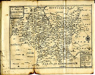
This article is intended to give an overview of the history of Leicestershire.

High Cross is the name given to the crossroads of the Roman roads of Watling Street and Fosse Way in Leicestershire, England. It is about a mile west of the village of Claybrooke Magna and was in the hundred of Guthlaxton. It was the site of a Romano-British settlement known as Venonae or Venonis, with a nearby fort.

The A1198 is a road in Cambridgeshire, England, which runs between the A505 at Royston, and the A1307 on the outskirts of Huntingdon.

Slawston is a village and civil parish in the Harborough district of Leicestershire, England, north-east of Market Harborough. According to the 2001 census the parish had a population of 143, including Welham and increasing to 191 at the 2011 census. The parish includes the deserted village of Othorpe at grid reference SP770956. Slawston is located roughly 1 km away from Medbourne.
Ashley is a village and civil parish in the North Northamptonshire, England, about 4 miles (6.4 km) northeast of Market Harborough, Leicestershire and 5 miles (8.0 km) west of Corby. The population of the civil parish at the 2011 census was 224. The village is near the River Welland, which forms the border with Leicestershire. The Roman road called Via Devana in the part from Ratae to Duroliponte ran just north of the village.

The A120 is an A-road in England, which runs between Puckeridge in Hertfordshire and Harwich in Essex.
The A607 is an A road in England that starts in Belgrave, Leicester and heads northeastwards through Leicestershire and the town of Grantham, Lincolnshire, terminating at Bracebridge Heath, a village on the outskirts of Lincoln. It is a primary route from Thurmaston to the A1 junction at Grantham.
National Cycle Route 51 is an English long distance cycle route running broadly east-west connecting Colchester and the port of Harwich to Oxford via Ipswich, Bury St Edmunds, Cambridge, Bedford, Milton Keynes, Bicester, and Kidlington.
The Great Northern and London and North Western Joint Railway was a British railway line, almost entirely within Leicestershire. Authorised by the same Act of Parliament, the Great Northern Railway Leicester Branch was built, branching from the Joint Line; on the same basis the Newark to Bottesford Line was built. The lines opened progressively between 1879 and 1883. The dominant traffic was iron ore, and the agricultural produce of the area served also generated considerable business. The passenger usage was never heavy, although some unusual through services were attempted at first.

Huntingdon Road is a major arterial road linking central Cambridge, England with Junction 14 of the M11 motorway and the A14 northwest from the city centre. The road is designated the A1307, follows the route of the Roman Via Devana, and is named after the town of Huntingdon, northwest of Cambridge.
The Domesday manor of Bromkinsthorpe was situated outside the West Gate of Leicester, on the alluvial west bank of the River Soar. Its location is now covered by the area around Braunstone Gate, Leicester, and for much of the medieval period was a liberty within the parish of St Mary de Castro, Leicester, and hence, part of the Borough of Leicester.

The Roman Road in Cambridgeshire, also known as Worsted Street Roman Road, is a 12.4-hectare (31-acre) linear biological Site of Special Scientific Interest stretching from south-east of Cambridge to north of Linton. It is also a Scheduled Monument, and is maintained by Cambridgeshire County Council.
Akeman Street is the name given to a Roman road in eastern England that runs from Cambridgeshire to the north coast of Norfolk. It is approximately 75 miles (120 km) long and runs roughly north-northeast.

