
U.S. Route 58 is an east–west U.S. Highway that runs for 508 miles (818 km) from U.S. Route 25E just northwest of Harrogate, Tennessee, to U.S. Route 60 in Virginia Beach, Virginia. Until 1996, when the Cumberland Gap Tunnel opened, US 58 ran only inside the commonwealth of Virginia. It was then extended southwest along a short piece of former US 25E, which no longer enters Virginia, to end at the new alignment in Tennessee. For most of its alignment, it closely parallels Virginia's southern border with North Carolina.

State Route 5 runs between the independent cities of Richmond and Williamsburg in the U.S. state of Virginia. Between Charles City County and James City County, it crosses the Chickahominy River via the Judith Stewart Dresser Bridge, a fixed-span bridge which replaced historic Barrett's Ferry and the former drawbridge.
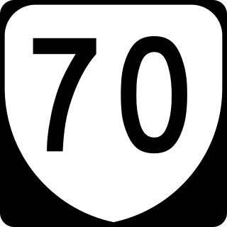
State Route 70 is a primary state highway in Lee County, Virginia, running from the Tennessee state line to U.S. Route 58 in Jonesville. Its continuation in Tennessee, also numbered State Route 70, continues south to the North Carolina state line at North Carolina Highway 208.

U.S. Route 421 (US 421) is a part of the U.S. Highway System that runs from Fort Fisher, North Carolina to Michigan City, Indiana. In Virginia, the U.S. Highway runs 69.23 miles (111.41 km) from the Tennessee state line between the twin cities of Bristol, Tennessee and Bristol, Virginia north and west to the Kentucky state line near St. Charles. Between its endpoints, US 421 has lengthy concurrencies with US 23 and US 58 during its course through Bristol, Weber City, Gate City, Duffield, and Pennington Gap in Southwest Virginia.
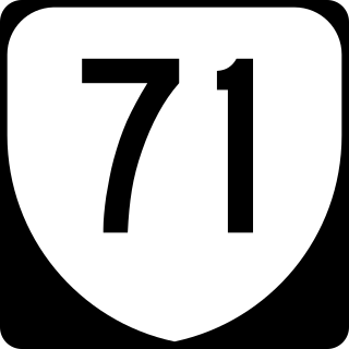
State Route 71 is a primary state highway in the southwest part of the U.S. state of Virginia. It runs from Gate City northeast to Lebanon, mostly through river valleys. Despite running more east–west than north–south, it is signed north–south; it parallels the similarly-oriented U.S. Route 11 and Interstate 81.

State Route 72 is a primary state highway in the southwest part of the U.S. state of Virginia. It runs from SR 71 in Gate City north to SR 65 at Fort Blackmore, northeast with SR 65 to Dungannon, and north via Coeburn to SR 83 near Clintwood.

State Route 67 is a primary state highway in the southwest part of the U.S. state of Virginia. It runs from SR 80 near Honaker east to U.S. Route 460 at Raven, east concurrently with US 460 and US 460 Business into downtown Richlands, and north to SR 616 at Jewell Ridge on the Tazewell–Buchanan county line.

State Route 16 is a primary state highway in the southwest part of the U.S. state of Virginia. It runs from the North Carolina border at North Carolina Highway 16 north to the West Virginia border at West Virginia Route 16, passing through the towns of Troutdale, Marion, and Tazewell. Highway 16 is part of a three-state route 16 that connects the Charlotte region with northwestern West Virginia.
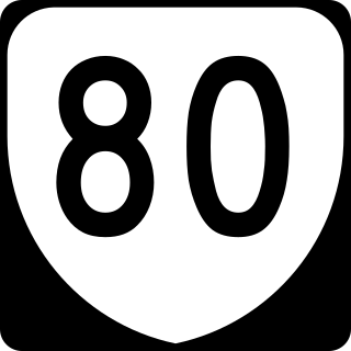
State Route 80 is a primary state highway in the southwest part of the U.S. state of Virginia. It runs from the Kentucky state line at Breaks Interstate Park east to U.S. Route 11 near Meadowview. Kentucky Route 80 and Missouri's Route 80 continue the number west to Matthews, Missouri. The entire length of SR 80 is part of U.S. Bicycle Route 76.

In the U.S. state of Virginia, U.S. Route 220 (US 220) is a major north-south state highway that extends from the North Carolina state line through Roanoke to the West Virginia state line. South of Roanoke, US 220 is a four-lane highway within the proposed Interstate 73 (I-73) corridor. US 220 narrows to two lanes north of Roanoke, connecting to I-64 near Clifton Forge and then paralleling the Appalachian Mountains north-northeasterly in the direction of Cumberland, Maryland.

U.S. Route 19 is a part of the U.S. Highway System that runs from Memphis, Florida to Erie, Pennsylvania. In Virginia, the highway runs 88.89 miles (143.05 km) between two pairs of twin cities: Bristol, Tennessee and Bristol, Virginia, at the Virginia–Tennessee state line, and Bluefield, Virginia and Bluefield, West Virginia, at the Virginia–West Virginia state line. Between its endpoints, US 19 has lengthy concurrencies with US 11, US 58 Alternate, and US 460 during its course connecting Abingdon, Lebanon, and Tazewell within Washington, Russell, and Tazewell counties in Southwest Virginia.
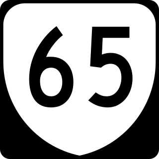
State Route 65, formerly State Route 66, is a primary state highway in the U.S. state of Virginia. The state highway runs 34.06 miles (54.81 km) from U.S. Route 23, US 58, and US 421 in Clinchport north to US 58 Alternate in Castlewood.

State Route 69 is a primary state highway in the U.S. state of Virginia. Known as Lead Mine Road, the state highway runs 3.59 miles (5.78 km) from SR 636 in Austinville east to U.S. Route 52 in Poplar Camp. SR 69 is the last remnant of a much longer route. At its peak from 1940 to 1945, this route ran from State Route 91 at Lodi east via St. Clair Bottom, Sugar Grove, Cedar Springs, Speedwell, Porters Crossroads, and Austinville to today's SR 69. However, it was never fully continuous; portions from Sugar Grove to Cedar Springs and west of Porters Crossroads to east of Austinville were secondary routes. The full length of this route as it existed and was planned is now part of SR 762, part of SR 660, all of SR 650, part of SR 16, all of SR 614, part of SR 749, part of US 21, part of SR 690, a small piece of SR 642, part of SR 619, part of SR 636, and SR 69.
State Route 96 is a primary state highway in the U.S. state of Virginia. Known for most of its length as Virgilina Road, the state highway runs 7.83 miles (12.60 km) from U.S. Route 501 near Cluster Springs east to the North Carolina state line in Virgilina. In Virgilina, SR 96 runs concurrently with SR 49 south to the border, where the highways continue as North Carolina Highway 96 and NC 49, respectively.
State Route 13 is a primary state highway in the U.S. state of Virginia. Known as Old Buckingham Road, the state highway runs 24.08 miles (38.75 km) from U.S. Route 60 and SR 45 in Cumberland east to US 60 in Plain View. SR 13 parallels US 60 to the south through eastern Cumberland County and western Powhatan County and passes through the latter county's seat of Powhatan. The state highway is the only state-numbered highway in Virginia that shares a number with a U.S. Highway but does not form a state-numbered extension of that U.S. Highway. SR 13's number comes from being a segment of the original cross-state SR 13 in 1918; that highway included portions of modern US 60. In 1933, US 60 was shifted to its present corridor between Buena Vista and Richmond, replacing SR 13. Two years later, SR 13 was assigned to Old Buckingham Road when US 60 was moved to its present alignment from Cumberland to east of Powhatan.
State Route 8 is a primary state highway in the U.S. state of Virginia. The state highway runs 55.88 miles (89.93 km) from the North Carolina state line near Palmetto, where the highway continues south as North Carolina Highway 8, north to U.S. Route 11 in Christiansburg. SR 8 is part of a 151-mile (243 km) two-state highway 8 system and is the main north–south highway of Patrick County, Floyd County, and southern Montgomery County, connecting their respective county seats of Stuart, Floyd, and Christiansburg with each other and with the Blue Ridge Parkway. The state highway also links the New River Valley region of Virginia with Southside Virginia via US 58 and the Piedmont Triad of North Carolina via NC 8.

State Route 271 is a primary state highway in the U.S. state of Virginia. Known as Pouncey Tract Road, the state highway runs 7.34 miles (11.81 km) from U.S. Route 250 in Short Pump north to SR 620 and SR 622 in Rockville. A small section of it was first added to the state highway system during 1930, and it gained its current routing and designation by 1940.


