Wallace, South Dakota

Last updated

Wallace, South Dakota
Codington County South Dakota Incorporated and Unincorporated areas Wallace Highlighted.svg
Location in Codington County and the state of South Dakota
Coordinates: 45°05′04″N97°28′41″W / 45.08444°N 97.47806°W / 45.08444; -97.47806
CountryUnited States
State South Dakota
County Codington
Incorporated1908 [1]
Area
[2]
  Total0.13 sq mi (0.34 km2)
  Land0.13 sq mi (0.34 km2)
  Water0.00 sq mi (0.00 km2)
Elevation
[3]
1,782 ft (543 m)
Population
 (2020) [4]
  Total91
  Density684.21/sq mi (264.13/km2)
Time zone UTC-6 (CST)
  Summer (DST) UTC-5 (CDT)
ZIP code
57272
Area code 605
FIPS code 46-68420 [5]
GNIS feature ID1267623 [3]

Wallace is a town in Codington County, South Dakota, United States. The population was 91 at the 2020 census. [6] It is part of the Watertown, South Dakota Micropolitan Statistical Area.

Contents

History

The town was named for the original owner of the town site. [7] Wallace is the birthplace of Hubert Humphrey, the Vice President of the United States from 1965 to 1969.

Hubert Humphrey was born in a room over his father's drugstore in Wallace. He was the son of Ragnild Kristine Sannes (1883–1973), a Norwegian immigrant, and Hubert Horatio Humphrey Sr. (1882–1949). Humphrey spent most of his youth in nearby Doland, a town with a population of approximately 600. His father was a licensed pharmacist and merchant who served as mayor and a town council member; he also served briefly in the South Dakota state legislature and was a South Dakota delegate to the 1944 and 1948 Democratic National Conventions. In the late 1920s, a severe economic downturn hit Doland; both of the town's banks closed and Humphrey's father struggled to keep his store open.

After his son graduated from Doland High School, Hubert Sr. left the area and opened a new drugstore in the larger town of Huron (population 11,000), where he hoped to improve his fortunes.

Geography

According to the United States Census Bureau, the town has a total area of 0.13 square miles (0.34 km2), all land. [8]

Demographics

Historical population
CensusPop.Note
1910 207
1920 23513.5%
1930 189−19.6%
1940 1932.1%
1950 188−2.6%
1960 132−29.8%
1970 95−28.0%
1980 90−5.3%
1990 83−7.8%
2000 863.6%
2010 85−1.2%
2020 917.1%
2021 (est.)94 [9] 3.3%
U.S. Decennial Census [10]
2020 Census [6] [4]

2010 census

As of the census of 2010, there were 85 people, 34 households, and 24 families residing in the town. The population density was 653.8 inhabitants per square mile (252.4/km2). There were 42 housing units at an average density of 323.1 per square mile (124.7/km2). The racial makeup of the town was 96.5% White, 2.4% African American, and 1.2% from two or more races.

There were 34 households, of which 38.2% had children under the age of 18 living with them, 47.1% were married couples living together, 17.6% had a female householder with no husband present, 5.9% had a male householder with no wife present, and 29.4% were non-families. 29.4% of all households were made up of individuals, and 8.8% had someone living alone who was 65 years of age or older. The average household size was 2.50 and the average family size was 3.13.

The median age in the town was 34.8 years. 35.3% of residents were under the age of 18; 5.8% were between the ages of 18 and 24; 18.9% were from 25 to 44; 29.5% were from 45 to 64; and 10.6% were 65 years of age or older. The gender makeup of the town was 50.6% male and 49.4% female.

2000 census

As of the census of 2000, there were 86 people, 37 households, and 23 families residing in the town. The population density was 637.8 inhabitants per square mile (246.3/km2). There were 45 housing units at an average density of 333.7 per square mile (128.8/km2). The racial makeup of the town was 100.00% White.

There were 37 households, out of which 35.1% had children under the age of 18 living with them, 54.1% were married couples living together, 5.4% had a female householder with no husband present, and 37.8% were non-families. 37.8% of all households were made up of individuals, and 27.0% had someone living alone who was 65 years of age or older. The average household size was 2.32 and the average family size was 3.13.

In the town, the population was spread out, with 33.7% under the age of 18, 3.5% from 18 to 24, 27.9% from 25 to 44, 9.3% from 45 to 64, and 25.6% who were 65 years of age or older. The median age was 34 years. For every 100 females, there were 72.0 males. For every 100 females age 18 and over, there were 83.9 males.

The median income for a household in the town was $27,708, and the median income for a family was $33,438. Males had a median income of $33,750 versus $24,063 for females. The per capita income for the town was $14,677. There were no families and 9.1% of the population living below the poverty line, including no under eighteens and 18.2% of those over 64.

Related Research Articles

<span class="mw-page-title-main">Bucyrus, North Dakota</span> City in North Dakota, United States

Bucyrus is a city in Adams County, North Dakota, United States. The population was 18 at the 2020 census.

<span class="mw-page-title-main">Wolsey, South Dakota</span> Town in South Dakota, United States

Wolsey is a town in Beadle County, South Dakota, United States. The population was 459 at the 2020 census.

<span class="mw-page-title-main">Tabor, South Dakota</span> Town in South Dakota, United States

Tabor is a town in Bon Homme County, South Dakota, United States. The population was 407 at the 2020 census.

<span class="mw-page-title-main">Stratford, South Dakota</span> Town in South Dakota, United States

Stratford is a town in southern Brown County, South Dakota, United States. The population was 57 at the 2020 census.

<span class="mw-page-title-main">Verdon, South Dakota</span> Town in South Dakota, United States

Verdon is a town in southeastern Brown County, South Dakota, United States. The population was 3 at the 2020 census.

<span class="mw-page-title-main">Westport, South Dakota</span> Town in South Dakota, United States

Westport is a town in western Brown County, South Dakota, United States. The population was 88 at the 2020 census.

<span class="mw-page-title-main">Florence, South Dakota</span> Town in South Dakota, United States

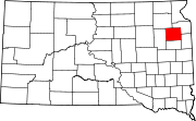
Florence is a town in northwestern Codington County, South Dakota, United States. It is part of the Watertown, South Dakota Micropolitan Statistical Area. The population was 337 at the 2020 census.

<span class="mw-page-title-main">Ethan, South Dakota</span> Town in South Dakota, United States

Ethan is a town in Davison County, South Dakota, United States. It is part of the Mitchell, South Dakota Micropolitan Statistical Area. The population was 365 at the 2020 census. Ethan is located 10 miles south of Mitchell.

<span class="mw-page-title-main">Lily, South Dakota</span> Town in South Dakota, United States

Lily is a former town in Day County, South Dakota, United States. The population was 4 at the 2010 census. The town was dissolved in March 2017 by the Day County court due to the population reaching zero.

<span class="mw-page-title-main">Onaka, South Dakota</span> Town in South Dakota, United States

Onaka is a town in Faulk County, South Dakota, United States. The population was 13 at the 2020 census.

<span class="mw-page-title-main">Revillo, South Dakota</span> Town in South Dakota, United States

Revillo is a town in southeastern Grant County, South Dakota, United States. The population was 99 at the 2020 census.

<span class="mw-page-title-main">Stockholm, South Dakota</span> Town in South Dakota, United States

Stockholm is a town in Grant County, South Dakota, United States. The population was 102 at the 2020 census.

<span class="mw-page-title-main">Kadoka, South Dakota</span> City in South Dakota, United States

Kadoka is a city in, and the county seat of, Jackson County, South Dakota, United States. The population was 543 at the 2020 census. The town occupies about 2.3 square miles.

<span class="mw-page-title-main">Lake City, South Dakota</span> Town in South Dakota, United States

Lake City is a town in Marshall County, South Dakota, United States. The population was 45 at the 2020 census. Fort Sisseton Historic State Park, whose fort is listed on the National Register of Historic Places, is located nearby.

<span class="mw-page-title-main">Crooks, South Dakota</span> City in South Dakota, United States

Crooks is a city in Minnehaha County, South Dakota, United States and is a suburb of Sioux Falls. The population was 1,362 at the 2020 census. Crooks was named New Hope until 1904. The town's present name honors W. A. Crooks, a local politician.

<span class="mw-page-title-main">Sherman, South Dakota</span> Town in South Dakota, United States

Sherman is a town in Minnehaha County, South Dakota, United States. The population was 81 at the 2020 census.

<span class="mw-page-title-main">Quinn, South Dakota</span> Town in South Dakota, United States

Quinn is a town in Pennington County, South Dakota, United States. The population was 63 at the 2020 census. The town is the home of the Badlands Observatory, located in the former community hospital, built in 1950.

<span class="mw-page-title-main">Doland, South Dakota</span> City in South Dakota, United States

Doland is a city in eastern Spink County, South Dakota, United States. The population was 199 at the 2020 census.

<span class="mw-page-title-main">Tulare, South Dakota</span> Town in South Dakota, United States

Tulare is a town in Spink County, South Dakota, United States. The population was 211 at the 2020 census.

<span class="mw-page-title-main">Turton, South Dakota</span> Town in South Dakota, United States

Turton is a town in Spink County, South Dakota, United States. The population was 55 at the 2020 census. The town was served by Turton High School from 1915 to 1956; students attended Doland High School thereafter.

References

  1. "SD Towns" (PDF). South Dakota State Historical Society . Retrieved February 17, 2010.
  2. "ArcGIS REST Services Directory". United States Census Bureau. Retrieved October 15, 2022.
  3. 1 2 U.S. Geological Survey Geographic Names Information System: Wallace, South Dakota
  4. 1 2 "Census Population API". United States Census Bureau. Retrieved October 15, 2022.
  5. "U.S. Census website". United States Census Bureau . Retrieved January 31, 2008.
  6. 1 2 "Explore Census Data". United States Census Bureau . Retrieved August 16, 2022.
  7. Federal Writers' Project (1940). South Dakota place-names, v.1-3. University of South Dakota. p. 66.
  8. "US Gazetteer files 2010". United States Census Bureau . Retrieved June 21, 2012.
  9. "City and Town Population Totals: 2020-2021". United States Census Bureau. June 24, 2022. Retrieved August 16, 2022.
  10. "Census of Population and Housing". Census.gov. Retrieved June 4, 2015.