Minerva is a town in Essex County, New York, United States. The population was 773 at the 2020 census. The town is named after Minerva, the Roman goddess of wisdom. The town has a highly irregular polygonal shape. It is located in the southwestern corner of the county. By road, it is 40 miles (64 km) north-northwest of Queensbury, 85 miles (137 km) southwest of Burlington, Vermont, 88 miles (142 km) south of Plattsburgh, 93 miles (150 km) north of Albany, and 147 miles (237 km) south of Montreal, Quebec.

Arietta is a town in Hamilton County, New York, United States. The population was 304 at the 2010 census. The town was named after the mother of one of the first settlers, Rensselaer Van Rennslaer.

Indian Lake is a town in Hamilton County, New York, United States. The population was 1,352 at the 2010 census. The name is from a lake of the same name that is largely inside the town. There are no permanent stop lights in the town. Law enforcement is provided by New York State Troopers and Hamilton County Sheriff's Office.
Long Lake is a town in Hamilton County, New York, United States. The population was 791 at the 2020 census.

Morehouse is a town in Hamilton County, New York, United States. The population was 92 at the 2020 census. The name is that of an early developer, Andrew K. Morehouse.

Wells is a town in Hamilton County, New York, United States. The population was 674 at the 2010 census. The town is named after Joshua Wells, a land agent, who built the first mills in the area. It is in the Adirondack Park and on the eastern border of the county. It is northwest of Schenectady.

Ohio is a town in Herkimer County, New York, United States. The population was 1,002 at the 2010 census. The town is named after the state of Ohio. The town is in the northern part of the county and northeast of Utica. Part of Ohio is within the Adirondack Park.

Russia is a town in Herkimer County, New York, United States. The population was 2,269 at the 2020 census, down from 2,587 in 2010. The town is located in the northwestern part of the county and is northeast of Utica.

Salisbury is a town in Herkimer County, New York, United States. The population was 1,958 at the 2010 census. The town is on the eastern edge of the county, north of the city of Little Falls. The northern part of the town is in the Adirondack Park.

Clifton is a town in St. Lawrence County, New York, United States. The population was 675 at the 2020 census. The town takes its name from a mining company.

Piercefield is a town in St. Lawrence County, New York, United States. The population was 310 at the 2010 census.

Big Moose Lake, at the head of the Moose River, is a large lake about five miles (8 km) north of Fourth Lake in the Adirondacks in upstate New York. The lake is within both Herkimer and Hamilton counties, and covers portions of the towns of Webb and Long Lake. Located southwest of the lake is the hamlet of Big Moose.
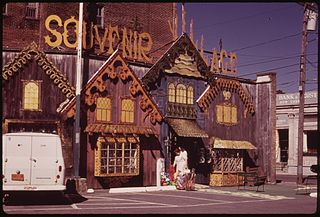
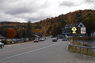
Old Forge is a hamlet on New York State Route 28 in the town of Webb in Herkimer County, New York, United States. The population was 756 at the 2010 census. Old Forge was formerly a village but dissolved its incorporation in 1936, but it remains the principal community in the region. As one of the western gateway communities of the Adirondack Park, Old Forge forms an extensive business district, primarily directed at tourism especially during the summer months. The local school is the Town of Webb UFSD, a K–12 institution with the Timberwolves as its mascot. Old Forge often records the lowest winter temperatures in New York. On February 17, 1979, the record low temperature for New York was set in Old Forge at −52 °F (−47 °C).

Thendara is a hamlet and census-designated place (CDP) in Herkimer County, New York, United States. Thendara is located in the Adirondack Park, in the southern part of the town of Webb, west of Old Forge on Route 28.

Eagle Bay is a hamlet on Route 28 in the town of Webb in Herkimer County, New York, United States. Eagle Bay is on the border of Herkimer and Hamilton counties, and borders Fourth Lake.

The Ha-De-Ron-Dah Wilderness Area, an Adirondack Park unit of New York's Forest Preserve, is located in the town of Webb, Herkimer County, and the Town of Greig, Lewis County. It is bounded on the north by private lands in the vicinity of North Pond, Hitchcock Pond, Moose Pond and the headwaters of the Independence River; on the east by private lands along the Remsen to Lake Placid railroad right-of-way; on the south by private lands along New York State Route 28 and by the wood road leading to the Copper Lake property; and on the west by Pine Creek and a DEC maintained foot trail from Pine Creek to Pine Lake, East Pine Pond, and Big Otter Lake.
The Pigeon Lake Wilderness Area, an Adirondack Park unit of the forest preserve, lies in the town of Webb, Herkimer County, and the towns of Long Lake and Inlet in Hamilton County. It is bounded on the north by Stillwater Reservoir and large blocks of private land in the vicinity of Rose Pond, Shingle Shanty Pond and Upper Sister Lake; on the east by a private road from Brandreth Lake to North Point and by Raquette Lake; on the south by private lands along the Uncas Road; and on the west by the Big Moose Road, private lands near Big Moose Lake, Thirsty Pond, Twitchell Lake, Razorback Pond, and the Remsen to Lake Placid railroad tracks.
Beaver River is a hamlet that is six-tenths of a mile square, at the east end of Stillwater Reservoir, in the town of Webb in Herkimer County, New York, United States. The hamlet is surrounded by the Adirondack Park. The hamlet has a year-round population of eight that increases during the summer, as many people have camps in this wilderness area. There are 125 private properties and three commercial businesses. No roads lead to the hamlet; it is accessible only by hiking, small self-propelled private track speeder or boat in the summer and by snowmobile, snowshoes or cross country skis in the winter. There is no electrical service. The town is named for the Beaver River, which was impounded to form the Stillwater Reservoir. The Beaver River is a west-flowing tributary of the Black River and part of the Lake Ontario watershed. The former New York Central Railroad right of way, on the National Register of Historic Places, passes through the hamlet; an existing bunkhouse is a part of the historic property. The Adirondack Railroad will resume tourist passenger service from Utica to Tupper Lake, via Beaver River, in 2023: 42 years since the last passenger train ran on its trackage. The last New York Central Railroad passenger train left Beaver River on April 24, 1965.
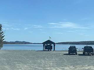
Stillwater Reservoir is a man-made lake located by Beaver River, New York within the Western Adirondacks. The lake has a large amount of recreational uses including camping, canoeing, boating, fishing, hunting, snowmobiling, and cross-country skiing. The lake has undeveloped edges with remote camping on both the islands and the shoreline. Camping permits and lake information may be obtained from the hamlet of Stillwater at the Forest Ranger Headquarters. Fish species present in the reservoir are smallmouth bass, splake, rock bass, yellow perch, sunfish and brown trout. There is a state owned hard surface ramp on Stillwater Road, 28 miles east of Lowville, New York. the record low temperature for the state of New York of −52 °F (−47 °C) took place at Stillwater Reservoir, and was later tied by Old Forge on February 17, 1979.
Clear Lake is located northeast of Stillwater, New York. The outflow creek flows into Witchhopple Lake. Fish species present in the lake are brown bullhead, and brook trout. Access via trail off Red Horse Trail and Salmon Lake Trail on the south shore. No motors are allowed on Clear Lake.