Wimbledon is a city in Pierce Township, Barnes County, North Dakota, United States. The population was 216 at the 2010 census.

Brookings is a city in Brookings County, South Dakota, United States. Brookings is the fourth largest city in South Dakota, with a population of 22,056 at the 2010 census. It is the county seat of Brookings County, and home to South Dakota State University, the largest institution of higher education in the state. Also found in Brookings are the South Dakota Art Museum, the Children's Museum of South Dakota, the annual Brookings Summer Arts Festival, and the headquarters of a number of manufacturing companies and agricultural operations.

Hecla is a city in Brown County, South Dakota, United States, located only a few miles south of the North Dakota border. The population was 227 at the 2010 census. State Highway 37 runs along the east side of town.

Clark is a city in and county seat of Clark County, South Dakota, United States. The population was 1,139 at the 2010 census.

Onaka is a town in Faulk County, South Dakota, United States. The population was 15 at the 2010 census.

Midland is a rural small town in the southeastern corner of Haakon County, South Dakota, United States. The population was 129 at the 2010 census.

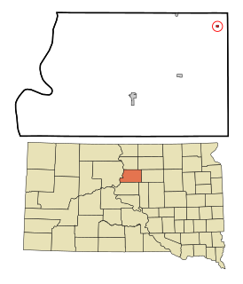
Ree Heights is a town in western Hand County, South Dakota, United States. The population was 62 at the 2010 census.

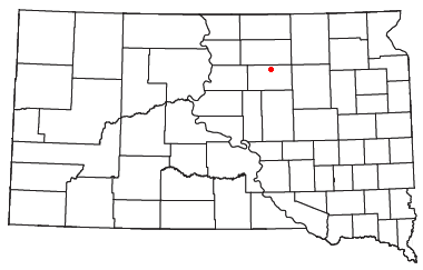
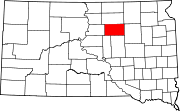
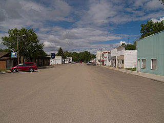
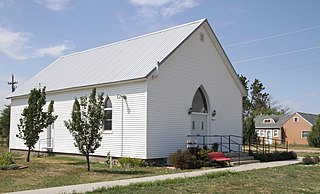
Harrold is a town in Hughes County, South Dakota, United States. It is part of the Pierre, South Dakota Micropolitan Statistical Area. The population was 124 at the 2010 census.

De Smet is a city in and the county seat of Kingsbury County, South Dakota, United States. The population was 1,089 at the 2010 census. The updated population is 998 of 2020 Recount. The median age of De Smet was 45.6. That was last updated as of 2018 in May.

Kennebec is a town in and county seat of Lyman County, South Dakota, United States. The population was 240 at the 2010 census

Eureka is a city in western McPherson County, South Dakota, United States, that is near the North Dakota state line. The population was 868 at the 2010 census.

Humboldt is a town in Minnehaha County, South Dakota, United States. The population was 589 at the 2010 census.
Quinn is a town in Pennington County, South Dakota, United States. The population was 54 at the 2010 census. The town is the home of the Badlands Observatory, located in the former community hospital, built in 1950.

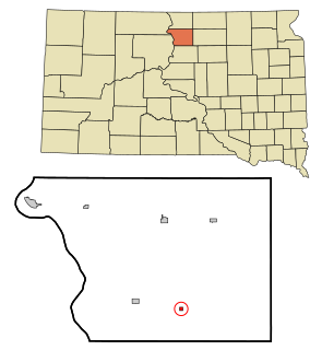
Wasta(Lakota: wašté) is a town in Pennington County, South Dakota, United States, situated along the Cheyenne River. It had a population of 80 at the 2010 census.

Gettysburg is a city and county seat of Potter County, South Dakota, United States, along the 45th parallel. The population was 1,162 at the 2010 census.
Tolstoy is a town in Potter County, South Dakota, United States. The population was 36 at the 2010 census.

Centerville is a city in Turner County, South Dakota, United States. The population was 882 at the 2010 census. Centerville is part of the Sioux Falls, South Dakota metropolitan area.

Java is a town in Walworth County, South Dakota, United States. The population was 129 at the 2010 census.
Lowry is a town in Walworth County, South Dakota, United States. The population was 6 at the 2010 census. The town is home to Lowry Pilgrim Community Church, Swan Creek Harness Shop, J & C Repair, Karst Service and a fire station. Lowry also has an abandoned school, and a post office, which closed to service in the early 1970s.

Meadow is an unincorporated community in Perkins County, South Dakota, United States. Meadow is twelve miles east of Bison and two miles from the junction of South Dakota Highways 20 and 73. Although not tracked by the Census Bureau, Meadow has been assigned the ZIP code of 57644. There is a post office located within the town of Meadow. The surrounding area is farming and ranching land.