West College Corner, Indiana | |
---|---|
Coordinates: 39°34′10″N84°49′08″W / 39.56944°N 84.81889°W | |
Country | United States |
State | Indiana |
County | Union |
Township | Union |
Area | |
• Total | 0.27 sq mi (0.69 km2) |
• Land | 0.27 sq mi (0.69 km2) |
• Water | 0.00 sq mi (0.00 km2) |
Elevation | 994 ft (303 m) |
Population (2020) | |
• Total | 545 |
• Density | 2,041.20/sq mi (788.37/km2) |
Time zone | UTC-5 (Eastern (EST)) |
• Summer (DST) | UTC-4 (EDT) |
ZIP code | 47003 |
Area code | 765 |
FIPS code | 18-82556 [3] |
GNIS feature ID | 2397731 [2] |
West College Corner (also known as just College Corner) is a town in Union Township, Union County, Indiana, United States. [2] The population was 545 at the 2020 census. The town is bordered on the east by the state line with Ohio, directly bordering the village of College Corner, Ohio. The town's public school, part of the Union County–College Corner Joint School District, is bisected by the state line and is operated jointly with Ohio authorities.
West College Corner takes its name from its Ohio counterpart, which was in the northwestern corner of the "College Township", the survey township designated by the Ohio General Assembly as the site of the state college that became Miami University. This survey township was later organized as a civil township, Oxford Township.
West College Corner is located on the border of Indiana and Ohio.
According to the 2010 census, West College Corner has a total area of 0.27 square miles (0.70 km2), all land. [4]
Census | Pop. | Note | %± |
---|---|---|---|
1890 | 290 | — | |
1900 | 392 | 35.2% | |
1910 | 432 | 10.2% | |
1920 | 439 | 1.6% | |
1930 | 437 | −0.5% | |
1940 | 454 | 3.9% | |
1950 | 513 | 13.0% | |
1960 | 613 | 19.5% | |
1970 | 709 | 15.7% | |
1980 | 614 | −13.4% | |
1990 | 686 | 11.7% | |
2000 | 634 | −7.6% | |
2010 | 676 | 6.6% | |
2020 | 545 | −19.4% | |
U.S. Decennial Census [5] |
As of the census [6] of 2010, there were 676 people, 274 households, and 174 families residing in the town. The population density was 2,503.7 inhabitants per square mile (966.7/km2). There were 310 housing units at an average density of 1,148.1 per square mile (443.3/km2). The racial makeup of the town was 97.5% White, 0.3% African American, 0.3% Native American, 0.1% Pacific Islander, 0.6% from other races, and 1.2% from two or more races. Hispanic or Latino of any race were 0.6% of the population.
There were 274 households, of which 37.2% had children under the age of 18 living with them, 41.2% were married couples living together, 15.7% had a female householder with no husband present, 6.6% had a male householder with no wife present, and 36.5% were non-families. 28.8% of all households were made up of individuals, and 8.7% had someone living alone who was 65 years of age or older. The average household size was 2.47 and the average family size was 3.07.
The median age in the town was 36 years. 29.1% of residents were under the age of 18; 8.7% were between the ages of 18 and 24; 23.8% were from 25 to 44; 27.7% were from 45 to 64; and 10.7% were 65 years of age or older. The gender makeup of the town was 47.6% male and 52.4% female.
As of the census [3] of 2000, there were 634 people, 242 households, and 164 families residing in the town. The population density was 2,410.4 inhabitants per square mile (930.7/km2). There were 272 housing units at an average density of 1,034.1 per square mile (399.3/km2). The racial makeup of the town was 98.26% White, 0.63% Native American, 0.16% from other races, and 0.95% from two or more races. Hispanic or Latino of any race were 0.16% of the population.
There were 242 households, out of which 37.2% had children under the age of 18 living with them, 52.1% were married couples living together, 10.7% had a female householder with no husband present, and 32.2% were non-families. 28.1% of all households were made up of individuals, and 11.6% had someone living alone who was 65 years of age or older. The average household size was 2.62 and the average family size was 3.25.
In the town, the population was spread out, with 31.7% under the age of 18, 7.1% from 18 to 24, 32.3% from 25 to 44, 19.6% from 45 to 64, and 9.3% who were 65 years of age or older. The median age was 32 years. For every 100 females there were 98.7 males. For every 100 females age 18 and over, there were 94.2 males.
The median income for a household in the town was $34,625, and the median income for a family was $37,083. Males had a median income of $28,472 versus $21,250 for females. The per capita income for the town was $13,528. About 14.0% of families and 16.1% of the population were below the poverty line, including 22.5% of those under age 18 and 14.6% of those age 65 or over.
The Union County–College Corner Joint School District includes all of Union County. [7]
Park Layne is a census-designated place (CDP) in Bethel Township, Clark County, Ohio, United States. The population of the CDP was 4,248 at the 2020 census. It is part of the Springfield, Ohio Metropolitan Statistical Area. Park Layne became a CDP in the 1980 United States Census.
Lyons is a village in Fulton County, Ohio, United States. The population was 602 at the 2020 census.
Cleves is a village in Miami Township, Hamilton County, Ohio, United States. Located along the Ohio River, it is a western suburb of Cincinnati. The population was 3,414 at the 2020 census.
Valley Hi is a village in Logan County, Ohio, United States. The population was 228 at the 2020 census. The village is located nearby U.S. Route 33 and is about an hour northwest of Columbus. The village lies mostly in Jefferson Township, but its southernmost portion extends into Monroe Township.
LaGrange is a village in Lorain County, Ohio, United States. The population was 2,595 at the 2020 census.
Spencer is a village in Spencer Township located in Medina County, Ohio, United States. The population was 684 at the 2020 census.
Riverside is a city in Montgomery County, Ohio, United States. The population was 24,474 at the 2020 census. A suburb of Dayton, it is part of the Dayton metropolitan area.
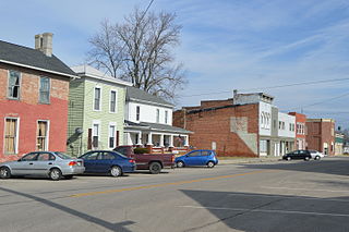
Cloverdale is a village in Perry Township, Putnam County, Ohio, United States. The population was 170 at the 2020 census.
Milford Center is a village in Union County, Ohio, United States. The population was 807 at the 2020 census.
Apple Creek is a village in East Union Township, Wayne County, Ohio, United States. The population was 1,188 at the 2020 census.
Hoytville is a village in Wood County, Ohio, United States. The population was 220 at the 2020 census.
Risingsun is a village in Wood County, Ohio, United States. The population was 541 at the 2020 census.
Glasgow is a borough in Beaver County, Pennsylvania, United States, along the Ohio River. The population was 71 at the 2020 census.
Forward Township is a township in Butler County, Pennsylvania, United States. The population was 3,164 at the 2020 census.
Union Township is a township that is located in Centre County, Pennsylvania, United States. It is part of the State College, Pennsylvania Metropolitan Statistical Area.
Chapman Township is a township in Snyder County, Pennsylvania, United States. The population was 1,565 at the 2020 census.
Charleston Township is a township in Tioga County, Pennsylvania, United States. The population was 3,562 at the 2020 census. Hills Creek State Park, one of 120 Pennsylvania state parks, is in Charleston Township.
Spring Creek Township is a township in Warren County, Pennsylvania, United States. The population was 776 at the 2020 census, down from 852 at the 2010 census.
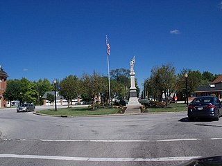
College Corner is a village in Butler and Preble counties in the southwestern part of the U.S. state of Ohio, 5 miles (8 km) northwest of Oxford. The population was 387 at the 2020 census. The village lies on the state line with Indiana, where it borders the town of West College Corner. The public school, part of the Union County–College Corner Joint School District, is bisected by the state line and is operated jointly with Indiana authorities.
Ohio Township is one of twenty-five townships in Bureau County, Illinois, USA. As of the 2020 census, its population was 814 and it contained 396 housing units. Ohio Township changed its name from Richland Township in June 1850.