Westport, Indiana

Last updated

Westport, Indiana
Main Street in Westport, Indiana.jpg
Main Street
Decatur County Indiana Incorporated and Unincorporated areas Westport Highlighted 1883276.svg
Location of Westport in Decatur County, Indiana.
Coordinates: 39°10′36″N85°34′29″W / 39.17667°N 85.57472°W / 39.17667; -85.57472
Country United States
State Indiana
County Decatur
Township Sand Creek
Area
[1]
  Total1.16 sq mi (3.01 km2)
  Land1.15 sq mi (2.98 km2)
  Water0.01 sq mi (0.03 km2)
Elevation
[2]
801 ft (244 m)
Population
 (2020)
  Total1,393
  Density1,211.30/sq mi (467.55/km2)
Time zone UTC-5 (EST)
  Summer (DST) UTC-5 (EST)
ZIP code
47283
Area code 812
FIPS code 18-83276 [3]
GNIS feature ID2397736 [2]
Website http://www.westportindiana.org

Westport is a town located in Sand Creek Township, Decatur County, Indiana. The population was 1,379 at the 2010 census. A covered bridge, built in 1880, is located about 1.5 miles east of town.

Contents

History

Westport, Indiana West Port, Indiana.jpg
Westport, Indiana

Westport was laid out in March 1836. Simeon Sharp and Hockersmith Merryman were the founders of Westport when 20 lots were laid out based around a center point at the intersection of Main and Poplar Streets. [4] The Westport post office was established in 1839, but first spelled West Port. [5]

Geography

According to the 2010 census, Westport has a total area of 1.333 square miles (3.45 km2), of which 1.32 square miles (3.42 km2) (or 99.02%) is land and 0.013 square miles (0.03 km2) (or 0.98%) is water. [6]

Demographics

Historical population
CensusPop.Note
1880 212
1890 452113.2%
1900 61435.8%
1910 6759.9%
1920 7095.0%
1930 637−10.2%
1940 6441.1%
1950 6582.2%
1960 83326.6%
1970 1,17040.5%
1980 1,45023.9%
1990 1,4781.9%
2000 1,5152.5%
2010 1,379−9.0%
2020 1,3931.0%
U.S. Decennial Census [7]

2010 census

As of the census [8] of 2010, there were 1,379 people, 548 households, and 369 families living in the town. The population density was 1,044.7 inhabitants per square mile (403.4/km2). There were 653 housing units at an average density of 494.7 per square mile (191.0/km2). The racial makeup of the town was 98.5% White, 0.1% African American, 0.2% Native American, 0.1% Asian, and 1.1% from two or more races. Hispanic or Latino of any race were 0.9% of the population.

There were 548 households, of which 34.7% had children under the age of 18 living with them, 48.0% were married couples living together, 14.8% had a female householder with no husband present, 4.6% had a male householder with no wife present, and 32.7% were non-families. 27.7% of all households were made up of individuals, and 11.1% had someone living alone who was 65 years of age or older. The average household size was 2.52 and the average family size was 3.08.

The median age in the town was 36.4 years. 27.6% of residents were under the age of 18; 8.3% were between the ages of 18 and 24; 26.1% were from 25 to 44; 23.8% were from 45 to 64; and 14.1% were 65 years of age or older. The gender makeup of the town was 48.5% male and 51.5% female.

2000 census

As of the census [3] of 2000, there were 1,515 people, 606 households, and 426 families living in the town. The population density was 1,142.7 inhabitants per square mile (441.2/km2). There were 659 housing units at an average density of 497.0 per square mile (191.9/km2). The racial makeup of the town was 99.21% White, 0.07% Native American, 0.07% Asian, 0.20% from other races, and 0.46% from two or more races. Hispanic or Latino of any race were 0.20% of the population.

There were 606 households, out of which 35.1% had children under the age of 18 living with them, 54.8% were married couples living together, 9.6% had a female householder with no husband present, and 29.7% were non-families. 26.2% of all households were made up of individuals, and 10.6% had someone living alone who was 65 years of age or older. The average household size was 2.50 and the average family size was 3.00.

In the town, the population was spread out, with 27.6% under the age of 18, 7.9% from 18 to 24, 30.6% from 25 to 44, 21.5% from 45 to 64, and 12.4% who were 65 years of age or older. The median age was 33 years. For every 100 females, there were 94.0 males. For every 100 females age 18 and over, there were 92.5 males.

The median income for a household in the town was $37,500, and the median income for a family was $47,826. Males had a median income of $31,890 versus $27,621 for females. The per capita income for the town was $18,298. About 6.5% of families and 10.5% of the population were below the poverty line, including 16.7% of those under age 18 and 3.0% of those age 65 or over.

Related Research Articles

<span class="mw-page-title-main">Trinity, Alabama</span> Town in Alabama, United States

Trinity is a town in Morgan County, Alabama, United States. It is included in the Decatur Metropolitan Area and the Huntsville-Decatur Combined Statistical Area. As of the 2020 census, the population of the town was 2,526, up from 2,095 in 2010. It was incorporated in 1901.

<span class="mw-page-title-main">Monroe, Adams County, Indiana</span> Town in Indiana, United States

Monroe is a town in Washington and Monroe townships, Adams County, Indiana, United States. The population of the town was 945 residents at the 2019 census. Adams Central Community Schools is located in Monroe.

<span class="mw-page-title-main">Milford, Decatur County, Indiana</span> Unincorporated community and Census-designated place in Indiana, United States

Milford is an unincorporated community in Decatur County, Indiana, United States. The population was 121 at the 2000 census. On August 4, 2007, Milford was dissolved into an unincorporated community.

<span class="mw-page-title-main">Millhousen, Indiana</span> Town in Indiana, United States

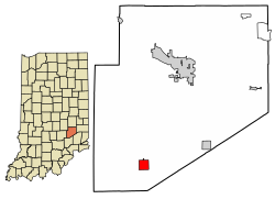
Millhousen is a town in Marion Township, Decatur County, Indiana, United States. The population was 149 at the 2020 census.

<span class="mw-page-title-main">St. Paul, Indiana</span> Town in Indiana, United States

St. Paul or Saint Paul is a small town on the border of Decatur and Shelby counties in the U.S. state of Indiana. The population was 1,031 at the 2010 census.

<span class="mw-page-title-main">Stilesville, Indiana</span> Town in Indiana, United States

Stilesville is a town in Franklin Township, Hendricks County, Indiana, United States. The population was 316 at the 2010 Census.

<span class="mw-page-title-main">Andrews, Indiana</span> Town in Indiana, United States

Andrews is a town in Dallas Township, Huntington County, Indiana, United States. The population was 1,048 at the 2020 census.

<span class="mw-page-title-main">Winfield, Indiana</span> Town in Indiana, United States

Winfield is a town in Winfield Township, Lake County, Indiana. The population was 2,298 at the time of the 2000 census, 4,383 in 2010, and 5,987 in 2019. The town was incorporated in 1993 in order to keep the residents from being annexed by other neighboring communities. Prior to that time it had been part of Winfield Township as an unincorporated town. Winfield is named for General Winfield Scott. The town is served by the Crown Point post office and addresses in Winfield share the Crown Point ZIP code.

<span class="mw-page-title-main">Kingsbury, Indiana</span> Town in Indiana, United States

Kingsbury is a town in Washington Township, LaPorte County, Indiana, just northwest of the intersection of U.S. Route 35 and U.S. Route 6. The town was founded in 1835 and incorporated on March 3, 1941. During 1940 - 1941, the Kingsbury Ordnance Plant (KOP) was built for use during World War II. The plant closed after the war but reopened during the Korean War, closing permanently in 1959. The population was 242 at the 2010 census. It is included in the Michigan City, Indiana-La Porte, Indiana Metropolitan Statistical Area. The town has its own fire department, KVFD, and a Greek revival style First Baptist church built in 1851 with its own graveyard and Winchell Cemetery.

<span class="mw-page-title-main">Bethany, Indiana</span> Town in Indiana, United States

Bethany is a town in Clay Township, Morgan County, in the U.S. state of Indiana. The population was 95 at the 2020 census.

<span class="mw-page-title-main">Paragon, Indiana</span> Town in Indiana, United States

Paragon is a town in Ray Township, Morgan County, in the U.S. state of Indiana. The population was 556 at the 2020 census, down from 659 in 2010.

<span class="mw-page-title-main">Clear Lake, Indiana</span> Town in Indiana, United States

Clear Lake is a town located in the northeast corner of Steuben County, Indiana, in Clear Lake Township. As such, is the northeasternmost community in the State of Indiana. The population was 339 at the 2010 census.

<span class="mw-page-title-main">Weldon, Iowa</span> City in Iowa, United States

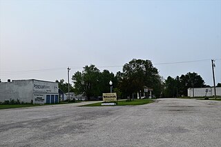
Weldon is a city in Clarke and Decatur counties of the U.S. state of Iowa. The population was 136 at the time of the 2020 census.

<span class="mw-page-title-main">Decatur, Mississippi</span> Town in Mississippi, United States

Decatur is a town in and the county seat of Newton County, Mississippi. The population was 1,841 at the 2010 census. This town is named after war hero Stephen Decatur, Jr.

<span class="mw-page-title-main">Decatur, Nebraska</span> Village in Nebraska, United States

Decatur is a village in Burt County, Nebraska, United States, adjacent to the upper Missouri River. The population was 481 at the 2010 census. This town is named after one of its incorporators, Stephen Decatur. It developed around a trading post established by Colonel Peter Sarpy, the namesake for Sarpy County in the state.

<span class="mw-page-title-main">Westport, South Dakota</span> Town in South Dakota, United States

Westport is a town in western Brown County, South Dakota, United States. The population was 88 at the 2020 census.

<span class="mw-page-title-main">Decatur, Wisconsin</span> Town in Wisconsin, United States

Decatur is a town in Green County, Wisconsin, United States. The population was 1,688 at the 2000 census.

<span class="mw-page-title-main">Sandwich (CDP), Massachusetts</span> Census-designated place in Massachusetts, United States

Sandwich is a village and census-designated place (CDP) in the town of Sandwich in Barnstable County, Massachusetts, United States. The population was 2,962 at the 2010 census, out of a total 20,675 people in the town of Sandwich.

<span class="mw-page-title-main">Hustisford (town), Wisconsin</span> Town in Wisconsin, United States

Hustisford is a town in Dodge County, Wisconsin, United States. The population was 1,379 at the 2000 census. Most of the town residents live in the village of Hustisford, within the town.

<span class="mw-page-title-main">New Point, Indiana</span> Town in Indiana, United States

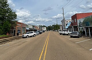
New Point is a town in Salt Creek Township, Decatur County, Indiana, United States. The population was 331 at the 2010 census.

References

  1. "2020 U.S. Gazetteer Files". United States Census Bureau. Retrieved March 16, 2022.
  2. 1 2 U.S. Geological Survey Geographic Names Information System: Westport, Indiana
  3. 1 2 "U.S. Census website". United States Census Bureau . Retrieved January 31, 2008.
  4. Harding, Lewis Albert (1915). History of Decatur County, Indiana: Its People, Industries and Institutions. B.F. Bowen. pp.  145.
  5. "Decatur County". Jim Forte Postal History. Retrieved August 31, 2014.
  6. "G001 - Geographic Identifiers - 2010 Census Summary File 1". United States Census Bureau. Archived from the original on February 13, 2020. Retrieved July 25, 2015.
  7. "Census of Population and Housing". Census.gov. Retrieved June 4, 2015.
  8. "U.S. Census website". United States Census Bureau . Retrieved December 11, 2012.