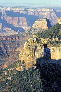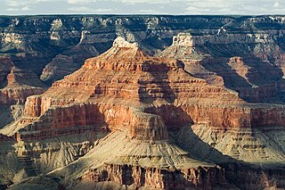
The geology of the Zion and Kolob canyons area includes nine known exposed formations, all visible in Zion National Park in the U.S. state of Utah. Together, these formations represent about 150 million years of mostly Mesozoic-aged sedimentation in that part of North America. Part of a super-sequence of rock units called the Grand Staircase, the formations exposed in the Zion and Kolob area were deposited in several different environments that range from the warm shallow seas of the Kaibab and Moenkopi formations, streams and lakes of the Chinle, Moenave, and Kayenta formations to the large deserts of the Navajo and Temple Cap formations and dry near shore environments of the Carmel Formation.

The Colorado Plateau, also known as the Colorado Plateau Province, is a physiographic and desert region of the Intermontane Plateaus, roughly centered on the Four Corners region of the southwestern United States. This province covers an area of 336,700 km2 (130,000 mi2) within western Colorado, northwestern New Mexico, southern and eastern Utah, northern Arizona, and a tiny fraction in the extreme southeast of Nevada. About 90% of the area is drained by the Colorado River and its main tributaries: the Green, San Juan, and Little Colorado. Most of the remainder of the plateau is drained by the Rio Grande and its tributaries.

The Grand Staircase is an immense sequence of sedimentary rock layers that stretch south from Bryce Canyon National Park and Grand Staircase–Escalante National Monument, through Zion National Park, and into the Grand Canyon National Park.

The exposed geology of the Canyonlands area is complex and diverse; 12 formations are exposed in Canyonlands National Park that range in age from Pennsylvanian to Cretaceous. The oldest and perhaps most interesting was created from evaporites deposited from evaporating seawater. Various fossil-rich limestones, sandstones, and shales were deposited by advancing and retreating warm shallow seas through much of the remaining Paleozoic.

The exposed geology of the Capitol Reef area presents a record of mostly Mesozoic-aged sedimentation in an area of North America in and around Capitol Reef National Park, on the Colorado Plateau in southeastern Utah.

The Cutler Formation or Cutler Group is a rock unit that is exposed across the U.S. states of Arizona, northwest New Mexico, southeast Utah and southwest Colorado. It was laid down in the Early Permian during the Wolfcampian epoch.

The Moenkopi Formation is a geological formation that is spread across the U.S. states of New Mexico, northern Arizona, Nevada, southeastern California, eastern Utah and western Colorado. This unit is considered to be a group in Arizona. Part of the Colorado Plateau and Basin and Range, this red sandstone was laid down in the Lower Triassic and possibly part of the Middle Triassic, around 240 million years ago.

The Kaibab Limestone is a resistant cliff-forming, Permian geologic formation that crops out across the U.S. states of northern Arizona, southern Utah, east central Nevada and southeast California. It is also known as the Kaibab Formation in Arizona, Nevada, and Utah. The Kaibab Limestone forms the rim of the Grand Canyon. In the Big Maria Mountains, California, the Kaibab Limestone is highly metamorphosed and known as the Kaibab Marble.

The Wingate Sandstone is a geologic formation in the Glen Canyon Group of the Colorado Plateau province of the United States which crops out in northern Arizona, northwest Colorado, Nevada, and Utah.

Coconino Sandstone is a geologic formation named after its exposure in Coconino County, Arizona. This formation spreads across the Colorado Plateau province of the United States, including northern Arizona, northwest Colorado, Nevada, and Utah.

Cedar Mesa Sandstone is a sandstone member of the Cutler Formation, found in southeast Utah, southwest Colorado, northwest New Mexico, and northeast Arizona.

The Hurricane Cliffs of southwest Utah and northwest Arizona are a red, limestone geographic feature, sets of cliffs along the western, eroded edge of the Kaibab Limestone; the cliffs are about 135-mi (217 km) long, with the south end terminus just north of the Grand Canyon.

The Middle Permian Toroweap Formation is a thin, darker geologic unit, between the brighter colored units of the Kaibab Limestone above, and Coconino Sandstone below. It is a prominent unit in Grand Canyon, Arizona, USA, found through sections of the South Rim, Grand Canyon, and the North Rim, of the Kaibab Plateau; also the Kaibab's southeast extension to Cape Royal, the Walhalla Plateau. The Colorado River of the Grand Canyon makes its excursion from due-south to due-west around the Walhalla Plateau, as it enters the east end of the Grand Canyon's interior, Granite Gorge. The formation is also found in southeast Utah.

The Toroweap Fault of northwest Arizona and southwest Utah is part of a fault system of the west Grand Canyon region, Arizona, US; also the west perimeter regions of the Coconino and Colorado Plateaus. The Hurricane Fault originates at the Toroweap Fault, in the region of the Colorado River, and strikes as the westerly depression of the Toroweap Fault. The Toroweap strikes northerly from the Colorado at the east of Toroweap Valley, and enters south Utah; from the Colorado River, the Hurricane Fault strikes north-northwest along the west flank of the small, regional Uinkaret Mountains, the west border of Toroweap Valley. The Hurricane Fault, and the Hurricane Cliffs strike into southwest Utah as part of the west, and southwest perimeter of the Colorado Plateau. The Hurricane Cliffs are made of Kaibab Limestone, an erosion resistant, cliff-forming rock unit.

Isis Temple is a prominence in the Grand Canyon, Arizona, Southwestern United States. It is located below the North Rim and adjacent to Granite Gorge. The prominence lies north of the north bank of the west-flowing Colorado River and is just north of Granite Gorge. The Trinity Creek and canyon flow due south at its west border; its north, and northeast border/flank is formed by Phantom Creek and canyon, a west tributary of Bright Angel Creek; the creeks intersect about 3 mi (4.8 km) southeast, and 1.0 mi (1.6 km) north of Granite Gorge. The Isis Temple prominence, is only about 202 ft (62 m) lower than Grand Canyon Village, the main public center on Grand Canyon’s South Rim.

The Lower Permian Esplanade Sandstone is a cliff-forming, resistant sandstone, dark red, geologic unit found in the Grand Canyon. The rock unit forms a resistant shelf in the west Grand Canyon, south side of the Colorado River, at the east of the Toroweap Fault, down-dropped to west, southeast of Toroweap Overlook, and west of Havasupai. The red, sandstone shelf, The Esplanade is about 20-mi long. At Toroweap Overlook region, Toroweap Valley with Vulcan's Throne, Uinkaret volcanic field, the resistant Esplanade Sandstone is described in access routes exploring the Toroweap Lake area.

The (Upper) Late Pennsylvanian Wescogame Formation is a slope-forming, sandstone, red-orange geologic unit, formed from an addition of eolian sand, added to marine transgression deposits,, and found throughout sections of the Grand Canyon, in Arizona, Southwest United States. It is one of the upper members of the Supai Group 'redbeds', with the Supai Group found in other sections of Arizona, especially in the Verde Valley region, or as a basement unit below the Mogollon Rim, just eastwards or part of the basement Supai Group of the southwest & south Colorado Plateau.

The Shinarump Conglomerate is a geologic formation found in the Four Corners region of the United States. It was deposited in the early part of the Late Triassic period.

The Organ Rock Formation or Organ Rock Shale is a formation within the late Pennsylvanian to early Permian Cutler Group and is deposited across southeastern Utah, northwestern New Mexico, and northeastern Arizona. This formation notably outcrops around Canyonlands National Park, Natural Bridges National Monument, and Monument Valley of northeast Arizona, southern Utah. The age of the Organ Rock is constrained to the latter half of the Cisuralian epoch by age dates from overlying and underlying formations. Important early terrestrial vertebrate fossils have been recovered from this formation in northern Arizona, southern Utah, and northern New Mexico. These include the iconic Permian terrestrial fauna: Seymouria, Diadectes, Ophiacodon, and Dimetrodon. The fossil assemblage present suggests arid environmental conditions. This is corroborated with paleoclimate data indicative of global drying throughout the early Permian.

The Blue Mesa Member is a member of the Chinle Formation. It is located in the Petrified Forest National Park of northeast Arizona.


