Williams River (West Virginia)

Last updated
Williams River
Williams River-27527.jpg
Williams River in the Monongahela National Forest.
Location
Country United States
State West Virginia
Counties Pocahontas, Webster
Physical characteristics
Source Beaverdam Run
 - locationDay Mountain, Pocahontas County, WV
 - coordinates 38°14′47″N80°09′54″W / 38.24639°N 80.16500°W / 38.24639; -80.16500
 - elevation3,892 ft (1,186 m) [1]
2nd sourceDowny Run
 - locationDay Mountain, Pocahontas County, WV
 - coordinates 38°14′03″N80°09′32″W / 38.23417°N 80.15889°W / 38.23417; -80.15889
 - elevation3,975 ft (1,212 m) [2]
Source Confluence 
 - location Pocahontas County, WV
 - coordinates 38°13′43″N80°01′10″W / 38.22861°N 80.01944°W / 38.22861; -80.01944
 - elevation3,448 ft (1,051 m) [3]
Mouth Gauley River [4]
 - location Donaldson, WV
 - coordinates 38°23′06″N80°30′48″W / 38.38500°N 80.51333°W / 38.38500; -80.51333 Coordinates: 38°23′06″N80°30′48″W / 38.38500°N 80.51333°W / 38.38500; -80.51333
 - elevation2,169 ft (661 m)
Length33 mi (53 km)
Discharge 
 - location Dyer, WV [5]
 - minimum0.62 cu ft/s (0.018 m3/s)(1995)
 - average30 cu ft/s (0.85 m3/s) [5]
 - maximum1,840 cu ft/s (52 m3/s)(1971)
Basin features
Basin size132 sq mi (340 km2)

The Williams River is a tributary of the Gauley River, 33 miles (53 km) long, [6] in east-central West Virginia, USA. Via the Gauley, Kanawha and Ohio Rivers, it is part of the watershed of the Mississippi River, draining an area of 132 square miles (342 km²) in a sparsely populated region of the southern Allegheny Mountains and the unglaciated portion of the Allegheny Plateau. [6] [7]

Tributary stream or river that flows into a main stem river or lake

A tributary or affluent is a stream or river that flows into a larger stream or main stem river or a lake. A tributary does not flow directly into a sea or ocean. Tributaries and the main stem river drain the surrounding drainage basin of its surface water and groundwater, leading the water out into an ocean.

Gauley River river in the United States of America

The Gauley River is a 105-mile-long (169 km) river in West Virginia. It merges with the New River to form the Kanawha River, a tributary of the Ohio River. The river features numerous recreational whitewater areas, including those in Gauley River National Recreation Area downstream of the Summersville Dam.

West Virginia State of the United States of America

West Virginia is a state located in the Appalachian region in the Southern United States that is also considered to be a part of the Middle Atlantic States. It is bordered by Pennsylvania to the north, Maryland to the east and northeast, Virginia to the southeast, Kentucky to the southwest, and Ohio to the northwest. West Virginia is the 41st largest state by area, and is ranked 38th in population. The capital and largest city is Charleston.

Contents

Name

The river has also been known historically as the South Fork of the Gauley River [4] In Webster County, it collects a short tributary known as the Middle Fork Williams River, [8] which itself collects the North Branch Middle Fork Williams River. [9] The river most likely was named after a landowner named Williams. [10]

Geography

The Williams River rises in southern Pocahontas County, approximately 5 miles (8 km) west of Marlinton, and flows initially northwardly, then westwardly into southern Webster County, where it joins the Gauley River approximately 2 miles (3 km) southeast of Cowen. [7] It flows for much of its length in the Monongahela National Forest, including the Cranberry Wilderness, in an area that was heavily logged in the early 20th century and has since been reforested. Coal mining activity took place along the river's lower course into the 1970s. [6]

Pocahontas County, West Virginia County in the United States

Pocahontas County is a county located in the U.S. state of West Virginia. As of the 2010 census, the population was 8,719. Its county seat is Marlinton. The county was established in 1821. It is named after the daughter of the Powhatan Native American chief from Jamestown, Virginia. She married an English settler and their mixed-race children became ancestors of many of the First Families of Virginia.

Marlinton, West Virginia Town in West Virginia, United States

Marlinton is a town in Pocahontas County, West Virginia, United States. The population was 1,054 at the 2010 census. It is the county seat of Pocahontas County, and is known for its scenic beauty.

Webster County, West Virginia County in the United States

Webster County is a county in the U.S. state of West Virginia. As of the 2010 census, the population was 9,154. Its county seat is Webster Springs. The county was founded in 1860 and named for Daniel Webster.

Fishing

The Williams River is regarded as one of the five best trout fishing streams in West Virginia, [6] due to its cold water temperature, low turbidity, and frequent stockings of trout (amounting to 27,000 pounds annually) by the West Virginia Division of Natural Resources. [11]

Trout Number of species of freshwater fish

Trout is the common name for a number of species of freshwater fish belonging to the genera Oncorhynchus, Salmo and Salvelinus, all of the subfamily Salmoninae of the family Salmonidae. The word trout is also used as part of the name of some non-salmonid fish such as Cynoscion nebulosus, the spotted seatrout or speckled trout.

Turbidity The cloudiness of a fluid caused by large numbers of particles that are generally invisible to the naked eye

Turbidity is the cloudiness or haziness of a fluid caused by large numbers of individual particles that are generally invisible to the naked eye, similar to smoke in air. The measurement of turbidity is a key test of water quality.

The West Virginia Division of Natural Resources (WVDNR) is an agency of the government of the U.S. state of West Virginia. While formerly known as the cabinet-level Department of Natural Resources, it is now part of the West Virginia Department of Commerce. The WVDNR is responsible for wildlife management, hunting and fishing regulations, and boater safety and also oversees state parks and resorts. It also operates the West Virginia State Wildlife Center, a zoo in French Creek that exhibits West Virginian wildlife.

West Virginia Route 150 is a 22.5-mile (36.2 km) long north–south scenic state highway in the Marlinton and Gauley Ranger Districts of the Monongahela National Forest in southeast West Virginia. The southern terminus of the route is at West Virginia Route 39 and West Virginia Route 55 northwest of Mill Point. The northern terminus is at U.S. Route 219 and WV 55 north of Edray, near Marlinton.

See also

Related Research Articles

Monongahela River river in Pennsylvania and West Virginia, United States

The Monongahela River — often referred to locally as the Mon — is a 130-mile-long (210 km) river on the Allegheny Plateau in north-central West Virginia and southwestern Pennsylvania. The river flows from the confluence of its west and east forks in north central West Virginia northeasterly into southwestern Pennsylvania, then northerly to Pittsburgh and its confluence with the Allegheny River to form the Ohio River. The river is navigable its entire length via a series of locks and dams.

Greenbrier River river in the United States of America

The Greenbrier River is a tributary of the New River, 162 miles (261 km) long, in southeastern West Virginia, in the United States. Via the New, Kanawha and Ohio rivers, it is part of the watershed of the Mississippi River, draining an area of 1,656 square miles (4,290 km2). It is one of the longest rivers in West Virginia.

Elk River (West Virginia) tributary of the Kanawha River in central West Virginia in the United States

The Elk River is a tributary of the Kanawha River, 172 miles (277 km) long, in central West Virginia in the United States. Via the Kanawha and Ohio rivers, it is part of the watershed of the Mississippi River.

Hughes River (West Virginia) river in the United States of America

The Hughes River is a tributary of the Little Kanawha River in western West Virginia in the United States. Via the Little Kanawha and Ohio Rivers, it is part of the watershed of the Mississippi River. As measured from the confluence of its north and south forks, the Hughes is 18 mi (29 km) long, and drains a rural area of the unglaciated portion of the Allegheny Plateau.

West Fork River river in the United States of America

The West Fork River is a principal tributary of the Monongahela River, 103 miles (166 km) long, in north-central West Virginia in the United States. Via the Monongahela and Ohio Rivers, it is part of the watershed of the Mississippi River, draining an area of 881 square miles (2,284 km²) on the unglaciated portion of the Allegheny Plateau.

Tygart Valley River river in West Virginia

The Tygart Valley River — also known as the Tygart River — is a principal tributary of the Monongahela River, approximately 135 miles (217 km) long, in east-central West Virginia in the United States. Via the Monongahela and Ohio rivers, it is part of the watershed of the Mississippi River, draining an area of 1,329 square miles (3,440 km2) in the Allegheny Mountains and the unglaciated portion of the Allegheny Plateau.

Black Fork (Cheat River tributary) river in the United States of America

The Black Fork is a principal tributary of the Cheat River in the Allegheny Mountains of eastern West Virginia, USA. It is a short stream, about four miles (6 km) in length, formed by the confluence of two other streams not far above its mouth. It was traditionally considered one of the five Forks of Cheat.

Blackwater River (West Virginia) river in the United States of America

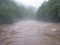
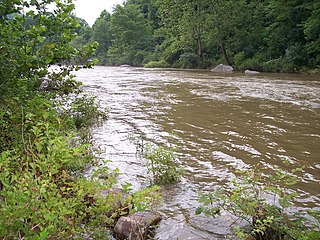
The Blackwater River is a 34.3-mile-long (55.2 km) river in the Allegheny Mountains of eastern West Virginia, USA. Via the Black Fork, it is a principal tributary of the Cheat River. Via the Cheat, the Monongahela and the Ohio rivers, it is part of the watershed of the Mississippi River and drains an area of 142 square miles (370 km2). It is a true blackwater stream, owing to spruce and hemlock trees in its watershed, the tannins of which impart a tea or amber color to its water.

Shavers Fork river in the United States of America

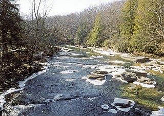
Shavers Fork of the Cheat River is situated in the Allegheny Mountains of eastern West Virginia, USA. It is 88.5 mi (142.5 km) long and forms the Cheat at its confluence with Black Fork at Parsons. It was traditionally considered one of the five Forks of Cheat and its upper reaches constitute the highest river in the eastern United States.

Dry Fork (Cheat River tributary) tributary of the Black Fork of the Cheat River in West Virginia, USA

The Dry Fork is a 39.1-mile-long (62.9 km) tributary of the Black Fork of the Cheat River in the Allegheny Mountains of eastern West Virginia, USA. Via the Black Fork, the Cheat, and the Monongahela and Ohio rivers, it is part of the watershed of the Mississippi River. The Dry Fork flows for much of its length in the Monongahela National Forest and drains mostly rural and forested areas. It was traditionally considered one of the five Forks of Cheat.

Cherry River (West Virginia) River in southeastern West Virginia

The Cherry River is a tributary of the Gauley River in southeastern West Virginia in the United States. Via the Gauley, Kanawha and Ohio rivers, it is part of the watershed of the Mississippi River. The Cherry River drains mostly rural and forested areas and flows for much of its length through the Monongahela National Forest. Throughout its entire length the Cherry goes over a series of whitewater rapids in a mountainous setting.

Cranberry River (West Virginia) river in West Virginia, United States

The Cranberry River is a tributary of the Gauley River located in southeastern West Virginia in the United States. It is a part of the Mississippi River watershed, by way of the Gauley, Kanawha, and Ohio Rivers, draining an area of 74 square miles (192 km2).

Glady Fork river in the United States of America

Glady Fork is a 31.9-mile-long (51.3 km) river in the Allegheny Mountains of eastern West Virginia, USA. It is considered one of the five principal headwaters tributaries of the Cheat River — known as the Forks of Cheat.

Laurel Fork (Cheat River tributary) river in the United States of America

Laurel Fork is a 37.8-mile-long (60.8 km) river in eastern West Virginia, USA. It is a tributary of the Dry Fork; via the Dry Fork, the Black Fork, and the Cheat, Monongahela and Ohio rivers, it is part of the watershed of the Mississippi River, draining an area of 60 square miles (160 km2) in the Allegheny Mountains. With the Dry Fork, the Glady Fork, the Shavers Fork and the Blackwater River, it is considered to be one of the five principal headwaters tributaries of the Cheat River.

Middle Fork River river in the United States of America

The Middle Fork River is a 35.4-mile-long (57.0 km) tributary of the Tygart Valley River in north-central West Virginia, USA. Via the Tygart Valley, Monongahela and Ohio rivers, it is part of the watershed of the Mississippi River, draining an area of 152 square miles (390 km2) on the easternmost part of the unglaciated portion of the Allegheny Plateau. According to the Geographic Names Information System, the Middle Fork River has also been known simply as "Middle Fork" and as "Middlefork."

Wheeling Creek (West Virginia) river in United States of America

Wheeling Creek is a tributary of the Ohio River, 25 miles (40 km) long, in the Northern Panhandle of West Virginia in the United States, with a watershed extending into southwestern Pennsylvania. Via the Ohio River, it is part of the watershed of the Mississippi River, draining an area of approximately 300 square miles (780 km2) on the unglaciated portion of the Allegheny Plateau. It flows into the Ohio River in downtown Wheeling, just downstream of Ohio's Wheeling Creek on the opposite bank. A variant name is Big Wheeling Creek.

Cranberry Wilderness

The Cranberry Wilderness is a 47,815-acre (19,350 ha) U.S. wilderness area in the Monongahela National Forest of southeast West Virginia, United States. Its name derives from the nearby Cranberry Glades as well as from the Cranberry River and Cranberry Mountain. In addition to being wilderness, it is a designated black bear sanctuary.

Buffalo Creek (Monongahela River tributary) river in West Virginia, United States of America

Buffalo Creek is a tributary of the Monongahela River, 30.2 miles (48.6 km) long, in northern West Virginia, in the United States. Via the Monongahela and Ohio rivers, it is part of the watershed of the Mississippi River, draining an area of 125 square miles (320 km2) on the unglaciated portion of the Allegheny Plateau. The stream's entire course and drainage basin are in Marion County.

References

  1. "USGS Elevation Web Service for -80.165, -38.246389". U.S. Geological Survey . Retrieved 2008-09-13.
  2. "USGS Elevation Web Service for -80.1589, -38.23409". U.S. Geological Survey . Retrieved 2008-09-13.
  3. 1 2 "Williams River". Geographic Names Information System . United States Geological Survey. 1980-06-27. Retrieved 2008-09-13.
  4. 1 2 "USGS Gage #03186500 on Williams River at Dyer, WV". National Water Information System . U.S. Geological Survey . Retrieved 2008-09-13.
  5. 1 2 3 4 McNeel, William P. "Williams River." The West Virginia Encyclopedia. Ken Sullivan, editor. Charleston, WV: West Virginia Humanities Council. 2006. ISBN   0-9778498-0-5.
  6. 1 2 DeLorme (1997). West Virginia Atlas & Gazetteer. Yarmouth, Maine: DeLorme. ISBN   0-89933-246-3.
  7. U.S. Geological Survey Geographic Names Information System: Middle Fork Williams River
  8. U.S. Geological Survey Geographic Names Information System: North Branch Middle Fork Williams River
  9. Kenny, Hamill (1945). West Virginia Place Names: Their Origin and Meaning, Including the Nomenclature of the Streams and Mountains. Piedmont, WV: The Place Name Press. p. 682.
  10. Monongahela National Forest: Williams River Retrieved on March 14, 2013.