Elkin is a town in Surry and Wilkes counties in the U.S. state of North Carolina, along the Yadkin River. Elkin shares its name with the surrounding township of Elkin Township. The population was 4,122 at the time of the 2020 census.

Shawboro is an unincorporated community located in Currituck County, North Carolina, United States.
The Museum of the Cape Fear Historical Complex is a museum about the history and cultural heritage of southern North Carolina. Opened in 1988 and located in Fayetteville, the museum is a regional branch of the North Carolina Museum of History in Raleigh. The complex includes the main history museum, the 1897 Poe House, and Arsenal Park.
New Hope is an unincorporated community in the Dobson Township of central Surry County, North Carolina. The community is on the outskirts of the town of Dobson along the Fisher River. Prominent landmarks include New Hope Baptist Church and the Fisher River county park. The community of New Hope also has a mirror community just outside of Whiteville, NC as well on US HWY 701 a.k.a.. This is home of the Tri-County sweet potato plant.
Oak Grove is an unincorporated community in northern Surry County, North Carolina, United States, located near Bottom.

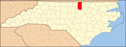
Ingleside is an unincorporated community in northern Franklin County, North Carolina, United States. It lies at the intersection of U.S. Route 401, and North Carolina Highway 39, north of Louisburg, at an elevation of 394 feet.
Justice is an unincorporated community in eastern Franklin County, North Carolina, United States.
McGee's Crossroads is an unincorporated community in Johnston County, North Carolina, United States, situated at the intersection of North Carolina Highway 50, and North Carolina Highway 210. It lies at an elevation of 292 feet.
Wood is a small unincorporated community in northeastern Franklin County, North Carolina, United States, on North Carolina Highway 561 east of Centerville. Settled in 1893, Wood was incorporated as a town in 1917. The town charter was repealed on May 5, 1961. Wood lies at an elevation of 322 feet.
Royal is an unincorporated community on U.S. Route 401, in southeastern Franklin County, North Carolina, United States.
Rocky Ford is an unincorporated community in Franklin County, North Carolina,United States. It is located at an elevation of 397 feet or 121 m, it is west-northwest of the neighboring unincorporated community of Ingleside.
Lewis is an unincorporated community in central Granville County, North Carolina, United States. It lies north of Oxford.
Grissom is an unincorporated community in southern Granville County, North Carolina, United States. It is located at the intersection of roads 1710 and 1713, south of Wilton.
Laurel Mill, also known as just Laurel, is an unincorporated community in northeastern Franklin County, North Carolina, United States.
Earle Sumner Draper (1893–1994) was an American town planner and a landscape designer, who is famous for having coined the term "urban sprawl".
Wise is a small unincorporated community located on U.S. Route 1 in Warren County, North Carolina, United States. The nearest town is Norlina.
Stallings Crossroads is an unincorporated community in eastern Franklin County, North Carolina, United States. It is located east of Louisburg, at an elevation of 384 feet. The primary cross roads where the community is located are N.C. Highway 56, Fire Tower Road and Edward Best Road.
Mapleville is an unincorporated community in east central Franklin County, North Carolina, United States.
Katesville is an unincorporated community in west central Franklin County, North Carolina, United States.
Townsville is an unincorporated community in Townsville Township in northern Vance County, North Carolina, United States. It is located at the intersection of N.C. Highway 39 and Tungsten Mine Road, 13 miles (21 km) north of Henderson, at an elevation of 427 feet. Townesville was established in about 1821 and was part of Granville County until 1881 when Vance County was created. Townsville is near the John H. Kerr Reservoir and Virginia state line.