Winters, Texas | |
---|---|
Coordinates: 31°57′32″N99°57′32″W / 31.95889°N 99.95889°W | |
Country | United States |
State | Texas |
County | Runnels |
Area | |
• Total | 2.94 sq mi (7.62 km2) |
• Land | 2.36 sq mi (6.10 km2) |
• Water | 0.59 sq mi (1.52 km2) |
Elevation | 1,841 ft (561 m) |
Population (2010) | |
• Total | 2,562 |
• Estimate (2019) [2] | 2,448 |
• Density | 1,039.05/sq mi (401.21/km2) |
Time zone | UTC-6 (Central (CST)) |
• Summer (DST) | UTC-5 (CDT) |
ZIP code | 79567 |
Area code | 325 |
FIPS code | 48-79876 [3] |
GNIS feature ID | 1350435 [4] |
Website | www |
Winters is a city in Runnels County, Texas, United States. The population was 2,562 at the 2010 census. [5]
Winters is located at 31°57′32″N99°57′32″W / 31.95889°N 99.95889°W (31.958786, –99.958810). [6] It is situated at the junction of U.S. Highway 83 and Farm Roads 53 and 1770 in north-central Runnels County, approximately 41 miles (66 km) south of Abilene and 52 miles (84 km) northeast of San Angelo. [7]
According to the United States Census Bureau, the city has a total area of 2.9 square miles (7.6 km2), of which 2.4 square miles (6.1 km2) are land and 0.58 square miles (1.5 km2), or 19.97%, are covered by water. [5]
The climate in this area is characterized by hot, humid summers and generally mild to cool winters. According to the Köppen climate classification system, Winters has a humid subtropical climate, Cfa on climate maps. [8]
In 1880, the families of C.N. Curry and C.E. Bell settled in an area known as Bluff Creek Valley, southwest of the present town. Local cowboy Jack Mackey suggested that the community be named in honor of John N. Winters, a rancher and land agent. [9] A post office was established in 1891 and Mr. Winters donated land for a school soon after. Winters had roughly 163 residents in 1892. It became famous for a traveling brass band that was organized by Charles Tipton Grant in 1901. A newspaper began publishing in 1903. Winters incorporated in 1909, the same year that the Abilene and Southern Railway built an extension from Abilene to Winters. Land values in the city jumped to $7.00 per acre. A cottonseed mill became the first major industry in Winters when it opened in 1909. It remained in operation until 1939. In 1910, the population had risen to 1,247. A public library was constructed in 1964. By 1980, the population stood at 3,061. That number fell slightly to 2,905 in 1990 and 2,880 in 2000. [9] Winters had a total of 140 businesses in 2000, up from 96 in 1970. Today, the city serves as a commercial and distribution center for a large agricultural and ranching area.
Census | Pop. | Note | %± |
---|---|---|---|
1910 | 1,347 | — | |
1920 | 1,509 | 12.0% | |
1930 | 2,423 | 60.6% | |
1940 | 2,335 | −3.6% | |
1950 | 2,676 | 14.6% | |
1960 | 3,266 | 22.0% | |
1970 | 2,907 | −11.0% | |
1980 | 3,061 | 5.3% | |
1990 | 2,905 | −5.1% | |
2000 | 2,880 | −0.9% | |
2010 | 2,562 | −11.0% | |
2019 (est.) | 2,448 | [2] | −4.4% |
U.S. Decennial Census [10] |
Race | Number | Percentage |
---|---|---|
White (NH) | 1,134 | 48.36% |
Black or African American (NH) | 41 | 1.75% |
Native American or Alaska Native (NH) | 7 | 0.3% |
Asian (NH) | 3 | 0.13% |
Pacific Islander (NH) | 1 | 0.04% |
Some Other Race (NH) | 2 | 0.09% |
Mixed/Multi-Racial (NH) | 63 | 2.69% |
Hispanic or Latino | 1,094 | 46.65% |
Total | 2,345 |
As of the 2020 United States census, there were 2,345 people, 854 households, and 610 families residing in the city.
As of the census [3] of 2000, 2,880 people, 1,082 households, and 750 families resided in the city. The population density was 1,280.7 inhabitants per square mile (494.5/km2). The 1,251 housing units averaged 556.3 per square mile (214.7/km2). The racial makeup of the city was 76.04% White, 2.05% African American, 0.94% Native American, 0.28% Asian, 0.07% Pacific Islander, 18.58% from other races, and 2.05% from two or more races. Hispanics or Latinos of any race were 39.24% of the population.
Of the 1,082 households, 34.6% had children under the age of 18 living with them, 52.1% were married couples living together, 12.0% had a female householder with no husband present, and 30.6% were not families. About 27.7% of all households were made up of individuals, and 16.8% had someone living alone who was 65 years of age or older. The average household size was 2.62 and the average family size was 3.21.
In the city, the population was distributed as 30.3% under the age of 18, 8.2% from 18 to 24, 23.2% from 25 to 44, 20.7% from 45 to 64, and 17.7% who were 65 years of age or older. The median age was 35 years. For every 100 females, there were 88.0 males. For every 100 females age 18 and over, there were 81.5 males.
The median income for a household in the city was $25,587, and for a family was $30,000. Males had a median income of $27,112 versus $18,438 for females. The per capita income for the city was $11,030. About 20.6% of families and 26.7% of the population were below the poverty line, including 38.0% of those under age 18 and 16.5% of those age 65 or over.
The Z.I. Hale Museum, housed in the former clinic of a prominent local optometrist, features exhibits of area history, photographs, and documents. A Missouri-Pacific caboose sits outside of the museum.
W. Lee Colburn Park is located 7 miles (11 km) east of Winters, adjacent to Elm Creek Reservoir. The park has various recreational facilities and 14 spaces for RVs with full hookups.
Every year, on the 1st Saturday of September, Winters celebrates the opening of dove hunting season with "Dovefest". people come from all over to hunt, listen to live music, or attend the gun show.
Public education in the city of Winters is provided by the Winters Independent School District. The district has three campuses – Winters Elementary School (grades Pre-K–5), Winters Junior High School (grades 6–8), and Winters High School (grades 9–12).
Tom Green County is a county located on the Edwards Plateau in the U.S. state of Texas. As of the 2020 census, its population was 120,003. Its county seat is San Angelo. The county was created in 1874 and organized the following year. It is named for Thomas Green, who was a Confederate soldier and lawyer. Tom Green County is included in the San Angelo metropolitan statistical area; the county is home to Goodfellow Air Force Base, as well as Angelo State University, part of the Texas Tech University System.
Taylor County is a county located in the U.S. state of Texas. As of the 2020 census, its population was 143,208. Its county seat is Abilene. The county was created in 1858 and later organized in 1878. It is named for Edward Taylor, George Taylor, and James Taylor, three brothers who died at the Battle of the Alamo.
Boggs Township is a township in Clearfield County, Pennsylvania, United States. The population was 1,666 at the 2020 census.
Live Oak is a city in Bexar County, Texas, United States. The population was 15,781 at the 2020 census. It is part of the San Antonio Metropolitan Statistical Area.
Baird is a city and the county seat of Callahan County, Texas, United States. Its population was 1,496 at the 2010 census. The city is named after Matthew Baird, the owner and director of the Texas and Pacific Railway. The railway depot is now operated as the visitor center and a transportation museum.
Putnam is a town in Callahan County, Texas, United States. The population was 63 at the 2020 census, down from 94 in 2010. It is part of the Abilene, Texas Metropolitan Statistical Area.
Coleman is a town in and the county seat of Coleman County, Texas, United States. As of the 2010 census, its population was 4,709.
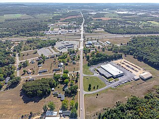
Ranger is a city in Eastland County, Texas, United States. Its population was 2,468 at the 2010 census. Ranger College, a community college, is the second-largest employer in the community.
Haskell is a city in central Haskell County, Texas, United States. As of the 2010 census, the city population was 3,322. It is the Haskell county seat.
Anson is a city in and the county seat of Jones County, Texas, United States. The population was 2,294 at the 2020 census. It is part of the Abilene, Texas metropolitan area. Originally named "Jones City", the town was renamed "Anson" in 1882 in honor of Anson Jones, the last president of the Republic of Texas.
Hawley is a city in Jones County, Texas, United States. The population was 634 at the 2010 census. Named for Congressman Robert B. Hawley, it is part of the Abilene metropolitan area.
Knox City is a town in Knox County, Texas, United States. The population was 1,119 at the 2019 census.
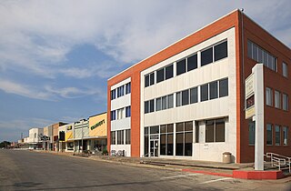
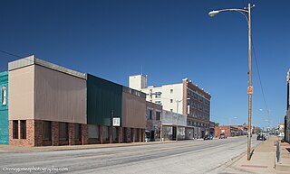
Ballinger is a city in Runnels County, Texas, United States. The population was 3,619 at the 2020 census. It is the county seat of Runnels County. Downtown Ballinger features historic 1800s buildings with shops and restaurants.
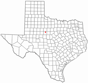
Lawn is a town in Taylor County, Texas, United States. As of the 2010 census, the town population was 314. It is part of the Abilene, Texas Metropolitan Statistical Area.
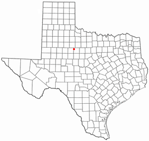
Merkel is a city in Taylor County, Texas, United States. Its population was 2,471 at the 2020 census. It is part of the Abilene metropolitan area.
Tuscola is a city in Taylor County, Texas, United States. The population was 742 at the 2010 census. It is part of the Abilene, Texas Metropolitan Statistical Area.
Tye is a city in Taylor County, Texas, United States. The population was 1,242 at the 2010 census. It is part of the Abilene, Texas Metropolitan Statistical Area.
Hamlin is a city in Jones and Fisher Counties in the U.S. state of Texas. The population was 2,124 at the 2010 census, and in 2018, the estimated population was 1,997. The Jones County portion of Hamlin is part of the Abilene, Texas metropolitan area.
Oakdale is a village in Monroe County, Wisconsin, United States. The population was 302 at the 2020 census. The village is located within the Town of Oakdale.
Runnels County is a county located in the U.S. state of Texas. As of the 2020 census, its population was 9,900. Its county seat is Ballinger. The county was created in 1858 and later organized in 1880. It is named for Hiram G. Runnels, a Texas state legislator.