Deception Pass is a strait separating Whidbey Island from Fidalgo Island, in the northwest part of the U.S. state of Washington. It connects Skagit Bay, part of Puget Sound, with the Strait of Juan de Fuca. A pair of bridges known collectively as Deception Pass Bridge cross Deception Pass. The bridges were added to the National Register of Historic Places in 1982.

The Glorieuses or Glorioso Islands are a group of French islands and rocks totalling 5 square kilometres, at 11°33′S47°20′E, in Comoro Islands, between the french region of Mayotte and Madagascar. In 2012, France founded parc naturel marin des Glorieuses, a marine protected area, to preserve the endangered flora and fauna of the islands. The Glorieuses have an Exclusive Economic Zone (EEZ) of 48,350 square kilometres (18,670 sq mi). There are anchorages offshore, and Grande Glorieuse has a 1,300-metre (4,300 ft) long airstrip.
The Kerguelen Islands, also known as the Desolation Islands, are a group of islands in the Antarctic constituting one of the two exposed parts of the Kerguelen Plateau, a large igneous province mostly submerged by the southern Indian Ocean. They are among the most isolated places on Earth, located 450 km (280 mi) northwest of the uninhabited Heard Island and McDonald Islands and more than 3,300 km (2,100 mi) from Madagascar, the nearest populated location. The islands, along with Adélie Land, the Crozet Islands, Amsterdam and Saint Paul Islands, and France's Scattered Islands in the Indian Ocean, are part of the French Southern and Antarctic Lands and are administered as a separate district.

The Holy Island of Lindisfarne, also known simply as Holy Island, is a tidal island off the northeast coast of England, which constitutes the civil parish of Holy Island in Northumberland. Holy Island has a recorded history from the 6th century AD; it was an important centre of Celtic Christianity under Saints Aidan of Lindisfarne, Cuthbert, Eadfrith of Lindisfarne and Eadberht of Lindisfarne. After the Viking invasions and the Norman conquest of England, a priory was reestablished. A small castle was built on the island in 1550.
The Mozambique Channel is an arm of the Indian Ocean located between the Southeast African countries of Madagascar and Mozambique. The channel is about 1,600 km (1,000 mi) long and 419 km (260 mi) across at its narrowest point, and reaches a depth of 3,292 m (10,800 ft) about 230 km (143 mi) off the coast of Mozambique. A warm current, the Mozambique Current, flows in a southward direction in the channel, leading into the Agulhas Current off the east coast of South Africa.

Saint Pierre and Miquelon is a French overseas collectivity in the Western Hemisphere and the Northern Hemisphere. It consists of an island archipelago off the coast of Newfoundland near North America. The collectivity shares a maritime boundary with Canada.

Chausey is a group of small islands, islets and rocks off the coast of Normandy, in the English Channel. It lies 17 kilometres (11 mi) from Granville and forms a quartier of the Granville commune in the Manche département. Chausey forms part of the Channel Islands from a geographical point of view, but, because it is under French jurisdiction, it is almost never mentioned in the context of the other Channel Islands. There are no scheduled transport links between Chausey and the other Channel Islands, although between two and four daily shuttles link Chausey to mainland France through Granville, depending on the season.

A tidal island is a piece of land that is connected to the mainland by a natural or man-made causeway that is exposed at low tide and submerged at high tide. Because of the mystique surrounding tidal islands many of them have been sites of religious worship, such as Mont Saint-Michel with its Benedictine Abbey. Tidal islands are also commonly the sites of fortresses because of their natural fortifications.

Chapel Island is a limestone outcrop that lies in the Leven estuary of Morecambe Bay in England, less than one mile (1.6 km) from the shoreline at Bardsea in the area known as Ulverston Sands. It is located at 54.1741°N 3.0416°W. It is one of the Islands of Furness in the county of Cumbria, in the area of the historic county of Lancashire. The island is approximately 450 yards (410 m) long and just over 100 yards (91 m) at its widest. Its area is about 7.5 acres.

The Minquiers are a group of islands and rocks, about 15 km (9.3 mi) south of Jersey. The Minquiers forms part of the Bailiwick of Jersey. They are administratively part of the Parish of Grouville.

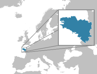
Île Longue is a peninsula of the roadstead of Brest in the department of Finistère in the Brittany region. It is the base of the SNLE, the French ballistic missile submarines, and as such one of the most secretive and heavily defended places in France.
The Islets of Mauritius includes nearly a hundred tiny islets and rocks scattered around the coast of Mauritius as well as Rodrigues.

Larmor-Baden is a commune in the Morbihan department of Brittany in north-western France.

Molène is an island off the west coast of Brittany and one of the Ponant Islands, the largest of an archipelago of some twenty islands. Administratively, it is part of a commune of the Finistère department of Brittany in north-western France, the commune of Île-Molène, which also comprises several neighbouring islets.

For the largest city on the island of Basse-Terre and capital of Guadeloupe, see Basse-Terre. For the capital of Saint Kitts and Nevis see Basseterre.

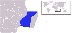
Petite Terre Islands are two small uninhabited islands located about 10 km (6.2 mi) to the south-east of the island of Grande-Terre (Guadeloupe), in the Lesser Antilles. These two islands are named Petite Terre in contrast with the much larger Grande-Terre island.

Péninsule Jeanne d'Arc, also known as Presqu'île Jeanne d'Arc, is a peninsula of Grande Terre, the main island of the subantarctic Kerguelen archipelago in the southern Indian Ocean.
"The Idiots" is a short story by Joseph Conrad, his first to be published. It first appeared in The Savoy in 1896. The story was included in the Conrad collection Tales of Unrest, published in 1898.