Molochna River, is a river in the Zaporizhia Oblast of south Ukraine. Literally the name of the river translates as Milky. The river is connected with the Russian Mennonite culture, once based in the southeastern region of Ukraine since 1804 as Molotschna colony which was part of the Russian Empire at that time.

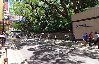
Haiphong Road is a road south of Kowloon Park, Tsim Sha Tsui, Hong Kong. The road links Canton Road and Nathan Road.

Loudwater railway station was a railway station which served Loudwater, Buckinghamshire and Flackwell Heath, on the Wycombe Railway.

Melincourt Falls is a spectacular 80 feet (24 m) high waterfall on Melin Court Brook, a left-bank tributary of the River Neath / Afon Nedd, located 1-mile (1.6 km) south of Resolven in the county borough of Neath Port Talbot, south Wales. It is formed where the brook plunges over a resistant band of 'Lower Pennant Sandstone' in a 13 acre / 5 hectare nature reserve managed by the Wildlife Trust of South and West Wales. The falls have been drawing visitors for at least two centuries – they are certainly known to have inspired J. M. W. Turner to paint them in 1794. The falls are considered by some to constitute a part of Waterfall Country though the bulk of these falls are a few miles further northeast at the head of the Vale of Neath.
Chicche District is one of twenty-eight districts of the province Huancayo in Peru.

Yūki Station is a JR East railway station located in Yūki, Ibaraki Prefecture, Japan.
Marie-Jean-Eudes Ecological Reserve is an ecological reserve in Quebec, Canada. It was established on April 15, 1992. It is located near La Mauricie National Park, northwest of the city of Shawinigan.
The Palomar Transient Factory, was an astronomical survey using a wide-field survey camera designed to search for optical transient and variable sources such as variable stars, supernovae, asteroids and comets. The project completed commissioning in summer 2009, and continued until December 2012. It has since been succeeded by the Intermediate Palomar Transient Factory (iPTF), which itself transitioned to the Zwicky Transient Facility in 2017/18. All three surveys are registered at the MPC under the same observatory code for their astrometric observations.
Lastva is a village in the municipality of Trebinje, Republika Srpska, Bosnia and Herzegovina.

Stueng Hav is one of four districts of Preah Sihanouk Province in Cambodia. According to the 1998 census of Cambodia, it had a population of 13,108.

Radiocentras is a commercial radio station in Lithuania, broadcasting from capital city of Vilnius. Established in 1991.
Çobanlar is a village in the District of Çobanlar, Afyonkarahisar Province, Turkey.
Ait Youssef Ou Ali is a small town and rural commune in Al Hoceïma Province of the Taza-Al Hoceima-Taounate region of Morocco. At the time of the 2004 census, the commune had a total population of 16,492 people living in 2981 households.
The Sherman House in Batesville, Indiana is a restaurant and hotel that dates from 1852. After 150 years of operation, the Sherman House closed on January 12, 2015, according to its website and local media reports.
Aghbalou is a commune in Midelt Province of the Drâa-Tafilalet administrative region of Morocco. At the time of the 2004 census, the commune had a total population of 8292 people living in 1584 households.
The Estadio Olímpico Universitario de Colima is a multi-use stadium in Colima City, Colima, Mexico. It is currently used mostly for football matches and is the home stadium for Loros de la Universidad de Colima. The stadium has a capacity of 11,812 people and opened in 1994.
Peculiar Township is an inactive township in Cass County, in the U.S. state of Missouri.
Tavern Township is an inactive township in Pulaski County, in the U.S. state of Missouri.

Pathani Samanta Planetarium is a planetarium in the city of Bhubaneswar in India named after astronomer Pathani Samanta. It was founded for creating awareness about acarries on activities like night sky viewing, audio visual programs and poster shows. It also displays various astronomical devices.

NGC 7014 is an elliptical galaxy located about 210 million Light-years away from Earth in the constellation Indus. NGC 7014 was discovered by English astronomer John Herschel on October 2, 1834.


