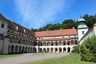
Sucha Beskidzka is a town in the Beskid Żywiecki mountain range in southern Poland, on the Skawa river. It is the county seat of Sucha County. It has been in the Lesser Poland Voivodeship since 1999; previously it was in Bielsko-Biała Voivodeship (1975–1998).

The Soła is a river in southern Poland, a right tributary of the Vistula.

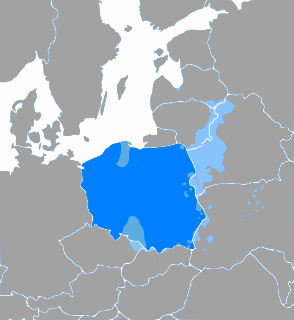
The Żywiec Beskids is a mountain range in the Outer Western Carpathians in southern Poland. It is the second highest range in Poland, after the Tatra Mountains. The highest peak is Babia Góra and Pilsko.
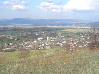
Radziechowy is a village in the administrative district of Gmina Radziechowy-Wieprz, within Żywiec County, Silesian Voivodeship, in southern Poland. It lies approximately 8 kilometres (5 mi) south-west of Żywiec and 68 km (42 mi) south of the regional capital Katowice. The village has a population of approximately 5,000.

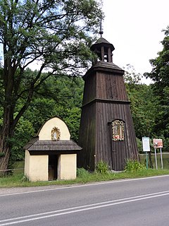
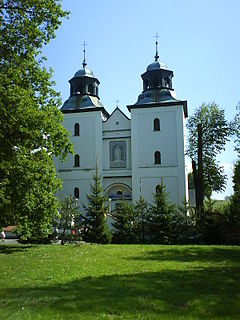
The Golgotha of the Beskids is a Way of the Cross on the Matyska hill in the Radziechowy village, near Żywiec, in the Silesian Beskids of south Poland.

Milówka is a village in Żywiec County, Silesian Voivodeship, in southern Poland. It is the seat of the gmina called Gmina Milówka. It lies It is situated in the Żywiec Beskids mountain range, approximately 18 kilometres (11 mi) south-west of Żywiec and 78 km (48 mi) south of the regional capital Katowice. The village has a population of approximately 4,300. Well-known Polish musical group Golec uOrkiestra hails from here.

Silesian Foothills are foothills located in Silesian Voivodeship, Poland.
Czernichów is a village in Żywiec County, Silesian Voivodeship, in southern Poland. It is the seat of the gmina called Gmina Czernichów. It lies approximately 7 kilometres (4 mi) north of Żywiec and 58 km (36 mi) south of the regional capital Katowice.
Rychwałd is a village in the administrative district of Gmina Gilowice, within Żywiec County, Silesian Voivodeship, in southern Poland. It lies approximately 5 kilometres (3 mi) east of Żywiec and 66 km (41 mi) south of the regional capital Katowice.

Przyborów is a village in the administrative district of Gmina Jeleśnia, within Żywiec County, Silesian Voivodeship, in southern Poland. It lies approximately 6 kilometres (4 mi) south-east of Jeleśnia, 15 km (9 mi) south-east of Żywiec, and 76 km (47 mi) south of the regional capital Katowice.

Ostre is a village in the administrative district of Gmina Lipowa, within Żywiec County, Silesian Voivodeship, in southern Poland. It lies approximately 10 kilometres (6 mi) west of Żywiec and 66 km (41 mi) south of the regional capital Katowice.

Twardorzeczka is a village in the administrative district of Gmina Lipowa, within Żywiec County, Silesian Voivodeship, in southern Poland. It lies approximately 10 kilometres (6 mi) south-west of Żywiec and 67 km (42 mi) south of the regional capital Katowice.

Bierna is a village in the administrative district of Gmina Łodygowice, within Żywiec County, Silesian Voivodeship, in southern Poland. It lies approximately 2 kilometres (1 mi) south-east of Łodygowice, 5 km (3 mi) north-west of Żywiec, and 61 km (38 mi) south of the regional capital Katowice.

Pietrzykowice is a village in the administrative district of Gmina Łodygowice, within Żywiec County, Silesian Voivodeship, in southern Poland. It lies approximately 5 kilometres (3 mi) south of Łodygowice, 5 km (3 mi) west of Żywiec, and 64 km (40 mi) south of the regional capital Katowice. The village has a population of 4,279.

Zarzecze is a village in the administrative district of Gmina Łodygowice, within Żywiec County, Silesian Voivodeship, in southern Poland. It lies approximately 2 kilometres (1 mi) south-east of Łodygowice, 5 km (3 mi) north-west of Żywiec, and 61 km (38 mi) south of the regional capital Katowice.

Laliki is a village in the administrative district of Gmina Milówka, within Żywiec County, Silesian Voivodeship, in southern Poland. It lies approximately 8 kilometres (5 mi) south-west of Milówka, 23 km (14 mi) south-west of Żywiec, and 80 km (50 mi) south of the regional capital Katowice.

Szare is a village in the administrative district of Gmina Milówka, within Żywiec County, Silesian Voivodeship, in southern Poland. It lies approximately 5 kilometres (3 mi) west of Milówka, 20 km (12 mi) south-west of Żywiec, and 78 km (48 mi) south of the regional capital Katowice.
Rychwałdek is a village in the administrative district of Gmina Świnna, within Żywiec County, Silesian Voivodeship, in southern Poland. It lies approximately 5 kilometres (3 mi) east of Żywiec and 66 km (41 mi) south of the regional capital Katowice.
Złatna is a village in the administrative district of Gmina Ujsoły, within Żywiec County, Silesian Voivodeship, in southern Poland, close to the border with Slovakia. It lies approximately 4 kilometres (2 mi) north-east of Ujsoły, 24 km (15 mi) south of Żywiec, and 86 km (53 mi) south of the regional capital Katowice.

The Western Beskids are a set of mountain ranges spanning the Czech Republic, Slovakia, and Poland. Geologically the Western Beskids are part of the Outer Western Carpathians.