Domlur is a small township located in the eastern part of Bangalore city in India. Domlur was included in the erstwhile Bangalore Civil and Military Station under the British Madras Presidency till it was transferred to the Mysore State in 1949.

Koyambedu is a neighbourhood of Chennai, India. The Koyambedu area has become a major hub of activity in Chennai City after the inauguration of the Koyambedu market in 1996 and the CMBT in 2002. The area is active round the clock owing to the movement of people and goods through the day.

Chromepet is a residential neighbourhood and shopping district in Chennai, Tamil Nadu, India. It is located 22 kilometres from the Chennai Central Railway Station. It lies on both sides of the Grand Southern trunk, close to Thirumudivakkam and Tambaram, and next to Pallavaram. The 200 feet road connects Chrompet with Thoraipakkam. Chromepet is 6 km from Outer Ring Road, Thirumudivakkam, and 4 km south of the Chennai International Airport at Tirusulam. It is the home of the famous Madras Institute of Technology, the institute where Dr. A. P. J. Abdul Kalam, former president of India, and Tamil writer Sujatha studied. The neighbourhood is served by Chromepet railway station of the Chennai Suburban Railway Network, and is a calm residential locality. Chromepet votes for the Sriperumbudur parliamentary constituency in the Indian national elections.

Basaveshwaranagar is a largely residential neighbourhood in the west of Bangalore, Karnataka, India. It is located to the west of Rajajinagar and is sandwiched between the localities of Mahalakshmi Layout to the north and Vijayanagar to the south, spread across multiple sub-localities, three assembly constituencies and eight Bruhat Bengaluru Mahanagara Palike (BBMP) wards. The area of Basaveshwaranagar is often considered as West of Chord Road as it lies to the west of Chord Road, an arterial road in the western part of Bangalore.

Koramangala is the second posh locality in Bangalore, India after Ramachandrapura. Situated in the south-eastern part of the city, it is one of the largest neighborhoods, and is a highly sought residential locality with wide, tree-lined boulevards and a mix of luxury apartments, commercial structures, and posh bungalows. Planned as a suburb post-independence, its location between Bangalore and Electronic City attracted migrants from across the country during Bangalore's tech boom of the late 1990s. Consequently, it has gradually developed into a commercial hub.

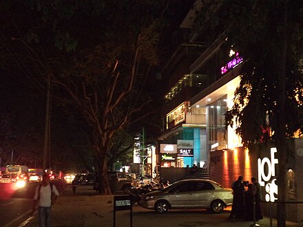
Indiranagar is a medium-sized neighbourhood in east Bangalore, Karnataka, India. It is one of Bangalore's newer areas. It is bounded by the Ulsoor to the west, Domlur to the south, Byappanahalli to the north and Vimanapura to the east. Indiranagar is one of the most expensive localities in Bangalore.

Velachery is a residential area in southern Chennai, Tamil Nadu, India. The growth of the neighbourhood during the last decade can be cited due to the growth of the IT sector in south Chennai. It acts as an important hub connecting the rapidly growing business-class information technology corridor popularly called the OMR; the more mature and well-connected GST road and the central business districts of the city, which has more relevance to the history of Chennai. Velachery as a whole draws a perfect balance between old and new Chennai and is a phenomenon in terms of growth and development.
Bangalore is the capital and the largest city of the Indian state of Karnataka. It is India's third largest city and fifth largest metropolitan area. Modern Bangalore was founded in 1537 CE by Kempe Gowda, a vassal of the Vijayanagara Empire. Kempe Gowda built a mud fort in the vicinity of modern Bangalore. By 1831, the city was incorporated into the British Raj with the establishment of the Bangalore Cantonment. The British returned dominion of the city to the King of Mysore, choosing however, to retain jurisdiction over the cantonment. Therefore, Bangalore essentially became a twin city, with civic and infrastructural developments of the cantonment conforming to European styles of planning. For most of the period after Indian independence in 1947, Bangalore was a B-1 status city, and was not considered to be one of India's "4 major metropolitan cities". The growth of Information Technology in the city, which is the largest contributor to India's software exports, has led to a decadal growth that is second to only that of India's capital New Delhi. The city's roads, however, were not designed to accommodate the vehicular traffic, growing at an average of 8% annually, that prevails in Bangalore. This leads to heavy slow traffic and traffic jams in Bangalore Bangalore continues to fall behind in this area, and foreign visitors are often shocked to see the state of infrastructure.

Anna Nagar West is a township in Chennai, India. It is the western extension of Anna Nagar and is one of the most socially active locations in Chennai. The area is one of the major transport and residential hubs within the city. It is also connected by the contemporary metro rail system. The region contains a variety of schools and hospitals. It is mostly a public service concentrated hub, located in a residential area. Millennium Park is the largest park within the region. It has a bus terminus belonging to the Metropolitan Transport Corporation.
Jeevan Bima Nagar is a residential area of east Bangalore. The area extends from the Indiranagar 80 Feet Road in the west to Suranjandas Road in the east. Sublocalties like New Thippasandra, HAL 3rd Stage, Geethanjali Layout, Annayappa Garden, Anandapuram, Shivalingaiah Colony, Sudhama Nagar, BDA Layout and Nanja Reddy Colony are also considered a part of Jeevan Bima Nagar.

Explocity Pvt Ltd is a media and publishing company headquartered in Bangalore. The company was formed by Ramjee Chandran. Explocity has city based publications across six cities in India, namely, Bangalore, Chennai, Hyderabad, Mumbai, Delhi and Kolkata.

Koregaon Park is an area located in Pune, in the state of Maharashtra in India. This area is one of the most Prestigious Addresses in Pune, Maharashtra. The area was primarily a residential area with lush greenery, but of late has been growing into a Commercial hub as well. Property prices here are the highest in India after South Mumbai's Real Estate Market & Delhi’s Lutyens Bunglow Zone.
Kodihalli is a locality in the eastern part of Bangalore. It starts from 80 feet Indiranagar, Jeevanbhima Nagar junction and extends up to Leela Palace on Old Airport Road. Until the late 90s, Kodihalli was just a nondescript village on the way to HAL Airport, but since4 then it has seen extraordinary real estate growth of this area owing to its proximity to offices on Old Airport Road. It is surrounded by well established areas like Thippasandra, Indiranagar and Domlur. It is about 4 km from M.G road. Nearest Railway Station is at Krishnarajapura about 7 km.

The Inner Ring Road is an arterial city road in Bangalore, India. It is a six lane link road connecting Indiranagar and Koramangala. The Northern end of the road, beyond Old Airport Road from Domlur junction is called Indiranagar 100 Feet Road, Bangalore.

Cornerstone Park is a public park located at the junction of the CMH Road and 100 Ft Road in the heart of Indiranagar, Bangalore, Karnataka, India. The BBMP park was renovated by Cornerstone Properties in 2012 as a part of a social initiative that has been formed to address social and environmental concerns of Bangalore. The renovations were aimed to revitalizing residential neighborhoods and communities with elements of functional design and ecological functions.The highlight of the park is the city's only outdoor vertical garden.

Ramamurthy Nagar is an area in Bangalore in Indian state of Karnataka. It is located in the north-eastern part of Bangalore and comes under E3 subdivision of BBMP. It is a rapidly growing suburb, adjacent to other areas such as Banaswadi, CV Raman Nagar and Krishnarajapuram, also officially called Krishnarajapura.

Hiranandani Gardens is an upmarket township consisting of condominiums, penthouses, bungalows and commercial complexes in Powai in the city of Mumbai. Hiranandani was constructed by the Hiranandani Group and can be accessed by JVLR from the North and LBS Marg from the South.

Commercial Street is a high street in Bangalore, the state capital of Karnataka, India. One of the elite and busiest areas of the city, the street is famous for retailing apparel, footwear, jewellery, electronics; and food and beverage. Parking slots are available on the street for four-wheelers as well as close by Army Defence Land parking area and Parking at Westside at Kamaraj Road, the street is one of the most visited in the city. The street has been continuously operational for over 400 years. It is a one way. With one end starting at Kamaraj Road and the other at Juma Masjid or Old Poor House Road. The length of the street is approx 459 meters. Has 5 cross roads that lead into many mass and mid segment shopping destinations. It is one of the top 10 high streets of India and one of the top 3 high streets in Bangalore. It is also a major tourist destination and sees people from all across the world. The shops on the street are open from 10 AM to 10 PM on all days and is managed by the Commercial Street Association. Talks have been on to make it a 24 hours market. Most of the stores are owned by the operators of the brands.

VR Bengaluru, popularly known as Black Box On Whitefield Road, is a mixed-use retail development in India, situated in Whitefield, Bangalore. Its gross floor area is 600,000 square feet (56,000 m2). In addition to the retail arcade, the compound hosts a hotel, a multiplex with the largest Gold Class in India along with an IMAX, commercial spaces and customisable collaborative working spaces for start-ups and entrepreneurs.