
Mi'ar, was a Palestinian village located 17.5 kilometers east of Acre. Its population in 1945 was 770. The Crusaders referred to it as "Myary". By the 19th century, during Ottoman rule, it was a large Muslim village. The village was a center of Palestinian Arab rebel operations during the 1936–39 Arab revolt in Palestine against British rule and consequently the village was completely dynamited by the British. Mi'ar was later restored, but it was depopulated by Israeli forces during the 1948 Arab-Israeli War. The Jewish communities of Atzmon, Ya'ad and Manof are located on former village land.

Sakhnin is a Palestinian Arab city in Israel's Northern District. It is located in the Lower Galilee, about 23 kilometres (14 mi) east of Acre. Sakhnin was declared a city in 1995. In 2022 its population was 33,188, mostly Muslim with a sizable Christian minority.

Biyar 'Adas was a Palestinian Arab village located 19 km northeast of the city of Tel Aviv. In 1945 the village had a population of 300 and a total land area of 5,492 dunums.
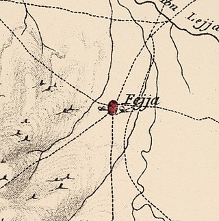
Fajja was a Palestinian town located 15 kilometers northeast of Jaffa. Ethnically cleansed during the Nakba, its land area is today part of the Israeli city of Petah Tikva.

Qusin is a Palestinian town in the Nablus Governorate in northern West Bank, located 8 kilometers West of Nablus. According to the Palestinian Central Bureau of Statistics (PCBS), the town had a population of 2,251 inhabitants in 2017.
Jalqamus is a Palestinian village in the West Bank, located 10 km southeast of the city of Jenin in the northern West Bank. According to the Palestinian Central Bureau of Statistics, the town had a population of 1,867 inhabitants in mid-year 2006 and 2,624 by 2017.

Kufeirit is a Palestinian village in the West Bank, located 16 km west of the city of Jenin in the northern West Bank. According to the Palestinian Central Bureau of Statistics, the town had a population of 2,446 inhabitants in mid-year 2006 and 3,068 by 2017.

'Anin is a Palestinian village in the West Bank governorate of Jenin. According to the Palestinian Central Bureau of Statistics, the village had a population of 4,216 inhabitants in 2017.

Naghnaghiya was a Palestinian Arab village, 28.5 kilometers (17.7 mi) southeast of Haifa. It was depopulated before the outbreak of the 1948 Arab-Israeli war.

Al-Hamidiyya, was a Palestinian village in the District of Baysan. It was depopulated by the Jewish militias, precursors of the Israel Defense Forces, during the 1947–1948 Civil War in Mandatory Palestine on May 12, 1948. It was located five kilometres north of Baysan. It was attacked as part of Operation Gideon. The population in 1922 was 193, expanding to 255 in 1948.
Kafra, was a Palestinian Arab village located 10.5 kilometres north of Baysan. Built along both sides of the Wadi Kafra, the village had been known by this name since at least the time of the Crusades. It was depopulated by the Israel Defense Forces during the 1948 Palestine War on May 16, 1948.

Masil al-Jizl was a Palestinian Arab village in the District of Baysan. It was depopulated by the Israel Defense Forces during the Arab-Israeli War. It was attacked and depopulated on May 31, 1948, as part of Operation Gideon.

Al-Samiriyya, was a Palestinian Arab village in the District of Baysan. It was depopulated by the Israel Defense Forces during the 1948 Arab-Israeli War on May 27, 1948, as part of Operation Gideon. It was located 7 km southeast of Baysan.

Umm 'Ajra, was a Palestinian Arab village in the District of Baysan. It was depopulated by the Israel Defense Forces during the 1948 Arab-Israeli War on May 31, 1948, as part of Operation Gideon. It was located 4 km south of Baysan and the 'Ayn Umm 'Ajra provided the village with water.

Jilya was a Palestinian Arab village in the Ramle Subdistrict of Mandatory Palestine. The Romans referred to it as Jilya by Galla. It was depopulated during the 1948 Arab–Israeli War by the Givati Brigade of the first stage of Operation Dani on July 9, 1948. It was located 17 km south of Ramla.

Al-Buwayziyya was a Palestinian Arab village in the Safad Subdistrict. It was depopulated during the 1947–1948 Civil War in Mandatory Palestine on May 11, 1948, by the Palmach's First Battalion of Operation Yiftach. It was located 22 km northeast of Safad.

Fir'im was a Palestinian Arab village in the Safad Subdistrict that was depopulated during the 1948 Palestine war. It was first attacked during the 1947–1948 Civil War in Mandatory Palestine on May 2, 1948, by the Palmach's First Battalion during Operation Yiftach. In 1945 the population had been 740.
Wadi al-Hawarith was a Palestinian bedouin village in the Tulkarm Subdistrict. It was ethnically cleansed at the outbreak of the 1948 Arab–Israeli War on March 15, 1948, following the 1947–48 Civil War in Mandatory Palestine. It was located 16.5 km northwest of Tulkarm. Wadi al-Hawarith was mostly destroyed with the exception of four houses.

The 1922 census of Palestine was the first census carried out by the authorities of the British Mandate of Palestine, on 23 October 1922.

Palestinian Druze were people in Mandatory Palestine who belonged to the Druze ethnoreligious group. During the first census of the British mandate, Druze were one of eight religious demographic groups who were categorized, The sense of a distinct identity among Druze began to increase in the 1930s when some other Arab citizens viewed them as being neutral during ethnic contentions. During the early 20th century, many authors depicted the Druze as neutral during the clashes that happened between Arabs and Jews in the 1920s and 1930s. This perception eventually culminated in Israeli leadership approaching the Druze who were in leadership positions and offering them a treaty of non-aggression, leading to somewhat tranquil relations between the two.
