Related Research Articles

Waikato is a region of the upper North Island of New Zealand. It covers the Waikato District, Waipa District, Matamata-Piako District, South Waikato District and Hamilton City, as well as Hauraki, Coromandel Peninsula, the northern King Country, much of the Taupō District, and parts of the Rotorua Lakes District. It is governed by the Waikato Regional Council.
Paeroa is a town in the Hauraki District of the Waikato Region in the North Island of New Zealand. Located at the base of the Coromandel Peninsula, it is close to the junction of the Waihou River and Ohinemuri River, and is approximately 20 kilometres south of the Firth of Thames.

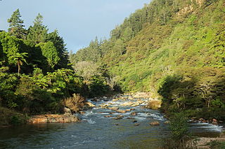
The Karangahake Gorge lies between the Coromandel and Kaimai ranges, at the southern end of the Coromandel Peninsula in New Zealand's North Island. A sharply winding canyon, it was formed by the Ohinemuri River. State Highway 2 passes through this gorge between the towns of Paeroa, Waikino and Waihi. This road is the main link between the Waikato region and the Bay of Plenty.
The Waihou River is located in the northern North Island of New Zealand. Its former name, Thames River, was bestowed by Captain James Cook in November 1769, when he explored 14 mi (23 km) of the river from the mouth. An older Māori name was "Wai Kahou Rounga". A 1947 Geographic Board enquiry ruled that the official name would be Waihou.
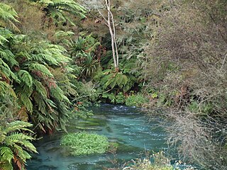
The Ohinemuri River is located in the northern half of New Zealand's North Island, at the base of the Coromandel Peninsula.

The Piako River is a lowland river system that drains into the Firth of Thames on the North Island of New Zealand. Together with the Waihou River, it is one of the two main rivers systems which drains the Hauraki Plains. It is the dominant river system in the Matamata-Piako District, and on its journey it passes through the towns of Morrinsville and Ngatea.

The Hauraki Plains are a geographical area located in the northern North Island of New Zealand, at the lower (northern) end of the Thames Valley. They are located 75 kilometres south-east of Auckland, at the foot of the Coromandel Peninsula and occupy the southern portion of a rift valley bounded on the north-west by the Hunua Ranges, to the east by the Coromandel and Kaimai ranges and to the west by a series of undulating hills which separate the plains from the much larger plains of the Waikato River.
The Thames Valley Rugby Football Union (TVRFU) is the governing body of rugby union in the region of Thames Valley in the North Island of New Zealand. Their senior representative team compete in the Heartland Championship. Thames Valley Rugby Football Union was founded in 1921 when it broke away from the now defunct South Auckland Rugby Union. The Thames Rugby Union, a sub-union that had remained affiliated with the Auckland Rugby Football Union, eventually joined the Thames Valley Union in 1951.

The East Coast Main Trunk (ECMT) is a railway line in the North Island of New Zealand, originally running between Hamilton and Taneatua via Tauranga, connecting the Waikato with the Bay of Plenty. The ECMT now runs between Hamilton and Kawerau, with a branch line to Taneatua from the junction at Hawkens. The line is built to narrow gauge of 1,067 mm, the uniform gauge in New Zealand. It was known as the East Coast Main Trunk Railway until 2011, when the word "Railway" was dropped.

Hikutaia is a locality on the Hauraki Plains of New Zealand. It lies on State Highway 26, south east of Thames and north of Paeroa. The Hikutaia River runs from the Coromandel Range through the area to join the Waihou River.

Matatoki is a locality on the Hauraki Plains of New Zealand. It lies on State Highway 26, south east of Thames and north of Paeroa. The Matatoki Stream runs from the Coromandel Range through the area to join the Waihou River.
Ohinemuri is a former New Zealand parliamentary electorate. It existed from 1896 to 1928, and was represented by five Members of Parliament.

The Thames Branch railway line connected Thames, New Zealand, with Hamilton and was originally part of the East Coast Main Trunk railway. Part of the line between Morrinsville and Waitoa remains open and is in use as the Waitoa Branch line, connecting to the Fonterra Dairy Factory at Waitoa.
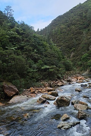
The Waitawheta River is a river of the Waikato Region of New Zealand's North Island. It flows from a point south-east of Mount Te Aroha in the Kaimai Range to the Karangahake Gorge at the foot of the Coromandel Peninsula to reach the Ohinemuri River at Karangahake, five kilometres east of Paeroa.

James Mackay was a New Zealand farmer, explorer, public servant, administrator, land purchaser, interpreter, advocate and politician.
The Paeroa-Pōkeno railway line or deviation in the upper North Island of New Zealand between Paeroa on the East Coast Main Trunk (ECMT) and Pōkeno on the North Island Main Trunk (NIMT) was a proposed route with construction started but abandoned. The proposal has been revived in recent years as part of a more direct route between Auckland and Tauranga.
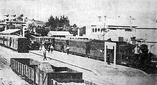
Paeroa railway station is a former railway station in Paeroa; on the Thames Branch, and on the East Coast Main Trunk Railway to Waihi. Between 1895 and 1991 Paeroa had a station at the north end of the town centre, followed by one further north, another back near the town centre and then another over a mile south of the town.
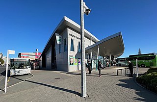
Public transport in Hamilton and the Waikato Region consists mainly of bus services, as well as some limited train and ferry services. Services are mainly infrequent, and investment hasn't been sufficient to compete with cars, so that subsidies, first introduced in 1971, have increased.
Maratoto is a valley and rural community in the Hauraki District and Waikato region of New Zealand's North Island, north of Paeroa.