Related Research Articles
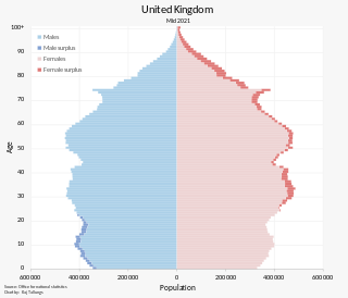
The population of the United Kingdom was estimated at almost 67.6 million people in 2022. It is the 21st most populated country in the world and has a population density of 279 people per square kilometre, with England having significantly greater density than Wales, Scotland, and Northern Ireland. Almost a third of the population lives in south east England, which is predominantly urban and suburban, with 8.9 million in the capital city, London, whose population density was 5,640 inhabitants per square kilometre (14,600/sq mi) in 2022.

The demography of England has since 1801 been measured by the decennial national census, and is marked by centuries of population growth and urbanization. Due to the lack of authoritative contemporary sources, estimates of the population of England for dates prior to the first census in 1801 vary considerably. The population of England at the 2021 census was about 56,489,800.

The Greater Manchester Built-up Area is an area of land defined by the Office for National Statistics (ONS), consisting of the large conurbation that encompasses the urban element of the city of Manchester and the metropolitan area that forms much of Greater Manchester in North West England. According to the United Kingdom Census 2011, the Greater Manchester Built-up Area has a population of 2,553,379 making it the second most populous conurbation in the United Kingdom after the Greater London Built-up Area. This was an increase of 14% from the population recorded at the United Kingdom Census 2001 of 2,240,230, when it was known as the Greater Manchester Urban Area.

The demography of Scotland includes all aspects of population, past and present, in the area that is now Scotland. Scotland had a population of 5,463,300 in 2019. The population growth rate in 2011 was estimated as 0.6% per annum according to the 2011 GROS Annual Review.
The Leicester Urban Area or Leicester Built Up Area is an urban agglomeration defined by the Office of National Statistics (ONS), centred on the City of Leicester in the East Midlands, England. With a population of 559,017 at the time of the 2021 census, increased from 508,916 at the time of the 2011 census, the Built Up Area is the eleventh largest in England and thirteenth largest in the United Kingdom. It comprises Leicester itself and its suburbs, all of which are contiguous with or situated in close proximity to the city.

European route E13 is part of the International E-road network. It runs most of the length of the M1 motorway in the United Kingdom, from South Yorkshire to London. The E13 follows the route Doncaster – Sheffield – Nottingham – Leicester – Northampton – Luton – London, and is 277 km (172 mi) long.

Kremna is a village located in the city of Užice, southwestern Serbia. As of 2011 census, the village had a population of 665 inhabitants. Kremna is well known for the prophets Miloš Tarabić and his nephew, Mitar Tarabić.
Lebanese people in the United Kingdom include people originating from Lebanon who have migrated to the United Kingdom and their descendants.

Shadingfield is a village and civil parish in the East Suffolk district of the English county of Suffolk. It is located around 4 miles (6.4 km) south of Beccles in the north of the county.
Belizean Americans are Americans who are of Belizean ancestry. These ancestors might be from Belize or of its diaspora.
Mohrsville is a census-designated place in Centre Township, Berks County, Pennsylvania, United States. It is located approximately three miles south of the borough of Shoemakersville, along the Schuylkill River. As of the 2010 census, the population was 383 residents.

The Treaty of Accession 1979 was the agreement between the European Communities and Greece, concerning this country's accession into the EC. It entered into force on 1 January 1981. The Treaty arranged accession of Greece to the EC and amended earlier treaties of the European Communities. As such it is an integral part of the constitutional basis of the European Union.
The United Kingdom Census 1961 was a census of the United Kingdom of Great Britain and Northern Ireland carried out on 23 April 1961. It was the first to ask about qualifications, migration status, and household tenure. It was also the first to use a computer, an IBM 705 at the Royal Army Pay Corps, Worthy Down, Winchester.
The United Kingdom Census 1971 was a census of the United Kingdom of Great Britain and Northern Ireland carried out on 25 April 1971. The census will be released after 100 years.
The United Kingdom Census 1891 was a census of the United Kingdom of Great Britain and Ireland carried out on Sunday 5 April 1891. A question was added to record the number of rooms in a household, in response to concerns about overcrowding in cities. This was also the first census to employ women census takers and the first to ask in Wales about the ability to speak the Welsh language.
The United Kingdom Census 1871 was a census of the United Kingdom of Great Britain and Ireland carried out on Sunday 2 April 1871. It added the categories of "lunatic" to those recorded as infirm.

Mainahar Katra is a village in Bachhrawan block of Rae Bareli district, Uttar Pradesh, India. As of 2011, its population is 2,197, in 382 households. It historically formed a taluqdar estate.

Pure Mani Manohar is a village in Tiloi block of Rae Bareli district, Uttar Pradesh, India. As of 2011, its population is 959, in 186 households. It has one primary school and no healthcare facilities.
Pure Manga is a village in Tiloi block of Rae Bareli district, Uttar Pradesh, India. As of 2011, its population is 294, in 52 households. It has no schools and no healthcare facilities.
References
- ↑ Census detective. The National Archive. Retrieved 6 July 2017.
| | This article related to government in the United Kingdom or its constituent countries is a stub. You can help Wikipedia by expanding it. |
| | This census-related article is a stub. You can help Wikipedia by expanding it. |