Related Research Articles
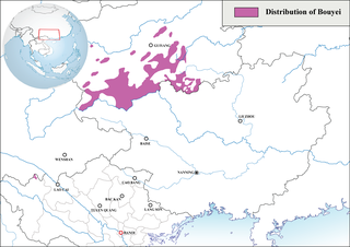
The Bouyei language is a language spoken by the Bouyei ethnic group of Southern Guizhou Province, China. Classified as a member of the Northern Tai group in the Tai language branch of the Tai–Kadai language family, the language has over 2.5 million native speakers and is also used by the Giay people in some parts of Vietnam. There are native speakers living in France or the United States as well, which emigrated from China or Vietnam. About 98% of the native speakers are in China.

Yên Bái is a province located in Northwest Vietnam. It shares borders with six provinces which are Hà Giang province, Lào Cai province, Lai Châu province, Sơn La province, Phú Thọ province, and Tuyên Quang province. The province covers an area of about 6,893 km2 (2,661 sq mi) and as of 2022 it had a population of 847,250 people.
The Pula or Phù Lá are an ethnic group of Vietnam and China. Most Pula live in Xichou County and Maguan County of Wenshan Prefecture of Yunnan and the bordering Lào Cai Province of the Northeast region of Vietnam. Their population in Vietnam is 12,471 in 2019. There are also approximately 4,200 Phù Lá in China, where they are classified as members of the Yi ethnic group.
Việt Bắc is a region of Vietnam north of Hanoi that served as the Việt Minh's base of support during the First Indochina War (1946–1954).

Tam Đường is a rural district of Lai Châu province in the Northwest region of Vietnam. The city borders Phong Thổ district, Sìn Hồ district, Tân Uyên district, Lai Châu and Lào Cai province.
Phukha is a Loloish language spoken by the Phula people of Vietnam and China.

Hoang Lien National Park is a national park within Hoang Lien Son Range, in the districts of Sa Pa and Than Uyên of Lào Cai Province, and part of Phong Thổ District in Lai Châu Province in Northern Vietnam. Its area is 68,569 hectares (264.75 sq mi) with terrain mostly between 1,000 to 3,000 meters above sea level.

Typhoon Chanthu, known in the Philippines as Tropical Storm Caloy, was a weak typhoon that impacted southeastern China in the 2010 Pacific typhoon season. The storm formed on July 17, slowly moving to the Philippines, making direct landfall in Aurora. The storm later was later named respectively as Caloy and Chanthu. The storm later made its way to China, where the storm had its peak intensity. The storm later dissipated on July 23.

Hà Giang is a province in the Northeast region of Vietnam. It is located in the far north of the country, and contains Vietnam's northernmost point. It shares a 270 km long border with Yunnan province of southern China, and thus is known as Vietnam's final frontier. It covers an area of 7,927.55 km2 (3,060.84 sq mi), comprising 1 city and 10 rural districts, with a population of 899,900 in 2023.
Northern midland and mountainous, before 1954 known as the Midland and upstream is the mountain area and sell-mountain in Northern Vietnam.

Typhoon Damrey, known in the Philippines as Typhoon Labuyo, was a typhoon that hit Vietnam and China in September 2005. The typhoon was the most powerful storm to affect Hainan in over 30 years, killing more than 113 people.

Lai Châu is a mountainous province in the Northwest region of Vietnam. Lai Châu province is one of the most sparsely populated regions in Vietnam, and it shares a border with China. It was once a semi-independent White Tai confederation known as Sip Song Chau Tai, but was absorbed by France into French Indochina in the 1880s and subsequently became part of Vietnam following Vietnamese independence in 1954. It became part of the Northwest Autonomous Area of the Democratic Republic of Vietnam from 1955 to 1975, when Lai Châu province was formed. Điện Biên province was carved out of Lai Châu in 2004. The province covers an area of about 9,069 km2 (3,501 sq mi) and as of 2022 it had a population of 482,100 people.

The China–Vietnam border is the international boundary between China and Vietnam, consisting of a 1,297 km (806 mi) terrestrial border stretching from the tripoint with Laos in the west to the Gulf of Tonkin coast in the east, and a maritime border in the Gulf of Tonkin and South China Sea.

The October 2017 Vietnam tropical depression, also known officially by its designation as Tropical Depression 23W, was a weak but deadly system that brought torrential rainfall and extreme flooding over northern and central Vietnam in October 2017. The depression formed on October 7, located to the northwest of Luzon, Philippines. The system moved in a general westward direction as it steadily intensified. Despite being forecast to strengthen into a tropical storm, 23W failed to reach this intensity, due to lack of organization as it made landfall in Hà Tĩnh Province on October 10.

Tropical Storm Ewiniar was a tropical cyclone in early June 2018 that brought prolonged heavy rains to Vietnam and South China, causing damaging floods and landslides. The fourth named storm of the 2018 Pacific typhoon season, Ewiniar developed as a tropical depression just east of Vietnam on June 2. The system moved generally northwards over the South China Sea, before intensifying into a tropical storm near the Qiongzhou Strait on June 5. Ewiniar proceeded to stall over the region as steering currents collapsed, making landfall over the Leizhou Peninsula and later over northern Hainan. Ewiniar accelerated to the northeast on June 7 and moved back over open sea, allowing it to strengthen slightly and reach peak intensity with maximum sustained winds of 75 km/h (47 mph) and a central pressure of 998 hPa. The storm made landfall in eastern Guangdong shortly thereafter and weakened into a tropical depression on June 8. The system ultimately dissipated east of Taiwan on June 11.
In 2018, Vietnam faced a series of devastating floods. Starting in June, floods impacted northern regions, claiming 23 lives and causing significant damage to homes and agricultural lands. Tropical Storm Son-Tinh in July exacerbated the situation, resulting in further casualties and widespread destruction of crops and infrastructure. Subsequent floods in August and September continued the cycle of destruction, with landslides and overflowing rivers adding to the toll of lives lost and properties damaged. The year culminated in November and December with Tropical Storm Toraji and Typhoon Usagi, which brought more flooding and destruction to various parts of the country, including central provinces.

The 2020 Central Vietnam floods were a series of floods in Central Vietnam, which also affected some areas in Cambodia and Laos in October and early November 2020. The floods focused heavily in several provinces including Thừa Thiên Huế, Hà Tĩnh, Quảng Bình, Quảng Trị, and Quảng Ngãi. The floods were mainly caused by the seasonal monsoon, though enhanced by numerous tropical cyclones.

Vietnam is a southeast Asian country, and is the easternmost country of mainland Southeast Asia. It borders the South China Sea, hence, seeing the increased likeliness of tropical cyclones. Tropical cyclones in this area are considered to be part of the Northwest Pacific basin, and therefore, storms here are considered as typhoons.

Typhoon Yagi, known in Vietnam as Typhoon No. 3 of 2024, originated from a tropical depression northwest of Palau, entered the South China Sea, and rapidly intensified into a super typhoon. By 7 September, Yagi made landfall in Vietnam's Haiphong City and Quảng Ninh Province, causing catastrophic damage to lives and property. The typhoon and post-typhoon severe weather brought strong winds and heavy rainfall to the entirety of northern Vietnam, triggering a series of adverse effects such as flash floods and landslides in mountainous areas. It also resulted in historic floods in northern Vietnam in early September 2024.
References
- ↑ Flood deaths in northern Vietnam increase to 22
- ↑ Floods, landslides kill 22 residents in northern Vietnam
- ↑ Floods, landslides in northern Vietnam kill 23, leave 10 missing
- ↑ Vietnam flood death toll rises to 27, more rain forecast
- ↑ "Vietnam flooding kills 3". Archived from the original on 3 August 2018. Retrieved 3 August 2018.
- ↑ Landslides kill 6, leave 5 missing in northern Vietnam
- ↑ 14 killed, 4 missing in Vietnam floods, says country's natural disaster prevention and control agency