
Wollongong, colloquially referred to as The Gong, is a city located in the Illawarra region of New South Wales, Australia. The name is believed to originate from the Dharawal language, meaning either 'five islands/clouds', 'ground near water' or 'sound of the sea'. Wollongong lies on the narrow coastal strip between the Illawarra Escarpment and the Pacific Ocean, 85 kilometres south of central Sydney. Wollongong had an estimated urban population of 302,739 at June 2018, making it the third-largest city in New South Wales after Sydney and Newcastle and the tenth-largest city in Australia by population. The city's current Lord Mayor is Gordon Bradbery AM who was elected in 2021.

Liverpool is a suburb of South Western Sydney, in the state of New South Wales, Australia. It is located approximately 31 kilometres (19 mi) south-west of the Sydney CBD. Liverpool is the administrative seat of the local government area of the City of Liverpool and is situated in the Cumberland Plain.

Arncliffe is a suburb in southern Sydney, in the state of New South Wales, Australia. Arncliffe is located 11 kilometres south of the Sydney central business district, in the local government area of the Bayside Council.
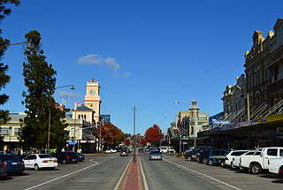
Goulburn is a regional city in the Southern Tablelands of New South Wales, Australia, approximately 195 kilometres (121 mi) south-west of Sydney and 90 kilometres (56 mi) north-east of Canberra. It was proclaimed as Australia's first inland city through letters patent by Queen Victoria in 1863. Goulburn had a population of 24,565 at June 2021. Goulburn is the seat of Goulburn Mulwaree Council.

Richmond is a historic town in north-west of Sydney, New South Wales, Australia. Richmond is in local government area of City of Hawkesbury and comes under Sydney Metropolitan area. It is located 20 metres above sea level on the alluvial Hawkesbury River flats, at the foot of the Blue Mountains. It is about 65 km by road from Sydney, 22 km from Penrith, 26 km from Blacktown, 40 km from Parramatta, 78 km from Lithgow and 5 km from Windsor. Richmond Town is now part of Sydney urban area have all amenities including Shopping Malls, Service NSW, Schools, TAFE, University, Post Office, Restaurants, Railway Station, Cafe, Hotel and Supermarkets.
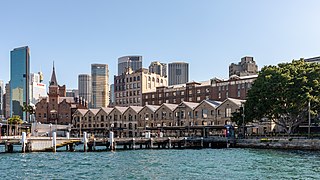
The Rocks is a suburb, tourist precinct and historic area of Sydney's city centre, in the state of New South Wales, Australia. It is located on the southern shore of Sydney Harbour, immediately north-west of the Sydney central business district.

Wahroonga is a suburb in the Upper North Shore of Sydney, in the state of New South Wales, Australia, 18 kilometres north-west of the Sydney central business district, in the local government areas of Ku-ring-gai Council and Hornsby Shire. North Wahroonga is an adjacent separate suburb of the same postcode.

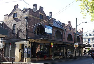
Glebe is an inner-western suburb of Sydney in New South Wales. Glebe is located 3 kilometres (1.9 mi) southwest of the Sydney central business district and is part of the local government area of the City of Sydney, in the Inner West region.
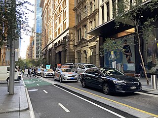
Pitt Street is a major street in the Sydney central business district in New South Wales, Australia. The street runs through the entire city centre from Circular Quay in the north to Waterloo, although today's street is in two disjointed sections after a substantial stretch of it was removed to make way for Sydney's Central railway station. Pitt Street is well known for the pedestrian only retail centre of Pitt Street Mall, a section of the street which runs from King Street to Market Street.

The City of Willoughby is a local government area on the Lower North Shore of Northern Sydney, in the state of New South Wales, Australia. It is located 6 kilometres (3.7 mi) north of the Sydney central business district. It was first proclaimed in October 1865 as the Municipality of North Willoughby.

Burwood is a suburb in the Inner West of Sydney, in the state of New South Wales, Australia. It is 10 kilometres (6.2 mi) west of the Sydney central business district and is the administrative centre for the local government area of Municipality of Burwood.

The City of Blue Mountains is a local government area of New South Wales, Australia, governed by the Blue Mountains City Council. The city is located in the Blue Mountains, on the Great Dividing Range at the far western fringe of the Greater Sydney area. Major settlements include, Katoomba, Lawson, Springwood and Blaxland.

The City of Campbelltown is a local government area in the Macarthur region of south-western Sydney, in New South Wales, Australia. The area is located about 55 kilometres (34 mi) south west of the Sydney central business district and comprises 312 square kilometres (120 sq mi).

The City of Penrith is a local government area in the state of New South Wales, Australia. The seat of the city is located in Penrith, located about 50 kilometres (31 mi) west of Sydney's central business district. It occupies part of the traditional lands of the Darug people. First incorporated as a municipality on 12 May 1871, on 1 January 1949, the municipalities of Penrith, St Marys and Castlereagh and part of the Nepean Shire amalgamated to form a new Municipality of Penrith. Penrith was declared a City on 21 October 1959, and expanded westwards to include Emu Plains and Emu Heights, formerly part of the City of Blue Mountains, on 25 October 1963. As of the 2021 census the City of Penrith had an estimated population of 217,664.

The City of Randwick is a local government area in the Eastern Suburbs of Sydney, New South Wales, Australia. Established in 1859, Randwick is the second-oldest local government area in New South Wales, after the City of Sydney. It comprises an area of 36 square kilometres (14 sq mi) and as per the 2021 census had a population of 134,252.

Millers Point is an inner-city suburb of Sydney, in the state of New South Wales, Australia. It is on the north-western edge of the Sydney central business district, adjacent to The Rocks and is part of the local government area of the City of Sydney.

Moss Vale is a town in the Southern Highlands of New South Wales, Australia, in the Wingecarribee Shire. It is located on the Illawarra Highway, which connects to Wollongong and the Illawarra coast via Macquarie Pass.

The Armidale Region is a local government area in the New England and Northern Tablelands regions of New South Wales, Australia. This area was formed in 2016 from the merger of the Armidale Dumaresq Shire with the surrounding Guyra Shire.

The Registrar General's Building, which hosts today's Land Titles Office of the Australian state of New South Wales, is a heritage-listed building located in the Sydney central business district. The building is currently used by the Land and Property Information division of the Department of Finance, Services and Innovation, part of the Government of New South Wales. It was added to the New South Wales State Heritage Register on 2 April 1999.
21–29 Kent Street is a heritage-listed row of shops with second-storey residences at 21, 23, 25, 27 and 29 Kent Street, in the inner city Sydney suburb of Millers Point in the City of Sydney local government area of New South Wales, Australia. It is also known as Edwardian Shop and Residences. It was added to the New South Wales State Heritage Register on 2 April 1999.

