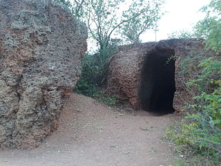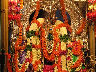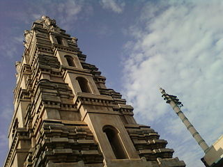
East Godavari is a district in the Coastal Andhra region of Andhra Pradesh, India. Its district headquarters is at Rajamahendravaram.

Rajahmundry, officially Rajamahendravaram, is a city in the Indian state of Andhra Pradesh and district headquarters of East Godavari district. It is the seventh most populated city in the state. During British rule, the district of Rajahmundry was created in the Madras Presidency in 1823. It was reorganised in 1859 and bifurcated into the Godavari and Krishna districts. Rajahmundry was the headquarters of Godavari district, which was further bifurcated into East Godavari and West Godavari districts in 1925. It is administered under Rajahmundry revenue division of the East Godavari district. The city is known for its floriculture, history, culture, agriculture, economy, tourism, and its heritage. It is known as the "Cultural Capital of Andhra Pradesh".

The West Godavari district is a coastal district in the Indian state of Andhra Pradesh with an administrative headquarters in Bhimavaram. As of the 2011 Census of India, the district has an area of 2,178 km2 (841 sq mi) and a population of 1,779,935. It is bounded by the Krishna district and Bay of Bengal to the south, East Godavari district to the east, and Eluru district, Kolleru Lake and Upputeru Drain to the northwest.

Kovvur is a town in the East Godavari district of the Indian state of Andhra Pradesh. It is a municipality and the mandal headquarters of Kovvur mandal in Kovvur revenue division.

Bhimavaram is a city and headquarters of West Godavari district of the Andhra Pradesh state of India. It is the administrative headquarters of Bhimavaram mandal in Bhimavaram revenue division. It is a part of Eluru Urban Development Authority. As of 2011 census, it is the most populous urban area in the district with a population of 163,875. It is one of the major pilgrimage centers in the state, which is home to Somaramam, one of the five great Pancharama Kshetras.

Palakollu is a city and the administrative headquarters of Palakollu Mandal in Narasapuram revenue division in West Godavari district of the Indian state of Andhra Pradesh. Palakollu is situated in Coastal Andhra region of the state. It occupies 4.685 square kilometres (1.809 sq mi). As of 2011 census, it had a population of about 61,284 and a Metro population of about 81,199. Palakollu Municipality merged five Grama panchayats of Seven village's on 7 January 2020. The Seven Villages' had a population of 42,932 as of 2011 Census. It around occupies 20.08 square kilometres (7.75 sq mi) and after merged palakollu municipality, It around occupies 24.68 square kilometres (9.53 sq mi) with 35 election wards it is total population of 1,04,216 and making it the third most populous urban area in West Godavari District in Andhra Pradesh. It is a part of Eluru Urban Development Authority.

Tadepalligudem is a city in West Godavari district of the Indian state of Andhra Pradesh. It is a Selection Grade municipality and the mandal headquarters of Tadepalligudem mandal and Tadepalligudem Revenue Division. Tadepalligudem is one of the biggest City in West Godavari district

Peddapuram is a town in the Kakinada district of Andhra Pradesh in South India. The town also forms a part of Godavari Urban Development Authority.

Rampachodavaram is a census town in Alluri Sitharama Raju district of the Indian state of Andhra Pradesh. It is located in Rampachodavaram mandal of Rampachodavaram revenue division. Rampachodavaram is known for its dense jungle and waterfalls which can be accessed by road transport only.

Narasapuram is a town in West Godavari district of the Indian state of Andhra Pradesh. It is a municipality and mandal headquarters of Narasapuram mandal in Narasapuram revenue division. The city is situated on the banks of the Vasista Godavari River. The lace industry is prevalent in the city and its surroundings.

Bikkavolu is a village in East Godavari district in the state of Andhra Pradesh in India. The village is known for its famous Subrahmanya Swamy Temple.
Kalla is a village in West Godavari district of the Indian state of Andhra Pradesh and the zonal centre of Kalla mandal. The nearest train station is Akividu (AKVD) located at a distance of 6.63 km.
Kothapalli Geetha is an Indian Politician and a former member of parliament from Araku, Andhra Pradesh. She won the 2014 Indian general election from Araku Constituency in a reserved Scheduled Tribe (ST) seat being a Yuvajana Sramika Rythu Congress Party (YSRCP) candidate. She started the Jana Jagruti Party in 2018. She later joined the Bharatiya Janata Party (BJP) on 2019.
Rajahmundry Urban mandal, officially known as Rajamahendravaram Urban mandal, is one of the 19 mandals in East Godavari of the state of Andhra Pradesh, India. It has its headquarters at Rajahmundry city, that covers the entire urban mandal. The mandal is surrounded by Rajahmundry (rural) mandal and lies on the banks of Godavari River.

Biccavolu mandal is one of the 19 mandals in East Godavari district of the Indian state of Andhra Pradesh. It is under the administration of Rajahmundry revenue division and the headquarters are located at Biccavolu village. Biccavolu Mandal is bounded by Rayavaram Mandal towards South, Pedapudi Mandal towards East, Anaparthy Mandal towards west, Ramachandrapuram Mandal towards north. It is located ata distance of 41 kilometres from Rajahhmundry.
Lingapalem Mandal is one of 28 mandals in the Eluru district of Andhra Pradesh in India. Its headquarters are located in Lingapalem. It is bordered by T.Narasapuram and Chintalapudi in the North, Khammam district tin the West, Kamavarapukota mandal in the East, and Pedavegi mandal in the South.
T. Narasapuram Mandal is one of the 28 mandals in Eluru district of the Indian state of Andhra Pradesh. The headquarters are located in T. Narasapuram town. The mandal is bordered by Jangareddygudem Mandal and Jeelugumilli to the north, Kamavarapukota Mandal to the east, Chintalapudi Mandal to the south and Khammam district to the west.
Palakollu mandal is one of the 46 mandals in the West Godavari district of the Indian state of Andhra Pradesh. The headquarters is located at Palakollu City. The mandal is bordered by Yelamanchili mandal in the north, Narasapuram mandal in the east, Poduru mandal in the south and Veeravasaram mandal in the west.
T Kothapalli or T Kothapalle is a small village and a Gram Panchayat in I. Polavaram Mandal of East Godavari District of Andhra Pradesh State in India. A total of 2255 families are residing in it and its population is around 7500 as per 2011 Socioeconomic and Caste Census of India. The village is mostly dependent on agriculture. Out of 7500, 1510 people are agricultural laborers and 212 people are cultivators. Scheduled caste population is 31% of the total population of the village. Sex ratio of the village is 990 i.e. for every 1000 male there are 990 females. Literacy rate of the village is 65.5%.

Kakinada district is a district in the Coastal Andhra Region in the Indian state of Andhra Pradesh. With Kakinada as its administrative headquarters, it was proposed on 26 January 2022 to become one of the resultant twenty six districts in the state after the final notification has been issued on 4 April 2022 by the government of Andhra Pradesh. The district was formed from Kakinada and Peddapuram revenue divisions from East Godavari district. Incidentally, during earlier times, the region comprising towns Pithapuram, Kakinada and Peddapuram were referred as Polnaud or Prolunadu, which now roughly corresponds to the areas in this district.


