
Speed limits on road traffic, as used in most countries, set the legal maximum speed at which vehicles may travel on a given stretch of road. Speed limits are generally indicated on a traffic sign reflecting the maximum permitted speed - expressed as kilometres per hour (km/h) and/or miles per hour (mph). Speed limits are commonly set by the legislative bodies of national or provincial governments and enforced by national or regional police and judicial authorities. Speed limits may also be variable, or in some places nonexistent, such as on most of the Autobahnen in Germany.
Interstate 24 (I-24) is an Interstate Highway in the Midwestern and Southeastern United States. It runs diagonally from I-57, 10 miles (16 km) south of Marion, Illinois, to Chattanooga, Tennessee, at I-75. It travels through Illinois, Kentucky, Tennessee, and Georgia. As an even-numbered Interstate, it is signed as an east–west route, though the route follows a more southeast–northwest routing, passing through Nashville, Tennessee. The numbering deviates from the standard Interstate Highway System grid, lying further north than its number would indicate west of Nashville.

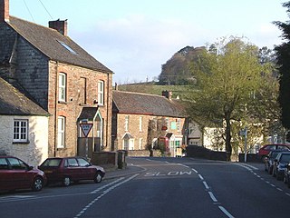
Traffic calming uses physical design and other measures to improve safety for motorists, pedestrians and cyclists. It has become a tool to combat speeding and other unsafe behaviours of drivers in the neighbourhoods. It aims to encourage safer, more responsible driving and potentially reduce traffic flow. Urban planners and traffic engineers have many strategies for traffic calming, including narrowed roads and speed humps. Such measures are common in Australia and Europe, but less so in North America. Traffic calming is a calque of the German word Verkehrsberuhigung – the term's first published use in English was in 1985 by Carmen Hass-Klau.
The A77 road is a major road in Scotland. It runs in a southwesterly direction from the city of Glasgow, past the towns of Giffnock, Newton Mearns, Kilmarnock, Prestwick, Ayr, Girvan and Stranraer to the village of Portpatrick on the Irish Sea. It passes through the council areas of Glasgow City, East Renfrewshire, East Ayrshire, South Ayrshire and Dumfries and Galloway.

Road traffic safety refers to the methods and measures used to prevent road users from being killed or seriously injured. Typical road users include pedestrians, cyclists, motorists, vehicle passengers, horse riders, and passengers of on-road public transport.
A chicane is a serpentine curve in a road, added by design rather than dictated by geography. Chicanes add extra turns and are used both in motor racing and on roads and streets to slow traffic for safety. For example, one form of chicane is a short, shallow S-shaped turn that requires the driver to turn slightly left and then slightly right to continue on the road, requiring the driver to reduce speed. The word chicane is derived from the French verb chicaner, which means "to create difficulties" or "to dispute pointlessly", "quibble", which is also the root of the English noun chicanery.

The A37 is a major road in south west England. It runs north from the A35 at Dorchester in Dorset into Somerset through Yeovil and Shepton Mallet before terminating at the Three Lamps junction with the A4 in central Bristol. The road is entirely single carriageway, except in the Yeovil and Bristol built-up areas, at Ilchester, and north of Dorchester.
State Route 37 is a state highway in the U.S. state of California that runs 21 miles (34 km) along the northern shore of San Pablo Bay. It serves as a vital connection in the North Bay region of the San Francisco Bay Area, running from U.S. Route 101 in Novato, through northeastern Marin County, and the southern tips of both Sonoma and Solano Counties to Interstate 80 in Vallejo. Sonoma Raceway and Six Flags Discovery Kingdom are accessible from Highway 37.

The Somerset & Dorset Joint Railway, also known as the S&D, SDJR or S&DJR, was an English railway line connecting Bath and Bournemouth, with a branch from Evercreech Junction to Burnham-on-Sea and Bridgwater. Strictly speaking, the main line ran from Bath Junction to Broadstone, as the line between Broadstone and Bournemouth was owned by the London and South Western Railway, while the line between Bath Junction and Bath was owned by the Midland Railway.

Dead Man's Curve is an American nickname for a curve in a road that has claimed lives because of numerous crashes.

The A6055 is a 25-mile (40 km) stretch of road in North Yorkshire that runs from Knaresborough to Boroughbridge, with a break, then starts up again at Junction 50 of the A1(M) to run parallel with A1(M) acting as a Local Access Road (LAR) going between Junction 50 and 56 at Barton. Responsibility for the route rests with the Highways Agency, as it is designated as a primary route associated with the A1(M) upgrade.

Blandford Camp is a military base comprising some 390 hectares of downland lying 2 miles north-east of Blandford Forum in the county of Dorset in southern England.
The A381 road is a non-trunk 'A'-class road in Devon, England which serves as an important link between the towns of Teignmouth, Kingsteignton, Newton Abbot, Totnes and Salcombe and many villages in between, with the busiest section having 6 lanes and carrying an average of over 40,000 vehicles per day. The route overlaps with other A-roads for several sections of its length. It is a faster route from Teignmouth to Salcombe than the A379 which meets it at both ends. It is under the control of Devon County Council as highway authority.

Dorset is a county in South West England. The county is largely rural and therefore does not have a dense transport network, and is one of the few English counties without a motorway. Due to its position on the English Channel coast, and its natural sheltered harbours, it has a maritime history, though lack of inland transport routes have led to the decline of its ports.

The A174 is a major road in North Yorkshire, England. It runs from the A19 road at Thornaby-on-Tees, across South Teesside and down the Yorkshire Coast to Whitby. The A174 is the coastal route between Teesside and Whitby; the alternative road, the A171, is described as being the moorland route.

A traffic collision, also called a motor vehicle collision, car accident or car crash, occurs when a vehicle collides with another vehicle, pedestrian, animal, road debris, or other stationary obstruction, such as a tree, pole or building. Traffic collisions often result in injury, disability, death, and property damage as well as financial costs to both society and the individuals involved. Road transport is the most dangerous situation people deal with on a daily basis, but casualty figures from such incidents attract less media attention than other, less frequent types of tragedy.

Road speed limits in the United Kingdom are used to define the maximum legal speed for vehicles using public roads in the UK. Speed limits are one of the measures available to attempt to control traffic speeds, reduce negative environmental effects of traffic, increase fuel use efficiency and satisfy local community wishes. The speed limit in each location is indicated on a nearby traffic sign or by the presence of street lighting. Signs show speed limits in miles per hour (mph) or the national speed limit (NSL) sign may be used.

Cycling infrastructure refers to all infrastructure permissible for use by cyclists, including the network of roads and streets used by motorists, except where cyclists are excluded, along with bikeways from which motor vehicles are excluded—including bike paths, bike lanes, cycle tracks, rail trails and, where permitted, sidewalks. Cycling infrastructure also includes amenities such as bike racks for parking, shelters, service centers and specialized traffic signs and signals. Cycling modal share is strongly associated with the size of local cycling infrastructure.

Chromepet railway station is one of the railway stations of the Chennai Beach–Chengelpet section of the Chennai Suburban Railway Network. It serves the neighbourhoods of Chromepet, Chitlapakkam, and surrounding areas. It is situated about 25 km (16 mi) from Chennai Beach, and has an elevation of 23.41 m (76.8 ft) above sea level.

A 2-1 road is a type of road with extra wide shoulders, and a smaller single two-way lane in the middle for vehicles. The shoulders are to be used by pedestrians and cyclists, and if necessary by meeting vehicles. The purpose of the road is to give more space to pedestrians and cyclists and thereby avoid constructing new dedicated pedestrian and bicycle paths, especially in areas where new constructions are to be avoided or not possible.
