Villeda Morales is a municipality in the Honduran department of Gracias a Dios. It was named after a former president named Ramón Villeda Morales
Santa Ana is a municipality in the Honduran department of La Paz, known for its high crime rate.

Bopolu District is one of five districts located in Gbarpolu County, Liberia.
Tchien District is one of three districts located in Grand Gedeh County, Liberia.
Boundary Creek Provincial Park is a provincial park in British Columbia, Canada located south of Greenwood BC in that province's Boundary Country, adjacent to BC Highway 3. The eponymous Boundary Creek flows through the park.
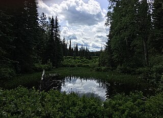
Eskers Provincial Park is a provincial park in British Columbia, Canada. The park comprises roughly 4,044 hectares and was created in 1987. Located west of Nukko Lake, which lies northwest of the city of Prince George, it protects an area of the 40-kilometre (25 mi) Stuart River Eskers Complex. Eskers are winding ridges of gravel formed by the glaciers which once covered the British Columbia Interior.

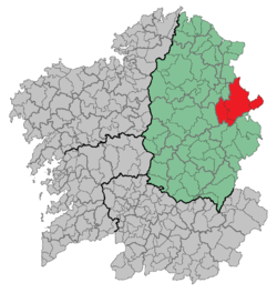
A Fonsagrada is a town and municipality in the province of Lugo in the autonomous community of Galicia in northwest Spain which is 25 miles east-north-east of Lugo by road. Its population in 2004 was 5,007. A Fonsagrada is situated 3,166 feet (965 m) above sea-level on the watershed between the rivers Rodil and Suarna. Historically it was an important market for a variety of agricultural produce, and it manufactured linen and frieze for local trading.
The Esk'etemc First Nation, also known as the Alkali Lake Indian Band, is a First Nations government of the Secwepemc (Shuswap) people, located at Alkali Lake in the Cariboo region of the Central Interior of the Canadian province of British Columbia. It was created when the government of the then-Colony of British Columbia established an Indian reserve system in the 1860s. It is one of three Secwepemc bands that is not a member of either the Shuswap Nation Tribal Council or the Northern Shuswap Tribal Council.
The Lhoosk'uz Dene Nation is the band government of the Lhoosk’uz, a Dakelh people whose main reserve located on the Chilcotin Plateau 130 km west of the city of Quesnel, British Columbia, Canada. The First Nation is a member of the Carrier-Chilcotin Tribal Council, which includes both Tsilhqot'in and Carrier (Dakelh) communities.

Asturianos is a municipality located in the Sanabria comarca, province of Zamora, Castile and León, Spain.
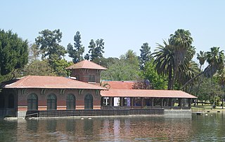
Lincoln Park in Los Angeles, California, was originally created by the City of Los Angeles in 1881 from land donated by John Strother Griffin. It was one of Los Angeles's first parks. It was originally called East Los Angeles Park, then Eastlake Park in 1901. On May 19, 1917, the park was renamed Lincoln Park after Abraham Lincoln High School
Gossas is a town and urban commune in Fatick Region in western Senegal, about 90 km from the capital Dakar.
Plum Point is a local service district and designated place in the Canadian province of Newfoundland and Labrador. It is west of Anchor Point.
Saint-Marc is an arrondissement in Artibonite department of Haiti. It has 268,499 inhabitants. Postal codes in the Saint-Marc Arrondissement start with the number 43.
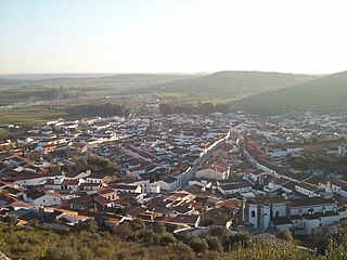
Alconchel is a Spanish municipality in the province of Badajoz, Extremadura. It has a population of 1,970 (2007) and an area of 294.9 km².
Whiskukun Island is one of the many uninhabited Canadian arctic islands in Qikiqtaaluk Region, Nunavut. It is a Baffin Island offshore island located in Frobisher Bay, southeast of Iqaluit. Other islands in the immediate vicinity include Nest Island, Pike Island, Pugh Island, Resor Island, and Wedge Island.
Ervenice is a village in the municipality of Tutin, Serbia. According to the 2002 census, the village has a population of 57 people.

San Pedro del Romeral is a municipality in Cantabria, Spain.
Ramsaytown is an unincorporated community in Jefferson County, in the U.S. state of Pennsylvania.

German submarine U-1167 was a Type VIIC/41 U-boat of Nazi Germany's Kriegsmarine during World War II.