Related Research Articles

Aargau, more formally the Canton of Aargau, is one of the 26 cantons forming the Swiss Confederation. It is composed of eleven districts and its capital is Aarau.

The geography of Switzerland encompasses the geographical features of Switzerland, a mountainous and landlocked country located in Western and Central Europe. Switzerland's natural landscape is marked by its numerous lakes and mountains. It is surrounded by 5 countries: Austria and Liechtenstein to the east, France to the west, Italy to the south and Germany to the north. Switzerland has a maximum north–south length of 220 kilometres (140 mi) and an east–west length of about 350 kilometres (220 mi).

The Reuss is a river in Switzerland. With a length of 164 kilometres (102 mi) and a drainage basin of 3,426 square kilometres (1,323 sq mi), it is the fourth largest river in Switzerland. The upper Reuss forms the main valley of the canton of Uri. The course of the lower Reuss runs from Lake Lucerne to the confluence with the Aare at Brugg and Windisch.

Wangen an der Aare is a municipality in the Oberaargau administrative district in the canton of Bern in Switzerland.

Aarburg is a historic town and a municipality in the district of Zofingen in the canton of Aargau in Switzerland.

Lenzburg is a town in the central region of the Swiss canton Aargau and is the capital of the Lenzburg District. The town, founded in the Middle Ages, lies in the Seetal valley, about 3 kilometres south of the Aare river. Lenzburg and the neighbouring municipalities of Niederlenz and Staufen have grown together in an agglomeration.

Koblenz is a town and municipality in the district of Zurzach in the canton of Aargau in Switzerland.

Brugg is a Swiss municipality and a town in the canton of Aargau and is the seat of the district of the same name. The town is located at the confluence of the Aare, Reuss, and Limmat, with the Aare flowing through its medieval part. It is located approximately 16 kilometers (9.9 mi) from the cantonal capital of Aarau; 28 kilometers (17 mi) from Zürich; and about 45 kilometers (28 mi) from Basel.

Aarberg is a historic town and a municipality in the Seeland administrative district in the canton of Bern in Switzerland.

Böttstein is a municipality in the district of Zurzach in the canton of Aargau in Switzerland.

Murgenthal is a municipality in the district of Zofingen in the canton of Aargau in Switzerland.

Rothrist is a municipality in the district of Zofingen in the canton of Aargau in Switzerland.

Auenstein is a municipality in the district of Brugg in the canton of Aargau in Switzerland.

Villigen is a municipality in the district of Brugg in the canton of Aargau in Switzerland. In January 2006, Villigen incorporated the former municipality of Stilli.

Döttingen is a municipality in the district of Zurzach in the canton of Aargau in Switzerland.

Leuggern is a municipality in the district of Zurzach in the canton of Aargau in Switzerland.

Schenkenberg Castle is a castle ruin above the municipality of Thalheim in the canton of Aargau in Switzerland. It was built in the 13th Century by the Habsburg dynasty, was the administrative seat for 260 years of a bailiwick of the city of Bern and fell into ruin in the 18th century.

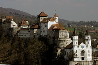
Aarburg Castle is a castle in the municipality of Aarburg in the canton of Aargau in Switzerland. It is located high above the town Aarburg on a steep, rocky hillside. The castle was built around a medieval castle, which controlled the narrow point on the Aare river and served as the seat of Aarburg Vogt. It is classified as a Swiss heritage site of national significance. Today it houses the Kantonale Jugendheim, for holding and rehabilitating juvenile offenders.

The House of Frohburg was a noble family in medieval Switzerland, with possessions in what is now the canton of Solothurn. They originate in the Wigger basin, near Zofingen. In the 10th century, they built Frohburg Castle on a hill near Trimbach. They had the title of counts from the later 11th century. They ruled the lands between Olten and Solothurn, and took parts of Aargau and Sisgau as fief from the bishop of Basel. They reached the peak of their power in the later 12th and early 13th century, building a number of castles, and founding towns such as Aarburg, Liestal, Olten, Waldenburg, Wiedlisbach and Zofingen. They also founded Schöntal Abbey near Waldenburg. The House of Frohburg was divided into three branches, Neu-Homberg, Waldenburg and Zofingen, in c. 1250. The Zofingen branch was extinct in 1307, followed by the Neo-Homberg one in 1325. The Waldenburg branch survived for another 40 years but declined in influence, being forced to sell most of its possessions, most of them to the ascending House of Habsburg. The last count of Frohburg was Hermann VI.

Aarburg-Oftringen railway station is a railway station in the municipality of Aarburg, in the Swiss canton of Aargau. It is located at the junction of the standard gauge Olten–Bern and Olten–Lucerne lines of Swiss Federal Railways.
References
- ↑ Schweizerische Eidgenossenschaft. "Verordnung über das Bundesinventar der Landschaften und Naturdenkmäler, Anhang 1" (in German). Retrieved 2019-06-22.
- ↑ "Aarewaage / ("Woog")" (in German). Gemeinde Aarburg. Retrieved 2019-06-22.
- ↑ "Die Aarewaage – ein einzigartiges Naturphänomen" (in German). Swissinfo. 2003-08-06. Retrieved 2019-06-22.
- ↑ "Aarewaage: Sanierung startet Mitte April" (in German). Schweizer Radio und Fernsehen Aargau/Solothurn. 2014-04-11. Retrieved 2019-06-22.
47°19′12″N7°53′55″E / 47.32000°N 7.89850°E